



In-depth guide · CampingSpirit
From Volos through the mountain villages of Pelion to the Aegean coast, by ferry to Evia and the thermal springs of Edipsos, over the Euripus bridge in Chalkida to Kymi: around 565 km, around 685 km with the optional south – on roads that are often narrower than your motorhome is long.
The spirit of the route
Pelion is a mountain that separates two seas. On one side lies the calm Pagasetic Gulf, with olive groves running down to the water; on the other, the open Aegean breaking against white pebble coves. In between, villages of grey slate and timber cling to the slopes, linked by cobbled mule paths, and on every village square stands a plane tree under which people have been drinking coffee for centuries. Through the sliding door you smell chestnut forest and thyme; in the morning mist lies over Zagora, in the evening the gulf glows copper below Makrinitsa. Over on Evia things get quieter: fishing villages, pine forests that largely burned in 2021 and are slowly growing back, hot spring water that runs straight into the sea at Edipsos. This route rewards small vehicles, short days and a willingness to walk the last kilometres into the village.
Stage-by-stage plan
1Stage 1: Volos to Agios Ioannis (east Pelion) (approx. 65 km)
- The drive
- Out of Volos up through many hairpins to Portaria (a good 600 m), with a short detour to Makrinitsa 3 km away, then on over the Hania pass (around 1,200 m) through beech and chestnut forest and down the eastern side to Zagora. From there the road winds down in tight bends to the coast at Agios Ioannis. The main road is asphalted throughout and passable for motorhomes, but twisty and narrow in Portaria and Zagora; around 2 hours of pure driving time. In winter there can be snow on the Hania pass.
- Highlights & must-sees
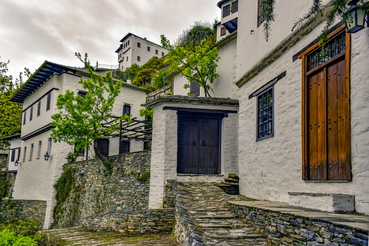
- Makrinitsa, the “balcony of Pelion”: a square with a plane tree and the church of Agios Ioannis, and below it the view over Volos and the whole gulf.
- Hania pass with the Agriolefkes ski area – in summer a starting point for hikes in the cool beech forest.
- Zagora: apple village on the north-eastern flank with the historic school (Ellinomouseio) and the church of Agios Georgios.
- CampingSpirit overnight tip
-
Official campsite or RV park: Camping Papa Nero right behind the beach of the same name near Agios Ioannis: shady pitches, sanitary facilities, electricity; check season, length limit and access with the operator in advance – the last kilometres to the coast are steep and twisty. If you prefer a flatter approach from Volos, start with the sites in Kato Gatzea (see stage 2) and visit the mountain villages as a day trip.
Free camping or nature tip (where legal): Wild camping is prohibited in Greece (€300 per person); this covers anything outside the outline of the vehicle, i.e. awning, table, chairs, levelling jacks. According to the police, spending the night in a correctly parked motorhome is not an offence, but there are hardly any suitable spots for it in the Pelion villages, and beach car parks on the east coast often carry local prohibition signs. Plan on campsites here.
- Insider tip for campers
- Makrinitsa and Portaria are car-free or very narrow villages: the motorhome stays in the car parks at the village entrance, where there is still space early in the morning. Fill up with fuel, shop and top up water in Volos before the climb – up top there are only village shops, and petrol stations on the east coast are few and far between.
2Stage 2: Agios Ioannis to Kato Gatzea (Pagasetic Gulf) (approx. 60 km)
- The drive
- After the walk to Damouchari, via Mouresi to Tsagarada, then the detour down to the beach at Mylopotamos – a narrow, steep lane with hairpins where passing buses only works in lay-bys. Back in Tsagarada, over the ridge to Milies and down to the gulf at Kala Nera and Kato Gatzea. A good 2 hours of driving in total, much of it in second gear.
- Highlights & must-sees
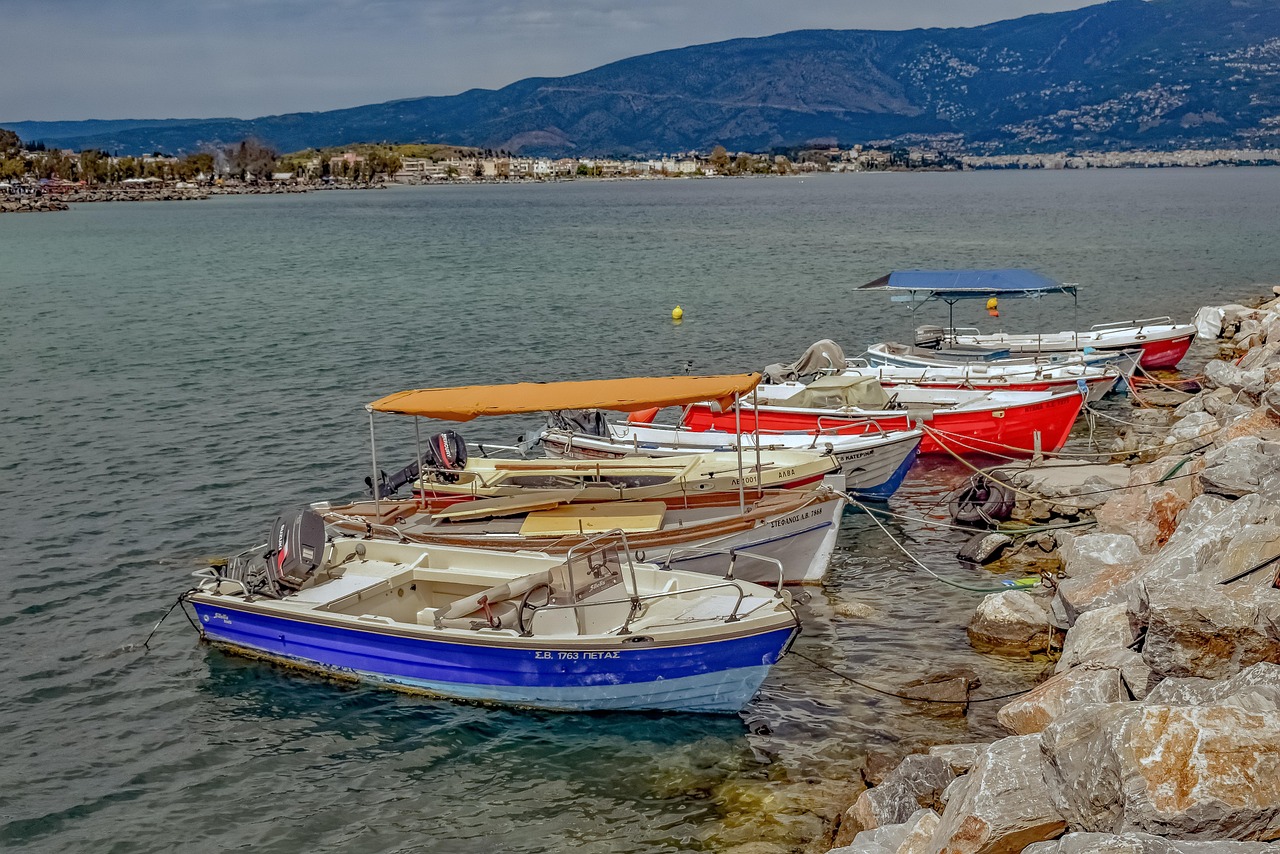
- Kalderimi from Agios Ioannis to Damouchari: a cobbled mule path through olive groves to the small cove with its fishing harbour, a good half hour on foot each way.
- The plane tree on the Agia Paraskevi square in Tsagarada, one of the oldest in Greece.
- Mylopotamos: two pebble coves linked by a passage through the rock, with crystal-clear water.
- CampingSpirit overnight tip
-
Official campsite or RV park: In Kato Gatzea there are two established sites right on the gulf under olive trees: Camping Hellas and Camping Sikia, both with electricity, sanitary facilities and beach access, partly terraced; check the season in advance. A good base for two nights: the station at Ano Lechonia is a few kilometres away, Volos around 20 km.
Free camping or nature tip (where legal): On the east coast between Agios Ioannis and Mylopotamos the car parks are small, often private or posted with prohibition signs; staying overnight there is not an option. The same applies on the gulf to the beach access roads near Kala Nera – campsite rather than beach car park.
- Insider tip for campers
- Do not drive the motorhome down to Damouchari: the access road is narrow and steep, and there is hardly anywhere to turn at the bottom. The footpath is the nicer way in anyway. In Mylopotamos, too, the car park above the beach is small – be there before 10 am, or skip it altogether with a large vehicle.
3Stage 3: Kato Gatzea to Kato Gatzea (Pelion railway and Afissos) (approx. 35 km)
- The drive
- A day without a long drive: in the morning take the narrow-gauge railway from Ano Lechonia up to Milies and back, in the afternoon follow the coast road along the gulf via Kala Nera to Afissos and back again. The road to Afissos is in good condition; in the village itself it gets tight.
- Highlights & must-sees
- The Pelion railway (“Moutzouris”) on the 600 mm narrow-gauge line Ano Lechonia–Milies, with the steel bridge at Taxiarches designed by Evaristo de Chirico, father of the painter Giorgio de Chirico.
- Milies: station with café, the Taxiarches church with frescoes and the historic library of the old school of Milies.
- Afissos: fishing village on the gulf with a shingle beach, waterside tavernas and, in the evening, views of the Othrys mountains.
- CampingSpirit overnight tip
-
Official campsite or RV park: Second night in Kato Gatzea. In Afissos itself there is no campsite we can recommend; the nearest sites are further south towards Milina.
Free camping or nature tip (where legal): On the gulf between Kala Nera and Afissos the beach car parks are full in season and partly posted with prohibition signs. Parking for a swim during the day is no problem; for the night, stick to the campsites.
- Insider tip for campers
- The train runs seasonally – from Easter usually at weekends, daily in high summer – and has been interrupted several times in recent years, most recently for eight months after the storm damage of September 2023; it is running again now, but the historic carriages are prone to breakdowns. Check the timetable and operation with Hellenic Train in advance and book seats in good time, as the trains are often fully booked. In Afissos, leave the motorhome on the edge of the village; the waterfront road is narrow and a dead end.
4Stage 4: Kato Gatzea to Rovies (northern Evia) (approx. 150 km)
- The drive
- Via Volos on the expressway to Almyros, then on the old national road along the coast via Sourpi to Glyfa. Ferry across the northern part of the Gulf of Evia to Agiokampos, a crossing of around half an hour. From there a short hop to Loutra Edipsou and on along the coast road via Ilia to Rovies. A good 2.5 hours of driving plus waiting time at the port.
- Highlights & must-sees
- Loutra Edipsou: spa town with over 80 springs, known since antiquity; at the eastern end of the seafront promenade the hot spring water runs straight into the sea and mixes with the bathing water there.
- The ferry crossing, with views back to Othrys and ahead to the forested mountains of northern Evia.
- Rovies: olive village with a Venetian tower on the shore.
- CampingSpirit overnight tip
-
Official campsite or RV park: Camping Rovies on the beach a little north-west of the village of Rovies: electricity, sanitary facilities, washing machine, shady pitches under trees, access to the shingle beach. Check season and current facilities in advance.
Free camping or nature tip (where legal): The Greek camping ban applies on Evia too. In Loutra Edipsou the waterfront is densely built up; motorhomes find parking on the edge of town. Parking is permitted there, camping behaviour at the thermal pools on the beach is not.
- Insider tip for campers
- Ferry fares are based on vehicle length: give the actual length including rear carrier. In season the ferries shuttle frequently, in winter less often – check the timetable the day before. Alternative in wind or if a sailing is cancelled: the Arkitsa–Loutra Edipsou ferry further south. Take water shoes for the hot springs on the beach; the water is very hot where it emerges.
5Stage 5: Rovies to Agia Anna (approx. 70 km)
- The drive
- Along the coast to Limni, then on the main road inland towards Mantoudi and Prokopi and on to the east coast at Agia Anna. The route passes through the area of the August 2021 wildfires: dead pine trunks still stand on wide slopes, with scrub and young trees growing back in between. Good road, around 1.5 hours.
- Highlights & must-sees
- Limni: fishing village with a seafront promenade, remains of Roman buildings and a small museum of history and folklore.
- Agios Nikolaos Galataki monastery on the coast south of Limni, with 16th-century frescoes (appropriate dress).
- Prokopi: pilgrimage church of Agios Ioannis o Rossos, one of the most visited pilgrimage sites in Greece.
- CampingSpirit overnight tip
-
Official campsite or RV park: Club Resort Agia Anna on the long sandy beach of Agia Anna, with pitches for tents and caravans; check facilities, season and length limit with the operator in advance. Alternatively, a second night in Rovies and Agia Anna as a day trip.
Free camping or nature tip (where legal): In the burned area, take particular care during the fire season: no fires, no barbecues, do not park on dry grass. On days of high fire risk, access to forest areas may be closed. On the beaches of the east coast, municipalities have put up signs in many places after conflicts with campers; free camping remains prohibited.
- Insider tip for campers
- The 2021 fires swept across around 50,000 hectares of northern Evia, mainly pine forest on which many families lived as resin tappers, beekeepers and forestry workers. Since then, heavy rain has caused erosion and flooding on bare slopes; hiking trails may be damaged or closed. Buy honey and olive oil from local producers – that supports the region directly.
6Stage 6: Agia Anna to Eretria via Chalkida (approx. 100 km)
- The drive
- Back inland and south on the main road via Mantoudi and Psachna; the road crosses the Kandili mountains in wide curves and is in good condition. In Chalkida, head to the old town on the Euripus, then take the coast road to Eretria. Around 2 hours of driving.
- Highlights & must-sees
- The old Euripus bridge in Chalkida: a sliding bridge over the strait, only around 40 m wide, whose current changes direction several times a day.
- Karababa fortress on the mainland side, with views over the strait and the old town.
- Eretria: ancient theatre, gymnasium and Archaeological Museum right in town.
- CampingSpirit overnight tip
-
Official campsite or RV park: Camping Milos, a good 1.5 km west of Eretria by the sea, with electricity at the pitches, sanitary facilities and a pool; usually open from April to the end of September, ask about water and waste disposal in advance. Chalkida and ancient Eretria are easy to reach from here.
Free camping or nature tip (where legal): Chalkida is a large city with heavy parking pressure along the waterfront. In built-up areas, motorhomes up to 7.5 m long may park without a time limit, longer ones for 24 hours at most – local bans take precedence, and there are many on the waterfront. For the night, head to the campsite in Eretria instead.
- Insider tip for campers
- For through traffic, use the high bridge south of the city; the old sliding bridge is narrow, is opened for ships mainly at night and has already paralysed traffic in Chalkida during technical faults. Park on the edge of the city and walk to the Euripus – the change of current is best seen from the old bridge. Chalkida has supermarkets and LPG filling stations.
7Stage 7: Eretria to Kymi (approx. 85 km)
- The drive
- On the coast road via Amarynthos to Aliveri, at Lepoura north into the hill country and through vineyards, fig orchards and forest to Kymi, which sits on a terrace above the Aegean. The final stretch down to the port of Paralia Kymis is twisty. Around 1.5 hours.
- Highlights & must-sees
- Kymi: old town with mansions and the folklore museum, views as far as the Sporades.
- Paralia Kymis: port from which the ferries to Skyros depart, with fish tavernas.
- The fig orchards and vineyards in the hill country around Kymi, for which the area is known.
- CampingSpirit overnight tip
-
Official campsite or RV park: Camping options around Kymi are thin. OpenStreetMap lists the Dragonera Cliffs site south-west of Kymi; check access, season and suitability for motorhomes with the operator in advance. Otherwise, visit as a day trip from Eretria.
Free camping or nature tip (where legal): At the port of Paralia Kymis the space is reserved for ferry and delivery traffic; do not stay there overnight. The general camping ban also applies on the beaches of the east coast.
- Insider tip for campers
- Kymi is known for dried figs – stop at farm shops on the way. The Lepoura–Kymi road has no narrow sections, but the passage through Kymi itself is tight: park up on the edge of town and walk into the lanes.
8Stage 8: Kymi to Karystos (optional, southern Evia) (approx. 120 km)
- The drive
- Back to Lepoura and on the main road across the narrow southern half of the island, past wind farms and barren mountainsides with views of both seas, to Karystos. Twisty but in good condition, around 2 hours. Return to the mainland by ferry from Marmari to Rafina in Attica (around 1 hour); from Karystos boats run only irregularly.
- Highlights & must-sees
- Karystos: port town with the Venetian Bourtzi tower and a long seafront promenade.
- Kokkino Kastro castle (Castello Rosso) above the town, a starting point for the Ochi mountain area.
- Dimosaris gorge on Ochi: hiking trail through chestnut forest and plane trees, only with full-day fitness and enough water.
- CampingSpirit overnight tip
-
Official campsite or RV park: Southern Evia has only a few campsites, and their status changes often – check current sites in Campercontact or park4night in advance. An alternative is to take the ferry to Rafina the same day and head for a campsite in Attica.
Free camping or nature tip (where legal): At the coves around Karystos the same rules apply as everywhere in Greece: parking yes, camping behaviour no. Ochi is a Natura 2000 area; avoid dirt tracks with the motorhome.
- Insider tip for campers
- Southern Evia often has a strong north wind, which can delay the ferry connections to Rafina and brings crosswinds on the open road – drive high-sided vehicles slowly. Top up water and diesel before the drive in Kymi or Aliveri.
Camping practice & local rules
Wild camping & overnight parking
- Wild camping is prohibited by law in Greece (Law 5170/2025); the fine is €300 per person. Anything that extends beyond the outline of the vehicle counts as camping: awning, table, chairs, barbecue, levelling jacks, washing line.
- Parking is governed by the Road Traffic Code 5209/2025, Art. 38, clarified by a police circular from 2026: in built-up areas, motorhomes up to 7.5 m long may park without a time limit, longer motorhomes and caravans for no more than 24 hours at a stretch; outside built-up areas on designated spaces or at the right-hand edge of the road without a time limit, provided no ban applies. According to the police, spending the night in a correctly parked motorhome is not an offence. Local prohibition signs always take precedence – and there are many of them on the beaches of Pelion and Evia.
- During the fire season, open fires and outdoor barbecues are prohibited; civil protection publishes a daily fire-risk map, and on days in the highest categories forest areas may be closed. Northern Evia has shown since 2021 what a major fire can do.
- For up-to-date user reports on parking, checks and access roads, park4night and Campercontact are useful; the information there on length and height limits in the Pelion villages mostly comes from users who have tried it themselves.
Waste disposal & supplies
- Water and waste disposal in Pelion and on Evia is available almost only at campsites; many let passing vehicles empty their tanks for a fee – ask first. Public service points are rare.
- Water: in the Pelion villages, spring fountains run in many squares and the locals drink the water; they are hardly suitable for filling a tank because of the narrow spout and the queues. On Evia water becomes scarce in places in high summer – use it sparingly and, if in doubt, buy drinking water in bottles.
- Never empty grey water or cassette contents into drains, streams or onto beaches – illegal dumping is a reason for new prohibition signs on both coasts.
- Gas: foreign exchange cylinders are not swapped in Greece. Autogas (“υγραέριο”, LPG) is available in Volos and Chalkida, but hardly at all in the mountain villages or on the east coast of Evia. For refillable cylinders, carry a suitable adapter and arrive with full cylinders.
Vehicle size & traffic rules
- Speed limits for motorhomes up to 3.5 t: in built-up areas, 30 km/h as a general rule since January 2026, 50 km/h on multi-lane or physically separated main roads; outside built-up areas 90 km/h, on expressways 110 km/h, on motorways 130 km/h. Over 3.5 t, 80 km/h on the motorway; lower limits apply to car-and-caravan combinations.
- Tolls: on the A1 motorway on the way to Volos, two-axle vehicles over 2.20 m high pay class 3, a good twice the car rate; payment by cash or card.
- Size: in Pelion, vehicle dimensions decide the route. Our recommendation, not an official limit: up to about 7 m long you can drive the main roads and most detours; larger vehicles and car-and-caravan combinations stay on the main axis Volos–Hania–Zagora and on the gulf road and skip the spur roads to coves such as Damouchari. Signs with weight or length restrictions at village entrances are binding.
- Ferries: Glyfa–Agiokampos and Arkitsa–Loutra Edipsou run as shuttle services, tickets usually directly at the port; fares by vehicle length, check the timetable in advance. Keep gas cylinders closed during the crossing.
- Blood alcohol limit 0.5, 0.2 for novice and professional drivers; phone calls while driving only hands-free. A fire extinguisher, first-aid kit and warning triangle are compulsory in the vehicle; if a bike rack sticks out beyond the rear, a red-and-white warning board is the safe choice.
CampingSpirit packing & preparation checklist
- Sturdy hiking boots or grippy sandals – the cobbled kalderimia in Pelion are worn smooth and slippery when wet.
- Water shoes for the pebble beaches on the east coast and the hot springs on the beach at Loutra Edipsou.
- Levelling ramps: the sites in Kato Gatzea and on east Pelion are partly terraced and rarely level.
- Two 10-litre water containers for topping up at sites with weak pressure or at fountains without needing the hose.
- Cash for village tavernas, farm shops and the ferry ticket office at the port, where card payment does not always work.
As of 2026-10. Closures, fees and booking rules change: check official sources before you go.