


In-depth guide · CampingSpirit
From Bratislava via Trnava, the fairy-tale castle of Bojnice, the mint town of Kremnica and the mining town of Banská Štiavnica into the Low Tatras, on to Vlkolínec and the Malá Fatra as far as Žilina: around 700 kilometres through Slovakia’s old Ore Mountains.
The spirit of the route
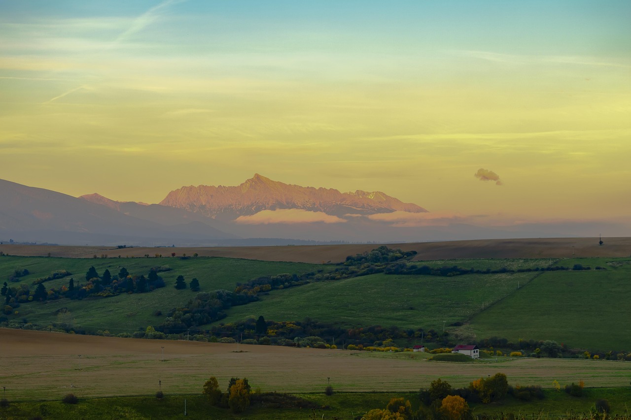
Central Slovakia took its wealth out of the mountain. Gold from Kremnica, silver from Banská Štiavnica, copper from Špania Dolina – what remains are baroque burghers’ houses on steep lanes, plague columns, spoil heaps covered in spruce and artificial mountain lakes, the tajchy, where people swim today. Beyond Banská Bystrica the land grows wilder: the road climbs through beech forest to Čertovica, up top there are alpine meadows and dwarf pine, and in the evening you see the ridge of the Low Tatras with Chopok and Ďumbier in the last light from your sliding door. This is brown bear country, and you notice it in the locked bins and the warning signs on the hiking trails. Further north, wooden houses cling to the hillside at Vlkolínec, the Váh cuts its way through the Fatra, and in Terchová you climb ladders through the gorges of Jánošíkove diery. A route of bends, church towers and cool nights – close to Vienna, but far from mass tourism.
Stage-by-stage plan
1Stage 1: Bratislava to Bojnice (via Trnava) (approx. 185 km)
- The drive
- Out of Bratislava on the D1 motorway to Trnava (around 50 km, e-vignette), then on the R1 expressway to Nitra and on north via Topoľčany into the upper Nitra valley to Prievidza; Bojnice directly adjoins Prievidza. Fast driving through farmland as far as Nitra, then country road through villages and increasingly hilly terrain. A good 2.5 hours without stops.
- Highlights & must-sees
- Bratislava in the morning: the old town with Michael’s Gate and the Main Square, the view from the castle hill over the Danube and the UFO Bridge – easiest by bus or bike from the campsite.
- Trnava, the “Slovak Rome”: almost completely preserved town walls, the University Church of St John the Baptist and the town tower above Trojičné námestie with an all-round view.
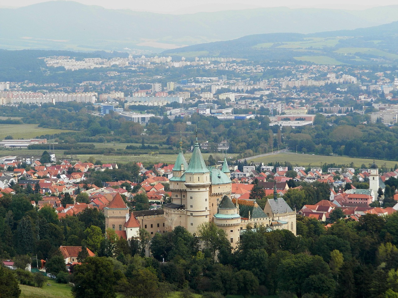
- Bojnice in the evening: the neo-Gothic castle with turrets and battlements above the spa park, photographed from the promenade below the castle hill.
- CampingSpirit overnight tip
-
Official campsite or RV park: In Bratislava, the municipal campsite Zlaté Piesky lies on the lake of the same name in the north-east, with electricity, sanitary facilities and a tram connection; alternatives are Huntry Camp Bratislava and, on the Danube, Kemping Čunovo by the white-water park. In Bojnice, Karavan camp Bojnice by the sports grounds is a motorhome site with electricity and water within walking distance of the castle; check the season and facilities in advance.
Free camping or nature tip (where legal): Outside the national parks, sleeping in your vehicle in public car parks is not expressly prohibited in Slovakia, but municipalities can ban it by signage. In Bratislava, Trnava and at the castle car park in Bojnice it is not intended; use the sites.
- Insider tip for campers
- Bratislava has residents’ parking zones across the city, with fees paid by app or machine; park the camper at the campsite and take public transport into the old town. In Trnava you park in the car parks outside the town walls, as the old town is largely traffic-calmed. You’ll find large supermarkets with car parks without height barriers on the arterial roads out of Nitra and Prievidza.
2Stage 2: Bojnice to Banská Štiavnica (via Kremnica) (approx. 125 km)
- The drive
- From Prievidza via Handlová on road I/9 through the wooded uplands into the Hron valley to Žiar nad Hronom, then north on the I/65 up to Kremnica. Back to Žiar and via Hliník nad Hronom on winding back roads into the Štiavnické vrchy mountains to Banská Štiavnica. Lots of climbs; the old towns are narrow and steep. A good 2.5 hours of pure driving time.
- Highlights & must-sees
- Kremnica: the mint, which has been striking coins since the 14th century and still produces them today, the National Bank’s Museum of Coins and Medals and the town castle with St Catherine’s Church above the steep market square.
- The Church of St John near Krahule above Kremnica, at the spot designated as the geographical centre of Europe – a short detour with wide views over the Kremnické vrchy.
- Banská Štiavnica at sunset: the view from the Calvary or from the New Castle (Nový zámok) over the old town in its valley basin.
- CampingSpirit overnight tip
-
Official campsite or RV park: Autocamp Počúvadlo on the tajch of the same name south-west of town (a good 10 km by road), with a bathing spot and forest all around; in Hodruša-Hámre in the neighbouring valley is the small Hodruša Kemp (Konibar). Ask about facilities, electricity and season at both sites in advance; the tajchy get busy in July and August.
Free camping or nature tip (where legal): The tajchy and their surroundings lie within the CHKO Štiavnické vrchy protected landscape area. The shores and bathing car parks are for day visitors; overnight stays with camping behaviour are not tolerated there, and you’ll only find quiet spots at designated motorhome sites and campsites.
- Insider tip for campers
- The old town of Banská Štiavnica lies on a slope, the lanes are narrow and steep, and access restrictions are signposted. Park in the signposted car parks on the edge and walk up. Kremnica also only has small car parks near the centre – with a large vehicle, stay down on the main road.
3Stage 3: Banská Štiavnica to Banská Bystrica (via Zvolen) (approx. 65 km)
- The drive
- North on the I/51 down to the R1 expressway at Hronská Breznica, then along the Hron valley to Zvolen and on along the R1 to Banská Bystrica. The first section is winding and narrow, from the R1 onwards it’s fast expressway (e-vignette). About 1 hour of pure driving time, ideal for half a day at the tajchy before you set off.
- Highlights & must-sees
- The open-air mining museum (Banské múzeum v prírode) on the edge of Banská Štiavnica, with a trip into a historic mine gallery; inside it is damp and cool.
- Tajch Počúvadlo or Veľká Vodárenská in the morning: a circular walk around the 18th-century reservoir, built for the water wheels of the silver mines – swim at the designated spots.
- Zvolen: the castle with paintings from the Slovak National Gallery, with the ruins of Pustý hrad above; in Banská Bystrica, SNP Square with the leaning clock tower and the Museum of the Slovak National Uprising.
- CampingSpirit overnight tip
-
Official campsite or RV park: Autocamping Tajov in the village of Tajov a few kilometres west of Banská Bystrica is the nearest option; be sure to check opening, electricity and space for larger vehicles by phone beforehand. If you’re flexible, stay a second night at the tajchy and drive straight to Banská Bystrica and Špania Dolina on the next stage.
Free camping or nature tip (where legal): Banská Bystrica and Zvolen have paid parking zones, and sleeping in a motorhome at the roadside there is not a good idea. Outside the towns you’re better off at a campsite or on a farm with permission confirmed by message.
- Insider tip for campers
- In Zvolen, park below the castle at the edge of the pedestrian zone; in Banská Bystrica, at the shopping centres on the edge of the city centre, then walk 10 minutes. There are large filling stations with shops on the R1; LPG is rarer in Slovakia than in neighbouring countries, so use the pumps you find.
4Stage 4: Banská Bystrica to Liptovský Hrádok (via Špania Dolina and Čertovica) (approx. 125 km)
- The drive
- First the steep, narrow spur road up to Špania Dolina and back. Then on the I/66 up the Hron via Podbrezová, from here on the I/72 through the valley below Ďumbier via Mýto pod Ďumbierom to the Čertovica pass (a good 1,200 m) and down in hairpins via Vyšná Boca to Kráľova Lehota and west to Liptovský Hrádok. The pass road is well built but winding and slippery when wet; lots of timber traffic. Around 2.5 hours of driving time.
- Highlights & must-sees
- Špania Dolina: a mining village with wooden houses between copper spoil heaps, the church up on the slope with its covered wooden staircase, and the village’s bobbin-lace tradition.
- The Hron valley near Podbrezová and Mýto pod Ďumbierom: the southern flank of the Low Tatras with meadows, sawmills and views of Ďumbier.
- Čertovica saddle: a short walk west along the ridge path with views over both sides of the Low Tatras.
- CampingSpirit overnight tip
-
Official campsite or RV park: Autocamping Vavrišovo in the neighbouring village of Vavrišovo a few kilometres east of Liptovský Hrádok, with electricity, water and sanitary facilities, quiet among the meadows at the foot of the Low Tatras; Minicamp Jana nearby is a small, family-run site. Check the season in advance.
Free camping or nature tip (where legal): The ridge and slopes of the Low Tatras belong to the Nízke Tatry National Park (NAPANT); camping there is only permitted at designated spots, for example for ridge hikers at the Čertovica saddle, and these are for tents, not vehicles. No overnight stays at the pass car park.
- Insider tip for campers
- On Čertovica, the pass inns also make a good lunch stop. Spare your brakes: drive down to Kráľova Lehota in a low gear. Liptovský Hrádok has supermarkets and filling stations – stock up before your days in the Demänovská dolina, where the choice is small and expensive.
5Stage 5: Liptovský Hrádok to Liptovská Mara (via Demänovská dolina and Jasná) (approx. 60 km)
- The drive
- Via Liptovský Mikuláš into the Demänovská dolina and up the valley past the caves to Jasná below Chopok (around 30 km, winding towards the end and with heavy day-trip traffic in summer). In the afternoon back and via Liptovský Mikuláš along the south shore of the Liptovská Mara to its western end near Bobrovník. A good 1.5 hours of driving time in total.
- Highlights & must-sees
- Chopok (2,024 m): take the cable cars from Jasná to the summit, then a ridge walk towards Ďumbier, the highest mountain in the Low Tatras, around 2 hours each way over boulders and scree.
- Demänovská jaskyňa slobody: a dripstone cave with sinter pools and underground lakes, guided tours only; plus the Demänovská ľadová jaskyňa, whose ice has since melted completely – check opening times and tours with the Slovak Caves Administration.
- Jasná and the mountain lake Vrbické pleso: a short walk from the car park to the glacial lake below the slopes of Chopok.
- CampingSpirit overnight tip
-
Official campsite or RV park: At the western end of the Liptovská Mara, Camping Marina Liptov lies on the shore near Bobrovník, with further sites on the north shore in Liptovský Trnovec. For the drive to Ružomberok, Bobrovník is the more practical base. Book in the summer season and on public holidays.
Free camping or nature tip (where legal): The Demänovská dolina and Jasná lie within the NAPANT national park; overnight stays at the cave and lift car parks are not intended, and camping outside designated sites is prohibited. At the reservoir, check local prohibition signs; camping behaviour is not tolerated on the shore.
- Insider tip for campers
- The car parks at the caves and in Jasná charge fees and fill up from late morning in high season – start early and do the cave first, then the cable car. The cave stays at around 6 °C all year, so bring a jacket. The cable cars have maintenance breaks in autumn; check operating times on the Jasná ski resort’s website.
6Stage 6: Liptovská Mara to Martin (via Vlkolínec and Ružomberok) (approx. 85 km)
- The drive
- Along the shore of the Liptovská Mara and partly on the D1 to Ružomberok, from there up the narrow, steep mountain road to Vlkolínec (around 7 km). Then through the Váh gorge near Kraľovany between the Greater and Lesser Fatra to Turany and Martin. Between Ružomberok and Turany the D1 still has a gap, so you drive on country road I/18 with lots of lorry traffic. A good 2 hours of driving time.
- Highlights & must-sees
- Vlkolínec (UNESCO World Heritage Site): a mountain village of around 45 pastel-coloured log houses, a wooden bell tower and a draw well on the slopes of the Veľká Fatra – at its quietest before 10 am.
- Ružomberok: the cable car to Malinô Brdo, then a hiking trail at the top with views over Liptov and on to Vlkolínec on foot.
- Múzeum slovenskej dediny in Martin: Slovakia’s largest open-air museum, with farmhouses, a wooden church and mills from the north of the country.
- CampingSpirit overnight tip
-
Official campsite or RV park: Autocamping Trusalova near Turany, around 15 km north-east of Martin above Turany at the foot of the Malá Fatra, with electricity, water and sanitary facilities; quiet at the edge of a forest. Check the season and space for long vehicles in advance.
Free camping or nature tip (where legal): Vlkolínec lies on the edge of the Veľká Fatra National Park; overnight stays in the village car park are not allowed. In the Váh valley you’re better off at a site anyway because of the railway line and lorry traffic.
- Insider tip for campers
- Vlkolínec is closed to vehicles; you park in the paid car park at the village entrance and pay admission to the village. The access road is narrow with passing places; with a large motorhome it’s better to park in Ružomberok and take the cable car to Malinô Brdo, then walk across for around an hour. Ružomberok has large supermarkets.
7Stage 7: Martin to Terchová (via Strečno) (approx. 40 km)
- The drive
- Via Vrútky through the narrow Váh valley, the Strečnianska tiesňava, with Strečno Castle on its rock, then at Varín into the valley of the Varínka and to Terchová. A short but winding stage; Terchová and the Vrátna dolina are busy on summer weekends. Just under 1 hour of driving time.
- Highlights & must-sees
- Strečno Castle above the Váh, with the ruins of Starhrad opposite: views from the castle courtyard into the gorge; in season, raft trips on the Váh through the Strečnianska tiesňava.
- Jánošíkove diery: a system of gorges between Biely Potok and Podžiar with ladders, walkways and chains over waterfalls, around 3 to 4 hours as a circular route.
- Terchová: the monument to the folk hero Juraj Jánošík on the hill above the village; on into the Vrátna dolina with the cable car towards Chleb.
- CampingSpirit overnight tip
-
Official campsite or RV park: Camping Belá Nižné Kamence near Belá, with electricity, water and waste disposal, sanitary facilities and views of the Malá Fatra, family-run and popular with motorhomers; Autocamping Varín on the Varínka is an alternative closer to Žilina. Book in high summer.
Free camping or nature tip (where legal): The Malá Fatra National Park begins right behind Terchová; camping and overnight stays outside designated sites are prohibited there, and the car parks in the Vrátna dolina and at the diery are paid day car parks.
- Insider tip for campers
- For Jánošíkove diery, park in Biely Potok on the road to Vrátna; the ladders are slippery after rain and some sections close when water levels are high, so follow the national park administration’s notices. The road into the Vrátna dolina is narrow but passable for motorhomes; it gets tight at the turning area at the top.
8Stage 8: Terchová to Žilina (approx. 25 km)
- The drive
- Down the valley via Belá and Varín back to the Váh and into the town of Žilina. A well-built road, around 30 minutes of driving time; from Žilina continue on the D1 west, to Czechia or to Poland.
- Highlights & must-sees
- Žilina: the square, arcaded Mariánske námestie with the Jesuit church, and the Burianova veža on Andrej Hlinka Square.
- Budatín Castle at the confluence of the Kysuca and the Váh, with the museum of the tinkers’ wire-working tradition.
- Last stop in Varín: a look back at the ridge of the Malá Fatra with Veľký Rozsutec.
- CampingSpirit overnight tip
-
Official campsite or RV park: Autocamping Varín is the nearest site for the last night, with electricity and sanitary facilities; if you’re driving on west overnight, you’ll find more sites in the Váh valley towards Trenčín.
Free camping or nature tip (where legal): Žilina has paid parking zones; sleeping at the roadside is not an option there. Plan your last night in Varín or Belá.
- Insider tip for campers
- In Žilina, park at the shopping centres on the edge of the old town, as the centre is pedestrianised. If you bought the ten-day e-vignette, check its expiry date before the return drive on the D1.
Camping practice & local rules
Wild camping & overnight parking
- Slovakia: outside protected areas, sleeping in your vehicle in public car parks is not prohibited in principle, but municipalities can ban it by signage. Camping behaviour with awning, table and chairs belongs on campsites or motorhome sites.
- This route passes through the Nízke Tatry (NAPANT), Veľká Fatra and Malá Fatra national parks; camping outside designated sites is prohibited there, and the national park rangers carry out checks. The few official bivouac sites on the Low Tatras ridge are for hikers with tents, not vehicles. Driving a motor vehicle into the forest or onto forestry tracks is prohibited.
- Bears: the Low Tatras, the Veľká and Malá Fatra and the forests around Banská Bystrica are among the densest bear areas in Europe, and the edges of villages and campsites are visited too. Always store food and rubbish in the closed vehicle, leave nothing outside, dispose of barbecue leftovers immediately and close bins. Be careful when hiking at dusk, make noise by talking, keep dogs on a lead; never approach a bear, back away slowly. Observe official warnings and closures; emergency number 112, mountain rescue 18 300.
- Because of the protected areas along the route, wild camping hardly makes sense. You’ll find campsites, motorhome sites and farms via park4night, Campercontact and the regional tourism portals; get private permissions confirmed by message.
Waste disposal & supplies
- Water supply and waste disposal are almost only available at campsites and some motorhome sites; public service points are rare. Never empty grey water or cassettes into streams, tajchy or drains – the Demänovská dolina is a karst area, and dirt goes straight into caves and groundwater.
- Tap water is generally drinkable in towns and at sites; at springs and wells in the mountains, look out for notice signs and boil the water if in doubt.
- Gas: German exchange cylinders are not swapped in Slovakia, and the connections of local cylinders don’t fit. Autogas (LPG) is available at some of the filling stations along the D1 and R1, but less often than in Poland or Czechia; bring an adapter set for refillable cylinders and check the connection on site.
- There are supermarkets with large car parks in Nitra, Prievidza, Banská Bystrica, Liptovský Mikuláš, Ružomberok, Martin and Žilina; in the mountain valleys, shops and filling stations are few and far between.
Vehicle size & traffic rules
- Tolls: vehicles up to 3.5 t may only use the D1 motorway and the R1 expressway (Trnava–Nitra–Zvolen–Banská Bystrica) with an e-vignette, bought online at eznamka.sk and linked to the number plate. 2026 prices according to the trade press (unchanged from 2025): 1 day €8.10, 10 days €10.80, 30 days €17.10, annual vignette €90 for 365 days from a date of your choice. Vehicles over 3.5 t pay distance-based tolls in the MYTO system with an on-board unit.
- Speed limits: 50 km/h in built-up areas, 90 km/h outside built-up areas, 130 km/h on motorways for vehicles up to 3.5 t; according to ADAC, motorhomes over 3.5 t and vehicles with trailers may drive at no more than 90 km/h outside built-up areas and on motorways. Dipped headlights are compulsory in daytime too, the blood alcohol limit is 0.0, and phones at the wheel only with a hands-free kit.
- Parking: Bratislava, Trnava, Banská Bystrica, Zvolen and Žilina have paid parking zones with payment by app, SMS or machine; there are currently no low-emission zones in Slovakia. Historic old towns such as Banská Štiavnica and Kremnica have narrow, steep lanes and some access restrictions – follow the signs.
- Winter equipment is compulsory in Slovakia in wintry road conditions, and for vehicles over 3.5 t generally from 15 November to 31 March; snow can fall on Čertovica and in Jasná from October. Mark rear carriers that project beyond the vehicle. Carry your ID card; Slovakia is part of the Schengen Area, and the currency is the euro.
CampingSpirit packing & preparation checklist
- Bear spray in a belt holster for hikes in the Low Tatras and the Fatra; available in Slovak outdoor shops – check the rules on carrying it in your home and transit countries beforehand.
- A lockable box or airtight containers for food and rubbish, so nothing smells outside at night.
- A warm jacket and a head torch for the caves in the Demänovská dolina and the gallery at the mining museum in Banská Štiavnica, where it is cool and damp all year.
- Gloves and hiking boots with grippy soles for the ladders and chains in Jánošíkove diery and the boulder fields between Chopok and Ďumbier.
- Swimwear and water shoes for the tajchy around Banská Štiavnica; the water stays fresh even in summer, and the entry points are stony.
- Levelling ramps for the often sloping meadow pitches in Liptov, Turany and Belá.
As of 2026-10. Closures, fees and booking rules change: check official sources before you go.