



In-depth guide · CampingSpirit
From the Bolivar ferry and Galveston via Matagorda, Port Lavaca and the crane marshes of Aransas to Port Aransas, onto the beach of Padre Island National Seashore and down to South Padre Island: around 900 kilometres of barrier islands, lagoons and shrimp boats.
The spirit of the route
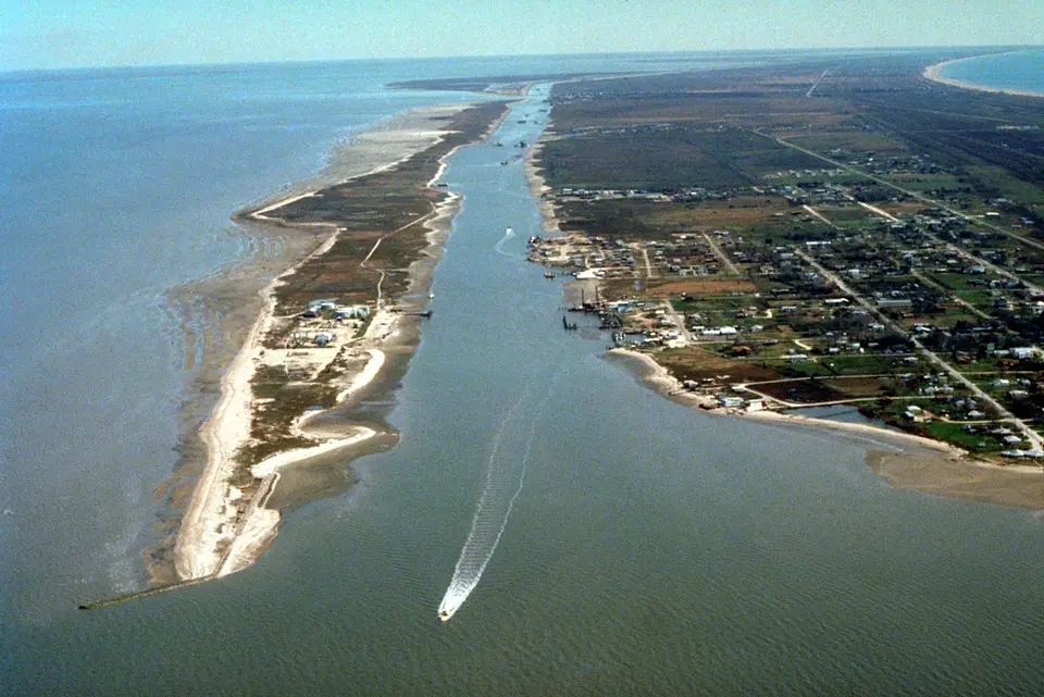
The Texas Gulf Coast is a narrow, flat seam between prairie and sea: long barrier islands, behind them lagoons, marsh and oyster reefs, with brown pelicans perched on the pilings of the jetties. Here you don't drive along the coast, you drive on it – by ferry across the harbour entrances of Galveston and Port Aransas, over causeways through the brackish water and, in the end, on the sand itself, where the beach is legally a road. From the sliding door in the morning you see shrimp boats against the horizon, curlews along the tideline and refinery flares in the distance; in the evening, gulls over beds of shell. In winter the world's last wild migrating whooping cranes stand in the salt water of Aransas Bay. On Padre Island the tarmac ends, and ahead of you lies the longest undeveloped barrier island beach on Earth: nothing but dunes, wind and tracks in the sand.
Stage-by-stage plan
1Stage 1: High Island to Galveston Island State Park (approx. 95 km)
- The drive
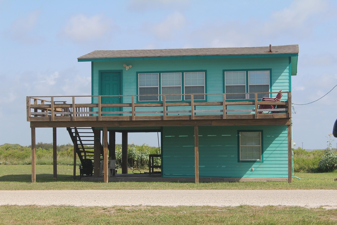
- Take TX-87 across the Bolivar Peninsula: a two-lane road behind the dune, lined with holiday homes on stilts, with marsh towards the bay and beach access roads to the Gulf. In Port Bolivar the free Texas Department of Transportation (TxDOT) ferry to Galveston is waiting; it runs around the clock and the crossing takes about 20 minutes, but on summer weekends and public holidays the queue can back up for hours. Motorhomes and trailer rigs are carried. In Galveston, head west along Seawall Boulevard and FM 3005 to the state park. Pure driving time around 1.5 hours plus waiting time at the ferry. Fill up in Winnie or Galveston; there are only a few petrol stations on the peninsula.
- Highlights & must-sees
- Bolivar ferry: from the deck you see dolphins in Bolivar Roads, tankers heading for Houston and Texas City, the wreck of the concrete ship SS Selma in the distance and gulls following the ferry. To the north stands the dark Bolivar Point Lighthouse (private, no access).
- High Island and Bolivar Flats: in April, High Island is one of the best-known places in North America for the spring songbird migration; the Bolivar Flats Shorebird Sanctuary at the tip of the peninsula is a wader habitat all year round – enter on foot only and respect the barriers.
- Galveston: Victorian houses in the East End, the Strand Historic District with buildings from before the 1900 storm, the Seawall (around 16 kilometres of sea wall) and the harbour with the 1877 barque Elissa at the Texas Seaport Museum.
- CampingSpirit overnight tip
-
Official campsite or RV park: Galveston Island State Park (Texas Parks and Wildlife Department, TPWD): after several years of rebuilding, open again since 2023 on both sides of FM 3005 – on the beach side around 95 renovated sites on raised platforms behind the dune, on the bay side around 30 sites by the marsh and lagoon. Sites with water and electricity, shower blocks, dump station. Book through the Texas State Parks reservation system; book early for weekends and spring, and check the vehicle length allowed per site.
Free camping or nature tip (where legal): On the Bolivar Peninsula you may drive and park on the beach in designated sections (partly with a Galveston County Beach Parking Permit); overnight stays there have so far been tolerated, but the county is considering maximum-stay rules – check current sections, seasonal rules and bans with the county. In the city of Galveston, overnight stays on the Seawall and in beach car parks are prohibited.
- Insider tip for campers
- Take the ferry before 9 am or late in the evening; TxDOT posts waiting times online and on signs along TX-87. Close the propane valves before boarding and follow the crew's instructions. In the state park, use the bay side for kayaking and birdwatching, the beach side for surf and sunrise.
2Stage 2: Galveston Island State Park to Matagorda (approx. 150 km)
- The drive
- Follow FM 3005 to the western end of the island and cross the San Luis Pass bridge (toll-free since 2025) onto the Bluewater Highway (County Road 257) through dunes and marsh to Surfside Beach. Through Freeport with its chemical plants and port, then along TX-36 and FM roads through rice fields, pasture and sugar cane to Bay City, and on FM 2031 to Matagorda at the mouth of the Colorado River. Flat and straight, speeds mostly 55–70 mph; the Bluewater Highway floods during storm surges and strong easterly winds. Pure driving time around 2.5 hours. Fuel and shopping in Freeport, Lake Jackson and Bay City.
- Highlights & must-sees
- Surfside Beach and Quintana: small beach towns at the Freeport harbour entrance; from the Quintana Jetty you can watch freighters and shrimp boats coming in. Quintana Beach is also a well-known stopover for migrating birds in spring.
- San Bernard National Wildlife Refuge: marsh, prairie wetlands and ponds with loop trails and a wildlife drive; in winter, geese, cranes and ducks in large numbers.
- Matagorda: an old town on the Colorado River with a wooden church and a marina; FM 2031 ends at Matagorda Bay Nature Park, where river, bay and Gulf meet. Fish from the pier and the jetty, and watch dolphins at the river mouth.
- CampingSpirit overnight tip
-
Official campsite or RV park: Matagorda Bay Nature Park (Lower Colorado River Authority, LCRA): campground at the end of FM 2031 between the Colorado River and the Gulf, sites with full hook-ups (30/50 A), some right by the water, shower blocks, beach access and fishing pier. Book online through the LCRA; book early for spring and public holidays. Alternative for the previous night: Quintana Beach County Park (Brazoria County) with full hook-up sites; the park was temporarily closed after storm damage – check its status with the county beforehand.
Free camping or nature tip (where legal): On parts of the Brazoria County beaches (such as Surfside Beach and Bryan Beach near Freeport), parking and overnight stays on the sand are allowed with a Beach Parking Permit from the relevant town or the county; sections and conditions vary, so check the status locally. Matagorda Beach also requires a vehicle permit; only drive on the sand when it is firm, and not near the waterline on a rising tide.
- Insider tip for campers
- The area around Freeport is an industrial zone: hazardous-goods lorries, level crossings and short-notice road closures come with it – take your satnav and the signs seriously. On the beaches, only drive in the firm track between dune and tideline; wet, dark sand holds, while dry, pale sand often doesn't.
3Stage 3: Matagorda to Port Lavaca (approx. 125 km)
- The drive
- Head back along FM 2031, then west on TX-35 via Palacios on Tres Palacios Bay and through pasture to Lavaca Bay; a detour on FM roads leads to Magnolia Beach and Indianola. TX-35 is the coast road of Texas: four-lane or wide two-lane, dead straight, speeds mostly 65–75 mph, with little traffic. Pure driving time around 2 hours including the detour. Fuel in Palacios and Port Lavaca.
- Highlights & must-sees
- Palacios: shrimp boat harbour with a sea wall, pier and the historic Luther Hotel; in the evening the boats come in.
- Indianola: once the most important immigrant port in Texas, through which many Germans also entered the country, abandoned after the hurricanes of 1875 and 1886. Today only a granite statue of La Salle, memorial plaques and the old cemetery remain – a quiet place on Matagorda Bay.
- Port Lavaca: small town on Lavaca Bay with the Half Moon Reef Lighthouse on the shore, a small lighthouse from 1858 that was moved from the reef onto land, and a long fishing pier along the old causeway.
- CampingSpirit overnight tip
-
Official campsite or RV park: Lighthouse Beach RV Park, run by the city of Port Lavaca: municipal site on the bay with full hook-up sites, shower blocks, a small swimming beach and fishing piers; online booking available. Alternative: Magnolia Beach (Calhoun County) with basic beach camping on the shore of Matagorda Bay, no hook-ups. Check occupancy rules and maximum stay locally.
Free camping or nature tip (where legal): Magnolia Beach is one of the few places on the route where you can stay by the water with simple means; there are toilets, but no comforts. Leave no rubbish behind – the county restricts use if it is abused.
- Insider tip for campers
- Lavaca Bay is shallow and windy: only put out awnings when there is no wind, and retract them at night. Around Port Lavaca, supermarkets and launderettes are easy to reach – a good place for laundry and supplies before crane country.
4Stage 4: Port Lavaca to Rockport/Fulton (approx. 145 km)
- The drive
- Head south on TX-35, from Tivoli on TX-239 and FM 774/FM 2040 via Austwell to Aransas National Wildlife Refuge; back to TX-35 and across the Copano Bay bridge to Fulton and Rockport. Flat country with cotton fields, groves of wind-bent coastal live oaks and marsh. The Tour Loop in the refuge is paved and suitable for motorhomes, with viewpoints and short trails. Pure driving time around 2 hours without the loop. Fuel in Port Lavaca, Tivoli and Rockport; nothing in the refuge.
- Highlights & must-sees
- Aransas National Wildlife Refuge: winter home of the only wild migrating population of whooping cranes, which arrives from Canada every year – usually from about November to March. From the observation tower and the Tour Loop you often see the white birds only in the distance; also alligators, javelinas, spoonbills and roseate spoonbills. Entry fee per vehicle; check opening times on fws.gov.
- Boat tours to the cranes: in winter, excursion boats leave from Rockport-Fulton harbour and travel along the Intracoastal Waterway to the refuge's marshes – usually the best close-up sightings.
- Fulton Mansion and Goose Island: a cattle baron's 1877 villa on the waterfront in Fulton (State Historic Site) and the “Big Tree”, a mighty coastal live oak many centuries old in Goose Island State Park.
- CampingSpirit overnight tip
-
Official campsite or RV park: Goose Island State Park (TPWD) north of Rockport: sites right on Aransas Bay along the waterfront and sites in the oak woods, with water and electricity, shower blocks, dump station and a long fishing pier. The waterfront sites are windy and unshaded, the woodland sites more sheltered. Rebuilt after Hurricane Harvey (2017); book through Texas State Parks, and book early in winter because of the cranes and the “Winter Texans”.
Free camping or nature tip (where legal): Overnight stays are prohibited in Aransas National Wildlife Refuge. In Rockport and Fulton, sleeping in your vehicle in public car parks and along the waterfront roads is not allowed; there is no legal free-camping option in the area.
- Insider tip for campers
- In winter, book a whooping crane boat tour in advance, and drive the Tour Loop early in the morning with binoculars or a spotting scope. The Copano Bay bridge has a parallel old bridge span used as a fishing pier – a good place for a break with the pelicans.
5Stage 5: Rockport/Fulton to Padre Island National Seashore (approx. 95 km)
- The drive
- Take TX-35 and TX-361 to Aransas Pass and the causeway to Harbor Island for the free TxDOT ferry to Port Aransas: a short crossing of a few minutes, with several ferries shuttling around the clock; long waits on summer weekends and during spring breaks. Through Port Aransas, head south on TX-361 across Mustang Island, past kilometres of dunes, then on Park Road 22 over Packery Channel onto North Padre Island and on to the entrance of the National Seashore. Pure driving time around 1.5 hours plus the ferry. Last petrol stations and supermarkets on North Padre Island before the park.
- Highlights & must-sees
- Port Aransas: fishing town at the harbour entrance with the Horace Caldwell Pier, the Leonabelle Turnbull Birding Center with a boardwalk across the marsh (alligators) and the harbour, where dolphins follow the ferry traffic.
- Mustang Island State Park: around eight kilometres of Gulf beach with dunes, plus a paddling trail through the lagoons on the bay side.
- Malaquite Visitor Center of Padre Island National Seashore: exhibition on the dunes, the Laguna Madre and sea turtles, with a boardwalk and viewing deck over the beach. From about April to July, Kemp’s ridley sea turtles lay their eggs on the beach; in summer there are public hatchling releases – dates are announced at short notice on nps.gov/pais.
- CampingSpirit overnight tip
-
Official campsite or RV park: Malaquite Campground (Padre Island National Seashore): just under 50 sites right behind the dunes, without hook-ups, with toilets, cold showers and picnic tables; dump station and drinking-water fill point on the access road. No reservations – sites are allocated on arrival (first come, first served), so arrive early in the day. Alternatives: Bird Island Basin on the Laguna Madre, basic waterside pitches for surfers and kiters, and Mustang Island State Park (TPWD) with water and electric sites as well as basic beach camping; check the condition and opening of the areas with TPWD beforehand. Since 2026, visitors to US national parks without US residency have in some cases had to pay higher fees and surcharges – check current amounts on nps.gov.
Free camping or nature tip (where legal): Beach camping in the National Seashore is allowed on North Beach and South Beach, but not on Malaquite Beach itself. On South Beach you don't need a separate camping permit, but you do need a weekly or annual park pass for overnight stays; maximum stay 14 consecutive days and 28 days per year. On Mustang Island, beach camping within Port Aransas city limits between Beach Markers 0 and 62 is allowed with a city Beach Parking Permit – no more than three nights in three weeks, keeping minimum distances from the driving lane, access roads and the waterline.
- Insider tip for campers
- In good conditions, the first few kilometres of South Beach (mile 0 to 5) are usually passable with two-wheel drive too; south of mile 5 to the Mansfield Channel at mile 60, four-wheel drive is always required. Motorhomes without 4x4 should therefore stay near miles 0–5 and only drive on firm sand; ask at the visitor centre every day about the weather and beach conditions. Low, signposted speed limits (15 or 25 mph) apply on the beach.
6Stage 6: Padre Island National Seashore to Corpus Christi (approx. 50 km)
- The drive
- Take Park Road 22 back to North Padre Island and cross the JFK Causeway over the Laguna Madre to Corpus Christi; then follow Ocean Drive along the bay into the centre and cross the new Harbor Bridge (in service since 2025) to North Beach. Pure driving time under an hour. A city with everything: petrol stations, garages, large supermarkets, camping and propane dealers.
- Highlights & must-sees
- USS Lexington Museum on the Bay: a Second World War aircraft carrier at North Beach, with flight deck and exhibitions; next to it the Texas State Aquarium, which focuses on the Gulf.
- Ocean Drive and Seawall: waterfront promenade with a cycle path and views of the bay, sailing boats and pelicans; lovely for cycling in the early evening.
- Laguna Madre: the hypersaline lagoon between the mainland and Padre Island, a playground for kiters, windsurfers and waders; easy to see from the JFK Causeway and from Bird Island Basin.
- CampingSpirit overnight tip
-
Official campsite or RV park: Padre Balli Park (Nueces County) on North Padre Island: county park with just under 100 paved sites with hook-ups near the Gulf beach and the newly built Bob Hall Pier, shower house; book by phone through the county's Coastal Parks Office. Alternatively, a second night at Malaquite or on the National Seashore beach.
Free camping or nature tip (where legal): On the Nueces County Gulf beaches outside Port Aransas, parking and overnight stays on the beach are possible in designated sections with a county Beach Parking Permit; check rules, maximum stay and closed zones with the county. In Corpus Christi itself, overnight stays in public car parks and on Ocean Drive are prohibited.
- Insider tip for campers
- Corpus Christi is the best place for maintenance: pump your tyres back up after beach driving, and rinse the salt off the underbody and brakes (car washes with high-pressure lances for large vehicles on the main roads out of town). Before the long stage south, stock up on water, food and fuel.
7Stage 7: Corpus Christi to South Padre Island (approx. 270 km)
- The drive
- Head south on US-77 (largely upgraded to I-69E) via Kingsville and through King Ranch country: around 100 kilometres of almost empty brushland with mesquite, cattle pasture and wind farms, and only a few petrol stations. Via Raymondville to Harlingen, then on TX-100 via Los Fresnos to Port Isabel and across the Queen Isabella Causeway (around 4 kilometres) to South Padre Island. Speeds up to 75 mph, straight and exposed to wind. Pure driving time around 3 hours.
- Highlights & must-sees
- King Ranch near Kingsville: one of the largest ranches in the world, with a visitor centre offering guided tours (check times in advance) and the King Ranch Museum in town.
- Port Isabel Lighthouse: white lighthouse from 1852 on the Laguna Madre, a State Historic Site you can climb, with views over the causeway and the island; next to it the museum on the Mexican–American War and the shipwrecks of the coast.
- South Padre Island: Sea Turtle Inc. (a sea turtle rescue centre), the South Padre Island Birding, Nature Center & Alligator Sanctuary with boardwalks across the Laguna Madre marsh and, at the southern tip, the jetties at Brazos Santiago Pass.
- CampingSpirit overnight tip
-
Official campsite or RV park: Isla Blanca Park (Cameron County) at the southern tip of the island: the large inner area with full hook-up sites is currently being renovated (electricity, water, sewer) and is closed during the works. Until then, only a few hook-up sites outside the main gate and a limited number of dry-camping sites are available, bookable only by phone or on site; the beach, jetties and boat ramps remain accessible for a day fee. Check the current situation with the county before you travel.
Free camping or nature tip (where legal): North of the built-up area of South Padre Island, Park Road 100 continues for a few more kilometres; after that, the Cameron County beach access points are the way onto a long, undeveloped beach. Parking and overnight stays on the sand are possible there under county rules with a Beach Access Permit; check sections, maximum stay and closures (for example during turtle nesting season) with the county. Further north, four-wheel drive is needed and the sand quickly turns soft.
- Insider tip for campers
- On the way back north there are Border Patrol checkpoints on US-77 near Sarita and on US-281 near Falfurrias: carry your passport with proof of entry; your vehicle may be searched. Drive high vehicles slowly across the Queen Isabella Causeway in strong crosswinds.
Camping practice & local rules
Wild camping & overnight parking
- Texas has hardly any public land for dispersed camping on the Gulf Coast. Instead, the beaches are public under the Texas Open Beaches Act, and in many places you may drive onto the sand and stay overnight – but only in designated sections and usually with a Beach Parking Permit from the town or county (for example Galveston County for Bolivar, Brazoria County and Surfside, Port Aransas, Nueces County, Cameron County). Rules differ from beach to beach; heed the signs at the access points.
- Padre Island National Seashore: beach camping on North and South Beach without a separate camping permit, but with a park pass for overnight stays; no more than 14 consecutive days and 28 days per year, quiet hours 10 pm–6 am, generators prohibited at night.
- Cities such as Galveston, Corpus Christi, Rockport and South Padre Island prohibit sleeping in vehicles on streets and in public car parks. TxDOT Safety Rest Areas on highways allow stops for rest, not for camping; observe the posted maximum stay. Supermarket car parks only with permission from the store.
- Reservations: Texas State Parks (Galveston Island, Goose Island, Mustang Island) through the central TPWD reservation system; Matagorda Bay Nature Park through the LCRA; county parks through the respective counties. Book early in winter (cranes, “Winter Texans”) and during the spring breaks in March.
- Federal lands: since 2026, visitors to US national parks without US residency have in some cases had to pay higher fees and surcharges; check current amounts on nps.gov. National Wildlife Refuges such as Aransas have their own entry rules.
- Wildlife: alligators in fresh and brackish water – keep your distance and keep dogs away from the shore. Don't touch Portuguese men o' war or jellyfish on the tideline. Mosquitoes and sand flies in high summer.
- Apps: iOverlander, Campendium, The Dyrt and Recreation.gov; Park4Night is not widely used here.
Waste disposal & supplies
- Dump stations: in the state parks (Galveston Island, Goose Island, Mustang Island), in Padre Island National Seashore, in county parks and at private campgrounds. There is no disposal on the beach – empty your tanks before beach nights.
- Drinking water: at campgrounds and at the National Seashore fill point; nothing on the beach. For several beach nights, bring water containers.
- Only empty grey water and chemical toilets at dump stations; draining onto the beach, dune or into the lagoon is prohibited and penalised.
- Propane: petrol stations, farm equipment dealers and DIY stores fill US cylinders and built-in tanks; European cylinders are generally not filled.
- Electricity: state parks mostly 30 A, some 50 A; Malaquite, Bird Island Basin and the beach have no power. Generators on the beach only during the day and quietly.
- Shopping and fuel: Galveston, Freeport/Lake Jackson, Bay City, Port Lavaca, Rockport, Corpus Christi and Harlingen; little on offer between Kingsville and Raymondville or on Padre Island.
Vehicle size & traffic rules
- Speed limits: Texas highways mostly 65–75 mph, some sections higher; there is generally no separate lower limit for motorhomes. Low limits apply on beaches, usually 15 mph, in the National Seashore 15 or 25 mph depending on the season.
- Beach driving: legally, the beach counts as a public road – driving licence, insurance and traffic rules apply. Only drive in the firm track between dune and water, never over dunes or vegetation, and not on tidal flats or lagoon areas. On soft sand, lower your tyre pressure and pump back up afterwards; a vehicle stuck on a rising tide can quickly be a write-off. Towing on the beach is expensive.
- Beach Parking Permits: they are only valid within the area of the issuing town or county and are generally available as a sticker or as an annual or day pass (sales outlets, town hall, petrol stations, sometimes online). The National Seashore charges its own entry fee instead.
- Ferries: the TxDOT ferries Galveston–Port Bolivar and Aransas Pass–Port Aransas are free and run around the clock; check waiting times online. Tolls: the route itself is toll-free (including the San Luis Pass bridge since 2025); in Houston there are electronic toll roads (EZ TAG/TxTag) – with rental vehicles, clarify how tolls are handled.
- Border checks: north of the Rio Grande Valley, the Border Patrol checks the immigration documents of all occupants at fixed checkpoints (US-77 near Sarita, US-281 near Falfurrias) – always carry your passport.
- Hurricane season: 1 June to 30 November, peaking from August to October. Harvey made landfall near Rockport in 2017, Beryl near Matagorda in 2024; Ike devastated Galveston and the Bolivar Peninsula in 2008. When warnings are issued, islands and peninsulas are evacuated, ferries suspended and campgrounds cleared; follow the signposted evacuation routes and check National Weather Service advisories daily. Even without a storm, spring tides with easterly winds flood beaches and low-lying roads.
- Emergency: 911. Mobile coverage on the coast is mostly good; there are dead spots on South Beach in the National Seashore and in the King Ranch brushland.
CampingSpirit packing & preparation checklist
- 4x4 recovery kit: shovel, sand tracks, compressor and tyre pressure gauge – on Texas beaches, tyre pressure decides whether you get anywhere.
- Long sand pegs and boards under jacks and levelling legs: pitches on the beach and behind the dune are on soft sand.
- Water containers (20 litres or more) and a solar panel: for several nights on the beach without hook-ups, where generators are prohibited at night.
- Binoculars or a spotting scope: the whooping cranes at Aransas often stand far out in the marsh, plus spoonbills, pelicans and dolphins.
- Weather radio or a severe-weather app with National Weather Service warnings, plus a tide table: storm surges and hurricanes give only limited warning.
- Freshwater spray bottle or garden hose nozzle: rinse salt and sand off the underbody, brakes and window seals after every beach drive.
As of 2026-10. Closures, fees and booking rules change: check official sources before you go.