

In-depth guide · CampingSpirit
From Louisville via Bardstown, Loretto and Mammoth Cave into the horse country around Lexington, through the Nada Tunnel into the Red River Gorge and on to the waterfall with the moonbow: around 1,000 kilometres through limestone, sandstone and broadleaf forest.
The spirit of the route
In autumn, Kentucky smells of mash and damp leaves. Between Bardstown and Lawrenceburg, blackened warehouses stand on the hills; the mould that feeds on the evaporating alcohol, which distillers call the “angels’ share”, stains bark and roofs. Beneath the karst plateau further south, the longest known cave system on Earth runs through the limestone, while above it the Green River rushes through green forest. Around Lexington, the pastures are framed by black wooden fences and stone walls, thoroughbreds graze on bluegrass, and the country roads are narrow and arched over by trees. In the east the landscape breaks open: sandstone arches, rock ledges and narrow gorges in the Red River Gorge, a single-lane tunnel from the logging era, and finally the broad falls of the Cumberland River, above which a pale rainbow hangs on clear full-moon nights. From the sliding door you see fireflies in June, mist in the valleys in the morning and maple red in October.
Stage-by-stage plan
1Stage 1: Louisville to Bardstown (approx. 70 km)
- The drive
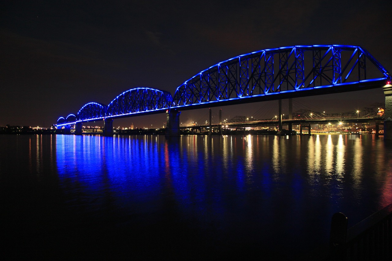
- From Louisville, take the I-65 south to Exit 112, then the KY 245 via Clermont to Bardstown. The interstate is busy in the city area; the KY 245 is a well-built two-lane country road through hills, woodland and rows of warehouses. Driving time a little over an hour. If you reach Louisville from the north (Indiana), you cross the Ohio bridges with electronic tolling (RiverLink) – see the practical section.
- Highlights & must-sees
- Whiskey Row on Main Street in Louisville: 19th-century cast-iron and brick façades that now house several distilleries and bourbon visitor centres offering tours. Don’t drive the motorhome into the city centre; leave it at the campground and take a bus or taxi.
- Churchill Downs and the Kentucky Derby Museum: the racetrack of the Kentucky Derby (first Saturday in May), with a museum and tours of the grounds. Around Derby time, pitches in the region are booked up months in advance.
- Bernheim Forest near Clermont: arboretum and research forest on the KY 245 with hiking trails and the “Canopy Tree Walk”, a boardwalk into the treetops; parking for larger vehicles available, check opening times in advance.
- CampingSpirit overnight tip
-
Official campsite or RV park: My Old Kentucky Home State Park in Bardstown: small state park campground (around 40 sites) with electric and water hook-ups at most sites, showers and a dump station; the hook-ups are sometimes a long way from the pitch, so bring long cables and hoses. Check opening times in advance; reservations through the Kentucky State Parks system. From the campground you can reach Bardstown’s old town on foot or by bike. In Louisville itself there are no state campgrounds close to the city; if you want to stay there, use private campgrounds south of the city.
Free camping or nature tip (where legal): There is no public land for free camping around Louisville and Bardstown; overnighting at the roadside or in distillery car parks is not allowed. Supermarket car parks only with explicit permission from the store management.
- Insider tip for campers
- Distillery tours with tastings almost everywhere require a reservation and are booked up early at weekends. Best to leave the camper in Bardstown and visit the town’s distilleries (Heaven Hill Bourbon Experience, Willett, Bardstown Bourbon Company) by taxi, bike or guided shuttle tour – that way nobody drives after the tasting.
2Stage 2: Bardstown to Mammoth Cave (approx. 150 km)
- The drive
- Take the KY 49 south through the hill country to Loretto, a narrow, winding country road without a hard shoulder. Then via KY 49/KY 84 and Hodgenville (US 31E) to the I-65 and south to Exit 53 (Cave City), from there on the KY 70 into the national park. Driving time about two and a half hours. The access roads to Maker’s Mark are narrow; if you are towing, drive slowly and expect oncoming coaches.
- Highlights & must-sees
- Maker’s Mark Distillery near Loretto: distillery on Star Hill Farm in a valley of black buildings with red shutters; tours by reservation only. Large vehicles use the designated car park; follow the staff’s directions.
- Abraham Lincoln Birthplace National Historical Park near Hodgenville: memorial building with 56 steps over a symbolic log cabin, and the Sinking Spring, the spring on the farm where Lincoln was born in 1809; a short stop right on the route.
- Arrival at Mammoth Cave National Park: visitor centre with exhibition, ticket office for the cave tours and starting point of the surface trails to the Historic Entrance and the River Styx Spring.
- CampingSpirit overnight tip
-
Official campsite or RV park: Mammoth Cave Campground near the visitor centre: the park’s largest campground, in broadleaf forest, sites without electric and water hook-ups, toilet and shower blocks, dump station nearby; open seasonally, reservations through recreation.gov. Electric and water hook-ups are only available at Maple Springs north of the Green River – seven group and horse sites, vault toilets, no dump station, motorhomes up to about 11.5 metres (trailers up to just under 8 metres). Motorhomes are not allowed on the Green River Ferry and have to take the detour via Brownsville (around 45 minutes); check facilities and lengths in advance on recreation.gov or nps.gov. Houchin Ferry Campground in the west of the park is a small, basic riverside site, unsuitable for large motorhomes.
Free camping or nature tip (where legal): In the national park, overnight stays are only allowed at the campgrounds or, with a backcountry permit, at the designated backcountry sites; car parks and roadsides are off limits. Outside the park, free camping on private land without permission is not allowed.
- Insider tip for campers
- The park charges no entrance fee; you pay for cave tours and campsites. Book cave tours on recreation.gov in good time – the popular tours (Historic, Domes and Dripstones, Grand Avenue) are often booked up days or weeks in advance in summer and on public holidays. Because of white-nose syndrome in bats, don’t wear clothing, shoes or gear that have already been used in other caves. Check current prices and tours on nps.gov.
3Stage 3: Mammoth Cave to Lexington (Kentucky Horse Park) (approx. 270 km)
- The drive
- Back to Cave City, north on the I-65 to Elizabethtown, then east on the Bluegrass Parkway – four lanes, steady, little traffic. At Exit 59 take the US 127 north to Lawrenceburg, then the US 62 to Versailles and on to Lexington. Driving time around three hours; between Lawrenceburg and Versailles, winding country roads with views over horse pastures. The Green River Ferry (back in service since March 2026 after repairs to the 2025 flood damage, daily approx. 6 am–6 pm) takes a maximum of two cars; motorhomes are not permitted, trailers only at certain water levels, and in high water it doesn’t run at all. With a camper, always go via Cave City.
- Highlights & must-sees
- Four Roses Distillery near Lawrenceburg: distillery in a Spanish Mission-style building from 1910, one of the most unusual buildings on the Bourbon Trail; tours by reservation.
- Wild Turkey Distillery on the Kentucky River near Lawrenceburg: visitor centre with large glass fronts above the river gorge; from the car park you can see Young’s High Bridge, a disused railway bridge over the Kentucky River.
- Cave tour in the morning before you leave: if you didn’t get a tour the day before, you can ask at the visitor centre early in the morning about remaining places; there is no guarantee.
- CampingSpirit overnight tip
-
Official campsite or RV park: Kentucky Horse Park Campground north of Lexington (I-75, Exit 120): large, year-round campground on the grounds of the state horse park with electric and water hook-ups, toilet and shower blocks, dump station and shop; from November to March only two loops are open, and the water at the sites is turned off from about mid-November to mid-March. Fills up quickly during major competitions and events; reservations through the Kentucky State Parks reservation system (ReserveAmerica).
Free camping or nature tip (where legal): In the Bluegrass region around Lexington, almost everything is private land with horse farms; free camping is not possible. Interstate rest areas are meant for short breaks, not for the night.
- Insider tip for campers
- Tasting on the Lawrenceburg section is the trickiest part of the route: if you have to drive, skip it or take samples with you sealed (many distilleries sell small bottles). After that, only drive on to Lexington if a sober person is at the wheel.
4Stage 4: Lexington to Lexington (Bluegrass loop) (approx. 70 km)
- The drive
- Loop through horse country: Old Frankfort Pike (KY 1681) west of Lexington, Pisgah Pike and the country roads around Midway and Versailles. The roads are narrow, lined with stone walls and trees, often without a hard shoulder and with nowhere to turn; drive them with restraint in large motorhomes or when towing. Driving time about two hours.
- Highlights & must-sees
- Kentucky Horse Park: museums on the history of the horse, horse shows and the grave of Man o’ War; within walking distance of the campground.
- Keeneland near Lexington: racetrack with limestone buildings; race meets in April and October, outside these times you can watch morning training early in the day – check access in advance.
- Midway: small railway town with a track running down the middle of the main street, cafés and shops; parking for larger vehicles on the edge of town.
- CampingSpirit overnight tip
-
Official campsite or RV park: Second night at Kentucky Horse Park Campground; it makes a good base, as Lexington, Midway and Georgetown are all a short distance away.
Free camping or nature tip (where legal): No legal free camping in the Bluegrass; on the farms, stopping at the fence and entering pastures without an invitation are not allowed.
- Insider tip for campers
- Visits to stud farms are only possible on a tour booked in advance; many farms don’t accept walk-in visitors. Use the fresh water and dump station at the Horse Park before heading on into the mountains – there are no hook-ups in the Red River Gorge.
5Stage 5: Lexington to Red River Gorge (Koomer Ridge) (approx. 140 km)
- The drive
- East on the I-64 to Winchester, then on the Bert T. Combs Mountain Parkway to Exit 33 at Slade. The loop through the gorge follows KY 11/KY 15, KY 77 and KY 715: narrow, winding, with rock walls right next to the road. On the KY 77 lies the Nada Tunnel – a single-lane, unlit tunnel from 1910/11, dating from the days of the logging railway, around 275 metres long, about 3.6 metres wide and around 4 metres high, with an uneven road surface and oncoming traffic managed by sight. Motorhomes larger than a van, rigs with trailers and anything taller than a pick-up with a topper don’t go through; they bypass it via KY 11/KY 15. Driving time for the approach about 1.5 hours.
- Highlights & must-sees
- Nada Tunnel: reachable in a small camper or on foot from the pull-outs at the portals. Stop before entering, switch on your lights and wait until the bore is clear; the passage is short, but tight and dripping wet. Because of inspections and roadworks (most recently, e.g., road surface repairs in the tunnel in 2025), the KY 77 is occasionally closed for days at a time; check announcements from the Kentucky Transportation Cabinet and the Forest Service.
- Sky Bridge on the KY 715: sandstone arch crossed by a short, partly paved loop trail; a starting point for photos of the gorge. The car park is small, and rigs with trailers often can’t find space.
- Chimney Top Rock: viewpoint rock at the end of Chimney Top Road (gravel) overlooking the Red River gorge; not suitable for large vehicles – go by van or on foot.
- CampingSpirit overnight tip
-
Official campsite or RV park: Koomer Ridge Campground of the Daniel Boone National Forest on the KY 15: sites in pine and broadleaf forest on the ridge, open year-round, flush toilets, drinking-water taps and seasonal showers, no electric or water hook-ups at the sites and no dump station; only 19 of the 54 sites are suitable for motorhomes. Reservations through recreation.gov; non-reserved sites are first come, first served. Trails lead straight into the gorge from here.
Free camping or nature tip (where legal): Stricter rules apply in the Red River Gorge Geological Area than in the rest of the national forest: overnight parking on Forest Service land requires an Overnight Parking Pass (available at Forest Service offices and from vendors such as the petrol stations in Slade), displayed visibly in the vehicle; camping is prohibited in many places (at rock ledges, arches, caves, near trails and roads). Free camping on the roadside of the KY 715 and KY 77 is not allowed. Get the current map and rules from the Forest Service (Gladie Visitor Center).
- Insider tip for campers
- The gorge is a climbing and hiking area that gets very busy on autumn weekends; car parks are full from mid-morning. Start early; mobile coverage is patchy in the valleys – save maps offline. Fill up in Slade; there are no petrol stations in the gorge itself.
6Stage 6: Red River Gorge to Natural Bridge State Resort Park (approx. 25 km)
- The drive
- Short stage south via KY 15 and KY 11 to the state resort park near Slade. The KY 11 winds through the valley of the Middle Fork – narrow, but with no height restriction. Driving time under half an hour; the rest of the day belongs to the trails.
- Highlights & must-sees
- Natural Bridge: sandstone arch above the forest, around 24 metres long and 20 metres high; the Original Trail climbs steeply for about three-quarters of a mile, and at the top you walk across the arch. Through “Fat Man’s Squeeze”, a cleft in the rock, you reach the other side.
- Sky Lift: chairlift to the top station near the arch, for those who want to shorten the climb; operating times seasonal and weather-dependent.
- Lover’s Leap and Laurel Ridge Trail: viewpoints on the ridge looking out over the forest of the gorge, especially in October.
- CampingSpirit overnight tip
-
Official campsite or RV park: Natural Bridge State Resort Park, two campgrounds: Whittleton Campground in the narrow valley along Whittleton Branch, and Middle Fork Campground on the Middle Fork of the Red River near Hoedown Island; sites with electric hook-ups, at Middle Fork also with water, at Whittleton at most sites; toilet and shower blocks, one shared dump station. 2026 season until mid-November. Whittleton is shady and tight; for long vehicles, choose Middle Fork. Reservations through the Kentucky State Parks system.
Free camping or nature tip (where legal): In the state park, only stay overnight at the campgrounds. In the surrounding Daniel Boone National Forest outside the Geological Area, dispersed camping is possible under Forest Service rules; check locations and closures with the ranger district.
- Insider tip for campers
- Hoedown Island in the park hosts square-dance evenings in summer. Top up fresh water before the long stage south and empty grey water at the dump station.
7Stage 7: Natural Bridge to Cumberland Falls State Resort Park (approx. 250 km)
- The drive
- Back via the KY 11 to the Mountain Parkway, west to Winchester, via the I-64 to the I-75 at Lexington, then south to Corbin (Exit 25) and via the US 25W and the KY 90 into the park. This option is longer, but much more relaxed for large vehicles than the direct KY 11 through Beattyville and Manchester, with its many bends and town centres. Driving time about three hours. The KY 90 to the falls is winding, with a descent to the river.
- Highlights & must-sees
- Cumberland Falls: the Cumberland River drops around 20 metres over a sandstone ledge about 38 metres wide; viewing platforms right by the car park. With a full moon and clear skies, a moonbow forms in the spray, usually on the nights around the full moon; the park publishes the dates.
- Eagle Falls Trail: hiking trail on the opposite bank to a second waterfall, with a view back to Cumberland Falls; steep in places, with steps.
- Corbin: small town on the I-75 with Harland Sanders’ first restaurant, now a museum café; a good chance to refuel and stock up.
- CampingSpirit overnight tip
-
Official campsite or RV park: Cumberland Falls State Resort Park campground (two loops, Ridgeline and Clifty) above the river: around 50 sites in the woods, about 20 of them with electric and water hook-ups, the rest for tents; showers, dump station. Unsuitable for large motorhomes – lengths of around 9 metres are the maximum. Open seasonally (in 2026 until the end of October), booked up early on moonbow dates and autumn weekends. Reservations through the Kentucky State Parks system.
Free camping or nature tip (where legal): Free overnight stays are not allowed in the state park or along the river. In the surrounding Daniel Boone National Forest, Forest Service rules for dispersed camping apply; ask the London Ranger District in advance about suitable areas.
- Insider tip for campers
- For the moonbow, bring a head torch with a red-light mode and a tripod; the platforms are crowded on these nights, so arrive an hour before moonrise. Clouds, haze or too little spray at low water prevent the phenomenon – no guarantee.
8Stage 8: Cumberland Falls to Laurel River Lake (Daniel Boone National Forest) (approx. 55 km)
- The drive
- Back along the KY 90 towards Corbin, then on country roads (KY 312 and KY 1193) west to Laurel River Lake, a reservoir with wooded shores in the Daniel Boone National Forest. The roads are two-lane and winding, but without bottlenecks. Driving time about an hour.
- Highlights & must-sees
- Laurel River Lake: clear, deep reservoir between sandstone cliffs, with boat ramps and swimming coves; a kayaking and canoeing area in summer.
- Daniel Boone National Forest: hiking trails, including sections of the Sheltowee Trace, which runs through the forest from north to south; trailheads on several roads around the lake.
- Finish in London or Corbin: shopping, refuelling and the way back via the I-75 to Lexington or south towards Tennessee.
- CampingSpirit overnight tip
-
Official campsite or RV park: Holly Bay Campground of the Daniel Boone National Forest on Laurel River Lake: sites in the woods on the lakeshore, some with electric hook-ups, toilet and shower blocks, dump station; open seasonally, reservations through recreation.gov. Alternatively Grove Campground in the south of the lake near Corbin, also Forest Service.
Free camping or nature tip (where legal): Dispersed camping is generally allowed in the Daniel Boone National Forest unless a closure applies: away from campgrounds, recreation areas and bodies of water, leaving no trace; length of stay is limited. Ask the London Ranger District about specific areas and rules.
- Insider tip for campers
- If you want to get to the water, scout the shore access points first: many tracks down to the lake are steep and narrow. Fill up and shop in London or Corbin; there are only a few shops around the lake.
Camping practice & local rules
Wild camping & overnight parking
- Kentucky has no statewide right to free camping. Overnight stays are permitted at campgrounds, in state parks only at the designated sites, and on private land only with the owner’s permission. Municipalities can issue their own bans on sleeping in vehicles.
- Daniel Boone National Forest: dispersed camping is mostly possible unless a closure applies. In the Red River Gorge Geological Area, overnight parking requires an Overnight Parking Pass and compliance with special restricted zones; Forest Service rangers carry out checks, and violations are fined.
- Mammoth Cave National Park: overnight stays only at the campgrounds or, with a backcountry permit, at the designated backcountry sites.
- Ticks: from spring to autumn, ticks are common in woodland and long grass (including the lone star tick and the American dog tick). Tuck long trousers into your socks, use repellent and check your body in the evening; remove ticks immediately and see a doctor if you develop a fever or rash. Venomous snakes (copperhead, rattlesnake) occur in rocky areas.
- Apps and websites: Campendium, iOverlander, The Dyrt and Park4Night, plus recreation.gov (national park and Forest Service) and the Kentucky State Parks reservation system.
Waste disposal & supplies
- Dump stations: at state park campgrounds, at the Kentucky Horse Park, at Mammoth Cave and at some petrol stations and truck stops; apps such as Campendium help you find them.
- Drinking water: tap water in towns and at campgrounds is drinkable unless signposted otherwise. Koomer Ridge has taps but no dump station and no hook-ups; for dispersed camping, carry enough water in the tank.
- Grey water and chemical toilet: empty only at dump stations, never on the ground or into streams – karst areas such as around Mammoth Cave channel waste water directly into the groundwater and the caves.
- Propane: available at many petrol stations, DIY stores and campgrounds; European cylinders are generally not refilled, so you need an adapter or a US cylinder.
- Fuel: cheaper in the cities (Louisville, Lexington, Corbin, London) than in the Red River Gorge and in small towns.
Vehicle size & traffic rules
- Speed limits in mph: interstates and parkways usually 65–70, two-lane highways mostly 55, in built-up areas 25–35. In Kentucky there is no generally lower limit for motorhomes and rigs with trailers; follow the signs.
- Alcohol: blood alcohol limit 0.08% (0.02% for under-21s); Kentucky prohibits open alcohol containers in the passenger area of a vehicle on public roads. There is an exception for passengers in motorhomes, but not for the driver – so keep opened bottles out of the driver’s reach and carry purchased bottles sealed in the storage compartment. Don’t drive after tastings; designate a driver or use shuttle tours.
- Tolls: the Kentucky parkways are toll-free. The Ohio bridges at Louisville (I-65 Abraham Lincoln and Kennedy Bridge, Lewis and Clark Bridge on the I-265) are tolled electronically (RiverLink), billed by transponder or by invoice to the registered keeper (more expensive); depending on size, motorhomes may fall into a higher vehicle class, and rental companies often add a service fee. The Sherman Minton Bridge (I-64) and the Clark Memorial Bridge (US 31) are toll-free.
- Dimensions: the Nada Tunnel (KY 77) is only about 3.6 metres wide and around 4 metres high – large vehicles go around it. Avoid narrow country roads in the Bluegrass and the Red River Gorge when towing.
- Reservations: cave tours and campgrounds at Mammoth Cave as well as Koomer Ridge and Holly Bay through recreation.gov; sites in the state parks (My Old Kentucky Home, Natural Bridge, Cumberland Falls) through the Kentucky State Parks reservation system.
CampingSpirit packing & preparation checklist
- Tick protection: repellent with DEET or picaridin, permethrin for clothing and a tick card or tick tweezers – woods and meadows are full of ticks from April to October.
- Head torch with a red-light mode and a tripod – for the moonbow night at Cumberland Falls and the Nada Tunnel on foot.
- Sturdy shoes and a jacket for the cave: in Mammoth Cave the temperature stays at about 12 °C all year round, and the paths are damp. Don’t bring shoes from other caves (white-nose syndrome).
- Offline maps and printed reservations – mobile coverage is weak in the Red River Gorge and around Cumberland Falls.
- Padded box or wine cartons for purchased bourbon bottles, so they travel sealed and unbreakable in the storage compartment.
- Water container (20 l) for dispersed camping in the Daniel Boone National Forest.
As of 2026-09. Closures, fees and booking rules change: check official sources before you go.