
Albula Pass and the Lower Engadine
Over the Albula into the Engadine, then through the Swiss National Park area to painted villages and Tarasp Castle.
- Distance
- approx. 121 km (75 mi)
- Driving
- 1 h 40 min
- Suggested days
- 4
- Stops
- 9
- Countries
- Switzerland
- Best time to go
- July
- Tolls and vignettes
- ≈ €40
- Updated
- July 23, 2026
At a glance: 4-day road trip of about 121 km (75 mi) with 9 stops, from Chur to Scuol. About 1 h 40 min of driving in total. Best time to go: July. Tolls and vignettes for a car: about €40 (Switzerland, Vignette).
More road trips in Switzerland · More road trips from Feldkirch
Photos along the route


Route description
From Chur, drive south over the Lenzerheide to Tiefencastel and into the Albula valley. Bergün is a village of painted houses where the Albula railway line spirals through tunnels and viaducts, part of a UNESCO World Heritage Site.
The Albula Pass climbs to 2,312 m through a stony, almost lunar landscape, a much quieter road than the Julier or the Bernina. It is narrow in places, closed in winter, and not recommended for large motorhomes or caravans.
Drop down to La Punt and turn east along road 27 into the Lower Engadine. Zuoz has some of the finest Engadine houses, with sgraffito decoration and deep-set windows. At Zernez, the national park visitor centre explains the park; take the Ofen Pass road to Il Fuorn and walk one of the marked trails.
Continue down the valley to Guarda, a village of beautifully decorated houses, then to Scuol, a spa town with mineral springs, below Tarasp Castle on its hill. The Lower Engadine is sunny and dry; July to September is ideal for walking.
Which stops are on Albula Pass and the Lower Engadine?
In driving order. Distances are estimates between consecutive stops.
- 1Start
Chur
Switzerland - 237 km
Bergün
Switzerland - 311 km
Albula Pass
ViewsBergün, SwitzerlandA quiet 2,312 m pass between Bergün and the Engadine, while the Albula railway tunnels far below. The road is narrow and winding, closed in winter, with marmots on the high meadows.
- 412 km
Zuoz
Switzerland - 519 km
Zernez
Switzerland - 612 km
Swiss National Park at Il Fuorn
NatureZernez, SwitzerlandSwitzerland’s only national park, strictly protected since 1914. Leave the car at the numbered car parks on the Ofen Pass road and walk in; red deer are easiest to spot at dawn.
- 717 km
Guarda
Switzerland - 811 km
Tarasp Castle
HistoryScuol, SwitzerlandA white castle on a rocky knoll above the Lower Engadine, one of the most striking in the Alps. Guided tours run in summer; the walk up from the village takes about ten minutes.
- 94 km
Scuol
Switzerland
How do you drive Albula Pass and the Lower Engadine in 4 days?
4 days, split by driving time. Campsites from OpenStreetMap: check opening dates before you go.
- Day 1: Chur → Bergün · 37 km · 0 h 30 minOvernight nearby, for example: Campingplatz Rona (12 km); Camping Gravatscha (15 km).
- Day 2: Bergün → Zuoz · 23 km · 0 h 19 minOn the way: Albula Pass.Overnight nearby, for example: Camping Madulain (2 km); Camping Gravatscha (9 km).
- Day 3: Zuoz → Swiss National Park at Il Fuorn · 30 km · 0 h 25 minOn the way: Zernez.Overnight nearby, for example: Camping Cul (10 km); Aquafresca (19 km).
- Day 4: Swiss National Park at Il Fuorn → Scuol · 31 km · 0 h 26 minOn the way: Guarda, Tarasp Castle.Overnight nearby, for example: Camping Arina (13 km); Camping Thöni (18 km).
When is the best time for Albula Pass and the Lower Engadine?
The most pleasant months are usually July. Still fine, with some compromises, in June and August–September. Cold, short days in November–March. July and August are the busiest months: book campsites early.
Estimate from long-term temperature averages, terrain and pass seasons
What should you know before driving Albula Pass and the Lower Engadine?
Tolls and vignettes for a car: about €40 (Switzerland, Vignette).
- Switzerland: Vignette needed for motorways. Vehicles over 3.5 t pay the heavy vehicle charge instead of the vignette. Motorway limit for cars: 120 km/h.
Road rules and fees change. Check official sources before you travel.
More routes for the best months
Practical guides for this route




Themes
Plan this route for your vehicle
Scout adapts this route to your vehicle, your days and your budget.
FAQs
How long is Albula Pass and the Lower Engadine?
4-day road trip of about 121 km (75 mi) with 9 stops, from Chur to Scuol. About 1 h 40 min of driving in total.
How many days do you need for Albula Pass and the Lower Engadine?
We suggest 4 days: about 1 h 40 min of driving, which leaves time for the stops.
Where does Albula Pass and the Lower Engadine start and end?
It starts in Chur and ends in Scuol.
Which countries does Albula Pass and the Lower Engadine pass through?
Switzerland.
Where can you camp along Albula Pass and the Lower Engadine?
OpenStreetMap lists 74 campsites and motorhome stopovers within 20 km of the stops on this route. For example: Camping Pradafenz, Camping Trin and Campingplatz Rona.
How much are the tolls on Albula Pass and the Lower Engadine?
Tolls and vignettes for a car: about €40 (Switzerland, Vignette). Estimate with typical rates; motorhomes pay more, and vehicles over 3.5 t often pay by distance.
More like this
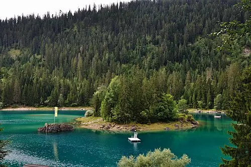 © Hansueli Krapf This file was uploaded with Commonist. · CC BY-SA 3.0
Rhine Gorge, Viamala and San Bernardino to Bellinzona
 Photo by Adrien Fu on Unsplash
Silvretta and Arlberg loop
 Photo by Samuele Bertoli on Unsplash