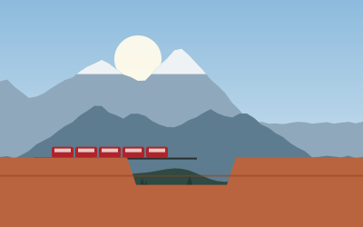
Mount Blue Sky, Georgetown and Loveland Pass to Breckenridge
West of Denver on one of the highest paved roads in North America, then through a silver-mining town and over the Continental Divide to Breckenridge.
- Distance
- 144 km (89 mi)
- Driving
- 1 h 36 min
- Suggested days
- 2
- Stops
- 7
- States
- CO
- Updated
- May 16, 2026
At a glance: 2-day road trip of about 144 km (89 mi) with 7 stops, from Denver to Breckenridge. About 1 h 36 min of driving in total.
More road trips in Colorado
Route description
Leave Denver west on I-70 and climb into Clear Creek Canyon to Idaho Springs, 50 km away, a gold-rush town with a lively main street and a historic hot springs. Summer weekends bring heavy traffic on I-70, so start early. From Idaho Springs, CO-103 climbs south for about 21 km through forest to Echo Lake, a good place for a picnic or a short walk around the shore.
At Echo Lake, CO-5 heads for the summit of Mount Blue Sky, formerly Mount Evans, at 4,348 m. The road reopened in 2026 after two years of repairs; it is open in summer only, and a timed-entry reservation is required. It is narrow, with steep drop-offs and no guard rails, so check current conditions before you go. Stop at Summit Lake, where mountain goats are often seen.
Back in Idaho Springs, continue west on I-70 to Georgetown, a well-preserved silver-mining town with Victorian houses and shops. The Georgetown Loop Railroad runs between Georgetown and Silver Plume over a high trestle, and Guanella Pass Scenic Byway climbs south from town to a trailhead above the tree line. Georgetown has limited RV parking, so park at the lake on the edge of town.
Leave I-70 at exit 216 and take US-6 over Loveland Pass at 3,655 m, a slower but more scenic route than the Eisenhower Tunnel. Vehicles carrying hazardous materials, including large propane loads, must use the pass. The road drops past Arapahoe Basin and Keystone to Dillon Reservoir; from there, CO-9 leads south to Breckenridge, a busy ski town with a historic district and a free bus system.
Stop-by-stop itinerary
In driving order. Distances are estimates between consecutive stops.
- 1Start
Denver
CO - 254 km
Idaho Springs
CO - 315 km
Echo Lake Park
NatureIdaho Springs, COA subalpine lake at 3,230 m at the foot of the Mount Blue Sky road (CO-5), with an easy loop trail. Good picnic spot before climbing higher.
- 410 km
Mount Blue Sky
ViewsIdaho Springs, COThe 4,348 m summit reached by the highest paved road in North America, reopened in 2026 after two years of repairs. It is open in summer only, with a timed-entry reservation; mountain goats and bighorn sheep graze the slopes.
- 517 km
Georgetown
CO - 619 km
Loveland Pass
ViewsDillon, COThe 3,655 m Continental Divide crossing on US-6, open year-round. Hazardous-material vehicles must use it instead of the Eisenhower Tunnel; parking lot at the summit.
- 729 km
Breckenridge
CO
FAQs
How long is Mount Blue Sky, Georgetown and Loveland Pass to Breckenridge?
2-day road trip of about 144 km (89 mi) with 7 stops, from Denver to Breckenridge. About 1 h 36 min of driving in total.
How many days do you need for Mount Blue Sky, Georgetown and Loveland Pass to Breckenridge?
We suggest 2 days: about 1 h 36 min of driving, which leaves time for the stops.
Where does Mount Blue Sky, Georgetown and Loveland Pass to Breckenridge start and end?
It starts in Denver and ends in Breckenridge.
Which states does Mount Blue Sky, Georgetown and Loveland Pass to Breckenridge pass through?
Colorado.