Peak to Peak Scenic Byway
Established in 1918, the Peak to Peak is Colorado’s oldest scenic byway. It runs about 55 miles along the Front Range with views of the Continental Divide.
- State
- Colorado
- Length
- 55 miles
- Suggested time
- About 80 minutes of driving
- Best season
- Usually summer and autumn, check winter first
- Established
- 1918
What should you know before visiting Peak to Peak Scenic Byway?
No toll roads expected for a car. Mountain passes: Trail Ridge Road (3,713 m, usually open June–September).
- The route is less than an hour from Denver, Boulder and Fort Collins, so it suits a day trip or a weekend.
- Gravel side roads lead off the main highway to high-country lakes, trailheads, campgrounds and the ghost towns of Hesse and Apex.
- The byway connects at Estes Park to Trail Ridge Road. Check its winter status and vehicle rules beforehand with the National Park Service.
The drive
The byway runs about 55 miles through Gilpin, Boulder and Larimer counties. The south end is at Black Hawk, the north end in Estes Park, where it meets Trail Ridge Road. Along the way are Rocky Mountain National Park, Golden Gate Canyon State Park, the Arapaho and Roosevelt National Forests, the Indian Peaks Wilderness and Eldora ski area. The drive is given as about 80 minutes without stops.
Planning
According to the Colorado Department of Transportation (CDOT), there are no fees for the byway. We found neither a high point nor season dates in the sources, so check weather and road conditions with CDOT beforehand, especially in winter. We found no information on length or weight limits for motorhomes. The route can be driven in either direction and combines well with a visit to Rocky Mountain National Park.
Camping
Campgrounds along the route are reached via gravel roads, and the national forests and Golden Gate Canyon State Park lie alongside. We found nothing in the sources on dispersed camping rules in the national forests or on reservations. Ask the Forest Service (Arapaho and Roosevelt National Forests) and Colorado State Parks beforehand about sites, vehicle lengths and whether reservations are required.
FAQs
How long is the Peak to Peak Scenic Byway?
About 55 miles. The sources give about 80 minutes of driving without stops. With detours to lakes, ghost towns and trails it quickly becomes a full day.
Are there fees for the byway?
According to CDOT and the Federal Highway Administration (FHWA), the byway itself has no fees. Fees may apply at individual destinations such as the national park or state park, so check with those agencies beforehand.
Where does the route start and end?
Sources place the south end at Black Hawk and the north end at Estes Park, where the byway meets Trail Ridge Road. For the exact highways in between, use the current CDOT map.
Places to see
 © Van Peltekian · CC BY 3.0
Trail Ridge Road
The highest continuous paved road in the US, topping out at 12,183 feet in Rocky Mountain National Park.…
 © Clyde Charles Brown · CC BY-SA 4.0
Mount Blue Sky
The 4,348 m summit reached by the highest paved road in North America, reopened in 2026 after two years of…
 Photo by Melanie Magdalena on Unsplash
Garden of the Gods
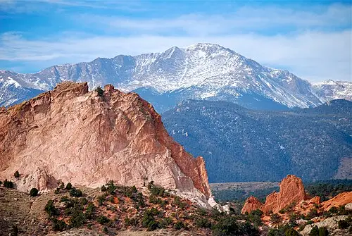
A free city park where red sandstone fins stand upright in front of Pikes Peak. The paved loops are easy.
 © Khoshhat · CC BY-SA 4.0
Red Rocks Amphitheatre
A concert venue carved between 300-foot sandstone monoliths. Visit during the day to climb the stairs and…

 © Evan Clark evanrclark · CC0
Echo Lake Park
A subalpine lake at 3,230 m at the foot of the Mount Blue Sky road (CO-5), with an easy loop trail. Good…
 © Famartin · CC BY-SA 4.0
Loveland Pass
The 3,655 m Continental Divide crossing on US-6, open year-round. Hazardous-material vehicles must use it…
 © Thomson M · CC BY 3.0
Holzwarth Historic Site
A 1920s dude ranch in Rocky Mountain National Park’s Kawuneeche Valley, reached by an easy 800 m walk from…
 © inkknife_2000 (7.5 million views +) · CC BY-SA 2.0
Adams Falls
A short walk from the East Inlet trailhead at Grand Lake to a waterfall squeezed through a granite gorge.…