Southern Oregon coast: Cape Arago to the Boardman corridor
Storm-watching gardens, sea lion reefs, the westernmost lighthouse in Oregon and the arches of the Samuel H. Boardman corridor.
- Distance
- 194 km (121 mi)
- Driving
- 2 h 09 min
- Suggested days
- 3
- Stops
- 9
- States
- OR
- Updated
- May 28, 2026
At a glance: 3-day road trip of about 194 km (121 mi) with 9 stops, from Coos Bay to Brookings. About 2 h 09 min of driving in total.
More road trips in Oregon
Route description
From Coos Bay, follow the Cape Arago Highway through Charleston for about 14 miles. Shore Acres State Park has formal gardens on sandstone cliffs where winter waves crash high; a day-use permit is required. At the end of the road, Cape Arago has tide-pool coves, and the Simpson Reef Overlook just before it is a good place to watch sea lions and seals.
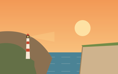
Return through Charleston and take the Seven Devils Road or US-101 south to Bandon, about 40 minutes, with sea stacks on its beaches. South of Bandon, US-101 runs inland through cranberry bogs and pastures. Cape Blanco State Park is five miles off the highway; its lighthouse, lit in 1870, stands at the westernmost point of Oregon, and the cape is very windy.
Port Orford is one of the few natural harbours on this coast; boats are lifted in and out of the water by crane. Battle Rock is in the middle of town. South of it, US-101 skirts Humbug Mountain, whose state park has a sheltered campground, then passes Gold Beach at the mouth of the Rogue River.
North of Brookings, the Samuel H. Boardman State Scenic Corridor runs for about 12 miles past arches, sea stacks and hidden beaches. Arch Rock Viewpoint has a large lot and a short loop; Natural Bridges is a few minutes south, with a view from the railing over collapsed sea arches. Most pull-outs are small, so motorhomes should use Arch Rock, Whaleshead or House Rock.
Stop-by-stop itinerary
In driving order. Distances are estimates between consecutive stops.
- 1Start
Coos Bay
OR - 217 km
Shore Acres State Park
NatureCoos Bay, ORFormer estate gardens on sandstone cliffs where winter storms throw spray high into the air. The formal garden is open all year and lit with lights in December; a day-use parking permit is required.
- 33 km
Cape Arago State Park
NatureCoos Bay, ORThe end of the Cape Arago Highway, with tide-pool coves below and sea lions barking on Shell Island and Simpson Reef. Stop at the Simpson Reef Overlook just before the cape with binoculars.
- 425 km
Bandon
OR - 541 km
Cape Blanco Lighthouse
HistoryPort Orford, ORThe oldest standing lighthouse on the Oregon coast, lit in 1870 near the state’s westernmost point. A side road leads five miles out from US-101; tower tours run in the warmer months and the headland is very windy.
- 614 km
Port Orford
OR - 773 km
Arch Rock Viewpoint
ViewsBrookings, ORA short loop through the Samuel H. Boardman corridor to a rock arch offshore and a picnic area above the surf. It is signed from US-101 about 12 miles north of Brookings; the lot fits larger vehicles.
- 82 km
Natural Bridges Viewpoint
ViewsBrookings, ORA viewpoint over collapsed sea arches in a narrow cove on the Samuel H. Boardman State Scenic Corridor. The main view is a few minutes from the pull-out; the paths beyond the railing are steep and eroded.
- 920 km
Brookings
OR
FAQs
How long is Southern Oregon coast: Cape Arago to the Boardman corridor?
3-day road trip of about 194 km (121 mi) with 9 stops, from Coos Bay to Brookings. About 2 h 09 min of driving in total.
How many days do you need for Southern Oregon coast: Cape Arago to the Boardman corridor?
We suggest 3 days: about 2 h 09 min of driving, which leaves time for the stops.
Where does Southern Oregon coast: Cape Arago to the Boardman corridor start and end?
It starts in Coos Bay and ends in Brookings.
Which states does Southern Oregon coast: Cape Arago to the Boardman corridor pass through?
Oregon.