Alsace Wine Route
Half-timbered villages, storks and Riesling on the slopes below the Vosges.
- Distance
- approx. 94 km (59 mi)
- Driving
- 1 h 18 min
- Suggested days
- 3
- Stops
- 6
- Countries
- France
- Best time to go
- May–September
- Tolls and vignettes
- ≈ €7
- Updated
- August 20, 2026
At a glance: 3-day road trip of about 94 km (59 mi) with 6 stops, from Strasbourg to Eguisheim. About 1 h 18 min of driving in total. Best time to go: May–September. Tolls and vignettes for a car: about €7 (France).
More road trips in France · More road trips from Strasbourg
Photos along the route




Route description
Start in Strasbourg, with its pink sandstone cathedral and the half-timbered canal quarter of Petite France. Check the Crit’Air sticker rules for the city’s low-emission zone before driving in. The Alsace Wine Route then runs south along the foot of the Vosges, first reaching Obernai, a lively town with a market square, ramparts and vineyard walks.
Follow the vineyard roads south past Barr and Dambach-la-Ville to Orschwiller, where a winding road climbs to Haut-Kœnigsbourg. This red sandstone castle, rebuilt by Kaiser Wilhelm II, has views across the Alsace plain to the Black Forest; the car parks along the access road fill up on summer afternoons.
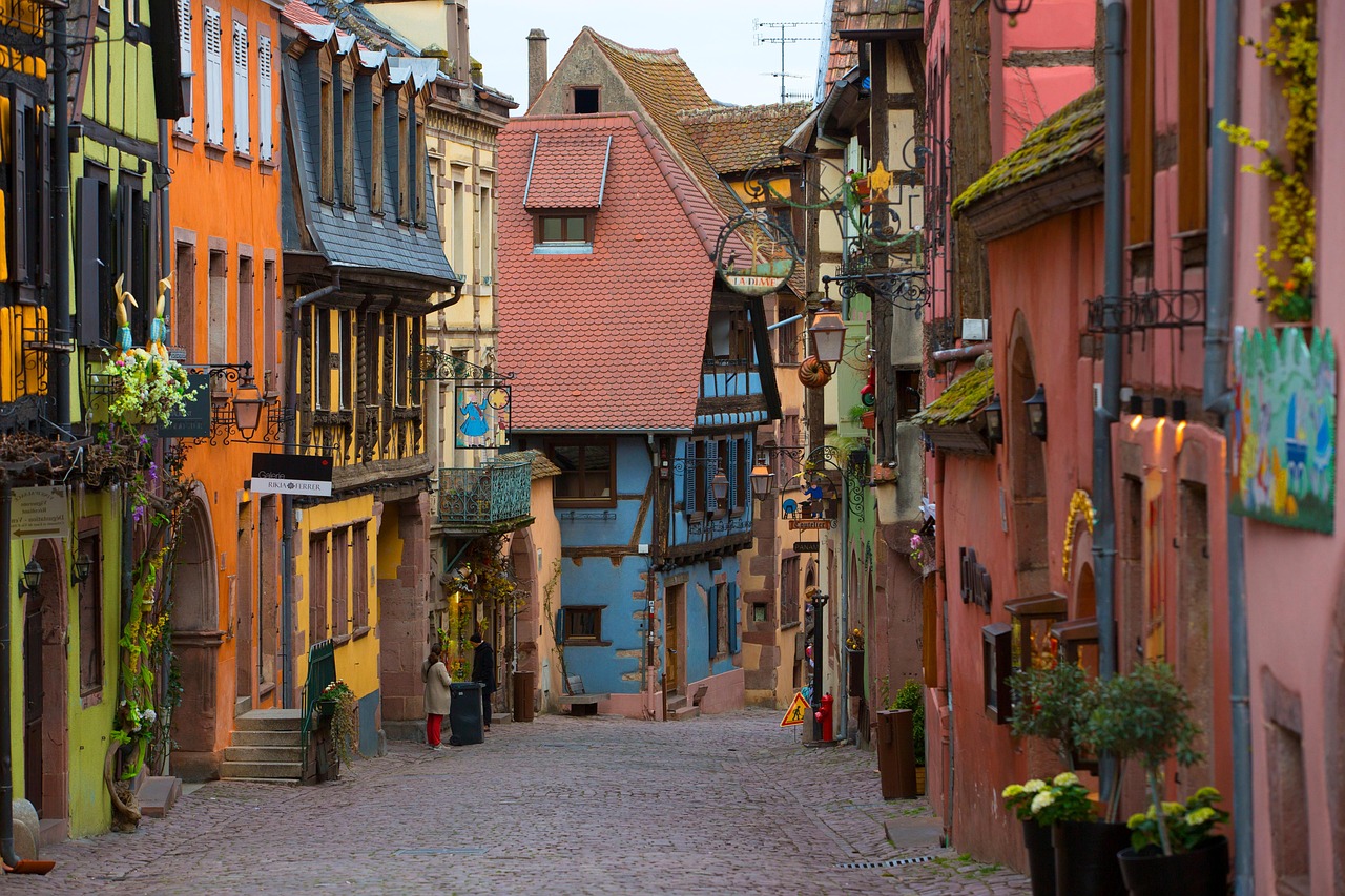
Riquewihr is a walled wine village of half-timbered houses and courtyards, best seen early before the day visitors arrive. Continue to Colmar, where the canal-side houses of Little Venice and the Unterlinden Museum with its Isenheim Altarpiece are the highlights, then end in Eguisheim, whose lanes run in concentric rings around the castle. Look out for storks nesting on roofs and church towers.
The route is good from spring to autumn, busiest at the September and October harvest, and again in December for the Christmas markets. Most villages have car parks at the edge, often with motorhome areas, as their centres are narrow and partly pedestrian. Wine tasting is part of the trip, so plan who drives.
Which stops are on Alsace Wine Route?
In driving order. Distances are estimates between consecutive stops.
- 1Start
Strasbourg
France - 229 km
Obernai
France - 332 km
Haut-Kœnigsbourg
HistoryOrschwiller, FranceA red sandstone castle above the Alsace plain, rebuilt by Kaiser Wilhelm II. Views reach the Black Forest.
- 412 km
Riquewihr
France - 513 km
Colmar
France - 67 km
Eguisheim
France
How do you drive Alsace Wine Route in 3 days?
3 days, split by driving time. Campsites from OpenStreetMap: check opening dates before you go.
- Day 1: Strasbourg → Obernai · 29 km · 0 h 24 minOvernight nearby, for example: Camping Municipal de Molsheim (9 km); Camping-car Park La porte des ours, Andlau (10 km).
- Day 2: Obernai → Haut-Kœnigsbourg · 32 km · 0 h 27 minOvernight nearby, for example: Camping du Haut-Kœnigsbourg (5 km); Camping Municipal Pierre de Coubertin (6 km).
- Day 3: Haut-Kœnigsbourg → Eguisheim · 33 km · 0 h 27 minOn the way: Riquewihr, Colmar.Overnight nearby, for example: Aire de camping-cars d'Eguisheim (< 1 km); Camping des Trois Châteaux (< 1 km).
When is the best time for Alsace Wine Route?
The most pleasant months are usually May–September. Still fine, with some compromises, in October. Cold, short days in December–February. July and August are the busiest months: book campsites early.
Estimate from long-term temperature averages, terrain and pass seasons
What should you know before driving Alsace Wine Route?
Tolls and vignettes for a car: about €7 (France).
- France: Motorway tolls. Tolls on most autoroutes; the limit drops to 110 km/h in rain. Motorway limit for cars: 130 km/h.
- Strasbourg: Low-emission zone (Crit’Air). A Crit’Air sticker is required and older vehicles may be banned. Order the sticker from the official website well in advance.
Road rules and fees change. Check official sources before you travel.
More routes for the best months
Practical guides for this route


Themes
Plan this route for your vehicle
Scout adapts this route to your vehicle, your days and your budget.
FAQs
How long is Alsace Wine Route?
3-day road trip of about 94 km (59 mi) with 6 stops, from Strasbourg to Eguisheim. About 1 h 18 min of driving in total.
How many days do you need for Alsace Wine Route?
We suggest 3 days: about 1 h 18 min of driving, which leaves time for the stops.
Where does Alsace Wine Route start and end?
It starts in Strasbourg and ends in Eguisheim.
Which countries does Alsace Wine Route pass through?
France.
Where can you camp along Alsace Wine Route?
OpenStreetMap lists 149 campsites and motorhome stopovers within 20 km of the stops on this route. For example: Camping de Strasbourg, Strandbad Gifiz and Camping Municipal de Molsheim.
How much are the tolls on Alsace Wine Route?
Tolls and vignettes for a car: about €7 (France). Estimate with typical rates; motorhomes pay more, and vehicles over 3.5 t often pay by distance.