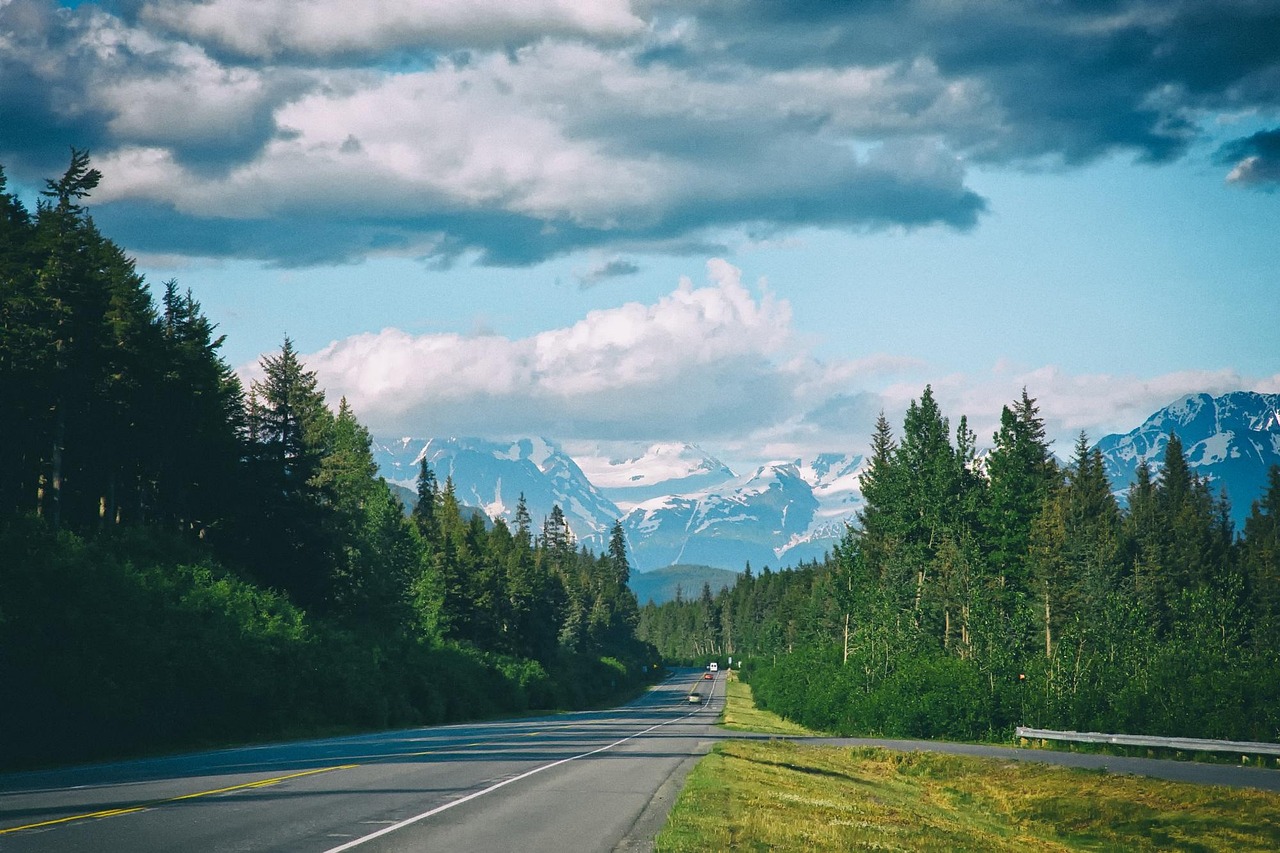
Seward Highway
The Seward Highway runs 127 miles from Anchorage along Turnagain Arm and through the Chugach Mountains to Seward. It holds national, state and All-American Road designations.
- State
- Alaska
- Length
- 127 mi (204 km)
- Start / end
- Anchorage area to Seward
- Road
- National Scenic Byway, All-American Road
- Best season
- Summer; check conditions in winter
What should you know before visiting Seward Highway?
No toll roads expected for a car.
- The first 50 miles run between the Chugach Mountains and Turnagain Arm. Beluga whales, Dall sheep and eagles can be seen, so use pullouts instead of stopping on the road.
- Stops include Girdwood, the Johnson Pass Trail, the Hope side trip of 18 miles, Summit Lake, Moose Pass and Exit Glacier near Seward.
- Moose and other wildlife can appear on the road. Check the Alaska 511 service for current conditions before you set out, especially outside summer.
The drive
The route runs between Seward and the Anchorage area; the Potter Marsh viewpoint just south of the city is among the first stops. After the Turnagain Arm section it climbs through mountains with broad views. The ground here dropped in the 1964 earthquake, and hundreds of spruce died in salt water. Girdwood is close to Crow Creek Mine, where visitors pan for gold, and Seward has the Alaska SeaLife Center and the Exit Glacier road.
Planning
Alaska DOT&PF runs the Alaska 511 service for road conditions. Summer traffic from Anchorage can be heavy, especially on weekends, so start early and allow time for pullouts. Fuel is listed in Anchorage, Girdwood and Seward, and little in between, so fill up in Girdwood. Chugach National Forest campgrounds such as Ptarmigan Creek take reservations, and some sites are first come, first served. For camping outside campgrounds, ask the Chugach National Forest, Chugach State Park and the City of Seward.
FAQs
How long is the Seward Highway?
It is 127 miles (about 204 km) between the Anchorage area and Seward. With stops at Girdwood, Hope or Exit Glacier, plan a full day or more.
What designations does the Seward Highway hold?
It is a USDA Forest Service Scenic Byway, an Alaska Scenic Byway and an All-American Road. That reflects the scenery along Turnagain Arm and through the Chugach Mountains.
Where do I check road conditions?
Use the Alaska 511 service run by Alaska DOT&PF for current road conditions. Check it before each leg, especially in the cold season.
Places to see

 Photo by Lori Stevens on Unsplash
Russian River Falls
A cascade where sockeye salmon leap upstream from late June to August, watched from a viewing platform. The…

 © Gillfoto · CC BY-SA 4.0
Homer Spit
A 4.5-mile gravel spit running into Kachemak Bay, lined with a harbour, beaches and campsites. Views take…
 © Wizz4prep · CC BY-SA 4.0
Independence Mine State Historical Park
The buildings of a 1930s hard-rock gold mine high in the Talkeetna Mountains below Hatcher Pass. The road…
 © Walter Siegmund (talk) · CC BY-SA 3.0
Matanuska Glacier
A glacier 27 miles long whose white tongue reaches the Glenn Highway valley. See it from the Matanuska…
 © Joseph from Cabin On The Road, USA · CC BY-SA 2.0
Denali Visitor Center
The starting point for Denali National Park, with exhibits, trails and the bus depot for the park road,…
 © OKJaguar · CC BY 4.0
Exit Glacier
A glacier you can walk toward, with signs showing how far the ice has retreated.
 © Forest Service Alaska Region, USDA · Public domain
Begich, Boggs Visitor Center
A visitor center on Portage Lake, where icebergs once drifted from Portage Glacier. The glacier has…
 © Ovedc · CC BY-SA 4.0
Ninilchik Holy Transfiguration Church
A white Russian Orthodox church from 1901 on a bluff above Cook Inlet, with views of the Redoubt and…
Campsites nearby
Trip guides
 © OKJaguar · CC BY 4.0
Alaska’s Seward Highway
 Photo by Lori Stevens on Unsplash
Kenai Peninsula to Homer on the Sterling Highway
 © Ovedc · CC BY-SA 4.0
Glenn Highway and Hatcher Pass
 © OKJaguar · CC BY 4.0