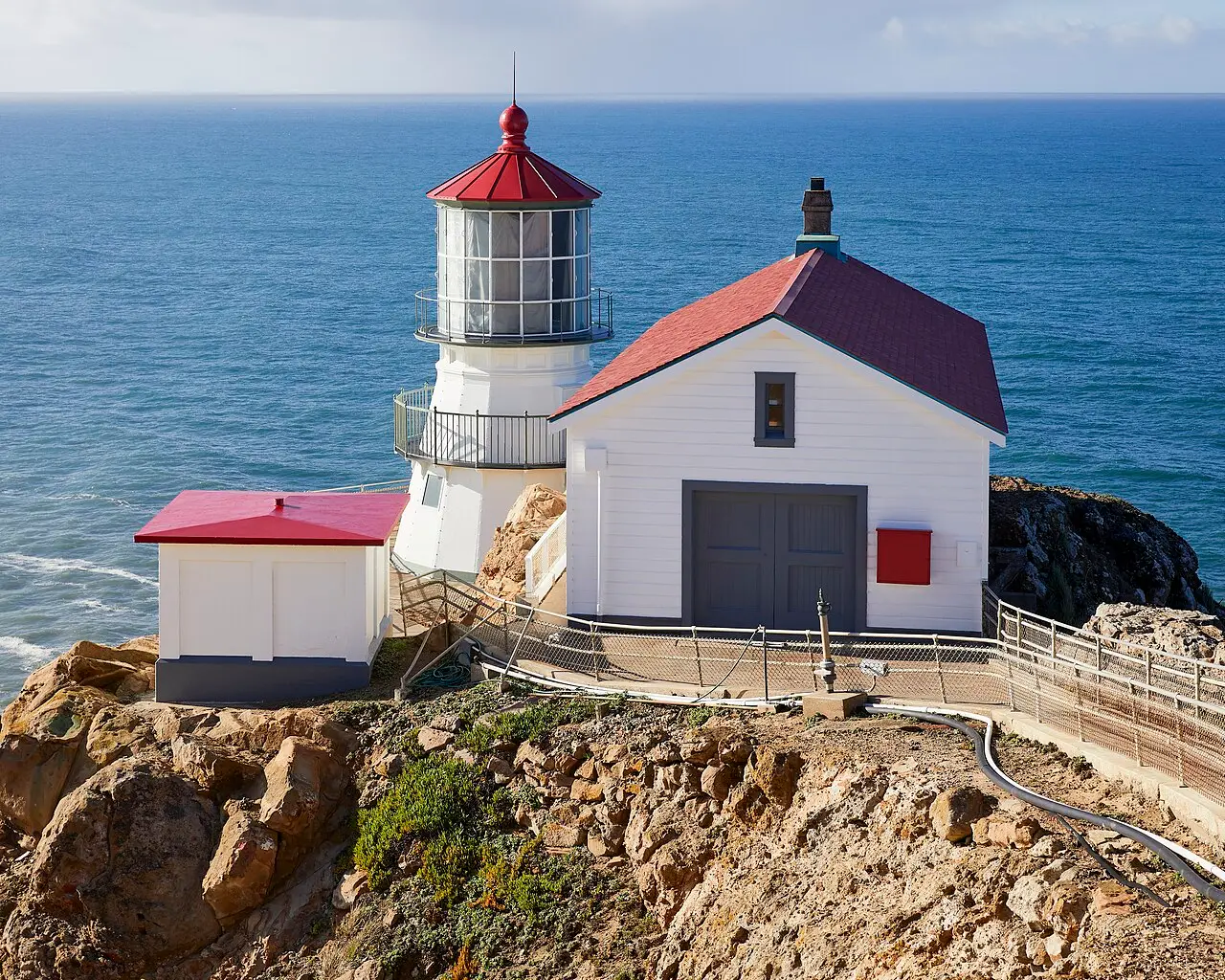
Point Reyes Lighthouse
Inverness, CA
A lighthouse down 300 steps on one of the windiest and foggiest headlands on the Pacific coast.
The Point Reyes light first shone on December 1, 1870. It was deliberately built low on the cliff, about 300 feet (90 m) below the top, to sit beneath the fog. The first-order Fresnel lens, with 24 prism panels and a weight of about 2.7 metric tons (6,000 pounds), was made in France in 1867. Point Reyes is considered the second foggiest place in North America, and gales bring winds of up to 133 mph (214 km/h). In 1975 the Coast Guard replaced the light with an automated beacon.
From the parking lot (38 spaces, often full in the afternoon) it is about 0.7 km (0.45 mile), mostly uphill, to the visitor center. From there, 313 steps lead down to the lighthouse. They close in winds above 40 mph (64 km/h) and from 4 p.m.; the observation deck stays open. RVs and vehicles with trailers cannot use the main lot and park along the road. From Bear Valley allow about 45 minutes, and the nearest gas station is about 20 miles (32 km) away in Point Reyes Station. Gray whales pass from December to May, with mothers and calves most likely from April to early May, and elephant seals are most numerous at Chimney Rock from December to March. Bring warm clothing.
- Nearest town
- Inverness, CA
- Category
- Scenic viewpoints
- GPS
- 37.9960, -123.0230
Hours, fees and access change. Confirm with the operator or park before you go.
Good to know
Best time to go
The most pleasant months are usually May–October. Still fine, with some compromises, in March–April and November. (Estimate from long-term temperature averages, terrain and pass seasons)
Sources
Featured in these trip guides


Nearby









Campsites nearby
- Olema CampgroundMotorhome stopover13 mi from Point Reyes LighthouseTentsMotorhomesElectricityWaste disposal
- Five Brooks Horse CampCampsite14 mi from Point Reyes Lighthouse
- Lawsons LandingCampsite18 mi from Point Reyes Lighthouse
- Doran Regional Park CampgroundCampsite22 mi from Point Reyes LighthouseTentsCaravans
- Steep Ravine Environmental CampgroundCampsite23 mi from Point Reyes LighthouseTentsDrinking waterToilets
- Pantoll CampgroundCampsite24 mi from Point Reyes LighthouseTentsDrinking waterToilets
All campsites in California · Campsite data: © OpenStreetMap contributors, ODbL 1.0 · Updated October 3, 2026
FAQs
Where is Point Reyes Lighthouse?
Point Reyes Lighthouse is in Inverness, CA, at GPS 37.9960, -123.0230. It is about 13 mi from Point Reyes Station.
Can you camp near Point Reyes Lighthouse?
Yes. The nearest campsite listed in OpenStreetMap is Marshall Beach Boat-In Campsites, about 13 mi away; within 25 mi there are 23 campsites and motorhome stopovers.
Which road trips pass Point Reyes Lighthouse?
Point Reyes Lighthouse is a stop on these CampingSpirit trip guides: Sonoma, Napa and Point Reyes and Tule elk, oysters and fog coast – by camper from Muir Woods via Point Reyes to Fort Ross.
What is there to see near Point Reyes Lighthouse?
Places worth a stop nearby: Bodega Head (21 mi), Muir Woods National Monument (25 mi), Goat Rock Beach (31 mi) and Battery Spencer Overlook (32 mi).
When is the best time to visit Point Reyes Lighthouse?
The most pleasant months are usually May–October. Still fine, with some compromises, in March–April and November. (Estimate from long-term temperature averages, terrain and pass seasons)