
Malheur National Wildlife Refuge
Burns, OR
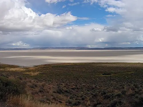
Vast marshes in the high desert, a stopover for hundreds of thousands of migrating birds. The headquarters has a small museum and a visitor center; spring is the peak.
Malheur National Wildlife Refuge is a nature reserve in Harney County in the high desert of southeastern Oregon, at about 4,100 feet (1,250 m). Headquarters lies roughly 32 miles (51 km) south of Burns: 26 miles on Highway 205, then 6 miles east on Sodhouse Lane.
At headquarters you will find a visitor center and the George Benson Memorial Museum with mounted birds, which is open year-round from sunrise to sunset. Frommer's counts more than 300 bird species in the refuge. Malheur Lake itself is closed to the public; the best views are from the Overlook Trail at headquarters and, when water levels are high, from the Narrows Pullout.
For road trippers: refuge roads are gravel, recommended only with good ground clearance, and can be in poor shape at any time of year; closures are more likely in fall and winter. The 42-mile auto tour has few pullouts and few places for large vehicles to turn around. There is no lodging and no fuel, cell reception is weak, and mosquitoes can be severe in summer. The visitor center is open April to September (8 am to 4 pm), closed October to February, with limited hours in March. Ask about road conditions beforehand at 541-493-2612 (as of October 2026).
- Nearest town
- Burns, OR
- Category
- Nature & parks
- GPS
- 43.2677, -118.8440
Hours, fees and access change. Confirm with the operator or park before you go.
Good to know
Best time to go
The most pleasant months are usually May and September–October. Still fine, with some compromises, in April and June. Hot in July. Cold, short days in January–February. (Estimate from long-term temperature averages, terrain and pass seasons)
Featured in these trip guides


Nearby






Campsites nearby
- The Narrows RV ParkMotorhome stopover6 mi from Malheur National Wildlife RefugeMotorhomesWi-Fi
- Hines RV & Mobile Home ParkMotorhome stopover22 mi from Malheur National Wildlife RefugeMotorhomes
All campsites in Oregon · Campsite data: © OpenStreetMap contributors, ODbL 1.0 · Updated October 3, 2026
FAQs
Where is Malheur National Wildlife Refuge?
Malheur National Wildlife Refuge is in Burns, OR, at GPS 43.2677, -118.8440. It is about 31 mi from Frenchglen.
Can you camp near Malheur National Wildlife Refuge?
Yes. The nearest campsite listed in OpenStreetMap is The Narrows RV Park, about 6 mi away; within 25 mi there are 2 campsites and motorhome stopovers.
Which road trips pass Malheur National Wildlife Refuge?
Malheur National Wildlife Refuge is a stop on these CampingSpirit trip guides: Steens Mountain and the Alvord Desert and Space, desert and juniper: by camper through Oregon’s High Desert.
What is there to see near Malheur National Wildlife Refuge?
Places worth a stop nearby: Pete French Round Barn (17 mi), Kiger Gorge Overlook (40 mi), Alvord Desert (54 mi) and Kam Wah Chung State Heritage Site (80 mi).
When is the best time to visit Malheur National Wildlife Refuge?
The most pleasant months are usually May and September–October. Still fine, with some compromises, in April and June. (Estimate from long-term temperature averages, terrain and pass seasons)