
Ubehebe Crater
Death Valley National Park, CA
A volcanic explosion crater about half a mile wide and 600 feet deep in the north of the park. The rim trail is short but the loose cinders make the walk back out of the crater hard work.
Ubehebe Crater in the north of Death Valley is a maar: rising magma turned groundwater into steam, and the explosions blasted out the crater. It is about half a mile (0.8 km) across and, depending on where you measure, 500 to 777 feet (150 to 235 m) deep. The National Park Service estimates its age at around 2,100 years, while other figures range from 800 to 7,000 years. It is the largest of the more than a dozen craters in the Ubehebe volcanic field; the Timbisha Shoshone know it as “Tempintta Wosah.”
From the paved parking area on the rim, which also fits buses and large RVs, you can see the crater without hiking. The rim loop is 1.5 miles (2.4 km) long, takes about an hour, and starts uphill; after half a mile (0.8 km) Little Hebe comes into view. Going down into the crater is easy, but the climb back out through ankle-deep cinders is hard, so skip it in summer. The wind is often strong, there are no restrooms at the lot, and the nearest ones are about 5 miles (8 km) east at the Grapevine Ranger Station (as of October 2026). Allow a little over an hour from Furnace Creek.
- Nearest town
- Death Valley National Park, CA
- Category
- Nature & parks
- GPS
- 37.0105, -117.4509
Hours, fees and access change. Confirm with the operator or park before you go.
Good to know
Best time to go
The most pleasant months are usually April and October. Still fine, with some compromises, in March, May, September and November. Hot in June–August. (Estimate from long-term temperature averages, terrain and pass seasons)
Featured in these trip guides


Nearby





Campsites nearby
- Mesquite Spring CampgroundCampsite6 mi from Ubehebe Crater · 40 pitchesTentsCaravansWaste disposal
All campsites in California · Campsite data: © OpenStreetMap contributors, ODbL 1.0 · Updated October 3, 2026
FAQs
Where is Ubehebe Crater?
Ubehebe Crater is in Death Valley National Park, CA, at GPS 37.0105, -117.4509. It is about 32 mi from Stovepipe Wells.
Can you camp near Ubehebe Crater?
Yes. The nearest campsite listed in OpenStreetMap is Mesquite Spring Campground, about 6 mi away; within 25 mi there are 1 campsites and motorhome stopovers.
Which road trips pass Ubehebe Crater?
Ubehebe Crater is a stop on these CampingSpirit trip guides: Death Valley in depth: Dante’s View to Ubehebe Crater.
What is there to see near Ubehebe Crater?
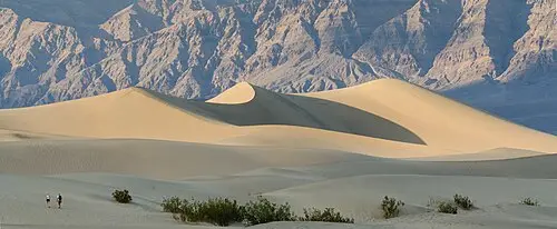
Places worth a stop nearby: Mesquite Flat Sand Dunes (34 mi), Mosaic Canyon (35 mi), Rhyolite ghost town (35 mi) and Manzanar National Historic Site (43 mi).
When is the best time to visit Ubehebe Crater?
The most pleasant months are usually April and October. Still fine, with some compromises, in March, May, September and November. (Estimate from long-term temperature averages, terrain and pass seasons)