 📷 Photo by Matteo del Piano on Unsplash
Scala di Santa Regina
Calacuccia, France
A gorge of pink granite cut by the Golo, followed by the D84 between the central valley and the Niolo. Drive slowly, the road is narrow with rockfall; old mule track steps survive in places.
The Scala di Santa Regina is a wild gorge of the Golo and is regarded as one of the best-known on the island. It was once the only route between the Niolu and the plain. Today the D84 leads from Francardo towards Calacuccia into the Golo gorge; the road is narrow and follows the rock face. Swimming is prohibited here.
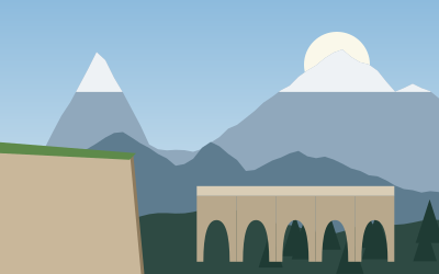
About 7 km beyond the Castirla bridge, the road crosses the Falconaia, where a tall waterfall can be seen when there is enough water; roughly 600 m further on comes the bridge over the Ruda. Nearby, a historic mule track crosses a Genoese double-arched bridge. Parking in the gorge may be prohibited at times, so check the signs. Half an hour is enough to drive through, a little more with stops.
- Nearest town
- Calacuccia, France
- Category
- Nature & parks
- GPS
- 42.3536, 9.0541
Hours, fees and access change. Confirm with the operator or park before you go.
Good to know
Best time to go
The most pleasant months are usually April–June and September–October. Still fine, with some compromises, in March, July–August and November–December. (Estimate from long-term temperature averages, terrain and pass seasons)
Getting there
- France: Motorway tolls. Tolls on most autoroutes; the limit drops to 110 km/h in rain. Motorway limit for cars: 130 km/h.
Sources
Featured in these trip guides

Nearby








Campsites nearby
- Camping Saint-PancraceCampsite8 km from Scala di Santa ReginaTentsCaravansElectricityShowersToilets
- Chez BarthoCampsite9 km from Scala di Santa ReginaTentsCaravansElectricityDrinking waterShowersToiletsWaste disposalDogs allowedWi-Fi
- Camping AlivetuCampsite10 km from Scala di Santa ReginaTentsCaravansElectricityDrinking waterShowers
- Camping Santa BarbaraCampsite13 km from Scala di Santa ReginaTentsCaravansElectricityDrinking waterShowersToiletsWaste disposal
- A TizarellaCampsite14 km from Scala di Santa ReginaTentsCaravansElectricityDrinking waterShowersToilets
- Camping CabanellaCampsite15 km from Scala di Santa ReginaCaravansElectricityDrinking waterShowersToilets
All campsites in France · Campsite data: © OpenStreetMap contributors, ODbL 1.0 · Updated October 3, 2026
FAQs
Where is Scala di Santa Regina?
Scala di Santa Regina is in Calacuccia, France, at GPS 42.3536, 9.0541. It is about 9 km from Corte.
Can you camp near Scala di Santa Regina?
Yes. The nearest campsite listed in OpenStreetMap is Camping Monte Cintu, about 4 km away; within 25 km there are 27 campsites and motorhome stopovers.
Which road trips pass Scala di Santa Regina?
Scala di Santa Regina is a stop on these CampingSpirit trip guides: Corsica’s mountain heart: Ajaccio to Porto.
What is there to see near Scala di Santa Regina?
Places worth a stop nearby: Restonica valley (10 km), Col de Vergio (16 km), Gorges de Spelunca (26 km) and Cascades des Anglais (27 km).
When is the best time to visit Scala di Santa Regina?
The most pleasant months are usually April–June and September–October. Still fine, with some compromises, in March, July–August and November–December. (Estimate from long-term temperature averages, terrain and pass seasons)