

In-depth guide · CampingSpirit
From the ferry at Kyllini to Zakynthos Town, the Navagio viewpoint, the Blue Caves and the turtle beaches of Laganas, Keri and Vasilikos: about 290 kilometres of island driving that calls for more consideration than speed.
The spirit of the route
Zakynthos smells of salt, warm thyme and diesel from the excursion boats, and it drives like a mosaic: to the north-west limestone cliffs cut straight down into the sea, while in the south lies the flat bay of Laganas, where turtles bury their eggs at night. From your sliding door you see olive groves to the horizon, mountain villages like Volimes, pale limestone rock and deep blue water. The roads are narrow, the villages tight and the rules of the marine park strict – in return you get an island that opens up only slowly. At the Navagio viewpoint you stand early, before the first coach arrives; on the beaches of Laganas it stays dark once the sun has gone down. If you leave the vehicle behind and carry on on foot or by boat, you experience Zakynthos the way it is meant to be: quiet, a little wild and with respect for the animals that were here before you.
Stage-by-stage plan
1Stage 1: Kyllini (port, Peloponnese) to Zakynthos Town (approx. 10 km)
- The drive
- Crossing from Kyllini to Zakynthos Town, about an hour and a quarter at sea. In the port of Zakynthos the road runs flat and wide into the town centre, and it is only a few kilometres from the quay to the campsite inland, north of the town towards Tsilivi. The island roads are paved throughout, but away from the main routes they are narrow, with walls and olive trees right at the edge of the carriageway.
- Highlights & must-sees
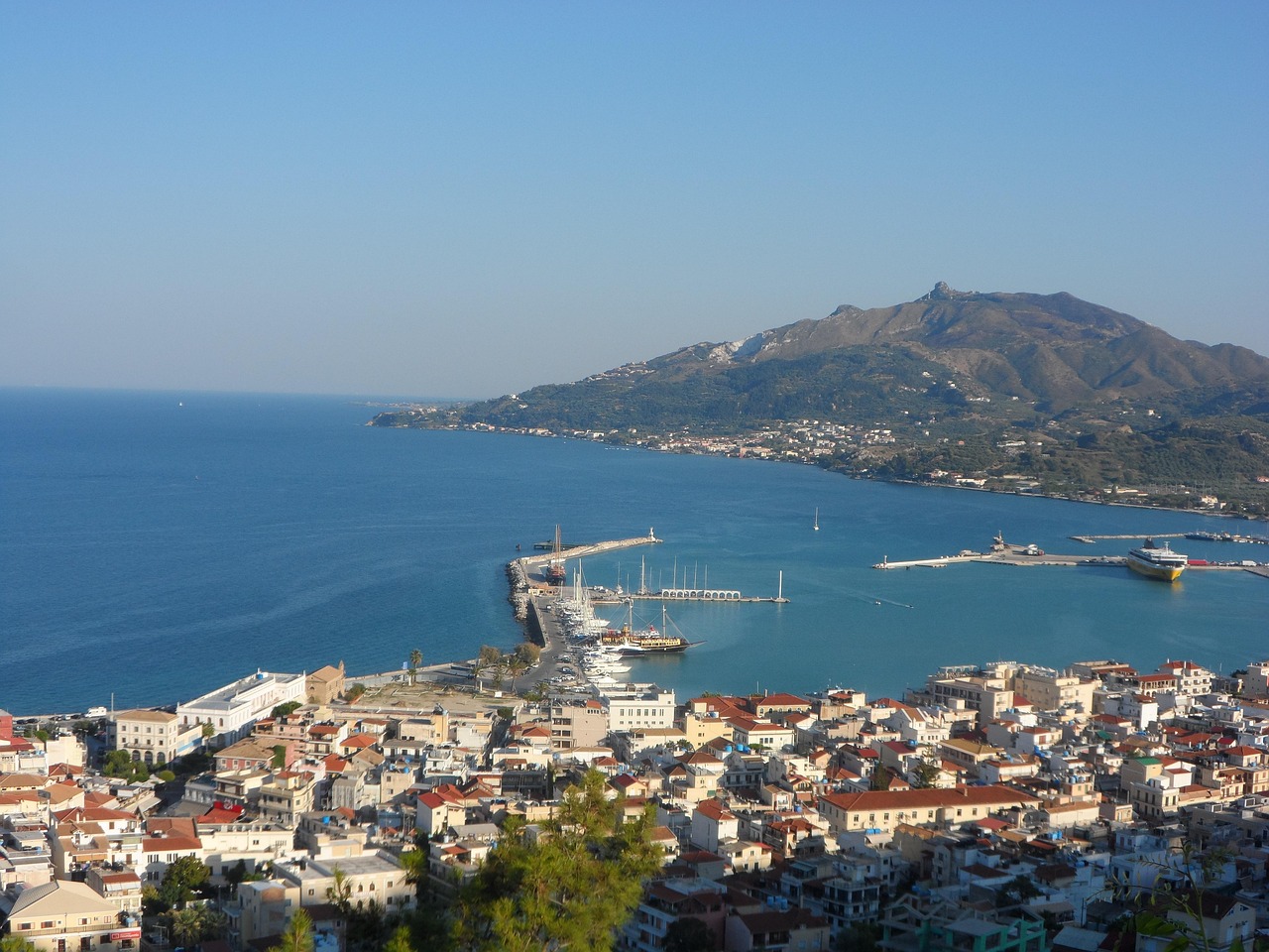
- Sailing into the port of Zakynthos, with a view of the town front and the hill with the Venetian castle above Bochali.
- Waterfront promenade and Agios Markos square: a first stroll while the evening light lies over the bay.
- Beach and taverna in Tsilivi for the first evening, just beyond the edge of town.
- CampingSpirit overnight tip
-
Official campsite or RV park: According to OpenStreetMap and camping portals, Camping Zante lies inland, north of Zakynthos Town (municipality of Arkadi, about 4 km from the centre). The portals list water, electricity, sanitary facilities, waste disposal and a pool; ask the site in advance about season and facilities, as portal details are not always up to date. Camping Paradice is listed in OpenStreetMap only with a rough location north-west of the town, and its operation and status are unclear – do not count on it.
Free camping or nature tip (where legal): Wild camping is prohibited in Greece (Law 5170/2025, €300 per person), and local parking rules apply in the port area and on the promenade. Outside built-up areas a motorhome may park at permitted spots on the right-hand edge of the carriageway; anything outside the outline of the vehicle counts as camping. For the first night the campsite is the relaxed solution.
- Insider tip for campers
- Book the ferry in good time and state the length and height exactly, including rear carrier, roof box and bike rack – vehicle spaces are limited in summer, and timetables are seasonal. Fill up with fuel and water in the Pyrgos area before the crossing. If you have to stay near the port the evening before: near Kyllini there are beach sites such as Fournia Beach and Camping Melissa; more on this in the CampingSpirit guide to Kefalonia and Ithaca.
2Stage 2: Zakynthos Town to Zakynthos Town (walk and Bochali) (approx. 20 km)
- The drive
- A quiet day without a long drive: from the campsite into town, up to Bochali and back. The road to Bochali is narrow and winds up the hillside in hairpins; leave motorhomes over seven metres below and take a taxi or bus. In the centre the limit within built-up areas is 30 km/h as a rule.
- Highlights & must-sees
- Solomos Square with the museum of Dionysios Solomos, poet of the Greek national anthem, and the church of Agios Dionysios, the town’s landmark.
- Bochali: the viewpoint above the town with a view across the bay, loveliest in the late afternoon.
- Ruins of the Venetian castle on the hill – panoramic view over town and port and, in clear weather, as far as the Peloponnese.
- CampingSpirit overnight tip
-
Official campsite or RV park: A second night at Camping Zante inland, north of the town – moving on is only worthwhile once you set off for the north or switch to Laganas.
Free camping or nature tip (where legal): Pitches for motorhomes in the old town are scarce; parking in the centre follows local rules. In built-up areas motorhomes up to 7.5 m may park with no time limit, longer vehicles for 24 hours at most at a stretch – watch for signs and times. After 1953 the town was rebuilt following the severe earthquake, hence the unusually wide streets.
- Insider tip for campers
- Park on the edge of town and walk the short distances. In summer, markets and shops open in the morning and again in the evening; midday is quiet. Do not fill drinking water from taps at the roadside, but buy it in the supermarket.
3Stage 3: Zakynthos Town to Zakynthos Town (Navagio viewpoint, there and back) (approx. 85 km)
- The drive
- From the town via Maries into the hill country of the north-west, with a detour to Volimes, then via Anafonitria to the viewing plateau above Navagio Bay. About 40 km each way, mostly narrow, winding country road with oncoming coaches and rental cars; driving time alone is about an hour each way. The last kilometres are very narrow – pull over early for oncoming traffic and fold in your mirrors.
- Highlights & must-sees
- Navagio viewpoint above the bay with the stranded freighter Panagiotis: the view from the cliff edge onto white shingle and turquoise water.
- Volimes: a village of weaving workshops and stone houses, quiet and good for a break.
- Monastery of Panagia Anafonitria near Anafonitria, dating from the 14th century, where Saint Dionysios, patron saint of the island, spent his last years.
- CampingSpirit overnight tip
-
Official campsite or RV park: Back to Camping Zante – in the north-west itself there is no campsite you could use as a day’s destination.
Free camping or nature tip (where legal): Navagio Bay is closed to visitors because of the risk of rockfall: access to the beach is prohibited, no swimming is allowed anywhere in the bay, and boats must not come closer than 50 m to the coast. The rule has been extended several times and is reassessed regularly; the municipality of Zakynthos monitors it, and the police can impose fines. The viewing platform on the cliff edge can be reached only via the existing platform and only after the safety works are complete. Check the current situation before the drive with the municipality of Zakynthos or the port authority. Staying overnight in the viewpoint car park is neither permitted nor sensible.
- Insider tip for campers
- Start early: from late morning the car park and the road fill up with coaches. The bay faces the west coast; when the sun reaches it depends on the season and time of day, and summer haze reduces visibility. Fill up in town; there are hardly any petrol stations in the north-west. The view is from above only – the beach stays closed to visitors, and boats observe the distance rule set by the port authority.
4Stage 4: Zakynthos Town to Laganas (via Skinari) (approx. 100 km)
- The drive
- From the town along the coast road to the north: Tsilivi, Planos, Alykes, then on to Cape Skinari and the harbour of Agios Nikolaos. Narrow coast road with villages to pass through; Alykes is tight and crowded in summer. Afterwards you return along the same route to the town and continue south to Laganas (about 9 km from the town). Total driving time about three hours, a long day.
- Highlights & must-sees
- Blue Caves (Kianoun Spilia) at Cape Skinari: boats leave from the harbour of Agios Nikolaos and run into the caves and to the rock arches – the water here glows deep blue.
- Salt pans and beach at Alykes: a wide bay, shallow water and the old salt basins behind the shore.
- Lighthouse and windmills at Cape Skinari: views over the northern tip.
- CampingSpirit overnight tip
-
Official campsite or RV park: According to OpenStreetMap, Tartaruga Camping lies south of Laganas on the road towards Keri, somewhat inland (rough location, proximity to the coast not confirmed), and is suitable as a base for the south and south-east; check electricity, sanitary facilities and season in advance. According to the available data, other sites on the island are rare.
Free camping or nature tip (where legal): In the north and at the harbour of Agios Nikolaos the same legal position applies as everywhere in Greece: wild camping is prohibited, parking at permitted spots is not. There is little room at the harbour; boat departures are in greatest demand in the morning. In the marine park around Laganas, camping is expressly prohibited.
- Insider tip for campers
- Book the boat trip to the Blue Caves with a licensed operator, preferably in the morning, when the sea is usually calm. The harbour authority and the operator set the boat rules; swim only where the skipper allows it, and leave valuables on board or in the vehicle. Plan the return drive for before dark – the narrow coast roads are unlit.
5Stage 5: Laganas to Keri (approx. 15 km)
- The drive
- From Laganas take the coast road south-west towards Keri: flat to undulating, in places tight between walls and fields, then up into the villages. A good 20 minutes’ drive, but the day belongs to the stops. Because of the marine protection rules you do not drive up to the beaches, but stay on the designated car parks.
- Highlights & must-sees
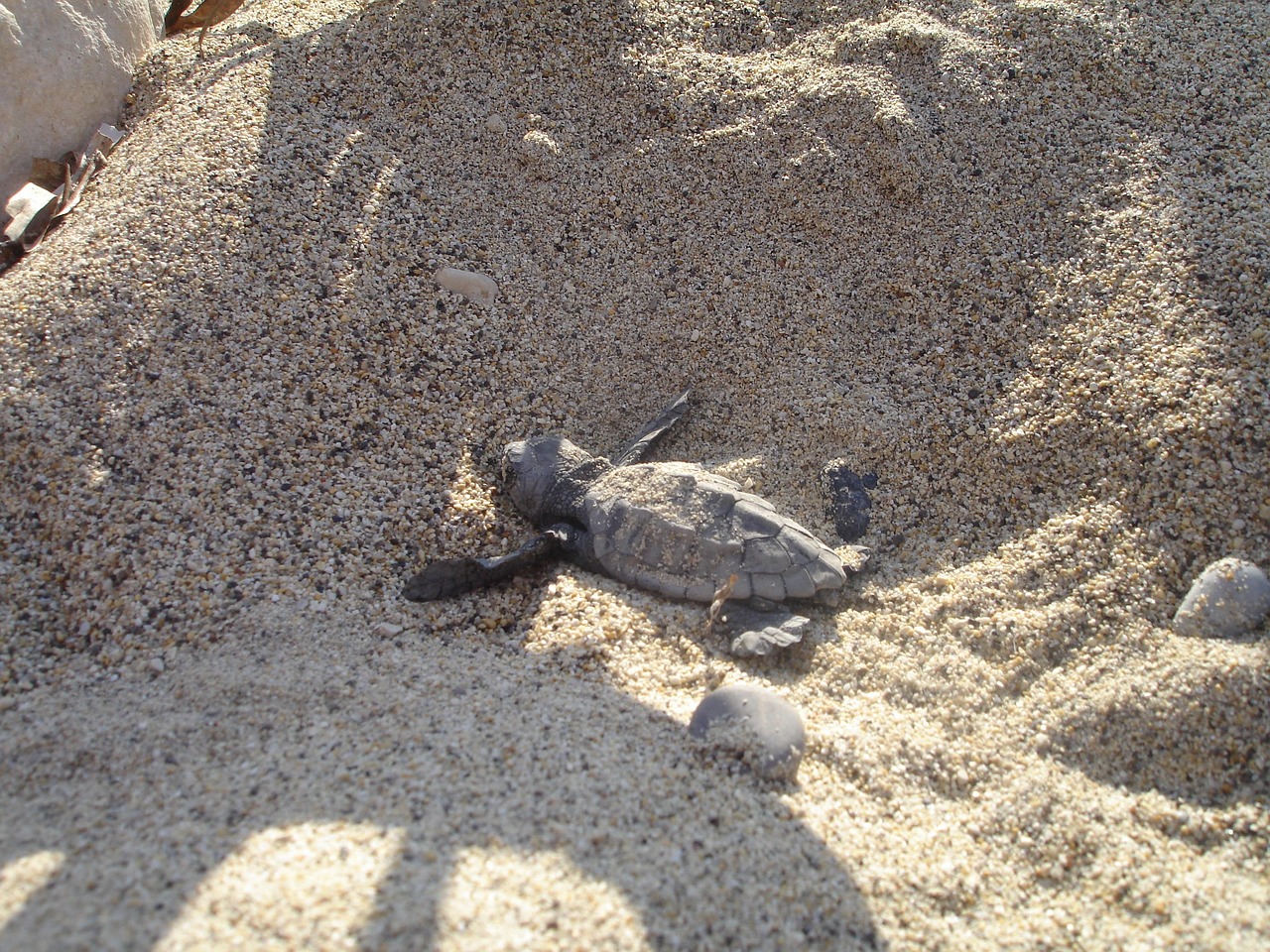
- Laganas Bay and Kalamaki: nesting area of the loggerhead sea turtle (Caretta caretta) in the marine park; Sekania beach, with the highest nest density, is closed to visitors. Watch only from the permitted paths and at a distance, and never with a light.
- Limni Keriou: a small harbour village with waterside tavernas and boat trips to the Keri caves; nearby are the tar springs at Lake Keriou, mentioned as far back as antiquity (Herodotus) – check access and opening times on site.
- Keri village and the lighthouse at Cape Keri (from 1925) with a view of the steep south-west coast.
- CampingSpirit overnight tip
-
Official campsite or RV park: Tartaruga Camping remains the possible base for this stage; from there you reach the southern tip with a short drive.
Free camping or nature tip (where legal): In the Zakynthos National Marine Park, camping and open fires are prohibited, and on the nesting beaches the following also applies: entry only in daytime (according to Archelon from 7 a.m. to sunset), no vehicles (bicycles included), no lamps or torches at night, parasols no more than 5 m from the water, no digging and do not touch the nest protection cages. Motorhomes do not belong at these beaches at night; parking at the roadside near the beach is unwise.
- Insider tip for campers
- If you use boats: the park is divided into zones – in Zone A boats are not allowed, in Zone B you may travel at no more than 6 knots and must not anchor, and in Zone C anchoring is possible at the same maximum speed. Choose only licensed operators who comply with this, and do not take boats into the nesting area. The Archelon association looks after stretches of beach and gives information on site about correct behaviour.
6Stage 6: Keri to Vasilikos (approx. 35 km)
- The drive
- From Keri back towards Laganas and from there on the country road past the airport eastwards onto the Vasilikos peninsula: wide, open landscape, olive groves, little traffic. The road to the tip of the peninsula is narrow and ends at the beaches, where turning with longer vehicles is difficult. About an hour’s driving time.
- Highlights & must-sees
- Gerakas: one of the most important nesting sites of the sea turtles in the south of the peninsula, with strictly regulated beach access and information from Archelon on site.
- Porto Roma and Banana Beach: long sandy beaches with gently shelving water, partly outside the strict protection zones.
- Hills and peninsula of Vasilikos: wide views over the east coast and the open Ionian Sea.
- CampingSpirit overnight tip
-
Official campsite or RV park: No campsite is recorded on the Vasilikos peninsula – continue to stay at Tartaruga Camping (south coast) or at a site towards Zakynthos Town before you return to the ferry.
Free camping or nature tip (where legal): On Vasilikos the marine park’s ban on camping and open fires applies; in the protection zone of Gerakas and Daphni, beach access is also controlled. Leave the vehicle on the designated parking areas, not in dunes or on field tracks.
- Insider tip for campers
- Plan your beach visit for the morning or afternoon, not at night: at night and at dusk, access to the nesting beaches is prohibited. Take your rubbish with you, do not dig in dry sand and keep parasols within the distance rule. Fill up in Laganas or Zakynthos Town – there are hardly any supplies on Vasilikos.
7Stage 7: Vasilikos to Kyllini (via Zakynthos Town) (approx. 25 km)
- The drive
- From Vasilikos back to Zakynthos Town, where you check in at the ferry port and cross to Kyllini; then continue via Pyrgos or the Patras–Pyrgos motorway. The Patras–Pyrgos motorway is open throughout, and the toll booths there are unmanned – keep a card or cash ready. Just under an hour to the port, plus waiting time.
- Highlights & must-sees
- A last walk along the harbour promenade with a view across the bay.
- Breakfast at a café on the promenade before check-in.
- The crossing, looking back at the island and the hills in the west.
- CampingSpirit overnight tip
-
Official campsite or RV park: Near the port on the mainland there are beach sites such as Fournia Beach or Camping Melissa near Kyllini; check operation and season in advance. On Zakynthos itself, the trip is best ended at Camping Zante, if it is open.
Free camping or nature tip (where legal): At the port, vehicles queue in rows for check-in; overnighting in the queue is not intended. On the mainland the general Greek parking rules apply again.
- Insider tip for campers
- Allow plenty of buffer for check-in, check your booking confirmation, vehicle documents and ID, and fill up in town before the return journey. If you are continuing with the Peloponnese round trip, you will find the route in the CampingSpirit guide to the Peloponnese round trip.
Camping practice & local rules
Wild camping & overnight parking
- Wild camping is prohibited in Greece (Law 5170/2025, €300 per person). Anything outside the outline of the vehicle counts as camping: awning, table, chairs, barbecue, levelling jacks, washing line.
- Parking is regulated by the Greek road traffic code (Law 5209/2025, Art. 38, clarified by a police circular of 2026): in built-up areas motorhomes up to 7.5 m may park with no time limit, longer motorhomes and caravans for 24 hours at most at a stretch; outside built-up areas on designated areas or at the right-hand edge of the carriageway with no time limit, as long as no ban applies. According to the police, staying in a correctly parked motorhome, including at night, is not an offence. Local bans take precedence.
- In the Zakynthos National Marine Park, camping and open fires are prohibited; the turtle nesting areas may be entered only between sunrise and sunset, vehicles and lamps are banned there, and boat traffic is regulated in three zones. Do not park motorhomes near the beach at night.
- Useful: park4night, Campercontact and the websites of the few sites on the island; booking is advisable in high summer.
Waste disposal & supplies
- Supply and disposal facilities are sparse on Zakynthos: no designated motorhome station is recorded. Empty grey and black water only at campsites or disposal points, never into nature.
- You should not drink tap water on the island without checking; buy drinking water in canisters or bottles in the supermarket.
- Gas: German exchange cylinders are not exchanged in Greece. Autogas (LPG) is widespread, but not everywhere with the right adapter; arrive with full cylinders and refill on the mainland before the crossing.
- There are only a few petrol stations in the west and north of the island; fill up in Zakynthos Town or Laganas.
Vehicle size & traffic rules
- Speed: in built-up areas 30 km/h as a rule (50 on multi-lane, divided main roads); vehicles over 3.5 t on the motorway 80 km/h at most. On the island itself the signs set the speed; tight villages and hairpins force slow driving anyway.
- Tolls: two-axle vehicles over 2.20 m in height pay in Class 3, a good twice the car rate. The Patras–Pyrgos motorway has been open throughout since December 2025; the toll booths there are unmanned.
- Ferry booking: state length and height exactly, including rear carrier, roof box and bike rack; ramps and decks can be tighter than expected. Book ahead in summer.
- Wildfire risk: in summer fire and barbecue bans often apply, and fire warnings arrive by phone; follow the instructions of the fire service and the authorities.
- The blood alcohol limit is 0.5 per mille; above that you face a fine and loss of licence, and at higher levels criminal proceedings. Phoning without a hands-free kit is prohibited, and seat belts are compulsory.
CampingSpirit packing & preparation checklist
- Levelling ramps (two, step 2): campsites and parking areas on Zakynthos are often uneven and gravelled.
- Red-and-white warning board for the rear carrier if bikes or boxes protrude – protection against fines and rear-end collisions.
- Head torch with red light, for the campsite only, never on the nesting beaches: lamps are banned there at night and disturb turtles.
- Sun protection (reef-safe if possible), a hat and plenty of water: heat dominates the summer days.
- Binoculars, to watch turtles and seabirds from a distance instead of going close.
- Folding guide mirrors or a reversing camera with a clean lens: in tight villages and harbour lanes you often manoeuvre to within centimetres.
As of 2026-10. Closures, fees and booking rules change: check official sources before you go.