

In-depth guide · CampingSpirit
From Ludlow over the Long Mynd and Offa’s Dyke to Hay-on-Wye, through Bannau Brycheiniog and Blaenavon into the Wye Valley and on to the Forest of Dean: about 380 kilometres on the left-hand side of the road, crossing between England and Wales several times as the speed signs jump from 30 to 20 mph.
The spirit of the route
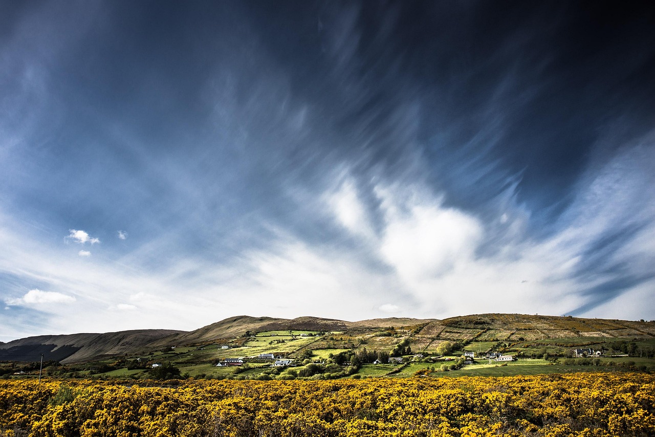
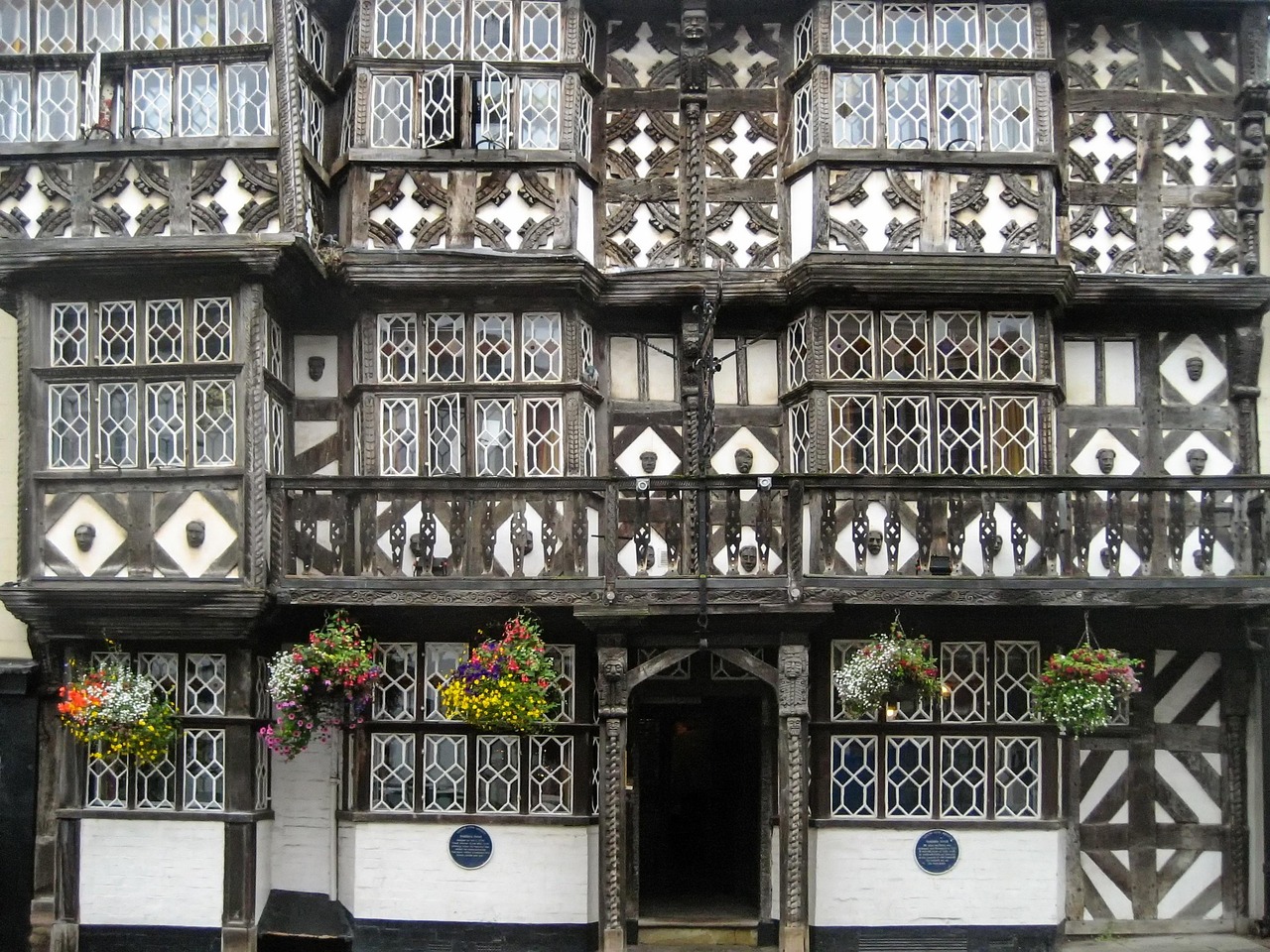
The Welsh Marches are no picture-postcard country but a border strip where the castles still seem to stand guard. Beyond Ludlow the ridge of the Long Mynd slides into view, sheep drift across heather and bracken, and on the hills just above Church Stretton the air smells of wind and damp fern. Further west you follow the bank of Offa’s Dyke through half-timbered villages with a pub on every other corner, until in Hay-on-Wye the bookshelves stand out in the street. Beyond rise the Black Mountains, then Bannau Brycheiniog with its canal, reservoir and coal museum. In the south the Wye cuts through limestone cliffs and beech woods, and at Tintern ivy grows from an abbey without a roof. The Forest of Dean waits at the end, where wild boar root about and sheep stand unfazed in the middle of the road. Whoever drives here learns to wait in passing places.
Stage-by-stage plan
1Stage 1: Ludlow to Church Stretton (approx. 35 km)
- The drive
- From Ludlow take the A49 north, past Bromfield and Craven Arms, then stay on the A49 to Church Stretton, which lies in the broad valley between the Long Mynd and Caer Caradoc. A well-made main road with no pass, but with lorry traffic and roundabouts in Ludlow and Craven Arms. A good 45 minutes of pure driving time; in Church Stretton itself it gets tight if you turn off into the side valleys.
- Highlights & must-sees
- Ludlow: the castle above the Teme, half-timbered houses on Broad Street and the market hall in the town centre; the walk from Castle Square down to the river takes a good two hours.
- Stokesay Castle near Craven Arms (English Heritage): a fortified medieval manor house with a moat and gatehouse, one of the best-preserved of its kind.
- Carding Mill Valley (National Trust) near Church Stretton: access to the Long Mynd and the climb to Pole Bank (516 m), about three hours there and back.
- CampingSpirit overnight tip
-
Official campsite or RV park: Around Church Stretton, OpenStreetMap lists small sites such as Church Stretton Camp & Fish (with a fishing pond) south-east of the town, Elsich Barn Campsite further south near Hope Bowdler and Hamperley Camping to the south-west at the foot of the Long Mynd. These are mostly farm and tent sites that we could not confirm individually; ask in advance about access, motorhome length and season. Near Ludlow itself there are hardly any larger sites.
Free camping or nature tip (where legal): There is no right to roam in England. Overnighting in your vehicle is not intended at the National Trust car parks on the Long Mynd or in Church Stretton; in the Shropshire Hills National Landscape the authorities ask visitors not to camp wild. With the owner’s permission, farm pitches and Camping Club sites are possible.
- Insider tip for campers
- Ludlow Food Centre is on the A49 near Bromfield, with a farm shop, butcher and café: this is the place to buy regional food before moving on. The road to Carding Mill is narrow and the car park small – large vehicles are better left in town, then walk about 1.5 km up the valley.
2Stage 2: Church Stretton to Knighton (Tref-y-Clawdd) (approx. 55 km)
- The drive
- Back along the A49 to Craven Arms, then west on the A489 to Bishop’s Castle, from there on minor roads to Clun and on through the Clun Forest to Knighton on the Welsh border. Mostly two-lane but winding country roads with hedges, a few single-track sections and passing places. About 1.5 hours of driving time; beyond Clun the sheep and cattle grids become more frequent.
- Highlights & must-sees
- Bishop’s Castle: a small market town with a steep high street and a brewing tradition, good for a break.
- Clun: a ruined castle above the river, a medieval stone bridge and a quiet village street, counted by A. E. Housman, together with its neighbouring villages, among the “quietest places under the sun”.
- Knighton: the Offa’s Dyke Centre on the Offa’s Dyke Path (about 285 km), whose early medieval earthwork is easy to see at Knighton.
- CampingSpirit overnight tip
-
Official campsite or RV park: Panpwnton Farm Campsite near Knighton (according to its OpenStreetMap entry with its own website) and Chapel Lawn Farm Campsite near Bucknell are small, quiet sites; electricity and waste disposal are not guaranteed there. Phone ahead if you have a large vehicle.
Free camping or nature tip (where legal): There is no right to roam here either; from the border the rules of the Welsh local authorities apply. Camping on or beside the Offa’s Dyke Path is not allowed without the landowner’s permission. Car parks along the dyke serve walkers; overnighting there is not intended.
- Insider tip for campers
- Fill up in Church Stretton or Craven Arms, because filling stations are thin on the ground in the Clun Forest. Once you cross into Wales, streets with lamps in built-up areas usually have a 20 mph limit instead of 30 mph; read the signs in both languages (Welsh and English).
3Stage 3: Knighton to Hay-on-Wye (Y Gelli Gandryll) (approx. 55 km)
- The drive
- From Knighton take the B4355 to Presteigne, on to Kington (Herefordshire) and via Eardisley on minor roads, finally on the A438, to Hay-on-Wye. Wide country roads through the Lugg and Arrow valleys, with only short single-track sections. About 1.5 hours; in Hay itself the streets are narrow.
- Highlights & must-sees
- Presteigne: a small town on the border; The Judge’s Lodging is a museum in the former judges’ accommodation (check opening times in advance).
- Hergest Ridge near Kington: a heathland ridge with wide views towards the Black Mountains, easily done in an hour’s walk.
- Hay-on-Wye: a book town with antiquarian shops, Hay Castle and the Honesty Bookshop on the castle wall.
- CampingSpirit overnight tip
-
Official campsite or RV park: Hay-on-Wye Caravan Park (according to OpenStreetMap, with website) and Black Mountain View Caravan Park are in and around Hay; please ask about facilities, electricity and motorhome access before you arrive. Smaller sites such as Baskerville Hall Camp Site (Clyro) are geared more towards tents.
Free camping or nature tip (where legal): The town car parks in Hay-on-Wye serve day visitors; overnighting in your vehicle is not intended there, so heed the signs. Wild camping on the edge of the national park is practically out of the question; the local authorities prefer campsites.
- Insider tip for campers
- The town has car parks on its edge; avoid the narrow side streets and one-way systems in the centre. The book town is very busy at weekends and during festival periods – if you arrive in summer, get there early in the day. Do water and waste at the campsite.
4Stage 4: Hay-on-Wye to Brecon (Aberhonddu) (approx. 45 km)
- The drive
- Take the A438 south-west via Glasbury and Three Cocks to Bronllys, then on to Brecon; with short detours to Talgarth and on minor roads to Llangorse Lake. A wide, mostly good road at the foot of the Black Mountains, driving time about 1 hour. The detour over the Gospel Pass (about 549 m) from Hay to Capel-y-ffin is a single-track, steep mountain road with free-roaming sheep and ponies and is not recommended for large motorhomes – we advise against it; better to drive there and back in a small vehicle or explore the plateau on foot (about 30 km extra).
- Highlights & must-sees
- Gospel Pass and Hay Bluff: an upland plateau with wide views of the Black Mountains, which can also be reached on foot; sheep and ponies roam freely.
- Talgarth Mill: a restored watermill with a bakery and café.
- Llangorse Lake: the largest natural lake in South Wales, with the reconstructed crannog (lake dwelling on an artificial island) from the early Middle Ages.
- CampingSpirit overnight tip
-
Official campsite or RV park: Priory Mill Farm near Brecon (according to OpenStreetMap) lies on the River Honddu, quiet and suited to tents and smaller campers; Lakeside Caravan Park on Llangorse Lake (with website) offers pitches by the water. Ask in advance about facilities and the motorhome length limit.
Free camping or nature tip (where legal): Bannau Brycheiniog has no right to roam; the park authority asks motorhomes not to stay overnight in walkers’ car parks. The national park is designated an International Dark Sky Reserve – if you are on a site, dim your lights. Camping on the Black Mountains commons is not permitted without permission.
- Insider tip for campers
- Sheep and ponies roam freely on the Gospel Pass and on the country roads; drive slowly, and be especially careful at night. In and around Brecon you will find supermarkets and filling stations; do water filling and waste disposal at the campsite. Have a parking app (e.g. RingGo, which varies by operator) and coins for pay machines ready.
5Stage 5: Brecon to Abergavenny (Y Fenni) (approx. 60 km)
- The drive
- From Brecon take minor roads along the Monmouthshire and Brecon Canal to Talybont-on-Usk and Llangynidr, then via Crickhowell and the upland near Brynmawr to Blaenavon and down the B4246 to Abergavenny. Some narrow canal-side roads with bridges and hedges, and open moorland stretches on the upland. About 1.5 hours of pure driving time; the canal bridges are tight for large vehicles.
- Highlights & must-sees
- Talybont-on-Usk and Llangynidr: locks and the towpath of the canal, and Talybont Reservoir with a woodland walk.
- Big Pit National Coal Museum in Blaenavon: a former coal mine with an underground tour; admission to the museum is free (Amgueddfa Cymru), while charges apply for the tour and for parking depending on the period, and the tour can be booked in advance.
- Blaenavon Ironworks (Cadw) and the industrial landscape, a UNESCO World Heritage Site.
- CampingSpirit overnight tip
-
Official campsite or RV park: Around Abergavenny, OpenStreetMap mainly lists small sites: Court Farm Campsite and Vale of Ewyas Campsite in the Vale of Ewyas near Llanthony north of the town, both more suited to tents and smaller campers, and in the Monnow valley to the north-east the Three Castles Country Caravan Park. Check motorhome access along narrow roads in advance.
Free camping or nature tip (where legal): In the national park and around Blaenavon, wild camping is not intended; museum car parks close in the evening. Daytime parking at Big Pit is possible (for a fee), but not meant for overnighting.
- Insider tip for campers
- The road over the upland (Heads of the Valleys, A465) is wide and much easier than the canal roads; if you drive a large vehicle, take this main road for the Crickhowell – Blaenavon stretch. Fill up in Abergavenny before heading east. For Crickhowell, Abergavenny, Chepstow, Tintern and Brecon you will find further details in the CampingSpirit guide “Castles, surf and mountain ridges – by motorhome through Wales from Pembrokeshire to Snowdonia”.
6Stage 6: Abergavenny to Symonds Yat (approx. 45 km)
- The drive
- Take the A40 via Raglan to Monmouth, then on the A40 towards Ross-on-Wye and on minor roads to Symonds Yat West in the Wye Valley. A wide main road as far as Monmouth, then narrow, hedged access roads. A good hour of driving time; in the Wye Valley bends and narrow points are numerous.
- Highlights & must-sees
- Raglan Castle (Cadw): a ruined castle with a large moat and gatehouse.
- Monmouth: a market town with the medieval Monnow Bridge and its gatehouse over the river, one of the few surviving gated bridges in Britain.
- Symonds Yat Rock: a viewpoint above the loop of the Wye, a spot for watching peregrine falcons in spring and summer; below, hand ferries cross the river.
- CampingSpirit overnight tip
-
Official campsite or RV park: Sterrett’s Caravan and Camping Park and River Wye Camping & Caravan Park (according to OpenStreetMap) are at Symonds Yat West in the Wye Valley; Doward Park Campsite on the ridge to the west is a small site. We know all three only from OpenStreetMap entries. Check facilities and motorhome access in advance; book early in summer.
Free camping or nature tip (where legal): In the Wye Valley National Landscape wild camping is not permitted; the car parks at Symonds Yat Rock belong to Forestry England and are meant for day visitors. Overnighting in your vehicle is not intended there.
- Insider tip for campers
- The car park at Symonds Yat Rock is limited for larger vehicles; look out for height barriers. The hand ferries do not run in high water – ask locally. In Monmouth there are supermarkets with a filling station on the edge of town.
7Stage 7: Symonds Yat to Tintern (approx. 40 km)
- The drive
- Back via Monmouth, then on the A466 through the lower Wye Valley via Redbrook, Bigsweir and Llandogo to Tintern. The A466 follows the river in the narrow valley and is passable for motorhomes, but full of bends and with narrow points in the villages. About 1 hour of driving time; high water, landslips and repairs can lead to closures.
- Highlights & must-sees
- Goodrich Castle (English Heritage) near Symonds Yat: a red sandstone castle high above the Wye.
- Wyndcliff (viewpoint “Eagle’s Nest”): a walk with 365 steps above the valley south of Tintern.
- Tintern Abbey (Cadw): a Cistercian ruin on the Wye, especially atmospheric in morning light or mist.
- CampingSpirit overnight tip
-
Official campsite or RV park: Around Tintern, OpenStreetMap lists small sites such as Beeches Farm Campsite near Tintern and, further north in the hinterland of the Wye Valley, Highlands Camping and Caravan Site; we know of no large site. Check motorhome access along narrow lanes in advance and arrive early in the evening.
Free camping or nature tip (where legal): Along the A466, lay-bys are signed for day visitors; overnighting in your vehicle is not intended. There is a flood risk by the river after heavy rain.
- Insider tip for campers
- Check the condition of the A466 before you set off (Traffic Wales, Welsh Government). For the abbey, the early morning before the coaches is best. The village has only a few shops – stock up in Monmouth or Chepstow.
8Stage 8: Tintern to Speech House (Forest of Dean) (approx. 45 km)
- The drive
- Take the A466 to Chepstow, then the A48 across the Wye towards Lydney and on minor roads via Parkend to Speech House in the middle of the Forest of Dean. A well-made main road as far as Lydney, then narrower forest roads; sheep stand unfazed on the carriageway, sometimes wild boar too. A good hour of driving time.
- Highlights & must-sees
- Chepstow Castle (Cadw): a castle on the rock above the Wye, right on the through road of the town.
- Dean Forest Railway near Lydney: a heritage railway on the edge of the forest, with steam on operating days (check the timetable in advance).
- Sculpture Trail at Beechenhurst Lodge: a circular trail with artworks in the forest, easy to walk.
- CampingSpirit overnight tip
-
Official campsite or RV park: Whitemead Forest Park near Parkend (according to OpenStreetMap, camping and caravan) and Bracelands at Berry Hill near Coleford lie in the forest. Bracelands is run by Forestry England; according to the operator the site is open all year, booking is required and campervans are possible. Ask in advance about facilities, length limits and motorhome pitches; book in good time in summer.
Free camping or nature tip (where legal): Overnighting in Forestry England forest car parks is not intended. If you want to sleep in the Forest of Dean, book a campsite; whether Forestry England offers pitches for campers there, check in advance with the operator.
- Insider tip for campers
- Signs for sheep and wild boar apply in the forest: drive slowly, especially at dusk. Many car parks ask for payment by app or card – have the app and coins ready. Fill up in Lydney or Coleford, as there are no filling stations in the forest.
Camping practice & local rules
Wild camping & overnight parking
- England and Wales have no right to roam that covers camping. Wild camping with a tent or vehicle needs the landowner’s permission; without it there is trespass, which is generally treated as a civil matter and usually ends with a request to leave. Parking and camping are distinguished: overnighting in a vehicle in a public car park can be prohibited by local rules, signs or height barriers.
- On this route lie the Shropshire Hills National Landscape, Bannau Brycheiniog (Brecon Beacons) with Dark Sky status and the Wye Valley National Landscape. All of them ask you not to camp wild; on the Black Mountains commons and on the slopes of the Long Mynd, camping without permission is not permitted.
- In the Forest of Dean, forest car parks are not meant for overnighting. You can sleep legally on campsites, Camping Club sites (Caravan and Motorhome Club, Camping and Caravanning Club) and small farm sites. Useful apps: park4night, Campercontact and the clubs’ search functions.
- Visitor levy: Welsh local authorities can introduce a charge on overnight stays, but must consult first and announce it about a year in advance. Whether Powys or Monmouthshire levy it and whether it applies to your site, ask the site before booking.
Waste disposal & supplies
- Empty chemical toilets at Elsan points on campsites and at a few public disposal points; grey water belongs at a disposal station, not on the ground. Freely accessible stations are rarer in England and Wales than in France or Italy.
- Tap water in England and Wales is generally fine to drink. Fill up with fresh water at campsites or filling stations; do not use standpipes without permission.
- Gas: British Calor cylinders and Campingaz cylinders are available from specialist shops and filling stations; foreign cylinders are generally not exchanged. Regulators and connections differ from German ones and do not always fit – bring adapters and a changeover regulator, or travel with Campingaz cylinders. Refillable cylinders can be filled at autogas stations with a suitable adapter, which does not work everywhere.
- Electricity: British campsites use blue CEE plugs (16 A, 230 V). An adapter for sockets in the washroom is worthwhile. Mobile reception drops out in the valleys of the Black Mountains and in the Clun Forest.
Vehicle size & traffic rules
- Entry: Great Britain is not in the EU. EU citizens need an ETA (Electronic Travel Authorisation) for short stays, applied for online via the official GOV.UK website or app; it carries a fee (current amount and validity on gov.uk) and is valid for multiple entries. Carry your passport, as an ID card is not enough. Keep the vehicle registration document and proof of insurance ready, and a Green Card if applicable; have your insurer confirm cover in Great Britain.
- Customs: Meat, milk and dairy products from the EU may not be brought into Great Britain since 2025. Separate conditions apply to dogs and cats: microchip, rabies vaccination and a valid EU pet passport, and for dogs also a tapeworm treatment by a vet 24 to 120 hours before arrival; check the rules in advance on gov.uk. Declare gas cylinders to the ferry company in advance.
- Driving on the left: Go clockwise at roundabouts and unlearn right-hand-traffic habits; adjust or mask the dipped headlights for left-hand traffic and fit extra mirrors if needed. On single-track roads with passing places the rule is: whoever has the passing place on their side stops there; do not reverse along the carriageway. On this route there are many cattle grids and hedged roads – adjust your speed.
- Speed limits (mph): Motorhomes up to 3.05 t unladen weight drive at most 60 mph on single carriageway roads, 70 mph on dual carriageways and motorways; above 3.05 t unladen weight, 50 mph applies on single carriageways, 60 mph on dual carriageways and 70 mph on motorways. Cars with caravans: 50 mph on single carriageways, 60 mph on dual carriageways and motorways. In Wales, built-up roads with street lamps (restricted roads) generally have a 20 mph limit, with 30 mph on a few selected roads; in England mostly 30 mph. The signs decide, and all speeds are in mph.
- Drink-drive limit in England and Wales: 80 mg per 100 ml of blood, but in practice it is better not to drink at all. Mobile phones at the wheel are banned, including for photos; fines and points are possible.
- Dimensions: maximum width 2.55 m, length for rigid vehicles 12 m; height restrictions at bridges and car parks are signed in feet and inches (usually also in metres). The route itself is not tolled; the Severn bridges have been toll-free since December 2018. If you arrive via the Dartford Crossing (M25), pay online through Dart Charge by midnight the following day. Check Clean Air Zones in Bath and Bristol for your own vehicle before arriving via those cities.
- Winter tyres are not compulsory, and upland roads can be wet and slippery in winter; high water in the Wye Valley and snow on the passes lead to closures. Warning plates are not compulsory.
CampingSpirit packing & preparation checklist
- Ordnance Survey maps OL13 (Brecon Beacons Eastern) and OL14 (Wye Valley & Forest of Dean) plus Explorer sheets for Ludlow and the Long Mynd: mobile reception drops out in the valleys.
- Extra mirrors and headlight masking for driving on the left: hedges and narrow bridges leave little room for error.
- Wellies and a weatherproof jacket: the ground is wet on heath and moorland, and showers are frequent even in summer.
- Adapters and a changeover regulator for British gas cylinders, plus a cable reel with a CEE plug for campsites.
- A parking app (e.g. RingGo) and coins for pay machines: in Brecon, Hay and the Forest of Dean many car parks accept payment by app; the provider changes depending on the operator.
- A lead for the dog: sheep, ponies and cattle roam freely on commons and pastures.
As of 2026-10. Closures, fees and booking rules change: check official sources before you go.