


In-depth guide · CampingSpirit
From Halifax eastwards, where the road shrinks between spruce forest and the Atlantic, the villages get smaller and the next camper often doesn’t show up until evening: around 550 kilometres of coastal road without souvenir miles.
The spirit of the route
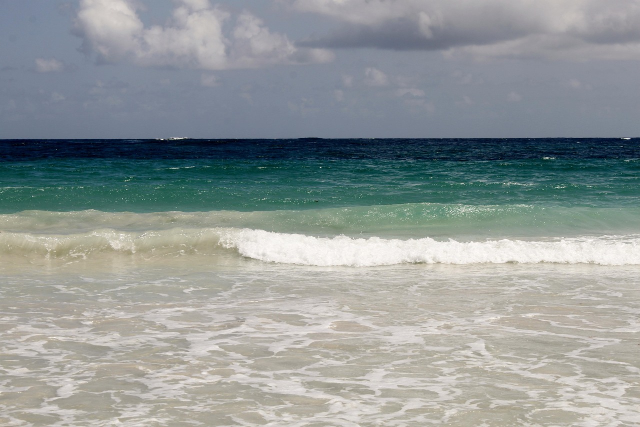
The Eastern Shore is the quiet counterpart to Nova Scotia’s better-known coasts. Beyond Dartmouth the traffic thins out and the Marine Drive (Highway 7) rolls through spruce, bog and salt marsh, with a bay opening up again and again, full of granite islands, buoys and stacked lobster traps. Through the sliding door you smell resin, seaweed and wood smoke. In Tangier fish hangs in the smokehouse, and on the Taylor Head peninsula you can walk for hours along cliffs and sandy beach without meeting a soul. In Sherbrooke an entire village shows how people lived in 1870. Further east the road swings into Chedabucto Bay, to Guysborough and the fishing town of Canso, where fog swallows the harbour lights. At the end you cross the Canso Causeway to Cape Breton. The route demands planning for fuel stops and campsites, but rewards you with emptiness, calm and space.
Stage-by-stage plan
1Stage 1: Halifax to Porters Lake (approx. 45 km)
- The drive
- From Halifax cross the MacKay or the Macdonald Bridge to Dartmouth, then take Highway 107 east and briefly Rte 207 to the beaches. The 107 is wide and fast, while the coast roads to Lawrencetown and Martinique are narrow, with speed limits of 50 to 80. Pure driving time is just under an hour; the short stage leaves time for the beach and shopping. Fill up, check your gas cylinders and top up fresh water in Dartmouth, because after that the infrastructure gets thinner.
- Highlights & must-sees
- Lawrencetown Beach Provincial Park: surf beach with breakers and beach meadows, day use only. Fog often rolls in here even in summer, the Atlantic is cold, and you should watch for currents.
- Martinique Beach: one of the longest sandy beaches in the province and a sanctuary for coastal birds; parts are closed off during the breeding season, so follow the signs and the dog rules.
- Fisherman’s Life Museum in Jeddore Oyster Pond: home of an inshore fisherman from the early 20th century, open seasonally, so check the hours beforehand.
- CampingSpirit overnight tip
-
Official campsite or RV park: Porters Lake Provincial Park on a long freshwater lake, about 30 minutes from Halifax: some sites with hookups, some without (check the facilities when booking), shower building, drinking water and dump station. According to Provincial Parks the campground opens in mid-May, and the Parks website gives the closing date; in high summer book in good time through the Nova Scotia Provincial Parks reservation system, and check vehicle lengths before booking.
Free camping or nature tip (where legal): In the Halifax Regional Municipality, overnighting in your vehicle in public car parks, beach access roads and viewpoints is not permitted and is enforced. Crown land only begins further east and further inland; the rules are in the Practice section.
- Insider tip for campers
- Fill the tank in Dartmouth or Musquodoboit Harbour: between here and Sheet Harbour filling stations are few and far between. It is better to visit Halifax by motorhome from Dartmouth using the harbour ferry, as the car parks in the city centre usually have height limits. You will find a more detailed Halifax section in the CampingSpirit guide to the Lighthouse Route in Nova Scotia.
2Stage 2: Porters Lake to Tangier (approx. 95 km)
- The drive
- From Porters Lake continue on the 107 and from Musquodoboit Harbour on Highway 7 (Marine Drive), which links the coastal villages of Jeddore, Ship Harbour and Murphy Cove here. The road is two-lane, with speed limits mostly 80 to 90 and 50 through villages; the curves are wide, and deer and moose crossings are frequent. Pure driving time is a good hour and a half. Mobile reception sometimes drops out in the bays.
- Highlights & must-sees
- Tangier: the smokehouse by the road has long been known for salmon and mackerel, with seasonal opening hours. The little harbour is good for a stroll, and local operators organise kayak tours to the offshore islands.
- Ship Harbour and Murphy Cove: fishing harbours with boat sheds and buoys, ideal for photos in the morning light; park only where it is allowed.
- Prince Alfred Arch and Graeme Ferguson Memorial Park in Tangier: a short stop, accessible all year.
- CampingSpirit overnight tip
-
Official campsite or RV park: Private: Murphy’s Camping on the Ocean near Murphy Cove, sites with water and electricity (15/30 A), dump station and showers, season according to the operator mid-May to mid-October; also Norse Cove Camping & Kayaking on the coast around Ship Harbour (check location, facilities and season beforehand). Phone ahead to check opening times, as many close in October. The next public campground is not until further east at Salsman or Boylston.
Free camping or nature tip (where legal): On the coast, wild parking in car parks, harbour piers and viewpoints is prohibited, and residents are quick to report it. On Crown land, mostly on forest tracks away from the coast, brief low-impact camping is possible; check the provincial map and avoid barriers and private land.
- Insider tip for campers
- Fish smokehouses and harbour shops often take cash only or have short opening hours, so shop in the morning. In fog switch on your dipped headlights and slow down; deer stand on the road, especially at night.
3Stage 3: Tangier to Sherbrooke (approx. 115 km)
- The drive
- The Marine Drive continues to Spry Bay and Sheet Harbour, then via Liscomb Mills to Sherbrooke. The road stays two-lane, with narrow bridges and climbs at river mouths, and speed limits of 50 to 90. Pure driving time is a good two hours, and with a hike and a museum it makes a full day. Sheet Harbour has shops and a filling station; after that, only the odd one until Sherbrooke.
- Highlights & must-sees
- Taylor Head Provincial Park near Spry Bay: a peninsula with trails over cliffs, beach and forest; day use only, no camping. Trails are partly long and poorly signposted, so take enough water and a rain jacket.
- Liscomb Mills: a village on the Liscomb River with riverside trails and a lodge with a harbour; a walk along the river bank, with trails maintained seasonally.
- Sherbrooke Village: a reconstructed 19th-century village with a blacksmith, printing office and shops, run by the provincial museum; check admission and seasonal opening hours beforehand.
- CampingSpirit overnight tip
-
Official campsite or RV park: Private: Rivers Edge Camping in Sherbrooke on the St. Mary’s River, water and electricity (not at all sites), showers, free dump station, season according to the operator mid-May to the end of September. There is no Provincial Parks campground in Sherbrooke; the nearest public campgrounds are Salsman and Boylston. Taylor Head has no campground.
Free camping or nature tip (where legal): Possible on Crown land in the hinterland, but often only along narrow forest tracks with nowhere to turn. Heed woods closures (Woods Closure) and fire bans in dry weather, and check the province’s current situation.
- Insider tip for campers
- Head for Taylor Head early in the day: the car parks are small and motorhomes often have to stop at the roadside. Fill up and shop in Sheet Harbour, because after that there is little infrastructure until Sherbrooke and Guysborough.
4Stage 4: Sherbrooke to Country Harbour (approx. 55 km)
- The drive
- From Sherbrooke take Route 211 to the coast; at Country Harbour a cable ferry crosses the bay, after which you continue on Route 316. A winding minor road through forest, bog and fishing villages, with speed limits mostly 50 to 80 and hardly any traffic. Pure driving time is about an hour; the stage is short so that there is time left for the water. Mobile reception is patchy.
- Highlights & must-sees
- Country Harbour Ferry: the small cable ferry crosses the bay at Isaacs Harbour and is run by the province; it carries only a few vehicles, so check your vehicle size and the operating times beforehand (signs at the junction show whether it is running).
- St. Mary’s River Salmon Museum in Sherbrooke: the history of salmon fishing on one of the province’s classic rivers, open seasonally.
- Port Hilford, Isaacs Harbour: harbour bays with boats, gulls and spruce forest, quiet viewpoints by the road.
- CampingSpirit overnight tip
-
Official campsite or RV park: Salsman Provincial Park in Middle Country Harbour on Highway 316, about 8 km north of the ferry: sites without electricity, showers, dump station, waterside location; season according to Provincial Parks from early June to mid-September, closed after that. Outside the season your options are private campgrounds or choosing a stopover further north.
Free camping or nature tip (where legal): The area has large stretches of Crown land, but access is often along forest tracks; turning a motorhome is difficult. If you park there, keep your distance from water, cabins and fences and take all your rubbish with you.
- Insider tip for campers
- Salsman is remote: plan on water in the tank, food for two days and spare fuel. Don’t let children and dogs go to the water unsupervised, as the tides in the bay are noticeable.
5Stage 5: Country Harbour to Guysborough (approx. 60 km)
- The drive
- From Country Harbour take Route 316 north, then country roads to Highway 16 and on to Guysborough at the head of Chedabucto Bay (check the turn-offs in your sat nav beforehand). Two-lane, little traffic, often gently hilly with views of the bay, speed limits 50 to 80. Driving time is about an hour, and with stops half the stage.
- Highlights & must-sees
- Guysborough Harbour: a small harbour town with shops, a café and a waterfront promenade; a walk by the water and a view of the boats.
- Chedabucto Bay: a wide bay with lighthouses, fishing boats and, in summer, whales and seabirds; bring binoculars.
- Lake at Boylston Provincial Park: a freshwater lake by the campground, for kayaking or canoeing; a provincial fishing licence is required.
- CampingSpirit overnight tip
-
Official campsite or RV park: Boylston Provincial Park near Guysborough on Highway 16: unserviced sites in the forest, shower building, drinking water, dump station, access to the lake; season according to Provincial Parks from early June, check the Parks website for the closing date. Private: check campgrounds in and around Guysborough before you travel.
Free camping or nature tip (where legal): Crown land in Guysborough County is extensive but unsigned; check the map and the legal situation. In towns, overnighting in car parks and at the harbour is not permitted.
- Insider tip for campers
- Guysborough is the last larger place to stock up before Canso: do your food shopping, fuelling and waste disposal beforehand. In autumn many shops and cafés are already closed.
6Stage 6: Guysborough to Canso (approx. 65 km)
- The drive
- Take Highway 16 east to Canso at the far tip of the peninsula. The road is two-lane and mostly well built, but runs through bog and forest with no settlements; speed limits 80 to 90, 50 in the village. Pure driving time is about an hour. Fog can severely limit visibility and orientation.
- Highlights & must-sees
- Canso Harbour and waterfront promenade: fishing harbour, jetties and boats, one of the oldest fishing harbours in the region.
- Grassy Island (part of the Canso Islands National Historic Site, Parks Canada): a former fishing station off the coast; the visitor centre is in Canso, and you can reach the island only by boat. Check the season and dates with Parks Canada beforehand.
- Whitman House Museum in Canso: a small local museum on the history of Canso and the fishery, open seasonally.
- CampingSpirit overnight tip
-
Official campsite or RV park: Canso RV Park & Marina on Union Street in Canso: sites with electricity, water and sewer, showers, dump station, season according to the operator mid-May to the end of October. The second choice is Seabreeze Campground & Cottages on Fox Island Main Road near Canso, with electricity, water and dump station; check the season beforehand.
Free camping or nature tip (where legal): In and around Canso, overnight parking at the harbour or at viewpoints is prohibited. Crown land lies away from the road, with narrow, boggy access tracks.
- Insider tip for campers
- The small shop and filling station in Canso are basic, and the range is limited. In fog, watch out for bollards, ropes and jetties at the harbour; motorhome spots right on the water are scarce.
7Stage 7: Canso to Port Hastings (Canso Causeway) (approx. 125 km)
- The drive
- From Canso go back along Highway 16 west and north along Chedabucto Bay, then on to Auld’s Cove and onto the Trans-Canada Highway 104. The Canso Causeway is a road embankment with a swing bridge over the canal, no toll. Pure driving time is around two hours; when the bridge is open, traffic waits a few minutes.
- Highlights & must-sees
- Canso Causeway: a road embankment between the mainland and Cape Breton, opened in 1955; viewpoint at the canal, with ships passing through the swing bridge.
- Chedabucto Bay from the coastal road: wide views of water, lighthouses and fishing villages, with several lay-bys.
- Visitor information at the bridgehead in Port Hastings: maps and up-to-date advice, with seasonal opening hours.
- CampingSpirit overnight tip
-
Official campsite or RV park: There is no provincial campground right at the causeway; in Port Hastings and Port Hawkesbury there are private campgrounds, so check names and season through Tourism Nova Scotia. If you continue to Cape Breton, you will find more campgrounds, for example around Whycocomagh, in the CampingSpirit guide to the Cabot Trail in Nova Scotia.
Free camping or nature tip (where legal): At the causeway and in the harbour area, overnighting in car parks is not permitted. There is Crown land on Cape Breton, often reached only along forest tracks.
- Insider tip for campers
- Fill up and shop in Port Hawkesbury before Cape Breton: prices on the island are higher and supermarkets along the Cabot Trail are small. If you continue from here towards Antigonish, you close the circle with the CampingSpirit guide to the Sunrise Trail on the Northumberland Strait.
Camping practice & local rules
Wild camping & overnight parking
- Crown land in Nova Scotia: on provincial land, brief low-impact camping is generally possible, but the rules are complex and change. Check beforehand in the province’s Crown land directory and with the Department of Natural Resources. It is off limits on private land, in protected areas and behind barriers. Campfires only in a fire ring and only where there is no ban.
- Wildfire situation: in dry weather the province can restrict or prohibit entry to the woods (Woods Closure), and then access along forest tracks is also forbidden. Check the current map (BurnSafe) and notices on the day you travel.
- On the coast and in towns, overnighting in car parks, harbour piers, beaches and viewpoints is prohibited; it is enforced by the municipality and police, and fines are possible. Supermarket car parks only with express permission.
- Apps and websites: iOverlander, Campendium, Park4Night; for reservations the Nova Scotia Provincial Parks website, for private campgrounds Tourism Nova Scotia. There is no campground at Taylor Head.
- Wildlife: black bears, moose, white-tailed deer, seals and many seabirds. Keep food in the vehicle at night and seal rubbish securely. Do not touch seals on the beach; keep your distance.
- Insects and ticks: from May to July blackflies and mosquitoes are fierce, later ticks in grass and undergrowth. Plan for repellent, long clothing and tick checks.
- Sea and fog: Atlantic waves crash unexpectedly high against granite rocks, the water is cold and currents are strong. In fog switch on your lights and slow down; do not walk coastal paths when visibility is down to a few metres.
- At checks stay friendly, leave the spot and don’t argue about interpretation.
Waste disposal & supplies
- There are dump stations at all Provincial Park campgrounds on the route and at a few private campgrounds; outside the season they are mostly closed. Use map apps and the Tourism Nova Scotia website.
- Drinking water: Provincial Park campgrounds have drinking-water taps; tap water in towns is mostly drinkable. At unserviced campgrounds bring canisters, and filter or boil lake water.
- Never discharge grey water into streams, lakes or onto the ground; empty chemical toilets only at dump stations.
- You can get propane at filling stations and dealers in Dartmouth, Sheet Harbour and Port Hawkesbury. European cylinders need an adapter and are mostly not refilled; rental motorhomes have a fixed tank, so check the level beforehand.
- Fuel in litres: reliable filling stations in Dartmouth, Musquodoboit Harbour, Sheet Harbour, Guysborough, Canso and Port Hawkesbury, with long gaps in between. Sherbrooke is the middle of the route, so check there before continuing.
- Shopping: supermarkets in Dartmouth, Sheet Harbour and Port Hawkesbury; in the small villages only village shops with a limited range and short opening hours.
- Electricity: sites with hookups offer 15, 30 or 50 A at 120 V; rental motorhomes have the right cable. At sites without hookups plan on the leisure battery.
- Laundry and rubbish: launderettes in Dartmouth and Port Hawkesbury; dispose of rubbish in the bins at the campgrounds and observe waste separation.
Vehicle size & traffic rules
- Speed limits in km/h: Highway 107 mostly 100, country roads 80 to 90, built-up areas 50, near schools 30. Observe the height signs at bridges and underpasses.
- Tolls: there are no tolls on the route itself, and the Canso Causeway costs nothing too; for the bridges between Halifax and Dartmouth check the current arrangements with Halifax Harbour Bridges. Admission fees for museums and Parks Canada vary, so check current amounts.
- Provincial Parks: camping fees are charged per night, reserve online several months ahead, especially in July and August. Day-use parks such as Taylor Head and Lawrencetown Beach have no camping.
- Dimensions and lengths: many campgrounds and village roads are tight for large motorhomes. Check length limits when booking; turning on forest tracks is difficult.
- Season: Provincial Park campgrounds mostly open from mid-May to early June and close from mid-September to mid-October, so in autumn plan for private campgrounds or the return trip. Museums and shops on the Eastern Shore are often closed in autumn.
- Weather: summer is mild with frequent fog, autumn has clear air and autumn colours, but also Atlantic storms. Hurricane remnants are possible well into autumn; take weather warnings seriously.
- Traffic law: turning right on red is allowed after a full stop, unless a sign prohibits it. Phone use at the wheel only hands-free, open alcohol containers in the vehicle are prohibited, and seat belts are compulsory in motorhomes too. A German driving licence is sufficient for tourists.
- Entry: Germans need an eTA for the flight to Canada; check the conditions with the Canadian immigration authority. Sort out the rental motorhome and insurance in advance.
- Emergency: 911; mobile reception on the coast is mostly decent, patchy inland. Make sure your return routes are clear before the tide comes in.
CampingSpirit packing & preparation checklist
- Insect protection with a head net and long, close-woven clothing for blackflies and mosquitoes from May to July.
- Tick protection (repellent, tweezers) for coastal meadows and forest trails on Taylor Head and at Liscomb.
- Waterproof hiking boots and a rain jacket for wet granite rocks and fog on the coastal paths.
- Water canister (20 l) and extra fuel and water reserves for the remote sections between Sheet Harbour and Sherbrooke.
- Binoculars and a camera with a telephoto lens for seals, seabirds and boats in the bays.
- Offline maps, printed reservations and cash for village shops and the smokehouse.
As of 2026-10. Closures, fees and booking rules change: check official sources before you go.