In-depth guide · CampingSpirit
From the quartzite falls in Sioux Falls via Palisades State Park, the Corn Palace in Mitchell and the reservoirs of Lewis and Clark Lake and Lake Francis Case to the Oahe Dam near Pierre: about 800 kilometres of prairie, river and sky in eastern and central South Dakota.
The spirit of the route
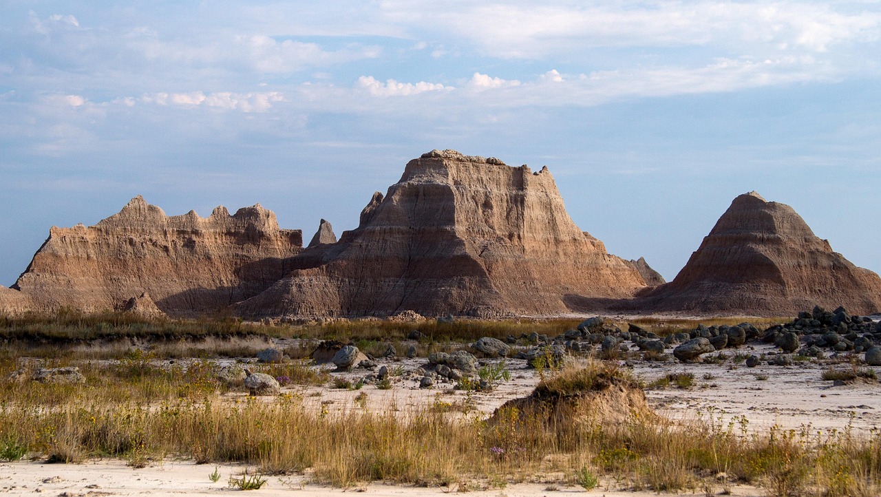
If you only know South Dakota as the land of the Black Hills, you are missing its quieter half. In the east the fields run to the horizon, silos stand like lighthouses in the wheat, and in Sioux Falls the Big Sioux River tumbles over pink quartzite. The further west the route goes, the wider the sky gets. Beyond Mitchell, where a palace made of corncobs stands, the Missouri appears – not as a wild river, but as a chain of huge reservoirs, with yellow grass and cedars growing along their shores. From your sliding door you see pelicans on the water, wind in the stalks in the evening and an unbroken horizon. This is a trip for people who don't need to fill up the open space: short stages, few people, long twilights and spots by the water that often only a handful of campers share.
Stage-by-stage plan
1Stage 1: Sioux Falls to Palisades State Park (approx. 40 km)
- The drive
- From downtown Sioux Falls take I-90 east to Garretson, then a few more kilometres on country roads to the park: flat farmland, straight roads. On I-90 in Sioux Falls a lower limit applies (65 mph), after that up to 80 mph. Pure driving time is about 30 minutes. There are plenty of petrol stations and supermarkets in Sioux Falls, but only a few in Garretson.
- Highlights & must-sees
- Falls Park in Sioux Falls: The Big Sioux River drops over several steps of pink quartzite; an observation tower and a visitor centre stand on the site, along with the remains of an old mill. The paths are freely accessible; parking for large vehicles is scarce, so it is better to park at the edges.
- Palisades State Park: At Split Rock Creek, quartzite walls rise out of the prairie, climbers practise here, and short hiking trails follow the creek. The legend of Jesse James's leap across the gorge (Devil’s Gulch) is set nearby and is part of local folklore.
- Quartzite and prairie: The Sioux Quartzite is one of the oldest rock layers in the region; information boards in the park explain the geology.
- CampingSpirit overnight tip
-
Official campsite or RV park: Palisades State Park: campground at Split Rock Creek with electric sites (30 or 50 A depending on the site) and a washroom building with showers; whether there is a dump station in the park is not certain – ask the park office beforehand or use the public station in Garretson. Reserve through the online portal of South Dakota Game, Fish & Parks (reservations.gooutdoorssouthdakota.com or phone 1-800-710-2267); sites go quickly. You also need the state park entrance pass (day or annual pass). From October to April the showers and water systems may be closed. Alternative in Sioux Falls: private campgrounds such as Sioux Falls KOA Journey, if you want to stay in town.
Free camping or nature tip (where legal): In Sioux Falls and in the villages, overnighting in your vehicle on streets and car parks is not allowed; free camping on public land is almost non-existent in the densely settled east. If you just want to sleep, stay in the state park.
- Insider tip for campers
- Visit Falls Park early in the morning, when parking and photo light are at their best. Take care of fresh water and shopping in Sioux Falls before heading into the sparsely populated west; large supermarkets and propane refill points are found in the city area.
2Stage 2: Palisades State Park to Mitchell (approx. 130 km)
- The drive
- Back to I-90 and west for about 120 kilometres to Mitchell: straight, wide, speed limit 80 mph (129 km/h) – in a motorhome, 65–70 mph is better, because crosswinds on the open prairie are strong. The landscape hardly changes; only silos, cornfields and wind turbines mark the towns. Pure driving time is about 1.5 hours. Petrol stations at almost every exit.
- Highlights & must-sees
- Corn Palace in Mitchell: The building with its onion-shaped turrets is re-clad every year with murals made of corncobs, grain and grasses; the designs change with an annual theme. You can see the façade from the street too; check beforehand about access to the hall and events inside.
- Mitchell Prehistoric Indian Village: archaeological site on Lake Mitchell, a fortified village of farmers that was inhabited about a thousand years ago. The covered excavation (Thomsen Center Archeodome) and a museum explain the finds; visits are seasonal (summer and autumn), so check opening times beforehand.
- Lake Mitchell: reservoir on the edge of town with a lakeside path; in the evening pelicans and cormorants fly over the water.
- CampingSpirit overnight tip
-
Official campsite or RV park: Lake Mitchell Campground: municipal campground on the reservoir north of downtown. Check facilities (electricity, water, showers), reservations and current conditions beforehand with the City of Mitchell; observe length restrictions. Alternatively, private campgrounds in Mitchell if the municipal one is full.
Free camping or nature tip (where legal): Overnighting on car parks and streets in Mitchell is not permitted; the I-90 rest areas are meant for breaks. Observe the maximum parking time posted on signs.
- Insider tip for campers
- The Corn Palace and the Prehistoric Indian Village are only a few kilometres apart – good for half a day. Cycle to the Palace or park the motorhome on the side streets; downtown has few height restrictions but tight corners. In a thunderstorm on the prairie, stay in your vehicle and do not shelter under lone trees.
3Stage 3: Mitchell to Lewis and Clark Recreation Area near Yankton (approx. 150 km)
- The drive
- From Mitchell take SD-37 south through the farmland (via Parkston) to Tyndall, then SD-50 east to Yankton: two-lane country roads, 55–65 mph, hardly any traffic. The fields give way to hills with cedars as you approach the Missouri. Pure driving time is about 2 hours. Petrol stations in Parkston, Tyndall and Yankton.
- Highlights & must-sees
- Yankton: The town on the Missouri has a historic centre with brick buildings and the Meridian Bridge, a steel bridge from 1924 that is now used by pedestrians and cyclists.
- Gavins Point Dam and Lewis and Clark Lake: The lowest dam on the Missouri impounds the lake; the Corps of Engineers visitor centre, a viewpoint and a fish hatchery (Gavins Point National Fish Hatchery) lie side by side.
- Missouri National Recreational River: The free-flowing stretch of river below the dam, with sandbars and woods, belongs to the NPS protected area; there are viewpoints along the bank.
- CampingSpirit overnight tip
-
Official campsite or RV park: Lewis and Clark Recreation Area (South Dakota State Park) on Lewis and Clark Lake: large campground near the lake, sites with electricity, some with water, shower buildings and a dump station. Reserve through the portal of South Dakota Game, Fish & Parks (reservations.gooutdoorssouthdakota.com); book early in summer and at weekends. The state park entrance pass is also required.
Free camping or nature tip (where legal): At the lake and the dam facilities, overnighting outside the campgrounds is prohibited; the Corps grounds can be used during the day. On GFP Game Production Areas, overnighting is allowed only where expressly designated – read the signs on site.
- Insider tip for campers
- The drive is less boring than it looks on the map if you use places like Parkston or Tyndall for coffee and cake. At the dam in a south wind the water is often rough – kayak and boat only in calm weather. In high summer, plan for mosquitoes on the shore in the evening.
4Stage 4: Lewis and Clark Recreation Area to Chamberlain (approx. 200 km)
- The drive
- From Yankton take SD-50 west all the way (via Tyndall, Wagner and Lake Andes) to Chamberlain: farmland and ranges of hills, with wide views over Lake Francis Case towards the end. Pure driving time is about 2.5 to 3 hours, a long day with stops. Petrol stations in the towns along the route and in Chamberlain; fill up before setting off.
- Highlights & must-sees
- Chamberlain and Oacoma: The Missouri divides the landscape; from the I-90 bridge there is a wide view over the reservoir. The little town supplies travellers with petrol stations, supermarkets and restaurants.
- Akta Lakota Museum and Cultural Center at St. Joseph’s Indian School, Chamberlain: The museum shows Lakota art, clothing and history. Check opening times and visiting rules beforehand; a respectful visit is welcome.
- Dignity – Of Earth and Sky: The stainless steel sculpture by Dale Lamphere, about 15 metres (50 feet) tall, honours the culture of the Lakota and Dakota. It stands on a rise at the Welcome Center between I-90 exits 263 and 265 near Chamberlain, with a view into the Missouri valley.
- CampingSpirit overnight tip
-
Official campsite or RV park: Several GFP campgrounds lie on Lake Francis Case: Snake Creek Recreation Area and Platte Creek Recreation Area offer lakeside campgrounds with electricity, showers and a dump station. Both, however, are off the route south of Chamberlain (Snake Creek about 14 miles west of Platte on SD-44), so allow a detour of a good hour. Closer to Chamberlain is American Creek Campground. Reserve through the portal of South Dakota Game, Fish & Parks (reservations.gooutdoorssouthdakota.com); from October to April the showers and water systems may be closed.
Free camping or nature tip (where legal): On Corps land at Lake Francis Case, camping is allowed only at designated sites. The same applies on Game Production Areas as before; there is no legal, signposted free-camping option in the Chamberlain area.
- Insider tip for campers
- The Dignity monument can be reached directly from I-90 at the Welcome Center; it is busy on summer weekends, so check parking for large vehicles on site. The best way to see Lake Francis Case is in the evening from the lakeside campgrounds: the sunset colours the water and the bluffs. Fill up and shop in Chamberlain – after that the distances get longer.
5Stage 5: Chamberlain to Pierre (approx. 155 km)
- The drive
- From Chamberlain west on I-90 to exit 212 (Vivian), then north on US-83 across the Fort Pierre National Grassland to Fort Pierre and Pierre. A wide, sparsely populated stretch, up to 80 mph on I-90 and mostly 65 mph on US-83; wind is a constant issue, with occasional headwinds and gusts. Pure driving time is about 2 hours; check road conditions if the weather changes. Fill up before setting off – inland, petrol stations are far apart.
- Highlights & must-sees
- State Capitol in Pierre: The 1910 Capitol is open to the public; tours take place at set times, so check current dates on the state's website. Pierre is one of the smallest state capitals in the USA.
- South Dakota Cultural Heritage Center: museum of the State Historical Society on the history and Indigenous culture of the state, with permanent exhibitions. Because of renovation and redesign work, check opening times and current status beforehand.
- Missouri River in Pierre: The river flows broad through the city; along the bank there are parks and paths that are good to ride by bike at sunset.
- CampingSpirit overnight tip
-
Official campsite or RV park: Farm Island Recreation Area (GFP) about 6 kilometres east of Pierre on SD-34: campgrounds with electricity, showers and a dump station, patches of woodland on the Missouri and hiking trails. Alternatively Oahe Downstream Recreation Area below the dam, with a campground on the river (Campgrounds 1 and 2 are closed from mid-November to the end of March for bald eagle winter roosts). Both can be reserved through the South Dakota Game, Fish & Parks portal (reservations.gooutdoorssouthdakota.com); state park pass required; from October to April the showers and water systems may be closed.
Free camping or nature tip (where legal): In Pierre and Fort Pierre, overnighting in your vehicle on streets and car parks is prohibited. Free camping is only possible on the Fort Pierre National Grassland (see next stage).
- Insider tip for campers
- Pierre has good shopping and propane refill points; before heading out to the grassland, stock up on supplies, fresh water and fuel. The Capitol has parking for larger vehicles on the side streets; downtown is quiet and easy to drive.
6Stage 6: Pierre to Fort Pierre National Grassland (approx. 55 km)
- The drive
- From Pierre across the Missouri bridge to Fort Pierre, then south on US-83 (about 24 miles / just under 40 kilometres to the grassland; US-83 divides it into two halves) and then on gravel roads into the open land: asphalt quickly turns to gravel or clay. When wet, the clay soil is slippery and can become impassable. Pure driving time is about 1.5 hours. There are no petrol stations and no services on the grassland.
- Highlights & must-sees
- Fort Pierre National Grassland: about 116,000 acres (roughly 470 km²) of mixed-grass prairie with ranges of hills, pronghorn antelope, prairie dogs, white-tailed deer and songbirds; also known for prairie chicken and pheasant hunting. The landscape is open and almost treeless; the sky takes up most of the picture.
- Fort Pierre: historic site where in 1743 the Verendrye brothers buried a lead plate (schoolchildren found it in 1913); the Verendrye Monument on a rise above the Missouri commemorates this. The town is also an old trading centre on the Missouri.
- Starry sky: far from cities and light sources the night is dark; the Milky Way shows itself on clear nights.
- CampingSpirit overnight tip
-
Official campsite or RV park: There are no developed campgrounds on the grassland itself. If you want electricity and showers, stay at Farm Island or Oahe Downstream and drive out during the day. There are also private campgrounds in Fort Pierre.
Free camping or nature tip (where legal): On the Fort Pierre National Grassland (Forest Service), camping away from developed sites is usually permitted, without reservation, with a limited length of stay (usually 14 days) and driving only on permitted routes; the parcels are interspersed with private and leased land, so observe the boundaries. Check the map (Motor Vehicle Use Map), fire bans and current rules on site with the Fort Pierre Ranger District of the Nebraska National Forests and Grasslands (office in Fort Pierre).
- Insider tip for campers
- After a thunderstorm the clay tracks are impassable – if it rains, get back onto asphalt in good time. Keep bringing water, and have everything you need in the vehicle; do not count on a phone connection. In autumn it is hunting season: watch out for pheasant hunters and wear highly visible clothing.
7Stage 7: Fort Pierre National Grassland to Lake Oahe and Oahe Dam (approx. 70 km)
- The drive
- From the grassland back to Fort Pierre and north on SD-1806 along the Missouri to the Oahe Dam: asphalt, good road, 55–65 mph, views of the water. Pure driving time is about 1.5 hours. Petrol stations in Pierre and Fort Pierre.
- Highlights & must-sees
- Oahe Dam: one of the largest earth-fill dams in the world, impounding the waters of the Missouri to form Lake Oahe. The Oahe Dam Visitor Center of the Corps of Engineers provides information about construction, the power plant and the consequences for Lakota and Dakota communities. Check tours and opening times beforehand.
- Lake Oahe: a long reservoir stretching all the way to North Dakota; anglers, sailors and pelicans define the scene.
- Oahe Downstream Recreation Area: lakeside path, fishing spots and viewpoints on the river below the dam.
- CampingSpirit overnight tip
-
Official campsite or RV park: Oahe Downstream Recreation Area (GFP) on the Missouri below the dam: campground with electricity, showers and a dump station; Campgrounds 1 and 2 are closed from mid-November to the end of March for bald eagle winter roosts. Alternatively Farm Island Recreation Area. Reserve through the portal of South Dakota Game, Fish & Parks (reservations.gooutdoorssouthdakota.com); state park pass required.
Free camping or nature tip (where legal): Overnighting is prohibited at the dam and in the Corps car parks. Dispersed camping is only available on the grassland (stage 6), not at the reservoir.
- Insider tip for campers
- North of the reservoir lie the Cheyenne River and Standing Rock reservations: show respect for memorial sites, and do not step on graves or closed-off areas. On the reservoir, waves in the wind quickly become dangerous – check the weather before going out on the water. From here the route leads back east or – heading west – to the Badlands, described in the CampingSpirit guide “Bison, needles and prairie – by camper through the Badlands and Black Hills”.
Camping practice & local rules
Wild camping & overnight parking
- In eastern South Dakota there is practically no public land for dispersed camping; here you camp at state park, Corps or private campgrounds. Streets, car parks and villages are off limits, and checks and orders to move on are possible.
- Fort Pierre National Grassland (Forest Service, Nebraska National Forests and Grasslands, Fort Pierre Ranger District): camping away from campgrounds is usually allowed, but only on federal land, not on interspersed private land, driving only on permitted routes and with a limited length of stay; check the rules and fire bans with the Ranger District beforehand.
- Corps of Engineers (Lake Francis Case, Lake Oahe, Lewis and Clark Lake): camping at designated sites; state park sites are reserved through the GFP portal, Corps sites through recreation.gov.
- GFP Game Production Areas: overnighting only where expressly designated; check the rules at gfp.sd.gov.
- State park reservations: reservations.gooutdoorssouthdakota.com (phone 1-800-710-2267); in addition, a vehicle entrance pass (day or annual pass) is required. Book early for summer weekends.
- Apps: iOverlander, Campendium, The Dyrt and Recreation.gov; Park4Night is not widely used here.
- Animals and weather: ticks and mosquitoes are common; prairie rattlesnakes live on the grassland, so walk carefully in grass and among rocks. Seek shelter in thunderstorms and hail; in summer tornado warnings are possible.
Waste disposal & supplies
- Dump stations: at most state park campgrounds (Lewis and Clark, Snake Creek, Platte Creek, Farm Island, Oahe Downstream; check beforehand at Palisades) and at private campgrounds; empty your tanks before the grassland.
- Drinking water: at taps on campgrounds and at petrol stations in the towns; there is none on the grassland, so bring water in canisters.
- Empty grey water and chemical toilets only at dump stations; dumping onto meadows, into rivers or lakes is strictly forbidden.
- Propane: petrol stations and hardware stores in Sioux Falls, Mitchell, Yankton, Chamberlain and Pierre fill US cylinders; European cylinders are generally not filled.
- Electricity: state park sites offer 30, sometimes 50 A; designated Corps sites are mostly without electricity or with basic hook-ups.
- Fuel and shopping: large supermarkets in Sioux Falls, Mitchell, Yankton and Pierre; between Chamberlain and Pierre and on the grassland, petrol stations are far apart.
Vehicle size & traffic rules
- Speed limits: interstates in rural sections up to 80 mph (129 km/h), lower in Sioux Falls (65 mph), country roads mostly 55–65 mph, through villages 25–35 mph. There is no separate limit for motorhomes, but crosswinds and length argue for a moderate speed.
- Tolls: there are no toll roads in South Dakota on this route.
- Wind: gusts of 40 mph and more are not uncommon on the prairie; leave tall motorhomes and trailer combinations parked during wind warnings.
- Winter and severe weather: from October to April blizzards are possible, closing I-90 and minor roads. Tornado and hail season runs from spring to summer.
- Time: the entire route to Pierre and the Oahe Dam is in the Central Time Zone; the boundary with Mountain Time runs along I-90 west of Murdo – keep this in mind before side trips towards the Black Hills.
- Emergency: 911. Mobile coverage is good in towns but often absent on the grassland and on remote country roads; give your itinerary to relatives.
CampingSpirit packing & preparation checklist
- Storm guy lines, long tent pegs and levelling ramps: the prairie wind grabs awnings and tents; retract the awning in gusts.
- Extra water canisters (20–40 litres): there is no water on the Fort Pierre National Grassland, and the tracks are long.
- Mosquito net, repellent with DEET or picaridin and tick tweezers: insects are numerous by the water and in the grass.
- Binoculars for pelicans, pronghorn antelope and prairie dogs.
- High-visibility clothing in autumn: in pheasant season the prairie is full of hunters.
- Weather radio or an app with National Weather Service warnings: thunderstorms, hail and tornadoes develop quickly in open country.
As of 2026-10. Closures, fees and booking rules change: check official sources before you go.