

In-depth guide · CampingSpirit
Around 1,100 km from Melbourne via the granite coves of the Prom, the gold-rush valley of Walhalla, the wetlands of Sale and the dunes of Ninety Mile Beach to the Gippsland Lakes, the caves of Buchan and the mouth of the Snowy River at Marlo – a journey through Victoria's south-east in short stages, with koalas above the ferry landing and kangaroos on the evening lawn.
The spirit of the route
Gippsland is the Victoria you don't understand by driving through. On Wilsons Promontory, granite boulders glow orange above turquoise water, and in the evening wombats graze between the campsites. A few hours later you are standing in a gorge where thousands dug for gold 150 years ago and barely twenty people live today. Beyond it the land turns flat and wide: dairy pastures, black swans in the marshes of Sale, then the endless line of dunes along Ninety Mile Beach, where you sleep behind banksias and tea-trees and hear nothing but the surf in the morning. The Gippsland Lakes are a labyrinth of lagoons, jetties and boatsheds; on Raymond Island koalas hang above the path. From the sliding door you see pelicans, mist over the Snowy River and eastern grey kangaroos in the last light. This route rewards those who drive slowly, book early and take the fire danger seriously in summer.
Stage-by-stage plan
1Stage 1: Melbourne to Wilsons Promontory (Tidal River) (approx. 230 km)
- The drive
- Out of Melbourne south-east on the Monash Freeway (M1), then on the South Gippsland Freeway and the South Gippsland Highway (A440) via Koo Wee Rup, Korumburra and Leongatha into the green hills of South Gippsland. At Meeniyan turn off to Fish Creek, cross the flat isthmus at Yanakie into the national park and follow the winding park road to Tidal River. Around 3 hours of pure driving time; lower speed limits in the park, and from the afternoon on wombats, kangaroos and emus are out on the road.
- Highlights & must-sees
- Lilly Pilly Gully Nature Walk: a loop from Tidal River through eucalypt forest into a damp gully of tree ferns and cool temperate rainforest, good for the afternoon of arrival.
- Pillar Point: a short walk from the campground up onto a granite knoll between Norman Bay and Squeaky Beach, the classic sunset spot on the Prom.
- Fish Creek: a small village on the edge of the hills with galleries and cafés – the last good stop for shopping before the park.
- CampingSpirit overnight tip
-
Official campsite or RV park: Tidal River Campground run by Parks Victoria: the only vehicle campground in the park, between Tidal River and Norman Bay, with amenities blocks, hot showers, powered and unpowered sites and the general store with takeaway in the village centre. Online booking and fees only. For the summer holidays (late December to late January) and certain long weekends, Parks Victoria allocates sites by ballot, which you apply for months in advance; Easter and the other long weekends are booked out early – check the current situation when booking.
Free camping or nature tip (where legal): In the national park, overnight stays outside Tidal River and the hike-in campgrounds (on foot only, with an overnight hiking permit) are prohibited, and rangers also check the car parks at the bays. If you can't get a site at short notice, fall back on the caravan parks in Yanakie, Fish Creek or Foster and drive into the park by day; there are practically no free sites in the area.
- Insider tip for campers
- There is no fuel in the park – the nearest petrol station is in Yanakie, so it's better to fill up in Leongatha, Fish Creek or Foster. Before setting off, check the Parks Victoria website for closures: individual areas and tracks are closed at times for conservation and wildlife projects, and on days of catastrophic fire danger the entire park is closed. Lock food and rubbish inside the vehicle in the evening; ravens and possums open anything left outside.
2Stage 2: Tidal River to Port Welshpool (via Foster) (approx. 110 km)
- The drive
- One more walk in the morning, then back via Yanakie and along Corner Inlet to Foster, the main town of the Prom region. On along the South Gippsland Highway to Toora with a detour into the hills to Agnes Falls, and via Welshpool down to Port Welshpool on the inlet. A short, quiet stage with a good 1.5 hours of driving; the access road to Agnes Falls is narrow but sealed.
- Highlights & must-sees
- Whisky Bay and Picnic Bay: two granite coves north of Tidal River with short tracks from the car park, usually deserted in the morning.
- Agnes Falls near Toora: the Agnes River plunges over a broad rock step into a forested gorge, with viewing platforms a few minutes from the car park; most impressive after rain.
- Long Jetty in Port Welshpool: the restored jetty reaching far out into Corner Inlet, with views back to the mountains of the Prom – for strolling, fishing and watching wading birds.
- CampingSpirit overnight tip
-
Official campsite or RV park: In Port Welshpool, Toora and Foster there are small caravan parks with power and amenities that are quiet outside the holidays; ask the park in advance about facilities, dump point and access for larger vehicles. If you'd rather stay closer to the Prom, there is a caravan park in Yanakie right on Corner Inlet.
Free camping or nature tip (where legal): South Gippsland Shire only allows overnight stays in vehicles on designated areas; foreshore car parks, boat ramps and the car park at the Long Jetty are not campsites. Individual designated sites in the shire and their current rules are shown on WikiCamps and CamperMate – the signage on the ground takes precedence.
- Insider tip for campers
- Foster has a supermarket, petrol stations and a bakery – shop here for the next two days, because Walhalla has no full-range store. For fishing from the Long Jetty or in Corner Inlet you need a Victorian Recreational Fishing Licence (available online); parts of Corner Inlet are a marine national park, where fishing is prohibited.
3Stage 3: Port Welshpool to Walhalla (approx. 190 km)
- The drive
- Via Welshpool and Alberton to Yarram, then north on the Hyland Highway over the Strzelecki Ranges to Traralgon. If you have time and a small vehicle, take the detour through the Tarra Valley up to Balook in Tarra-Bulga National Park: sealed, but narrow and very winding through rainforest – unsuitable for large rigs; then down the Traralgon-Balook Road. From Traralgon via Moe and Erica on the Walhalla Road; the last kilometres to Walhalla run narrow, steep and winding down into the valley of Stringers Creek. Around 3 hours of pure driving time.
- Highlights & must-sees
- Tarra-Bulga National Park: the Fern Gully Walk and the suspension bridge over a fern gully beneath mountain ash, a few minutes from the car park at Balook.
- Walhalla: an 1860s gold-mining town in a narrow valley, with a bandstand, timber houses, the cemetery on the steep hillside and guided tours of the Long Tunnel Extended Mine.
- Walhalla Goldfields Railway: a narrow-gauge railway through the Stringers Creek gorge over timber bridges; runs only on selected days – check the timetable in advance.
- CampingSpirit overnight tip
-
Official campsite or RV park: North Gardens at the northern end of Walhalla: a free community camping area without bookings (first come) with flush toilets, gas barbecues, fireplaces and water that is not drinking water; lawns for tents, hardstanding for campervans and at most small trailers, dogs on a lead allowed. There are no showers. On long weekends the area is full by Friday evening. About 2 km further north on Stringers Creek is the Chinese Gardens Camping Ground, with fees, showers, toilets, laundry and gas barbecues; it is closed in winter and opens from about October.
Free camping or nature tip (where legal): Baw Baw Shire prohibits camping on council land, including road verges, under its local law; in Walhalla camping is only allowed on the designated areas. In the surrounding state forest there are basic sites, mostly reached via gravel and generally not permitted for rental campervans.
- Insider tip for campers
- Walhalla has only one access road and lies in a forested valley: on days of extreme or catastrophic fire danger, don't go there at all. Large motorhomes and rigs will find hardly anywhere to turn or park in the town – leave them on the area at the entrance to the town and continue on foot. There is no fuel in Walhalla; fill up in Moe or Traralgon. Mobile reception in the valley is poor.
4Stage 4: Walhalla to Sale (approx. 135 km)
- The drive
- Back via Erica to Moe and on the Princes Freeway/Highway (M1/A1) through the Latrobe Valley with its power stations and open-cut mines via Traralgon and Rosedale to Sale. Apart from the Walhalla Road an easy, wide route; around 1 hour 45 minutes of driving, enough time for the afternoon in Sale.
- Highlights & must-sees
- Port of Sale: the old harbour basin on the canal, from which steamers once sailed across the Gippsland Lakes, with a cultural centre, art gallery and visitor centre on the water.
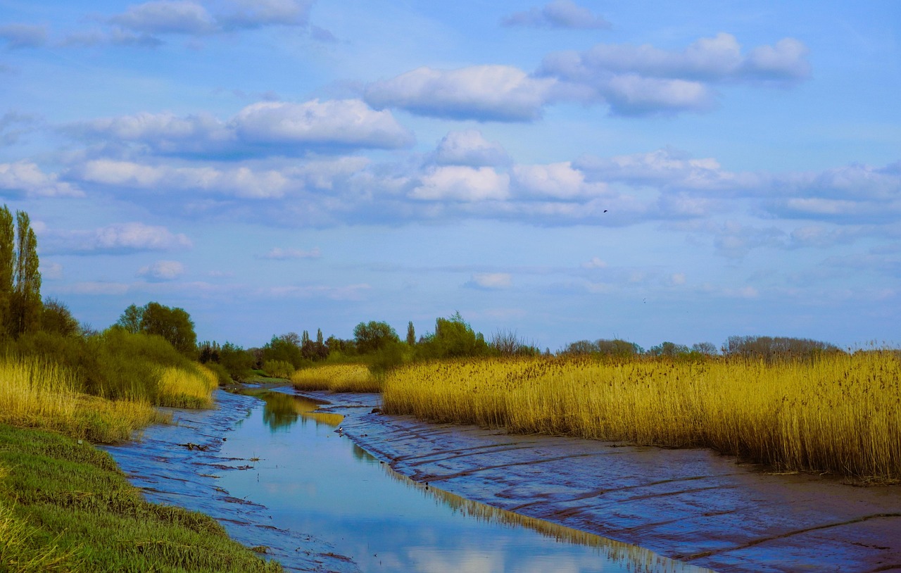
- Sale Common: a wetland on the edge of town with boardwalks and a bird hide – black swans, spoonbills, ibises and in wet years thousands of waterbirds.
- Lake Guthridge in the centre, a walk for the evening; in late summer flocks of bats and birds in the trees.
- CampingSpirit overnight tip
-
Official campsite or RV park: Sale Showgrounds Caravan & Motorhome Park on the Maffra-Sale Road: powered sites, toilets, drinking water and a dump point, suitable for large vehicles. Alternatively Sale Motor Village on the Princes Highway with power, amenities, laundry and dump point. Outside event weekends there is usually space without booking.
Free camping or nature tip (where legal): Wellington Shire does not allow overnight stays in vehicles on just any town land; an RV rest area for self-contained vehicles is provided in Heyfield, around 35 km north of Sale (rules and length of stay as signposted on site, check the current situation). Short rest breaks at signposted rest areas on the highway are possible, camping there is not.
- Insider tip for campers
- Sale has large supermarkets and cheap petrol stations – the last good opportunity before the coast. Pack the binoculars in the morning: at Sale Common the birds are most active in the first hour after sunrise. Over the town, the aerobatic team and training aircraft from RAAF Base East Sale occasionally practise.
5Stage 5: Sale to Ninety Mile Beach (Seaspray – Golden Beach) (approx. 75 km)
- The drive
- South out of Sale on the South Gippsland Highway, a short stop at the historic Swing Bridge, then via Longford through flat pasture to Seaspray. From there the sealed Shoreline Drive runs north-east behind the dunes to Golden Beach, between Ninety Mile Beach on one side and the lagoon of Lake Reeve on the other. A short stage, a good hour of driving; the access tracks to the individual camps are partly sandy.
- Highlights & must-sees
- Swing Bridge south of Sale: a 19th-century iron swing bridge over the confluence of the Thomson and Latrobe Rivers, accessible to pedestrians.
- Ninety Mile Beach at Seaspray: kilometres of sandy beach in front of an unbroken line of dunes; in summer only the section in front of the Surf Lifesaving Club is patrolled.
- Lake Reeve behind the dunes at Golden Beach: a shallow lagoon with wading birds, especially beautiful in the evening light.
- CampingSpirit overnight tip
-
Official campsite or RV park: Seaspray Caravan Park on Futcher Street, a few steps from the beach: powered sites, amenities and dump point. Quieter and simpler: the numbered camps along Shoreline Drive between Seaspray and Golden Beach, between the dunes and the road in the shade of banksias and tea-trees, most recently free and without booking (first come), with pit toilets at some camps; there is no water or power. Parks Victoria has at times required bookings here – check the current situation before the trip.
Free camping or nature tip (where legal): The Shoreline Drive camps are the legal way to camp freely on Ninety Mile Beach; camping in the dunes and on the beach is prohibited. Dogs only on a lead and only at camps 1 to 6 on the edge of Golden Beach, prohibited at all others – otherwise you face fines. Rubbish must be taken with you. In the summer holidays the sites are full – then there is no alternative but the caravan parks.
- Insider tip for campers
- Bring water and food from Sale, the camps have no supplies, and arrive with an empty cassette. The surf is rough and the currents strong – only swim on the patrolled section of beach. Don't drive onto the sand: rental vehicles are not insured there, and soft dune sand stops four-wheel drives too.
6Stage 6: Golden Beach to Paynesville and Raymond Island (approx. 140 km)
- The drive
- Back via Longford to Sale, then on the Princes Highway via Stratford, where the highway crosses the Avon River, to Bairnsdale and out along the Paynesville Road to the lakes. A flat, well-built route, just under 2 hours of driving. With a detour to Eagle Point for the Silt Jetties.
- Highlights & must-sees
- Mitchell River Silt Jetties at Eagle Point: two narrow tongues of river sediment pushing kilometres out into Lake King – visible from the lookout and from the road along the embankment.
- Raymond Island: across on the short ferry from Paynesville and along the Koala Trail through residential streets and bush – koalas here often sit at eye level in the trees.
- Paynesville: a boat harbour with canals, yachts and fishing boats; pelicans on the shore in the evening.
- CampingSpirit overnight tip
-
Official campsite or RV park: Lake King Waterfront Caravan Park and Eagle Point Caravan Park in Eagle Point, a few kilometres from Paynesville: powered sites, amenities and dump point, some with views over Lake King. In Paynesville itself there are further holiday parks; book early for the summer and Easter holidays.
Free camping or nature tip (where legal): East Gippsland Shire does not allow overnight stays in foreshore and town car parks; checks take place mainly in season. There are practically no free vehicle sites at the lakes – the nearest alternative is the state forests in the hinterland, mostly via gravel.
- Insider tip for campers
- Leave the camper in Paynesville and walk onto the ferry: for pedestrians and cyclists the crossing to Raymond Island is free, vehicles pay by vehicle type (more with a trailer or caravan), card only on boarding – and you don't need a car on the island. Bairnsdale has a public dump point as well as large supermarkets and cheap petrol stations. Bairnsdale is also the end of the Great Alpine Road – if you want to extend the trip into the mountains, you'll find it in the CampingSpirit guide “Mountain ash, muscat and snow poles – by camper through Victoria's High Country”.
7Stage 7: Paynesville to Buchan (via Metung and Lakes Entrance) (approx. 125 km)
- The drive
- On back roads back to the Princes Highway and at Swan Reach onto the peninsula to Metung. On to Lakes Entrance – today just a drive-through with a stop at the lookout – and then north into the hill country, finally on the Bruthen-Buchan Road into the valley of the Buchan River. Winding but well-built country roads, a good 2 hours of driving in all.
- Highlights & must-sees
- Metung: a village on a spit between Lake King and Bancroft Bay, with jetties, pelicans on the wharf and the Metung Hot Springs (geothermal pools, booking required).
- Jemmy's Point Lookout at Kalimna: views over the lakes, the artificial entrance to the sea and the dunes of Ninety Mile Beach.
- Nyerimilang Heritage Park between Metung and Lakes Entrance: an old homestead with gardens and views over the lakes, a quiet picnic spot.
- CampingSpirit overnight tip
-
Official campsite or RV park: Buchan Caves Reserve run by Parks Victoria: a campground on the valley floor with 34 powered and 16 unpowered sites, hot showers, toilets, laundry, camp kitchen and barbecues. Booking and payment in advance required all year round. Pets are not allowed. The reserve is closed on days of catastrophic fire danger.
Free camping or nature tip (where legal): In the reserve itself only the booked campground is allowed. In the state forests around Buchan there are basic, free sites, but almost always via gravel, often steep – generally not permitted for rental campervans. In Lakes Entrance overnight stays on public land are prohibited.
- Insider tip for campers
- Book the cave tours of Royal Cave and Fairy Cave online at least 24 hours in advance; walk-up places are rare. In the evening eastern grey kangaroos graze on the lawns of the reserve – watch from a distance, don't feed them. Buchan has a pub, a café and a small shop, but no supermarket; shop in Lakes Entrance or Bairnsdale.
8Stage 8: Buchan to Cape Conran (via Orbost and Marlo) (approx. 95 km)
- The drive
- From Buchan through forest and pasture to Orbost on the Snowy River; the direct forest road is winding and narrow, with logging trucks – check its condition after storms or fires in advance, otherwise go via Nowa Nowa and the Princes Highway. From Orbost along the river to Marlo at the mouth and on the coast road to Cape Conran. About 1.5 hours of driving.
- Highlights & must-sees
- Orbost: a timber town on the Snowy River with a rainforest walk on the edge of town and views over the broad river flats.
- Marlo: the mouth of the Snowy River into the lagoon and the sea, pelicans on the sandbanks, views from the veranda of the old hotel over the estuary.
- Cape Conran: the Yeerung River with its lagoon, Salmon Rocks and the reddish rock platforms at East Cape, reached on short tracks through coastal heath.
- CampingSpirit overnight tip
-
Official campsite or RV park: Banksia Bluff Campground in Cape Conran Coastal Park (Parks Victoria): large sites among banksias behind the beach, flush toilets, only a cold beach shower, bore water not of drinking quality, no power, generators prohibited; dogs on a lead only on the sites designated for them. Online booking only, quickly booked out in the summer holidays. The campground was recently redeveloped (new water supply, cabins) and was closed for months for the work – check the current situation before booking. Marlo and Orbost have caravan parks with power and dump points.
Free camping or nature tip (where legal): In the coastal park only on the booked campground. In the state forests north and east of Orbost camping is generally allowed without booking or fees where not signposted otherwise – the access roads are almost always gravel. The forests of East Gippsland have burnt repeatedly over large areas in recent decades; closures and fallen trees remain an issue for a long time after fires.
- Insider tip for campers
- Orbost is the last town with a supermarket and several petrol stations before the distances to the east get long. If you want to go on: from here it's a good two hours on the Princes Highway to Mallacoota on the border with New South Wales – the route and sites are described in the CampingSpirit guide “Bays, bush and penguins – by camper along the Princes Highway from Sydney to Melbourne”. Back to Melbourne it's around 380 km.
Camping practice & local rules
Wild camping & overnight parking
- Victoria has no general right to free camping. On council land the shires regulate by local law where you may sleep in a vehicle; along this route (South Gippsland, Baw Baw, Wellington, East Gippsland) foreshore car parks, boat ramps and town centres are off limits. Exceptions are designated areas such as the North Gardens in Walhalla or the camps on Shoreline Drive.
- Parks Victoria: Tidal River, Buchan Caves Reserve and Cape Conran can only be used with online booking in advance and for a fee. Some free sites also require a booking – the rule is stated on the page for each site. For the summer holidays at Tidal River there is a ballot.
- State forests: camping there is generally free and allowed without booking, including on simple clearings, unless signposted as prohibited. The access roads are mostly gravel and often excluded for rental vehicles.
- Rest areas on the highway are for fatigue breaks; where it is not expressly allowed, they do not become campsites. Keep truck parking bays clear.
- Bushfires: the route lies in the West and South Gippsland and East Gippsland fire districts. During the Fire Danger Period (usually late spring to autumn) campfires are allowed only under conditions, and on Total Fire Ban days all open fires and wood barbecues are prohibited. At catastrophic fire danger, parks such as Buchan close; avoid Walhalla with its single access road and the forests of East Gippsland then. The VicEmergency app shows warnings and closures.
- Apps: WikiCamps and CamperMate show campgrounds, rest areas, dump points and user comments on closures and checks; bookings for Parks Victoria sites directly through Parks Victoria.
Waste disposal & supplies
- Dump points: at almost all caravan parks (such as Sale Showgrounds, Sale Motor Village, Seaspray, Stratford, Eagle Point) and a public one in Bairnsdale. Travel between Walhalla and Ninety Mile Beach with an empty cassette, the Shoreline Drive camps have no dump point. Check locations and access for non-guests in WikiCamps.
- Drinking water from town mains is safe; at Ninety Mile Beach and at forest campgrounds there is none or only untreated water. Carry at least 20 litres in reserve and fill up in Sale before the nights on the coast.
- Gas: Australian bottles today mostly have the LCC27 valve, older ones the POL fitting. Exchange via the swap system at petrol stations and hardware stores, refilling only with a valid test date; European bottles and adapters are no help.
- Fuel: no fuel in Tidal River or Walhalla; fill up in Foster, Fish Creek, Moe or Traralgon. Sale, Bairnsdale, Lakes Entrance and Orbost are the cheap and reliable places to fill up in the east; Buchan and the coastal villages have little or no choice.
- Shopping: large supermarkets in Leongatha, Traralgon, Sale, Bairnsdale, Lakes Entrance and Orbost; only small shops in between.
Vehicle size & traffic rules
- Driving on the left: keep left, overtake on the right. Roundabouts are driven clockwise, and whoever is already on the roundabout has right of way; indicate left before exiting.
- Speed limits: without signage 50 km/h in built-up areas and 100 km/h outside them, 110 km/h only on signposted sections of freeways such as the Princes Freeway. Lower limits apply in national parks and on the Walhalla Road. Slow to 40 km/h when passing stationary emergency, tow and breakdown vehicles with flashing or warning lights. School zones 40 km/h on school days at the times shown.
- Tolls: the route itself is toll-free. If you drive from the city centre via CityLink (Burnley Tunnel) to the Monash Freeway, you pay an electronic toll; without an e-tag, buy a pass online no later than three days after the trip, otherwise a payment notice and fees follow.
- Animals on the road: eastern grey kangaroos, wallabies, wombats and emus are out on all country roads at dusk and at night – especially on Wilsons Promontory, around Buchan, at Cape Conran and in the Strzelecki Ranges. Arrive before sunset, and brake in a controlled way rather than swerve for animals.
- Rental campervans: many contracts exclude unsealed roads, beach driving and sometimes night driving; underbody, roof and glass damage as well as animal collisions are often not insured – read before the trip. Gravel access roads to forest sites and lookouts (such as Little River Gorge north of Buchan) are therefore mostly off limits. A foreign driving licence only needs a translation or an International Driving Permit if it is not in English.
- Alcohol and phones: blood alcohol limit 0.05 BAC, 0.0 for learner and probationary drivers; breath tests are frequent. Operate the phone only in a fixed cradle, phone-detection cameras are in use.
CampingSpirit packing & preparation checklist
- Binoculars: for the waterbirds at Sale Common, the koalas on Raymond Island and the pelicans, spoonbills and sea eagles on the Gippsland Lakes.
- Insect repellent and a head net: at the lakes and behind the dunes of Ninety Mile Beach, mosquitoes and March flies bite in summer.
- An extra water container (20 litres): the camps on Shoreline Drive and some forest sites have no drinking water.
- A warm jacket and sleeping bag for cool nights: in the Walhalla valley and on the Prom it gets chilly at night even in spring and autumn, and the wind off Bass Strait is cold.
- Fishing gear and a Victorian Recreational Fishing Licence bought online: fishing from the Long Jetty, on the lakes and on the Snowy River is a fixed part of Gippsland life.
- A head torch: the campgrounds at Tidal River, Buchan and Cape Conran are dark at night, and wombats and kangaroos suddenly appear beside the vehicle.
As of 2026-10. Closures, fees and booking rules change: check official sources before you go.