

In-depth guide · CampingSpirit
Around 1,000 km from Rockhampton via the Blackdown Tableland, the gemfields of Sapphire and Rubyvale, the mesas around Springsure and the white walls of Carnarvon Gorge to Roma – a route for people who would rather stay two nights in one place than move on every day.
The spirit of the route
The Central Highlands are not picture-book outback but a land of steps. Beyond Rockhampton, sandstone plateaus rise out of brigalow plains and coalfields; up on the Blackdown Tableland the air is suddenly cool, and water spills over edges of orange rock. Further west, people have been digging through red gravel with sieve and shovel for more than a hundred years, looking for a blue or yellow glint, and in the evening the campfires of long-term fossickers burn between the mullock heaps. To the south, the mesas around Springsure stand like castles above the grassland, until Carnarvon Gorge opens up – a gorge where cycads, moss and rock art keep a different kind of time. From the sliding door you see ironbarks in the evening light, kangaroos at the edge of the track and a starry sky free of light pollution. The route demands planning for water, fuel and weather – and rewards you with silence.
Stage-by-stage plan
1Stage 1: Rockhampton to Blackdown Tableland (Munall) (approx. 190 km)
- The drive
- Rockhampton is just the starting point: a big shop, full tanks, then via Gracemere onto the Capricorn Highway (A4) heading west. The stretch via Duaringa to Dingo is already covered in the CampingSpirit guide to the Queensland outback along the Matilda Way; what's new is the turn-off south onto the Blackdown Tableland, around 11 km west of Dingo. The access road climbs steeply and with many bends for around 6 km up onto the sandstone plateau; beyond the entrance shelter the park roads are unsealed, winding and slippery when wet. Munall Campground lies around 8 km beyond the Yaddamen Dhina day-use area. About 2 hours to the turn-off; take the climb slowly in a low gear.
- Highlights & must-sees
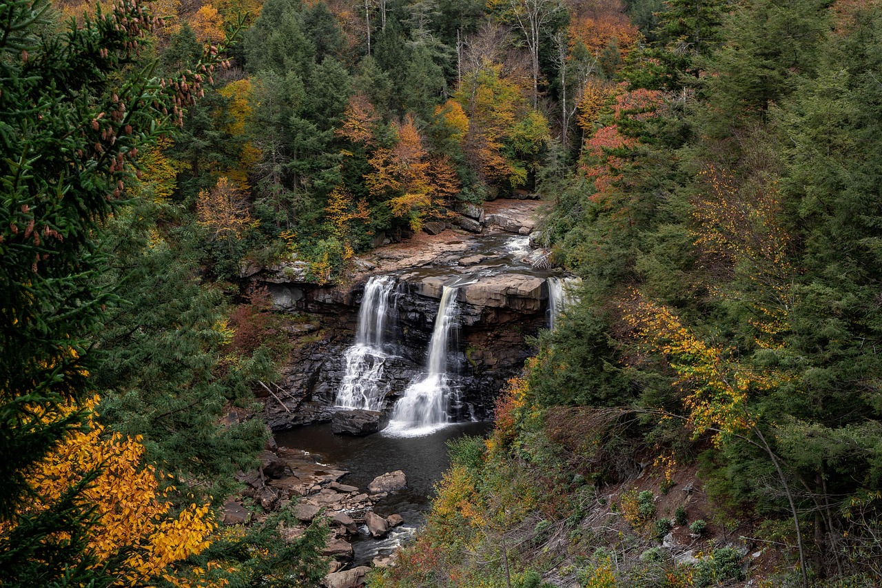
- Rainbow Falls (Gudda Gumoo): the creek plunges around 40 m over a sandstone edge into a shady gorge with swimming holes; the path down involves many steps – save some energy for the way back.
- Ghungalu rock art: on the circuit past the stencil art of the plateau's Traditional Owners, touch nothing, stay on the path and don't put your hands on the rock face.
- Lookouts on the plateau edge with views down onto the plain – in the late afternoon, when the rocks glow orange.
- CampingSpirit overnight tip
-
Official campsite or RV park: Munall Campground, run by the national parks service (QPWS): 16 numbered sites on natural ground under eucalypts, composting toilets, fire rings, no drinking water, no mobile reception, generators prohibited. The parks service recommends 4WD; drive up in vans and small motorhomes only in dry weather and with care; some sites are tent-only. Book online in advance, no self-registration on site; display your booking number visibly at your site.
Free camping or nature tip (where legal): In the national park, only stay overnight on booked sites – car parks at lookouts and walking tracks are off limits. If you're travelling with a caravan or heavy trailer, you won't get up there: the parks service describes the access road and park roads as unsuitable for caravans and heavy trailers. In that case, stay at a road authority (TMR) rest area on the Capricorn Highway or a designated council site in Blackwater and visit the plateau as a day trip without the trailer.
- Insider tip for campers
- The Loop Road on the plateau is open to 4WD only and may be closed when wet – read the QPWS Park Alerts before you go. Bring clean, untreated firewood from below; collecting wood in the park is prohibited. At night it is noticeably colder up top than on the plain, in winter often only a few degrees.
2Stage 2: Blackdown Tableland to Emerald (Lake Maraboon) (approx. 135 km)
- The drive
- Carefully back down to the Capricorn Highway, then on west through Blackwater, where coal trains of more than a hundred wagons run beside the road, and via Comet to Emerald. Sealed throughout, flat, plenty of mine and heavy traffic; around 2 hours. Shortly before Emerald, brigalow remnants and grazing land give way to irrigated cotton and citrus fields.
- Highlights & must-sees
- Big Easel in Emerald: an easel around 25 m tall holding a reproduction of Van Gogh's “Sunflowers” – a nod to the region's sunflower fields and a quirky photo opportunity.
- Fairbairn Dam: look out over the dam wall and the spillway; behind it stretches Lake Maraboon, a large reservoir on the Nogoa River – when the dam is full, the spillway roars.
- Boat ramp and shore at Lake Maraboon at sunset: pelicans, cormorants and water-skiers at weekends.
- CampingSpirit overnight tip
-
Official campsite or RV park: Lake Maraboon Holiday Village near Fairbairn Dam, around 18 km south of Emerald: powered and unpowered sites, amenities, water and dump point, kiosk. In Emerald there are further caravan parks with power on the main road through town – more practical for an early start, but noisier.
Free camping or nature tip (where legal): In Emerald, the local laws of the Central Highlands Regional Council apply: in town and on the lakeshore, stay overnight only in caravan parks or expressly designated areas. The council maintains basic overnight areas for self-contained travellers in several smaller towns – which are currently open and how long you may stay is stated on the council website and on the signs on site.
- Insider tip for campers
- Emerald is the last town with large supermarkets, workshops and gas refills before the Gemfields and the south – fill or swap gas bottles here, stock up on water and empty cassettes. If you want to fish in the reservoir, check whether a Stocked Impoundment Permit is required for stocked waters.
3Stage 3: Emerald to Rubyvale (Sapphire Gemfields) (approx. 60 km)
- The drive
- Around 40 km west on the Capricorn Highway to Anakie, then north on the Anakie-Sapphire Road to Sapphire and on to Rubyvale. Sealed all the way into the towns, flat, just under an hour. The Gemfields settlements are loosely scattered among mullock heaps, corrugated-iron huts, claims with marker posts and ironbark forest.
- Highlights & must-sees
- Underground mine tours in Rubyvale: in former sapphire tunnels, guides show how the layers of “wash” lie and how the work used to be done by hand.
- Gem-cutting workshops and galleries in Rubyvale and Sapphire: watch rough stones being faceted and have your own finds cut.
- Bucket sieving without a licence: at several businesses you buy prepared gravel, sieve and wash it at drums and have your finds explained – the best introduction before fossicking on your own.
- CampingSpirit overnight tip
-
Official campsite or RV park: Rubyvale Holiday Park in town with power, amenities, water and dump point; further basic caravan parks in Sapphire. In winter (May to September) many long-stay guests are in residence – reserve powered sites by phone in advance.
Free camping or nature tip (where legal): The Gemfields have a special feature: on the Designated Fossicking Land areas of Sapphire, Rubyvale, Scrub Lead, Divide and Reward you may camp in the bush with a camping permit – for up to three months on one area, but not within 1.5 km of the town centres of Sapphire and Rubyvale. The permit is available online or from licence outlets. Mining claims and leases, recognisable by their posts, are private land, however: camping and fossicking there only with the holder's permission.
- Insider tip for campers
- Drinking water is available at the water station in Sapphire. If you stay on the Reward fossicking area, you'll find no facilities there apart from a solar phone and must be fully self-sufficient. Some tracks south-east of Sapphire only make sense with 4WD.
4Stage 4: Rubyvale to Sapphire Gemfields (fossicking day) (approx. 40 km)
- The drive
- A day without changing base, or just a short move to a bush camp on the fossicking areas. The connecting tracks between Sapphire, Scrub Lead and Rubyvale are short, but off the main roads they are gravel and deep dust; after rain the red ground turns greasy. If you like, take a detour north on the Gregory Highway to Clermont: a coal and cattle town with a lagoon, around 100 km from Emerald – for this route, just a pointer.
- Highlights & must-sees
- Fossicking yourself on Designated Fossicking Land with a licence: sieve, shovel and water; the classic finds zones are in old river gravels.
- The mullock heaps and abandoned huts near Scrub Lead in the morning light – a piece of mining history to photograph, but keep your distance from open shafts.
- Starry skies over the bush camps: hardly any light pollution, clear and cold in winter.
- CampingSpirit overnight tip
-
Official campsite or RV park: Second night at Rubyvale Holiday Park or at a bush camp on designated fossicking land (with camping permit, without power, water or amenities – organise toilet and rubbish yourself).
Free camping or nature tip (where legal): Free camping outside the designated fossicking areas is not an option in the Gemfields: the claims, leases and cattle country around them are private. On fossicking land, fires only when no fire ban is in force, and never in dry grass.
- Insider tip for campers
- Buy your fossicking licence online in advance (there are individual and family licences) and read the rules: only hand tools are allowed (pick, shovel, hammer, sieve, shaker sieve, metal detector), no machinery; holes must be backfilled. On claims and leases only with the holder's written permission, which must be noted on or attached to the licence. Old shafts are not always fenced off – don't let children and dogs roam freely, and don't wander about at night.
5Stage 5: Sapphire Gemfields to Springsure (approx. 120 km)
- The drive
- Via Anakie and the Capricorn Highway back to Emerald, then south on the Gregory Highway. Well built, flat, then the mesas of the Minerva Hills appear; around 1.5 hours. Just before Springsure, the pale rock face of Mount Zamia rises directly above the road.
- Highlights & must-sees
- Virgin Rock on Mount Zamia: settlers once saw the outline of a Madonna and child in the rock face; erosion has blurred the image, but the view of the cliff at the edge of town is still worthwhile.
- Minerva Hills National Park via Dendle Drive: Fred’s Gorge up on Mount Zamia with shelters and toilets, Eclipse Gap with a short walk from the car park, and the Skyline Lookout circuit of around 1.6 km to two viewing platforms.
- Old Rainworth Fort south of Springsure: a stone store and defensive building from an early station, a quiet insight into the region's often violent colonial history.
- CampingSpirit overnight tip
-
Official campsite or RV park: In town there is a basic caravan park with power and amenities; check names and facilities in advance at the Visitor Centre or in WikiCamps. Camping is not permitted in Minerva Hills National Park.
Free camping or nature tip (where legal): The Central Highlands Regional Council designates overnight areas for self-contained travellers in some towns; whether Springsure is one of them and what length of stay applies, check locally. On the Gregory Highway there are TMR rest areas where up to 20 hours are allowed, unless the signs say otherwise.
- Insider tip for campers
- The parks service recommends the spur roads to Springsure Lookout and the Norwood Creek picnic area for 4WD only; in a motorhome, stay on Dendle Drive and park large vehicles lower down if the road gets narrow. Go up in the morning, before the heat sets in.
6Stage 6: Springsure to Carnarvon Gorge (approx. 180 km)
- The drive
- Around 70 km east on the Dawson Highway to Rolleston, then around 60 km south on the Carnarvon Highway to the turn-off and along the sealed park road, around 45 km long, into the gorge. Wide cattle plains, floodways at the Comet River and creeks, grids and road trains carrying cattle; around 2.5 hours. The last kilometres head straight towards the white sandstone cliffs.
- Highlights & must-sees
- Rolleston: small town on the Comet River and the last reliable fuel stop before the gorge.
- View of the sandstone walls of the Consuelo Tableland on the approach in the late afternoon.
- Dusk by the creek in the visitor area: with patience platypuses surface, plus wallabies on the grassy flats.
- CampingSpirit overnight tip
-
Official campsite or RV park: Outside the QPWS school holiday periods, your base is the year-round BIG4 Carnarvon Gorge Holiday Park (formerly Takarakka Bush Resort) on the access road: powered and unpowered sites, amenities, shop. Sandstone Park nearby caters for self-contained campers without power or showers and is only open seasonally. The QPWS camping area at the visitor area opens only during the Queensland school holidays at Easter, in June/July and in September/October – book online early for those times.
Free camping or nature tip (where legal): The land along the access road is leasehold; inside the park, only booked sites apply. The Big Bend camp in the gorge is reachable on foot only. If you want to camp for free, the most you'll find between Rolleston and the park turn-off are TMR rest areas – observe the signs.
- Insider tip for campers
- Fill up in Rolleston and factor in the return trip: the stretch Carnarvon Gorge – Injune has no reliable fuel station. The park road is sealed but crosses creek crossings; after heavy rain it can be impassable for days. In the park there is only limited, unreliable mobile reception – load important bookings and maps beforehand.
7Stage 7: Carnarvon Gorge to Carnarvon Gorge (walking day) (approx. 10 km)
- The drive
- Just the short drive from the campground to the car park at the visitor area. The main track follows Carnarvon Creek with many crossings on stepping stones; the side gorges branch off to the left and right. If you combine all three classics – Moss Garden, Amphitheatre and Art Gallery – you'll cover around 14 km there and back and need most of the day; to Big Bend and back it's 19.4 km. In floods the crossings become impassable and tracks are closed.
- Highlights & must-sees
- Moss Garden: a rock alcove where water seeps out of the sandstone and mosses, ferns and liverworts form a permanently damp green curtain, with a small waterfall.
- Amphitheatre: you climb a set of ladders into a crevice and suddenly stand in a rock chamber around 60 m high and open at the top – the light is at its best around midday.
- Art Gallery: along a long sandstone wall there are around 2,000 engravings, ochre stencils – of hands, boomerangs and tools, for example – and freehand paintings – evidence of the Bidjara and Karingbal peoples and their ancestors. Stay on the boardwalk, touch nothing, keep quiet; this is a cultural site, not a photo studio.
- CampingSpirit overnight tip
-
Official campsite or RV park: Same site as the previous day; plan at least two, better three nights for the gorge, so you have a day in reserve for weather or tired legs.
Free camping or nature tip (where legal): Not an option in the park area. Overnight stays in walking track car parks are not permitted.
- Insider tip for campers
- Start at first light: from October to March the gorge quickly gets very hot; the side gorges then stay in shade until midday, but the return along the main track does not. At least 3 litres of water per person, a hat and shoes with good tread that can get wet. Before setting off, read the Park Alerts on closed sections.
8Stage 8: Carnarvon Gorge to Roma (approx. 250 km)
- The drive
- Out along the park road and south on the Carnarvon Highway across the tableland and through eucalypt and cypress forest to Injune, then on to Roma. Sealed, partly narrow with unsealed shoulders, floodways, cattle and road trains; around 3 hours. Between the park turn-off and Injune there is a long stretch with no services and no reception.
- Highlights & must-sees
- Pointer to Lake Nuga Nuga: this shallow lake with water lilies and birdlife lies off to the east of the Carnarvon Highway in the Arcadia Valley; access via long gravel roads, unsuitable when wet, 4WD recommended; camping only with a QPWS permit and without any facilities, nearest fuel in Rolleston – a separate detour for well-prepared campers.
- Roma’s Big Rig: drilling rig and Oil Patch Museum on the history of Australia's first natural gas and oil finds, with a Night Show in the evening.
- Heroes Avenue in Roma: over 90 bottle trees planted around 1920; the trees originally bore name plaques for the 93 local men killed in the First World War; close by are the huge saleyards with an information centre.
- CampingSpirit overnight tip
-
Official campsite or RV park: Roma Big Rig Tourist Park near the Big Rig with powered and unpowered sites; there are further caravan parks in Roma. If you break the journey in Injune: Possum Park Campground near Injune with toilets, hot showers and powered and unpowered sites.
Free camping or nature tip (where legal): The Maranoa Region regulates overnight stays through its own local laws; free camping within Roma's town area is not provided for. For designated areas for self-contained travellers and their length-of-stay limits, ask the Visitor Centre or check WikiCamps; TMR rest areas on the highway as signposted.
- Insider tip for campers
- Roma is the end point with full services: supermarkets, workshops, tyre service, gas, dump point. If you arrive on a cattle sale day, you can follow the auctions from the catwalk – dates from the saleyards information centre. From Roma, the Warrego Highway leads towards Toowoomba and Brisbane.
Camping practice & local rules
Wild camping & overnight parking
- Queensland has no statewide right to free camping. The councils – here mainly the Central Highlands Regional Council and the Maranoa Regional Council – regulate overnight stays through local laws: within towns only in caravan parks or designated areas, length of stay as signposted. If in doubt, ask at the Visitor Centre.
- Road authority (TMR) rest areas: up to 20 hours unless otherwise signposted; truck-only rest areas are off limits.
- National parks (Blackdown Tableland, Carnarvon, Nuga Nuga): camping only in designated camping areas with a QPWS permit bought online in advance; display the booking number visibly. Minerva Hills is a day-use-only park.
- Sapphire Gemfields: camping on designated fossicking land only with a camping permit, for a maximum of three months per area, not within 1.5 km of the town centres of Sapphire and Rubyvale. Fossicking only with a Queensland Fossicking Licence; on claims and leases only with the holder's permission.
- Station country is private land: don't drive off-road or stay overnight without permission, leave gates as you found them, don't camp at stock watering points.
- Apps and sources: WikiCamps and CamperMate for sites, water and dump points; QLDTraffic (also by phone on 13 19 40) for closures and flooding; the QPWS Park Alerts before every park visit.
Waste disposal & supplies
- Fuel: full services in Rockhampton, Emerald and Roma, plus fuel stations in Dingo, Blackwater, Anakie or the Gemfields, Springsure, Rolleston and Injune. The critical sections are the Blackdown Tableland access (there and back without a fuel station, nearest in Dingo) and Rolleston – Carnarvon Gorge – Injune; arrive in Rolleston with a full tank and top up there.
- Water: there is no drinking water on the Blackdown Tableland or on the fossicking areas; in the Gemfields you fill up at the water station in Sapphire. Carry at least 10 litres per person per day plus a reserve.
- Dump points: in Emerald and Roma and at many caravan parks; WikiCamps and the Visitor Centres show the exact locations. At bush camps never bury cassettes or empty them into composting toilets.
- Gas: Australian bottles today mostly have an LCC27 valve, older ones POL. Swaps and refills are reliable in Rockhampton, Emerald and Roma; not guaranteed in the small towns. European bottles are not refilled.
- Food and workshops: large supermarkets only in Rockhampton, Emerald and Roma; in the Gemfields, Springsure, Rolleston and Injune, small shops with limited choice. Shop for several days before Carnarvon Gorge.
Vehicle size & traffic rules
- Left-hand traffic – consciously keep left even when turning on empty roads. Roundabouts are driven clockwise; vehicles already on the roundabout have right of way.
- Speed limits: in Queensland 100 km/h outside built-up areas unless otherwise signposted, in towns usually 50 or 60 km/h. Drink-driving limit 0.05 BAC. Mobile phone at the wheel only in a fixed cradle. There are no toll roads on this route.
- Road trains and heavy traffic: road trains carrying cattle and coal or mining transports use the Capricorn, Gregory and Carnarvon Highways. Overtake only with a very long clear view; on narrow bitumen with oncoming traffic, move left onto the shoulder and slow down. A UHF radio (channel 40) helps with communication.
- Animals: kangaroos and wallabies especially at dusk, cattle on open grazing land, emus at the roadside. Don't drive at dusk or at night, slow down before grids.
- Unsealed roads and insurance: many campervan rental agreements exclude gravel roads or don't cover underbody, glass and tyre damage – this affects the plateau roads on the Blackdown Tableland, tracks in the Gemfields and the access to Lake Nuga Nuga. Clarify this in writing beforehand. Caravans and heavy trailers do not belong on the Blackdown Tableland.
- Rain and closures: from around December to March, storms and monsoonal remnants can make floodways, creek crossings and park roads impassable for days. Never drive through flooded roads, don't drive on closed roads; check QLDTraffic and the Park Alerts daily.
- Heat and when to go: most pleasant from April to September, with warm days and cool to cold nights. In summer, temperatures above 35 °C are common – walk only early in the morning then; in a breakdown, stay with the vehicle and ration water.
- Mobile reception: coverage mostly only in and around towns and along parts of the highways; none on the Blackdown Tableland, in Carnarvon Gorge or on long sections of the Carnarvon Highway. Carry a satellite messenger or PLB and leave your route details with someone.
CampingSpirit packing & preparation checklist
- Coarse and fine sieves, a small shovel and a water bucket for fossicking in the Gemfields – expensive locally, and on designated fossicking land hand tools are what's needed anyway.
- Water containers for at least 40 litres in reserve, because Munall Campground and the fossicking areas have no drinking water.
- Sure-footed shoes that can get wet and walking poles for the creek crossings in Carnarvon Gorge and the steps to Rainbow Falls.
- Clean, untreated firewood or a gas cooker, as collecting wood is prohibited in the national parks.
- A warm sleeping bag: on the Blackdown Tableland and in the Gemfields, winter nights drop to near freezing.
- A satellite messenger or PLB and a UHF radio for the sections without reception and for communicating with road train drivers.
As of 2026-10. Closures, fees and booking rules change: check official sources before you go.