

In-depth guide · CampingSpirit
From the Lift Lock in Peterborough via the rock carvings of Kinomagewapkong, the mineral town of Bancroft and the lakes of the Haliburton Highlands back to the locks of the Trent-Severn Waterway: a loop of just under 800 kilometres through Ontario’s cottage country.
The spirit of the route
Between Toronto and the Canadian Shield lies a landscape that changes with every hour of driving. South of the Kawartha Lakes there are fields, brick towns and locks where houseboats and canoes wait; north of them, pink and grey granite ridges break through the forest, and the lakes grow smaller, clearer and quieter. When you open the sliding door in the morning, you see mist over the water, hear loons calling and smell pine resin and woodsmoke. The route follows the Trent-Severn Waterway, a 19th-century canal system, and leaves it for the Anishinaabe rock carvings, the caves of Warsaw and the mineral dumps around Bancroft. The stages are short, the roads winding, and in the evening you sit by a provincial park lake where no motorboats are allowed. In autumn the maples change colour, in early summer the black flies bite – both are part of it.
Stage-by-stage plan
1Stage 1: Toronto to Peterborough (approx. 140 km)
- The drive
- Leave Toronto heading east on Highway 401, then take Highway 35/115 north-east to Peterborough. The alternative is Highway 407 east: the private 407 ETR section to Pickering is tolled and billed exclusively electronically, while the following province-owned 407 East section up to Highway 35/115 is toll-free. On the 401, traffic jams are the rule at rush hour; if you set off early in the morning or after 7 pm, you often save an hour. From Clarington it turns rural: hills of the Oak Ridges Moraine, farms, patches of woodland. Pure driving time about 1.75 hours without traffic.
- Highlights & must-sees
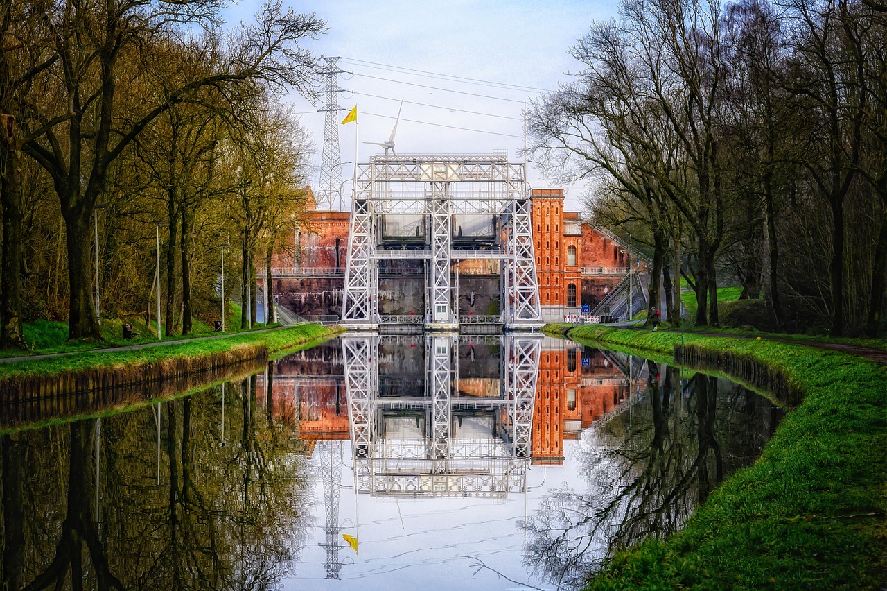
- Peterborough Lift Lock (Lock 21 of the Trent-Severn Waterway): a hydraulic boat lift opened in 1904 that raises and lowers boats around 20 metres in two water-filled chambers. Parks Canada runs a visitor centre; during the navigation season you can watch the lifts from the bank.
- Canadian Canoe Museum: in the new building opened in 2024 right next to the Lift Lock on the canal bank, with one of the largest collections of canoes and kayaks in the world, from First Nations birchbark canoes to fur-trade boats. Half a day goes by quickly; check opening hours and paddling offers on the museum’s website.
- Little Lake and downtown Peterborough: lakeside path, market and cafés on George Street; the Trans Canada Trail and the Rotary Greenway Trail lead out of town on old railway lines.
- CampingSpirit overnight tip
-
Official campsite or RV park: Beavermead Campground on the east shore of Little Lake, just a few minutes from the Lift Lock, run by Otonabee Conservation on behalf of the City of Peterborough: mostly sites with electrical and water hookups, some without hookups, comfort station with showers, dump station, beach in Beavermead Park next door. Reservations online only; check the season and vehicle lengths before booking. Alternative without city noise: Emily Provincial Park near Omemee (see stage 6), about 30 minutes west.
Free camping or nature tip (where legal): In the Greater Toronto Area and in Peterborough, sleeping in your vehicle on streets and in public car parks is not permitted; the municipalities have their own parking by-laws and enforce them. There is no legal free-camping alternative here.
- Insider tip for campers
- Do your big shop in Peterborough: this is the last place with this choice of supermarkets, outdoor shops and propane before you head into the Highlands. There are car parks on the canal bank by the Lift Lock, but they are scarce on summer weekends; with a large vehicle, arrive early or walk or cycle over from the campground.
2Stage 2: Peterborough to Warsaw Caves (via Lakefield and Petroglyphs Provincial Park) (approx. 95 km)
- The drive
- Take Highway 28 north to Lakefield on the Otonabee River, continue to Burleigh Falls and there turn east onto Northey’s Bay Road on the north shore of Stony Lake to Petroglyphs Provincial Park. Then take county roads south through forest and fields to the hamlet of Warsaw. Two lanes, with bends and crests, narrow on the minor roads. Pure driving time about 1.75 hours.
- Highlights & must-sees
- Lakefield: small town on the Trent-Severn Waterway with a lock, a waterfront park and the Lakefield Trail on an old railway line; good for a coffee break.
- Petroglyphs Provincial Park (Kinomagewapkong, “the rocks that teach”): hundreds of figures carved into a limestone slab – turtles, snakes, humans, boats –, now under a protective building. The site is sacred to the Anishinaabe; photography and phones are not permitted at the carvings. The Learning Place Visitor Centre explains their history and meaning. Day visits only; check opening days with Ontario Parks in advance.
- Warsaw Caves Conservation Area: limestone caves and crevices you explore on your own, plus potholes (“kettles”) and a riverside path along the Indian River, which disappears underground for a stretch here.
- CampingSpirit overnight tip
-
Official campsite or RV park: Warsaw Caves Conservation Area (Otonabee Conservation): 52 sites without hookups in the forest, comfort station with toilets, showers, laundry and dishwashing area; reservations online only. There is no electricity, so arrive with charged batteries and a full water tank. The site is open seasonally; caving is not permitted from November to May.
Free camping or nature tip (where legal): Around Peterborough and Lakefield the land is private or belongs to municipalities and conservation areas; free camping is not an option here. The Kawartha Highlands north of Burleigh Falls are a provincial park where you may only stay overnight on designated, booked backcountry sites.
- Insider tip for campers
- For the caves, bring old clothes, sturdy shoes and a headlamp per person; the passages are narrow and wet, and some can only be passed by crawling. The car park at Petroglyphs Provincial Park is some distance from the protective building – no problem with a motorhome, but full on summer weekends.
3Stage 3: Warsaw to Silent Lake Provincial Park (approx. 110 km)
- The drive
- Back to Lakefield and north on Highway 28 via Burleigh Falls, through the Kawartha Highlands and via Apsley to Silent Lake Provincial Park just before Bancroft. The Canadian Shield begins at Burleigh Falls: granite rock in road cuttings, lakes left and right, long climbs and bends, hardly any towns. Pure driving time about 1.75 hours.
- Highlights & must-sees
- Burleigh Falls: rapids and a lock on the boundary between fields and rock country, a popular stop for a first look at the Shield.
- Kawartha Highlands Provincial Park: a large area of forest and lakes between Highway 28 and Highway 507, accessible only by canoe or on foot; access points are on side roads off Highway 28.
- Silent Lake: motorboats are banned, and a loop trail of about 15 kilometres leads around the lake over rock ridges and through mixed forest; there are also mountain-bike trails and canoe rental.
- CampingSpirit overnight tip
-
Official campsite or RV park: Silent Lake Provincial Park: Pincer Bay and Granite Ridge campgrounds in the forest, a few sites with electricity (in Granite Ridge, quickly booked out), plus walk-in sites, yurts and cabins. Comfort station with showers, flush toilets and drinking water. Reservations through Ontario Parks; check vehicle length and site size when booking, as many sites are cut more for tents and smaller campers.
Free camping or nature tip (where legal): In the Kawartha Highlands, overnight stays are only permitted on numbered backcountry sites with a reservation, not at your vehicle. Genuine Crown land only begins north and east of here, around Bancroft (see stage 4).
- Insider tip for campers
- There are only a few petrol stations on Highway 28 between Burleigh Falls and Bancroft; fill up in Lakefield. Mobile reception at Silent Lake is weak – save your reservation number and map offline.
4Stage 4: Silent Lake to Haliburton (via Bancroft) (approx. 105 km)
- The drive
- Take Highway 28 north to Bancroft, then Highway 118 west through the Haliburton Highlands to Haliburton on Head Lake. Hilly, winding, with many lakes and rock cuttings; in autumn one of the most colourful drives in the area. Pure driving time about 1.5 hours.
- Highlights & must-sees
- Bancroft: the small town on the York River calls itself the mineral capital of Canada; in town there are rock and mineral shops, a mineral museum and a large mineral show every summer. In the surrounding area there are pits where you can collect yourself for a fee – ask about conditions locally.
- Eagle’s Nest Lookout in Bancroft: a rock outcrop high above the York River Valley with a wide view over forest and hills, reached via an access road on the edge of town.
- Haliburton Sculpture Forest: open-air exhibition with dozens of sculptures by Canadian artists on forest paths in Glebe Park next to the art college; free to enter, a good hour on foot.
- CampingSpirit overnight tip
-
Official campsite or RV park: Haliburton Forest & Wild Life Reserve north of Haliburton: a large private forest known far beyond the region for its Wolf Centre, treetop canopy tour and lakes. Basic sites right on the lakeshore with fire pit, picnic table and pit toilet, without hookups and without showers; in summer some can be reached by vehicle, with access via forest roads. Reservation only; check with the operator in advance whether a motorhome will fit. Alternatively, stay two nights at Silent Lake and visit Bancroft as a day trip.
Free camping or nature tip (where legal): There is Crown land around Bancroft and in the Haliburton Highlands. South of the French and Mattawa rivers, according to the province, non-residents do not need a Crown land camping permit; maximum stay and local restrictions still apply. Access is mostly via unpaved forest roads – unsuitable for large motorhomes. Check beforehand in the province’s Crown Land Use Policy Atlas whether the land really is public; lakeshores and cottage access roads are almost always private.
- Insider tip for campers
- White-tailed deer cross Highway 118 and Highway 28, and in the north moose too; drive more slowly in the morning, evening and at night. In early summer, turtles cross the roads to lay their eggs – brake, swerve around them if possible, and only help if you can stop safely.
5Stage 5: Haliburton to Balsam Lake Provincial Park (via Minden) (approx. 90 km)
- The drive
- Take Highway 118 west to Carnarvon, then Highway 35 south via Minden, Norland and Coboconk to the turn-off for Balsam Lake Provincial Park near Kirkfield. North of Minden rock and forest, south of Coboconk fields again. Pure driving time about 1.25 hours.
- Highlights & must-sees
- Minden: town on the Gull River with a riverside promenade; to the north lies the Minden Wild Water Preserve, a whitewater channel where kayakers train and you can watch from the bank.
- Coboconk: town at the north end of Balsam Lake; Balsam Lake is considered the highest point of the Trent-Severn Waterway, and from here the water flows off in both directions.
- Kirkfield Lift Lock (Lock 36): the canal’s second hydraulic boat lift, smaller and quieter than the one in Peterborough; with picnic spots on the bank.
- CampingSpirit overnight tip
-
Official campsite or RV park: Balsam Lake Provincial Park: a large campground with several hundred sites, some of them with electricity, plus showers, a fill and dump station and a long sandy beach on Balsam Lake. Reservations through Ontario Parks; check the season before you arrive.
Free camping or nature tip (where legal): South of Minden the land is private again; free camping is not an option. Sleeping in your vehicle is not permitted in the car parks at Parks Canada locks, except where it is explicitly offered.
- Insider tip for campers
- There are petrol stations and shops in Minden and Coboconk; Balsam Lake Provincial Park is off the beaten track, so shop beforehand. The beach is shallow and warm, but choppy in a westerly wind – start canoe trips in the morning. If you want to continue north from Haliburton: Algonquin and Georgian Bay are covered in the CampingSpirit guide to Algonquin, Georgian Bay and the Bruce Peninsula.
6Stage 6: Balsam Lake to Emily Provincial Park (via Fenelon Falls and Bobcaygeon) (approx. 80 km)
- The drive
- Take county roads east to Fenelon Falls, then Highway 36 to Bobcaygeon and on south into the Pigeon River valley near Omemee. Flat to rolling country, fields, lakes and town centres to drive through. Pure driving time about 1.25 hours; in Fenelon Falls and Bobcaygeon, slow traffic and scarce parking in summer.
- Highlights & must-sees
- Fenelon Falls: a waterfall in the middle of town between Cameron Lake and Sturgeon Lake, with Lock 34 beside it; riverside path and viewpoints right at the falls.
- Bobcaygeon: Lock 32 on an island in town, built in 1833 as the first on the entire Trent-Severn Waterway; plus the open-air museum Kawartha Settlers’ Village.
- Kawartha Lakes: Sturgeon Lake, Pigeon Lake and Cameron Lake are linked by locks; at many waterfront parks you can put in a canoe and watch houseboats.
- CampingSpirit overnight tip
-
Official campsite or RV park: Emily Provincial Park near Omemee: campground on the Pigeon River with sites with and without electricity, showers and dump station, boat launch and canoe rental. Reservations through Ontario Parks; check the season and site lengths in advance.
Free camping or nature tip (where legal): Sleeping in your vehicle is prohibited in the towns of the Kawartha Lakes; waterfront parks and lock car parks are closed in the evening. No legal free-camping alternative.
- Insider tip for campers
- With a large vehicle, park on the edge of town in Fenelon Falls and Bobcaygeon; the town-centre car parks are small and full on summer weekends. The waterfront parks at the locks often have drinking water and toilets.
7Stage 7: Emily Provincial Park to Toronto (via Lindsay and Port Perry) (approx. 150 km)
- The drive
- West to Lindsay, then via Highway 7A and county roads south to Port Perry on Lake Scugog, and from there via country roads and Highway 407 or 401 back to Toronto. Rural and quiet as far as Port Perry, then increasingly suburban. Pure driving time about 2 hours without traffic.
- Highlights & must-sees
- Lindsay: main town of the City of Kawartha Lakes with a wide Kent Street, brick façades and Lock 33 on the Scugog River; the Victoria Rail Trail starts here.
- Port Perry: town on the shore of Lake Scugog with a well-preserved Victorian main street, harbour park and promenade – the last quiet stop before the Greater Toronto Area.
- Lake Scugog: a shallow lake with reed beds and birdlife; good view over the water from the causeway between Port Perry and Scugog Island.
- CampingSpirit overnight tip
-
Official campsite or RV park: For a last night before returning the vehicle in Toronto, Emily Provincial Park is still a good choice; there are private campgrounds around Port Perry – check facilities and status beforehand.
Free camping or nature tip (where legal): Free camping is not possible in the Greater Toronto Area; supermarket and shopping-centre car parks are mostly off-limits at night too.
- Insider tip for campers
- Empty your tanks before returning the vehicle: Emily Provincial Park has a station, while in Toronto it is difficult. If you use the 407 ETR west of Pickering, you pay a toll, which is billed via the rental company. An extension to the east along Lake Ontario is described in the CampingSpirit guide to Prince Edward County.
Camping practice & local rules
Wild camping & overnight parking
- Ontario has no general right to sleep in your vehicle. In the south of the province and in the Kawarthas, almost everything is private property, municipal land or park land; free camping is not allowed there and is enforced.
- Crown land: there is public land in the Haliburton Highlands and around Bancroft. South of the French and Mattawa rivers, according to the province, the permit requirement for non-residents does not apply; maximum stay per site, fire rules and protected areas still apply. The Crown Land Use Policy Atlas on ontario.ca shows whether an area is public.
- Provincial parks and conservation areas: overnight stays only on booked sites. In Kawartha Highlands Provincial Park, only on numbered backcountry sites with a reservation.
- Useful apps and websites: Ontario Parks (reservations, season dates, Fall Colour Report), iOverlander, Campendium, Park4Night; for Crown land, the Crown Land Use Policy Atlas.
- Black flies and mosquitoes: in early summer black flies are a real nuisance in the Highlands, mosquitoes into late summer; light-coloured long clothing, a head net and repellent with DEET or icaridin.
- Ticks: blacklegged ticks, which can transmit Lyme disease, are widespread in the region around Peterborough and the Kawarthas. Check yourself after hikes, remove ticks early, and see a doctor if you get a bull’s-eye rash.
- Wildlife: black bears live in the Highlands; store food and rubbish in your vehicle or in bear-proof containers. Raccoons are everywhere on the campgrounds.
- Fire: fires only in fire pits; in dry spells municipalities and the province impose fire bans. Don’t bring firewood from far away; buy it locally (pests such as the emerald ash borer).
Waste disposal & supplies
- Dump stations: in Balsam Lake and Emily provincial parks, at Beavermead Campground in Peterborough, at many larger campgrounds and at a few petrol stations; rarer in the Highlands, so empty your tanks beforehand.
- Drinking water: at campgrounds and in the waterfront parks at locks; boil or filter lake water before drinking.
- Fuel: petrol stations in Peterborough, Lakefield, Bancroft, Haliburton, Minden, Fenelon Falls, Bobcaygeon and Lindsay; only a few on Highway 28 between Burleigh Falls and Bancroft and on Highway 118.
- Propane: at petrol stations and hardware stores in Peterborough, Lindsay, Bancroft and Haliburton; European cylinders don’t fit, and rental vehicles have built-in tanks.
- Shopping: supermarkets in Peterborough, Lindsay, Bancroft, Haliburton and Minden; in the smaller towns only shops with a limited range.
- Electricity: campgrounds offer 15, 30 or 50 A hookups at 120 V; rental vehicles have the matching plugs, and a 15/30 A adapter is useful.
Vehicle size & traffic rules
- Speed limits: mostly 100 km/h on the 400-series highways, 110 km/h on some sections; usually 80 km/h on rural roads, 50 km/h or less in towns. Watch the signs.
- Tolls: the private Highway 407 ETR (to Pickering) is tolled and has no toll booths; cameras record the licence plate and the bill goes to the registered owner, i.e. the rental company, which passes on the toll plus a handling fee. The province’s 407 East section adjoining it to the east is toll-free. Vehicles over 5,000 kg must have a valid transponder on the 407 ETR, otherwise high camera charges apply per trip – with large motorhomes, check the gross vehicle weight and the rental company’s policy in advance, or take the toll-free Highway 401.
- Reservations: Ontario Parks accepts bookings up to five months in advance; the camping permit usually includes one vehicle, and additional vehicles need an extra permit. On summer weekends Balsam Lake and Silent Lake fill up quickly.
- Wildlife crossings: deer and moose, especially at dusk; drive more slowly on Highways 28, 35 and 118 and use high beams where possible.
- Autumn colours: the timing of the colour change varies from year to year and depends on weather and elevation. Ontario Parks publishes an ongoing report. On peak-colour weekends the parks are often fully booked.
- Season: many campgrounds and locks are only open between spring and autumn; check park opening times and Trent-Severn Waterway navigation times on the official websites.
- Traffic law: drive on the right, seat belts compulsory, phones at the wheel hands-free only, alcohol in the vehicle only if sealed. Stop in both directions for school buses with flashing red lights.
- Driving licence: a German driving licence is sufficient for tourists for a limited period; an International Driving Permit is recommended.
- Emergency: 911; hospitals in Peterborough, Lindsay, Bancroft, Haliburton and Minden.
CampingSpirit packing & preparation checklist
- Head net and repellent with DEET or icaridin: in early summer, black flies turn every hike in the Highlands into an ordeal.
- Tick remover and long light-coloured trousers: ticks carrying a Lyme risk are widespread in the region around Peterborough and the Kawarthas.
- Headlamps and old clothes for the Warsaw caves: the passages are dark and wet, and some can only be passed by crawling.
- Folding canoe or paddling gear: Silent Lake, the Kawartha Highlands and the Trent-Severn Waterway are best experienced from the water.
- Bear-proof storage box or lockable cool box: black bears and raccoons are active at the sites.
- Offline maps: mobile reception is weak between Burleigh Falls and Bancroft.
As of 2026-10. Closures, fees and booking rules change: check official sources before you go.