



In-depth guide · CampingSpirit
From Folkston via Waycross and Fargo into the Okefenokee, then along the Suwannee River via White Springs, Big Shoals and Live Oak to Manatee Springs, Ichetucknee and High Springs: around 800 kilometres of swamp, river and spring water at 22 degrees.
The spirit of the route
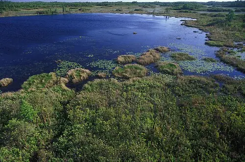
The Okefenokee is not a swamp in the sense of a mire but a vast, slow-moving wetland of peat, water lilies and bald cypresses, with mist lying over it in the morning and bullfrogs booming in the evening. The water is black as tea, stained by tannins, and so still that clouds and Spanish moss appear twice in it. From it rises the Suwannee, which the world knows from Stephen Foster’s song, even though the composer never saw it. The route follows it south through pine forest and farmland to where Florida’s limestone breaks open and springs of incredible clarity emerge: turquoise, cool, full of fish and, in winter, full of manatees. From the sliding door you see alligators on logs, ospreys over the river and, in the evening over Billys Lake, a starry sky without a light dome. You drive slowly here, you sweat, you paddle – and you swim.
Stage-by-stage plan
1Stage 1: Jacksonville to Folkston (Okefenokee National Wildlife Refuge, east entrance) (approx. 95 km)
- The drive
- From Jacksonville take US-1/US-301 north, cross the St. Marys River into Georgia and continue on US-1 to Folkston: four lanes, flat, through pine plantations, mostly 55–65 mph. Driving time around one hour. Coming from Savannah, you drive around 200 kilometres south on I-95 to Kingsland and west on GA-40 to Folkston (a good two hours). Beyond Folkston, GA-121/GA-23 and a spur road (Spur 121) lead around 18 kilometres to the Suwannee Canal Recreation Area, the refuge’s main entrance. Fuel stations and a supermarket in Folkston, none in the refuge.
- Highlights & must-sees
- Swamp Island Drive in the Okefenokee National Wildlife Refuge: a loop through pine forest and swamp edge with side roads and pull-outs; alligators in the ditches, cranes, red-cockaded woodpeckers. At the end is the Chesser Island Boardwalk, a boardwalk across the open swamp prairie to an observation tower, and the Chesser Island Homestead, a pioneer farm from around 1927 with a swept sand yard. Since 2026 the refuge has been a UNESCO World Heritage Site – Georgia’s first World Heritage Site and the first National Wildlife Refuge in the USA with this status; expect more visitors. The refuge is open in daytime only, entry is charged per vehicle, the America the Beautiful Pass is valid.
- Boat trip or canoe on the Suwannee Canal: at the boat landing a concessionaire offers guided tours and rentals. The canal was dug around 1890 to drain the swamp – the project failed, and today the canal leads straight into the Chesser and Chase prairies.
- Folkston Funnel: viewing platform at Folkston station, where dozens of freight trains between Florida and the North roll through town every day – world-famous among railfans, with scanner radio and lighting for night photos.
- CampingSpirit overnight tip
-
Official campsite or RV park: There is no campground in the refuge at the east entrance. The nearest public option: Charlton County’s Traders Hill Recreation Area & Campground on the St. Marys River south of Folkston, a simple site with water and electricity, dump station, restrooms with showers, boat ramp and fishing pier; reservations go through the county, check the condition of the restrooms and book by phone in advance. Near the refuge access road there is also the private Okefenokee Pastimes Campground.
Free camping or nature tip (where legal): Overnighting in vehicles is prohibited in the refuge, and the access road is closed in the evening. The only way to spend a night in the swamp itself is on wilderness canoe trips with wooden platforms, with a permit and reservation (via recreation.gov, check conditions on the refuge website) – an experience, but only with paddling experience and your gear in the boat.
- Insider tip for campers
- Be at the gate early in the morning: until about 10 am the light is soft, the animals are active and the heat is bearable. There is no water point for vehicles on Swamp Island Drive – fill up with drinking water in Folkston. Dogs are not allowed on the boardwalks; pets in the refuge must always be on a leash and kept away from the water.
2Stage 2: Folkston to Waycross (Laura S. Walker State Park) (approx. 75 km)
- The drive
- Take US-1 north-west via Homeland and Racepond to Waycross: straight, fast, hardly any bends, with logging trucks and freight trains as constant companions. South of Waycross take GA-177 to the Okefenokee Swamp Park on the northern edge of the swamp and back to Laura S. Walker State Park. Driving time around 1.5 hours. Waycross is the last larger shopping town before the west entrance – fill the tank and stock up for several days.
- Highlights & must-sees
- Okefenokee Swamp Park: a non-profit northern entrance with boat tours on old canals, a boardwalk, an observation tower, a pioneer island with a reconstructed settlement and a small train through the forest. Not part of the refuge, separate admission; the park was closed for a long time after Hurricane Helene (2024) – check operating status and opening hours in advance.
- Laura S. Walker State Park: a lake in pine-oak forest on the edge of the Okefenokee, trails with pitcher plants in the damp hollows and, with luck, gopher tortoises in the sand.
- Waycross: a railway town with a classification yard, a brick downtown and, on the edge of town, the Okefenokee Heritage Center with exhibits on the region and an old steam locomotive.
- CampingSpirit overnight tip
-
Official campsite or RV park: Laura S. Walker State Park: lakeside campground with sites with water and electricity, a bathhouse with showers and a dump station. Reservations via Georgia State Parks; vehicles also pay a ParkPass fee. Check site lengths when booking.
Free camping or nature tip (where legal): The neighbouring Dixon Memorial Wildlife Management Area is hunting land; in Georgia’s WMAs camping is only allowed at designated sites and often only at certain times, check the rules with the Georgia DNR. There is no legal free-camping option in Waycross itself.
- Insider tip for campers
- GA-177 to the Swamp Park is a dead end; if you drive a large vehicle, park in the designated visitor car park and turn there. Get food, ice and fuel for the next day here or in Homerville – the choice in Fargo is tiny.
3Stage 3: Waycross to Stephen C. Foster State Park (west entrance) (approx. 125 km)
- The drive
- Take US-84 west to Homerville, then US-441 south to Fargo on the Suwannee River; from there GA-177 runs around 27 kilometres (17 miles) along a narrow, dead-straight spur road through pine forest and swamp edge to the park, which lies deep in the west of the Okefenokee. Deer, turtles and snakes cross the road, especially at dusk. Driving time around 1.5 hours. The road ends at the park – this is the only way in and out.
- Highlights & must-sees
- Boat tour on Billys Lake and into the swamp: the park offers guided trips as well as canoe, kayak and motorboat rentals. Among cypresses draped with Spanish moss, alligators lie on the logs; on good days you see dozens.
- Billys Island: an island reachable by boat with the remains of a logging settlement from the 1910s and 1920s and old graves; a short path leads through the forest.
- Starry sky: the park is an International Dark Sky Park; on clear, moonless nights the Milky Way stands over the lake, and the nearest town is far away.
- CampingSpirit overnight tip
-
Official campsite or RV park: Stephen C. Foster State Park: a renovated campground on the edge of the swamp with two loops, around 50 sites, some of them with full hookups, and restroom buildings; the cottages are being renovated, check availability when booking. Reservations via Georgia State Parks; book early for weekends in spring and autumn. The park gate is closed at night – check arrival and gate times in advance; campers must check in before the gate closes.
Free camping or nature tip (where legal): Overnighting outside the campground is prohibited in the park and along GA-177. The wilderness platforms in the swamp can only be reached by canoe and with a permit.
- Insider tip for campers
- No shop, no fuel station beyond Fargo: arrive with a full tank, full water tanks and food. When there is wildfire danger in spring and early summer, parts of the park may be closed; check the status with Georgia State Parks before you go. Lock food in your vehicle at night – raccoons here are remarkably skilful.
4Stage 4: Stephen C. Foster State Park to White Springs (Stephen Foster Folk Culture Center State Park) (approx. 105 km)
- The drive
- Take GA-177 back to Fargo, US-441 across the state line into Florida and back roads through the Osceola National Forest and farmland west to White Springs on the Suwannee River. Two-lane country roads, flat, 55–60 mph, hardly any traffic. Driving time around 1.5 hours. I-75 and I-10 are close by if you need fuel or a supermarket (Lake City to the south).
- Highlights & must-sees
- Stephen Foster Folk Culture Center State Park: a museum with dioramas about Foster’s songs, a bell tower (carillon) above the river and a craft square; the Florida Folk Festival is traditionally held here on Memorial Day weekend. At the bank, the dark Suwannee runs between limestone walls.
- Big Shoals State Park east of White Springs: here the Suwannee drops over limestone ledges – at a river level of about 59 to 61 ft above sea level, Class III whitewater, the strongest in Florida. The park advises against running it, and only very experienced paddlers try; there is a portage. Trails on the high bank and a paved bike and foot path between the Big Shoals and Little Shoals entrances.
- White Springs: a small town with the stone springhouse of the White Sulphur Spring on the river, once a spa resort with hotels; quiet today, with wooden houses and oaks.
- CampingSpirit overnight tip
-
Official campsite or RV park: Stephen Foster Folk Culture Center State Park: campground under oaks with sites with water and electricity, a bathhouse and a dump station, plus cabins. Reservations via the Florida State Parks online system; fully booked during the Folk Festival. The park was badly damaged by Hurricane Helene (2024) and was closed for a long time – check the status of the campground and cabins in advance.
Free camping or nature tip (where legal): In the Osceola National Forest, dispersed camping is generally possible outside the hunting season; during the general gun hunting season (roughly mid-November to early January) only at designated hunt camps and at Ocean Pond Campground; check rules and fire closures with the Forest Service. Ocean Pond Campground in the forest is an official campground with showers and some electric sites, Hog Pen Landing a simple lakeside site.
- Insider tip for campers
- Check the level of the Suwannee before visiting Big Shoals: at low water the rocks lie dry, at high water riverside trails and parts of the parks are closed. Tap water in White Springs often smells slightly of sulphur – it is harmless, but still filter drinking water for the tank or fill up in the park.
5Stage 5: White Springs to Suwannee River State Park (approx. 65 km)
- The drive
- Take US-41 south and US-129 to Live Oak, then US-90 west to the park at the confluence of the Suwannee and the Withlacoochee. If you want to be quicker, take I-10. Two-lane country roads, flat, fields and forest; driving time under one hour. Supermarkets and fuel stations in Live Oak.
- Highlights & must-sees
- Confluence: from the viewpoint in the park you can see the Withlacoochee flowing into the Suwannee; here the river has high, wooded limestone banks.
- Civil War earthworks: Confederate positions guarded the railway bridge here; the park also holds the old cemetery of the vanished town of Columbus.
- Florida National Scenic Trail and Suwannee River Wilderness Trail: a hiking trail and a paddling route run through the park; along the river, a day apart, are river camps with covered, screened sleeping platforms.
- CampingSpirit overnight tip
-
Official campsite or RV park: Suwannee River State Park: campground with sites with water and electricity, a bathhouse and a dump station, plus cabins. Reservations via the Florida State Parks online system. The park was closed after the 2024 hurricanes; after floods or storms, parts may be closed – check the status in advance.
Free camping or nature tip (where legal): The river camps on the Suwannee River Wilderness Trail can only be reached from the river or in some cases via hiking trails, vehicles are not allowed; reservations are recommended, and individual camps such as Holton Creek were closed after storm damage. The Suwannee River Water Management District manages land with simple, partly free tent sites that must be reserved in advance; check access for motorhomes.
- Insider tip for campers
- Live Oak is the best place for a bigger shop and laundry. If you want to canoe: outfitters offer shuttles on the Suwannee; the river is slow, but after rain it is fast and full of driftwood.
6Stage 6: Suwannee River State Park to Manatee Springs State Park (approx. 145 km)
- The drive
- Back to Live Oak and south on US-129 via Branford and Trenton to Chiefland, then around 10 kilometres west on SR-320 to the park. The Suwannee mostly stays out of sight but accompanies the route through fields, pine plantations and small towns. Driving time around two hours. Supermarket and fuel stations in Chiefland.
- Highlights & must-sees
- Manatee Springs: a first-magnitude spring with a turquoise basin from which a short spring run flows to the Suwannee; a boardwalk leads through bald cypresses to the river. In winter, roughly from November to March, manatees move from the river into the warmer spring water.
- Swimming and snorkelling in the spring basin in summer, at a water temperature of around 22 °C; cave diving only with certification and registration.
- Fanning Springs State Park on US-19 as a side trip: another spring on the Suwannee with a swimming area and boardwalk.
- CampingSpirit overnight tip
-
Official campsite or RV park: Manatee Springs State Park: campground in hardwood forest with several loops (Hickory, Magnolia), sites with water and electricity, bathhouses and a dump station. Reservations via the Florida State Parks online system; after storms or floods the park may be closed. Busy in winter because of the manatees and at summer weekends.
Free camping or nature tip (where legal): In the surrounding area the Suwannee River Water Management District has land with tent sites that require reservations; there is little on offer for motorhomes. In Chiefland and along US-19, free camping is only possible with the explicit permission of a business.
- Insider tip for campers
- Swimming is only permitted where signposted; outside those areas, in the river and at dusk, an alligator may be lying in wait. Keep dogs away from the water. In high summer, thunderstorms come almost daily in the afternoon – swim in the morning, and get out of the water immediately at the first thunder.
7Stage 7: Manatee Springs State Park to O’Leno State Park (Ichetucknee Springs, Ginnie Springs) (approx. 135 km)
- The drive
- Via Chiefland and US-129 back north to Branford, then east on US-27 towards Fort White; the south entrance of Ichetucknee is right on US-27, the north entrance on CR-238. Continue via Fort White and north on US-441 to O’Leno State Park. Two-lane country roads through pasture and forest, 55–60 mph. Driving time around two hours, a full day with swimming.
- Highlights & must-sees
- Ichetucknee Springs State Park: a chain of springs feeds the crystal-clear river, around 10 kilometres long, on which you drift in a tube or canoe among eelgrass, turtles and fish. Tubing is offered from the south entrance (Dampier's Landing), a trip of about one hour with the return by tram or on foot; the Midpoint launch was closed for repairs, and the upper section from the north entrance was most recently not open for tubing. At the north entrance no tubes are allowed in the springs. Food, alcohol, tobacco and vapes, glass, coolers, drinks in disposable containers and other disposable items are prohibited; check rules, tram and current status on floridastateparks.org.
- Ginnie Springs: a privately run spring area on the Santa Fe River west of High Springs, known among divers for its caves; for swimming and snorkelling with its own admission and its own rules. Crowded and loud at summer weekends.
- O’Leno State Park: here the Santa Fe River disappears into a sinkhole (River Sink) and only resurfaces a few kilometres further on; a loop trail leads there, and a suspension bridge from the 1930s spans the river.
- CampingSpirit overnight tip
-
Official campsite or RV park: O’Leno State Park: one of Florida’s oldest state parks, with a campground in two loops in the forest, sites with water and electricity, bathhouses and a dump station. Reservations via the Florida State Parks online system. There is no campground in Ichetucknee Springs State Park.
Free camping or nature tip (where legal): Around Ichetucknee and Ginnie there are only private campgrounds; overnighting in state park car parks is prohibited, and they close at sunset. There is no legal free-camping option in the area.
- Insider tip for campers
- On hot summer weekends and holidays the Ichetucknee car parks are often full, and the gates are then closed at times – come on a weekday and early. Bring life jackets for children and non-swimmers. Beyond Fort White fuel is scarce; fill up in High Springs or Lake City.
8Stage 8: O’Leno State Park to High Springs (approx. 35 km)
- The drive
- Take US-441 around 10 kilometres south to High Springs, then a side trip to the springs on the Santa Fe River west of town. Short distances, flat; the day belongs to the water. From High Springs you reach Gainesville and I-75 in half an hour.
- Highlights & must-sees
- High Springs: a small railway town with wooden and brick buildings on Main Street, antiques and outfitters for paddlers and divers – the centre of the springs region.
- River Rise Preserve State Park: here the Santa Fe River resurfaces; bridle and hiking trails link the area with O’Leno.
- Poe Springs Park: an Alachua County park with a spring basin and riverside area on the Santa Fe River; check opening hours and swimming in advance.
- CampingSpirit overnight tip
-
Official campsite or RV park: A second night at O’Leno State Park, just a few minutes away; alternatively private campgrounds around High Springs with advance reservations.
Free camping or nature tip (where legal): Overnighting in vehicles is not permitted in High Springs or in municipal car parks. For the onward journey, state park campgrounds along I-75 or on the Atlantic and Gulf coasts are suitable.
- Insider tip for campers
- If you are continuing south or to the coasts, Gainesville is the next large shopping and service area; RV repair shops and propane are available along I-75. The Florida Atlantic coast and the Gulf Coast are covered by separate CampingSpirit travel guides.
Camping practice & local rules
Wild camping & overnight parking
- Georgia and Florida have hardly any public land for dispersed camping along this route. In the Okefenokee National Wildlife Refuge, in the state parks and in the car parks at the springs, overnighting outside designated sites is prohibited; parks close their gates at night.
- The exception is the Osceola National Forest (Florida): dispersed camping is generally allowed outside the hunting seasons; during the general gun hunting season (roughly mid-November to early January) only at designated hunt camps and at Ocean Pond Campground; when there is wildfire danger, all or part of the forest may be closed. Wildlife Management Areas in both states only allow camping where designated.
- Rest areas on I-75 and I-10 are meant for breaks; camping is prohibited and parking time is limited. Supermarket and department store car parks only with the store’s permission – many municipalities prohibit it.
- Reservations: Georgia State Parks through their own reservation system (plus a daily ParkPass fee per vehicle), Florida State Parks through their online reservation system; book popular parks such as Stephen C. Foster, Manatee Springs and O’Leno early for spring, autumn and winter. Wilderness canoe trips in the Okefenokee with a permit via recreation.gov.
- Fees: there is no national park on the route; the Okefenokee NWR charges entry per vehicle, the America the Beautiful Pass is valid. Since 2026, some different pass and surcharge rules apply to visitors without US residency – check current amounts on nps.gov or recreation.gov.
- Alligators: feeding them is a criminal offence in Georgia and Florida. Only swim in designated areas and in daylight, keep a distance of at least 10 metres, and keep dogs and small children away from the water’s edge. Venomous snakes (water moccasin, rattlesnakes) occur.
- Apps: iOverlander, Campendium, The Dyrt and Recreation.gov; Park4Night is not widely used here. For river levels and weather, the USGS and National Weather Service websites.
Waste disposal & supplies
- Dump stations at the state park campgrounds of Laura S. Walker, Stephen Foster Folk Culture Center, Suwannee River, Manatee Springs and O’Leno, and at Traders Hill; at Stephen C. Foster State Park ask when booking; none in the refuge or at springs without a campground.
- Drinking water at the campground taps; well water in North Florida sometimes tastes of sulphur but is drinkable. Arrive for the days in the swamp with a full tank.
- Empty grey water and chemical toilets only at dump stations. The springs are sensitive groundwater outlets – do not drain anything into the karst ground.
- Propane: fuel stations, DIY stores and RV dealers in Waycross, Lake City, Live Oak and Gainesville fill US cylinders; European cylinders are generally not filled.
- Electricity: state park sites mostly 30 A, some 50 A; in summer the air conditioning runs almost non-stop – make sure the circuit is adequately rated.
- Fuel and shopping: Folkston, Waycross, Homerville, Lake City, Live Oak, Chiefland, High Springs. Between Fargo and Stephen C. Foster State Park there is nothing.
Vehicle size & traffic rules
- Speed limits: interstates in Georgia and Florida mostly 70 mph, US highways 55–65 mph, country roads 55 mph; considerably less in towns and parks, often 15–25 mph in state parks.
- Phones while driving: in Georgia only hands-free use is allowed (Hands-Free Georgia Act); in Florida texting while driving is prohibited, and any handheld use in school and work zones.
- Move Over law: in both states, change lanes or slow down considerably for stationary emergency, breakdown and road service vehicles.
- Tolls: no toll roads on the route. If you continue: Florida uses SunPass, Georgia Peach Pass; with rental vehicles, clarify the toll arrangement in advance.
- Wildfires: in dry years the Okefenokee burns over large areas (major fires in 2007, 2011 and 2017); spring and early summer are the critical period. Closures and thick smoke on the roads are then likely, and in fog a dangerous “superfog” can form. Open fires only in fire rings; observe county burn bans.
- Heat and thunderstorms: from May to September, afternoon thunderstorms with lightning almost daily – Florida is one of the most lightning-prone regions in the USA. At the first thunder, get out of the water and off the boat. Heat above 35 °C with high humidity is normal in summer.
- Hurricane season: 1 June to 30 November, peaking from August to October. Storm surges hit the coasts; inland, flooding on the Suwannee and Santa Fe, fallen trees and power cuts follow; parks are then closed. Check the weather daily and follow evacuation orders.
- Emergency: 911. Mobile coverage is patchy in the Okefenokee and along GA-177.
CampingSpirit packing & preparation checklist
- Mosquito screens for door and windows, repellent with DEET or picaridin and long, light-coloured clothing: mosquitoes, horseflies and, in early summer, the swamp’s “yellow flies” are the real challenge.
- Snorkel, mask and shorty wetsuit: the springs are around 22 °C all year round, and after an hour in the water you get cold.
- Waterproof dry bag and water shoes for canoeing and tubing; glass and disposable packaging are prohibited on the Ichetucknee.
- Binoculars for alligators, cranes, ospreys and manatees from a safe distance.
- Weather radio or severe weather app with National Weather Service alerts: for thunderstorms, hurricanes and wildfire smoke.
- Fan with a 12-volt plug: for nights when there is no hook-up or the air conditioning is not enough.
As of 2026-10. Closures, fees and booking rules change: check official sources before you go.