
In-depth guide · CampingSpirit
From Boise via the raptor canyons of the Snake River, the ghost town of Silver City and the tallest single-structured sand dune in North America to the spring-fed walls of Thousand Springs and the tuff gorges of the Owyhees: around 1,050 kilometres of basalt desert, gravel and silence.
The spirit of the route
From the interstate, southwest Idaho looks like an empty plateau of sagebrush and lava. Only when you turn off do you notice that the Snake River has sliced this plain open: basalt walls where prairie falcons nest, black boulders with carved symbols, cold springs that pour white out of the canyon wall. To the south rise the Owyhee Mountains, with a mining town where time seems to have stopped in 1900, and beyond them begins one of the most remote corners of the USA. From the sliding door you see a 140-metre sand dune in the first light of morning, red and yellow tuff towers in Leslie Gulch in the evening, and at night a sky that city dwellers no longer know. Here you drive on gravel, count in tankfuls rather than kilometres, and sometimes meet no one for hours except pronghorn and a rancher in a pickup.
Stage-by-stage plan
1Stage 1: Boise to Celebration Park (approx. 95 km)
- The drive
- From Boise head south via Kuna onto Swan Falls Road: dead straight across the plateau, with farmland giving way to sagebrush steppe. Just before the canyon is Dedication Point; after that the road drops in steep bends to Swan Falls Dam – the last section is narrow with a steep gradient, so take it carefully with long rigs and descend in a low gear. Return via Kuna and Melba to Celebration Park; the last few kilometres to the park are narrow. Pure driving time around 2 hours. Fill up and shop in Boise, Kuna or Melba.
- Highlights & must-sees
- Boise River Greenbelt: cycle and footpath along the river right through the city, ideal for a morning loop before you set off; look for parking for larger vehicles on the edge of town rather than downtown.
- Dedication Point in the Morley Nelson Snake River Birds of Prey National Conservation Area: a short path to the rim of the Snake River Canyon, with views over the basalt walls where one of the densest raptor populations in North America breeds. The best time is spring and early summer, when prairie falcons, golden eagles and red-tailed hawks are feeding their young; by high summer many have already left.
- Swan Falls Dam: the oldest hydroelectric plant on the Snake River (in operation since 1901), now with a small museum in the historic powerhouse and riverside paths below the dam. The museum is usually open only on summer Saturdays; check current times with Idaho Power.
- CampingSpirit overnight tip
-
Official campsite or RV park: Celebration Park (Canyon County): Idaho's first archaeological park on the Snake River, with a basic camping area by the river, toilets and drinking water in season. Check sites and fees with Canyon County Parks; don't expect hookups. Alternative closer to the dam: Swan Falls River Access, a basic Idaho Power riverside site downstream of the dam. If you're starting in Boise, Eagle Island State Park northwest of the city has an RV campground with hookups.
Free camping or nature tip (where legal): The Birds of Prey NCA is BLM land; dispersed camping is allowed in parts, but not everywhere. The National Guard's Orchard Combat Training Center lies in the middle of the area and is closed to the public, and there are also zones with shooting and fire restrictions. Before camping wild, get the current rules from the BLM Four Rivers Field Office, obey signs and never camp on the canyon rim above nesting sites.
- Insider tip for campers
- Swan Falls Dam has toilets and room to turn around, but no fuel station and hardly any mobile signal. Late afternoon is the time for Celebration Park: the low-angled light falls on the petroglyphs, and the basalt boulders are no longer heating up so much. Bring binoculars – falcons often hunt at eye level above the canyon.
2Stage 2: Celebration Park to Silver City (approx. 75 km)
- The drive
- Via Walters Ferry onto the ID-45 and across the Snake River, then on the ID-78 to Murphy, the tiny county seat of Owyhee County. Just beyond it, Silver City Road branches off: around 37 kilometres (23 miles) of gravel that climb in tight bends and steep ramps over a pass into the Owyhee Mountains and then drop to the town at around 1,900 metres. Doable for pickup campers, vans and small motorhomes with ground clearance; large motorhomes and long rigs don't belong on this road – best to leave trailers in Murphy or at the previous night's campground. For cars, vehicles with ground clearance are recommended; in places rock steps protrude from the road surface. Driving time for the dirt road alone 1–1.5 hours. Silver City has neither a fuel station nor a fully stocked shop.
- Highlights & must-sees
- Silver City: mining town from the silver era of the 1860s with dozens of surviving wooden buildings, the Idaho Hotel, a church, school and hillside cemetery. Almost all buildings are privately owned and looked after by summer residents – view them only from the road and don't enter the properties.
- Jordan Creek and War Eagle Mountain: old adits, tailings and mill remains lie all around the town. Never enter the mine tunnels – risk of collapse and bad air.
- Celebration Park petroglyphs in the morning: the Melba Petroglyph Trail leads to the rock art among the basalt boulders; next to it stands the historic Guffey railroad bridge, now a footbridge across the Snake River.
- CampingSpirit overnight tip
-
Official campsite or RV park: Silver City Campground (BLM): a few basic sites on Jordan Creek near the town, with no hookups and no drinking water. Don't use water from the creek – it may contain mercury from past mining. Check status and facilities with the BLM Owyhee Field Office. Come fully self-sufficient.
Free camping or nature tip (where legal): Along Silver City Road and around the town there is plenty of BLM land where dispersed camping is allowed for up to 14 days unless signed otherwise. Use only previously used sites, keep your distance from private land and mine workings, and observe fire bans, which are almost always in force in summer.
- Insider tip for campers
- The road is closed seasonally, from the first snow in autumn until around Memorial Day at the end of May; after thunderstorms the clay sections turn slick. Ask the Owyhee County Sheriff or the BLM about exact dates and conditions beforehand. Set off with a full tank from Murphy, or better still from Melba, and don't run your tyre pressure too high – the stones are sharp-edged.
3Stage 3: Silver City to Bruneau Dunes State Park (approx. 140 km)
- The drive
- Back along the gravel road to Murphy, then southeast on the ID-78 along the foot of the Owyhees: Oreana, Grand View, wide expanses of sagebrush, irrigation circles and repeated views of the Snake River. Two-lane, little traffic, speed mostly 60–65 mph. At Bruneau take the ID-51 north to the state park. Pure driving time around 2.5 hours including the dirt road. Fuel in Grand View; better to do your shopping beforehand, as the choice in Bruneau is small.
- Highlights & must-sees
- Bruneau Dunes: the main dune is considered the tallest single-structured sand dune in North America and rises around 140 metres (about 470 feet) above the small lake at its foot. The climb through the sand takes longer than you'd think; go early in the morning or in the evening – sandboards can be rented in the park.
- Bruneau Dunes Observatory: observatory in the park with telescopes and public evening programmes, usually on Fridays and Saturdays from about mid-March to mid-October and only when the sky is clear. Check current dates and fees with Idaho Parks and Recreation.
- Dunes Lakes: two small lakes between the dunes where only non-motorised boats are allowed; a loop trail around dune and lakes with birdwatching.
- CampingSpirit overnight tip
-
Official campsite or RV park: Bruneau Dunes State Park: two camping loops, Eagle Cove and Broken Wheel, with water and electric sites, some pull-throughs, showers and a dump station, plus a small equestrian area. Book through the Idaho Parks and Recreation reservation system; check lengths when booking. The park is open year-round.
Free camping or nature tip (where legal): South of the park lies extensive BLM land where dispersed camping is allowed for up to 14 days unless signed otherwise. Within the park itself, overnight stays are allowed only at the campgrounds.
- Insider tip for campers
- In July and August the sand gets so hot by midday that you can't walk on it without shoes, and air temperatures are often above 38 °C. Book sites with electricity for air conditioning or a fan, and plan hikes for the early morning. There is almost always wind here: retract the awning before you leave your site.
4Stage 4: Bruneau Dunes State Park to Three Island Crossing State Park (approx. 135 km)
- The drive
- From Bruneau take the unsigned Hot Springs Road southeast and after around 25 kilometres turn southwest at the “Canyon Overlook” sign across the plateau to the Bruneau Canyon Overlook: around 30 kilometres each way, partly gravel, flat, but slick after rain and washed out in places. Back to Bruneau, via the ID-78 to Hammett and on the I-84 or the old highway to Glenns Ferry. Pure driving time around 2.5 hours. Fuel in Glenns Ferry or Mountain Home.
- Highlights & must-sees
- Bruneau Canyon Overlook (BLM): from the rim you look into a rhyolite gorge around 240 metres deep whose opposite edge is only about 400 metres away; at the bottom the Bruneau River glitters – one of the most impressive canyon views in Idaho, with no facilities apart from the parking area and usually deserted.
- Snake River near Hammett and Glenns Ferry: the ID-78 follows the river, and several access points lead to riverside spots for a break.
- Three Island Crossing State Park: at this point many emigrants on the Oregon Trail crossed the Snake River via the islands; from the park you can see wagon ruts on the opposite bank, and there are information boards and the Oregon Trail History and Education Center (open daily in high season, usually closed on public holidays; check times in advance). More on the history of the trail in the CampingSpirit guide to the Oregon Trail through Wyoming.
- CampingSpirit overnight tip
-
Official campsite or RV park: Three Island Crossing State Park in Glenns Ferry: shady campground on the Snake River with water and electric sites, showers, a dump station and a few cabins. Book through Idaho Parks and Recreation; check lengths when booking.
Free camping or nature tip (where legal): Around Bruneau Canyon and on the plateau south of Bruneau there is BLM land with dispersed camping for up to 14 days. There is no place to stay overnight at the overlook itself; don't park right at the edge. Parts of the area border the Saylor Creek Air Force Range – be sure to obey closure signs.
- Insider tip for campers
- Only drive the dirt road to the overlook in dry weather and, if in doubt, ask the BLM Jarbidge Field Office about conditions; after rain the clay turns into a slippery mass in which even four-wheel-drive vehicles get stuck. At the overlook there is no water, no shade and no mobile signal. Rattlesnakes like to sun themselves on warm rock slabs at the rim – look before you step.
5Stage 5: Three Island Crossing State Park to Hagerman (approx. 55 km)
- The drive
- On the I-84 or, more relaxed, via the old US-30 southeast into the Hagerman Valley. From Bliss the US-30 follows the Snake River as the Thousand Springs Scenic Byway: two-lane, speed 55–65 mph, short climbs. The access roads to some park units are narrow and steep, especially Niagara Springs. Pure driving time under an hour, a full day with detours. Fuel stations and a shop in Hagerman, large supermarkets in Twin Falls.
- Highlights & must-sees
- Hagerman Fossil Beds National Monument: site of the Hagerman horse (Equus simplicidens), one of the oldest known members of the genus Equus. Visitor centre in town; up on the cliffs an overlook with views over the Snake River and preserved Oregon Trail wagon ruts.
- Thousand Springs State Park: several units along the river, including Malad Gorge with a narrow chasm right next to the interstate, Box Canyon with a crystal-clear spring, and Billingsley Creek. From the canyon wall opposite, groundwater from the Snake River Aquifer emerges in cascades.
- Ritter Island and Niagara Springs: Ritter Island is an island with historic ranch buildings, Niagara Springs a spring-fed waterfall at the foot of the canyon wall. The access road to Niagara Springs is steep and unsuitable for large vehicles – leave rigs parked at the top.
- CampingSpirit overnight tip
-
Official campsite or RV park: Billingsley Creek Campground in Thousand Springs State Park near Hagerman: RV campground with around 50 full-hookup sites; check facilities and lengths when booking through Idaho Parks and Recreation. There are also private RV parks in the Hagerman Valley.
Free camping or nature tip (where legal): The Hagerman Valley is mostly private land and farmland; wild camping isn't possible here. The nearest BLM land is on the plateau outside the valley; check access and boundaries on a BLM map.
- Insider tip for campers
- Fish farming shapes the Hagerman Valley; trout from the springs is sold in the area's shops and restaurants. If you want to bathe, there are private thermal pools in the valley. Malad Gorge is reached via the Tuttle exit on the I-84.
6Stage 6: Hagerman to Lake Owyhee State Park (OR) (approx. 310 km)
- The drive
- The long transfer day back west: I-84 via Mountain Home and Boise to Caldwell, then via Parma to Nyssa in Oregon and on the OR-201 to the turn-off for Owyhee Lake Road. The last 40 kilometres or so lead through the Owyhee Canyon to the reservoir: wide at first, then after Owyhee Dam narrow, winding and steep in places, with no guardrails and in places barely wider than one lane; use the passing places. With long motorhomes and rigs drive slowly and avoid weekends, when boat trailers come the other way. Pure driving time around 4 hours. The time zone doesn't change at the state line – both places are on Mountain Time.
- Highlights & must-sees
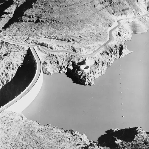
- Owyhee Dam: arch dam from the early 1930s in a narrow basalt gorge; parking and viewpoint on the crest.
- Owyhee Canyon: the road follows the river through reddish rock walls where golden eagles and prairie falcons nest; bighorn sheep are occasionally seen on the slopes.
- Lake Owyhee: the reservoir, more than 80 kilometres long, stretches far into the desert; from the park there are boat trips, fishing for bass and crappie, and long evenings looking out over the water.
- CampingSpirit overnight tip
-
Official campsite or RV park: Lake Owyhee State Park (Oregon State Parks): two campgrounds, McCormack (water and electric sites, some tent sites, showers and a dump station) and Indian Creek (water and electric sites, two cabins, boat ramp, no showers). Season roughly mid-April to the end of October; book through Oregon State Parks – in October mostly first come, first served on site. No mobile signal.
Free camping or nature tip (where legal): Around the reservoir lies BLM land (Vale District) with dispersed camping for up to 14 days within 28 days unless signed otherwise. The shoreline access roads are often reachable only with four-wheel drive and ground clearance.
- Insider tip for campers
- Fill up, top up your drinking water and shop in Nyssa or Adrian before Owyhee Lake Road – there's no fuel station or fully stocked shop at the lake. Self-service fuelling is now permitted in Oregon, but many stations still have attendants; just wait at the pump to see whether someone comes.
7Stage 7: Lake Owyhee State Park (OR) to Leslie Gulch (OR) (approx. 135 km)
- The drive
- Back through the canyon to the OR-201 and via Adrian to the turn-off for Succor Creek Road, a gravel road that heads south through hills of ash and tuff. Along the way lies Succor Creek State Natural Area; further south, Leslie Gulch Road branches off west and drops over around 25 kilometres (15 miles) through a gorge of red and yellow tuff to the Owyhee Reservoir. Both roads are gravel, narrow and steep in several places; the BLM recommends high-clearance vehicles and advises against large motorhomes, and trailers don't belong here either. Often impassable after rain, during flash floods and in winter. Driving time around 3.5 hours.
- Highlights & must-sees
- Succor Creek State Natural Area: a narrow gorge with sheer walls of rhyolite and tuff, famous for thundereggs, which you may collect in limited quantities for personal use – check current collecting rules with Oregon State Parks.
- Leslie Gulch: towers, spires and honeycombed walls of weathered ash in red, ochre and yellow; short hikes into side canyons such as Juniper Gulch lead in among the rocks. Bighorn sheep are common, often right by the road.
- Owyhee Reservoir at the end of Leslie Gulch: boat ramp and shoreline where the gorge runs into the water – the walls glow in the evening light.
- CampingSpirit overnight tip
-
Official campsite or RV park: Slocum Creek Campground (BLM) at the lower end of Leslie Gulch: nine basic, free sites near the reservoir, with vault toilets, no hookups and no drinking water, stays of up to 14 days. Alternatively, the basic campground in Succor Creek State Natural Area with a parking area and toilets, likewise without hookups.
Free camping or nature tip (where legal): Leslie Gulch is an Area of Critical Environmental Concern: overnight stays and fires only at Slocum Creek Campground, not along the road or in the side canyons; rocks, plants and firewood may not be collected. Outside the protected area, dispersed camping is allowed on BLM land for up to 14 days.
- Insider tip for campers
- Take the weather forecast seriously: a single thunderstorm turns the clay of Succor Creek and Leslie Gulch into a slide you may not get out of for days. There is no mobile signal. There's no fuel station between Adrian and Jordan Valley, so go in with a full tank, a spare fuel can and at least two days' supply of water.
8Stage 8: Leslie Gulch (OR) to Jordan Valley (OR) (approx. 105 km)
- The drive
- Back through Leslie Gulch to the junction near Rockville and east on McBride Creek Road for around 13 kilometres to the US-95 in Idaho (alternatively via Succor Creek Road). Then south on the paved US-95, back across the state line and over the plateau to Jordan Valley: wide sagebrush steppe, cattle pasture, the Owyhee Mountains on the horizon. Pure driving time around 2 hours, half of it on gravel. Jordan Valley has a fuel station, shop and café; the nearest larger city is Boise, around 140 kilometres to the north.
- Highlights & must-sees
- Jordan Valley: ranching town with Basque roots; immigrants from the Basque Country came to the region as sheepherders. The stone pelota frontón in town recalls the Basque ball game.
- Antelope Reservoir west of Jordan Valley: a shallow reservoir in the steppe where waterbirds and pronghorn appear in the evening.
- Onward travel: from Jordan Valley the US-95 runs south towards Nevada; if you want to explore more of Oregon's desert, the CampingSpirit guide to Oregon's High Desert continues as far as Steens Mountain.
- CampingSpirit overnight tip
-
Official campsite or RV park: Antelope Reservoir Campground (BLM) west of Jordan Valley: basic site on the reservoir with no hookups and no reliable drinking water. The next official campgrounds with hookups are back in the Boise area or at Lake Owyhee State Park.
Free camping or nature tip (where legal): Around Jordan Valley there is plenty of BLM land (Vale District) with dispersed camping for up to 14 days unless signed otherwise. Always leave stock gates as you found them, and don't camp at water troughs or corrals.
- Insider tip for campers
- Fill up and top up water in Jordan Valley before moving on – heading south or west there are long stretches without services. If you're returning to Boise, you can plan a detour to the Snake River via Homedale or Marsing. If you want to continue the region northwards, the CampingSpirit guide to Hells Canyon, the Salmon River and Lolo Pass is the matching follow-on route.
Camping practice & local rules
Wild camping & overnight parking
- In the southwest, Idaho and Oregon have large areas of Bureau of Land Management (BLM) land. Dispersed camping there is generally allowed for up to 14 days (in Oregon up to 14 days within 28 days), after which you must move a significant distance. Exceptions apply in protected areas such as Leslie Gulch, on military land (Orchard Combat Training Center, Saylor Creek Air Force Range) and wherever signs prohibit it.
- Private ranches are often unfenced or marked only by stock gates. Check boundaries with a BLM map or an app with a land ownership layer; don't drive onto private land without permission.
- Fire: from summer to autumn, fire restrictions are almost always in force on BLM land, often including charcoal; gas stoves with a shut-off valve are usually permitted. Sparks from chains and exhausts can start fires in dry grass – don't park in tall grass.
- Cities such as Boise restrict sleeping in vehicles on public streets; use supermarket and department store car parks only with the explicit permission of the store. Rest areas on the I-84 are for rest breaks, not camping; observe the signs.
- Reservations: Idaho State Parks (Bruneau Dunes, Three Island Crossing, Thousand Springs, Eagle Island) through the Idaho Parks and Recreation reservation system; Lake Owyhee through Oregon State Parks. Hagerman Fossil Beds is a National Monument; for visitors without US residency, higher fees and surcharges apply at some heavily visited national parks – check current rules on nps.gov.
- Apps: iOverlander, Campendium, The Dyrt and Recreation.gov; for land ownership boundaries, apps with a public land layer. Park4Night is not widely used here. Be sure to download offline maps – in the Owyhees there's no mobile signal over long stretches.
Waste disposal & supplies
- Dump stations: Bruneau Dunes, Three Island Crossing, Lake Owyhee (McCormack) and full-hookup sites at Thousand Springs (Billingsley Creek); plus fuel stations and private RV parks in the Boise, Mountain Home and Twin Falls areas. The BLM sites (Silver City, Slocum Creek, Antelope Reservoir) have none.
- Drinking water: at state park campgrounds in season; not reliably available at BLM sites. For the Owyhee stages, allow at least 4 litres per person per day plus a reserve.
- Empty grey water and chemical toilets only at dump stations. Leave No Trace applies on BLM land: take waste water with you, and don't bury toilet paper – pack it out.
- Fuel distances: there are no fuel stations between Murphy and Silver City, on the Adrian–Succor Creek–Leslie Gulch–Jordan Valley stretch, or around Bruneau Canyon. Fill up before every gravel stage; the last reliable stations are Melba, Grand View, Glenns Ferry, Nyssa, Adrian and Jordan Valley.
- Propane: fuel stations, farm supply stores and RV parks fill US cylinders; European cylinders are generally not filled.
- Shopping: large supermarkets in Boise, Nampa, Mountain Home, Twin Falls and Ontario; only a limited selection in the small towns.
Vehicle size & traffic rules
- Speed limits: on rural sections of the I-84 in Idaho up to 80 mph, now also for heavy trucks – still drive considerably slower with a motorhome or rig, especially in crosswinds; in Oregon on the eastern I-84 usually 70 mph for cars, less for trucks. Two-lane highways such as ID-78, OR-201 and US-95 mostly 55–65 mph. Keep to 25–40 mph on gravel roads, even where there is no sign.
- Tolls: neither Idaho nor Oregon charges tolls on this route. There are no low-emission zones.
- Gravel roads: Silver City Road, Succor Creek Road, Leslie Gulch Road and the dirt road to the Bruneau Canyon Overlook are impassable after rain or snowmelt; Silver City Road is closed in winter. If in doubt, ask the BLM (Owyhee or Jarbidge Field Office in Idaho, Vale District in Oregon) or Owyhee or Malheur County.
- Dimensions: there are no fixed length limits on Owyhee Lake Road, Silver City Road or Leslie Gulch, but bends, gradients and single-lane sections set practical limits. Leave long motorhomes and trailers on the paved main roads and do the detours in a smaller vehicle.
- Heat and weather: in summer, temperatures above 38 °C are normal on the Snake River Plain; thunderstorms bring torrential rain, hail and lightning. In winter, snow and ice on the passes. The best times to travel are May to June and September to October.
- Wildlife: rattlesnakes (Great Basin rattlesnake) are widespread throughout the region, especially on warm rocks and in canyons. Wear sturdy shoes, don't reach into crevices, and keep your distance if you meet one. Cattle on open range have right of way, especially at night.
- Emergency: 911. There is largely no mobile signal in Silver City, at Bruneau Canyon, at Lake Owyhee or in Leslie Gulch; before detours, tell someone your route and return time.
CampingSpirit packing & preparation checklist
- Satellite messenger or emergency beacon: in the Owyhees and at Bruneau Canyon there's no mobile signal over long stretches.
- Spare fuel can and extra water containers: otherwise fuel distances and the lack of drinking water at BLM sites make the gravel stages tight.
- Full-size spare wheel, tyre repair kit and compressor: the sharp-edged stones on Silver City Road and in Leslie Gulch slice tyres; readjust tyre pressure after the dirt road.
- Sturdy hiking boots and gaiters: protection against rattlesnakes and sharp lava rock at canyon rims and petroglyph boulders.
- Binoculars: for prairie falcons and golden eagles in the Snake River Canyon, bighorn sheep in Leslie Gulch and pronghorn around Jordan Valley.
- Red-light head torch and star chart: the sky over Bruneau Dunes and the Owyhees is among the darkest in the West; red light preserves your night vision.
As of 2026-10. Closures, fees and booking rules change: check official sources before you go.