

In-depth guide · CampingSpirit
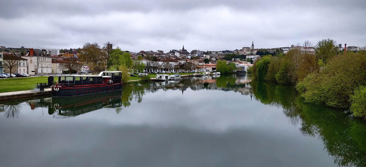
Around 605 kilometres across high plateau, reservoirs and granite gorges: from the porcelain city of Limoges via Vassivière, Millevaches and Aubusson into the Creuse valley and down to the red villages of the Corrèze.
The spirit of the route
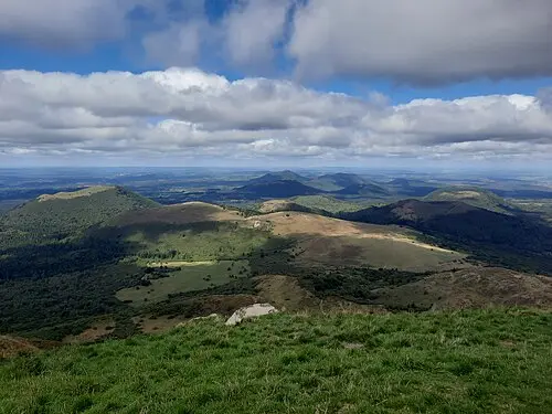
The Limousin is France without the stage set. Between Limoges and the Plateau de Millevaches the villages get smaller and the pastures bigger, until at some point there is nothing but red-brown Limousin cattle behind dry-stone walls, birches lining black peat bogs and the wind sweeping over heath and gorse. In the morning mist hangs over the Lac de Vassivière, in the evening the Vézère rushes through granite boulders, and from the sliding door you rarely see more than forest, water and the tip of a church spire. On top of that, this is a land of crafts: porcelain in Limoges, tapestries in Aubusson, paper in Saint-Léonard. And a place that leaves you silent – Oradour-sur-Glane, the destroyed village that was left standing as a memorial. In the north, Monet and the Crozant painters painted the gorges of the Creuse; in the south, the sandstone houses of Collonges-la-Rouge glow. The aires are small, cheap and often empty; you drive slowly and almost always find a spot by the water.
Stage-by-stage plan
1Stage 1: Limoges to Oradour-sur-Glane (approx. 25 km)
- The drive
- A short start: from Limoges on the D9 north-west through the pastureland of the Glane valley to Oradour-sur-Glane, about 30 minutes. The way out of Limoges runs along multi-lane boulevards; the old town, with its narrow, steep lanes, is unsuitable for motorhomes. You are better off spending the morning in Limoges on foot.
- Highlights & must-sees
- Musée national Adrien Dubouché: the city’s large ceramics and porcelain collection, from Chinese porcelain to Limoges manufactories.
- Gare des Bénédictins with its clock tower and dome, plus Saint-Étienne cathedral and the gardens of the former bishop’s palace overlooking the Vienne.
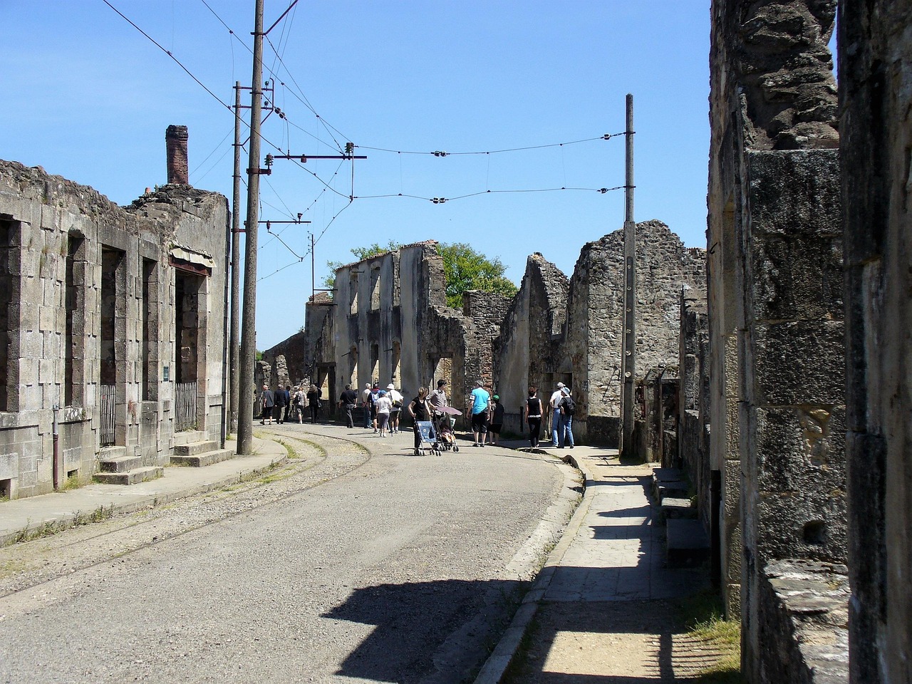
- Oradour-sur-Glane: the ruined village where on 10 June 1944 a unit of the Waffen-SS division “Das Reich” murdered 643 people. Access is through the Centre de la mémoire, which explains the background and the aftermath.
- CampingSpirit overnight tip
-
Official campsite or RV park: Aire de camping-car Oradour-sur-Glane, run by Camping-Car Park: just under 40 pitches, open all year, with electric hook-up, water and waste disposal included in the price, access by card at the terminal. There is no campsite close to the centre of Limoges itself; alternatives in the surrounding area are the aire in Solignac south of the city and the Camping-Car Park aire in Pierre-Buffière.
Free camping or nature tip (where legal): The ruins of Oradour are a Monument historique; wild camping is prohibited in the surrounding area anyway, and the car parks at the Centre de la mémoire are intended for visitors. Spend the night on the aire. In Limoges itself, overnighting on street parking is allowed as parking where signs do not prohibit it, but it is noisy and not recommended.
- Insider tip for campers
- Oradour is a place of remembrance: no picnicking in the ruined village, pets are not allowed there, and children should know where they are. The village is only accessible during the opening hours of the Centre de la mémoire and is closed from roughly mid-December to mid-January. Allow at least two hours, the museum first. For Limoges: check before you travel whether the Métropole enforces a ZFE with driving bans; you should have a Crit’Air sticker on the windscreen in any case.
2Stage 2: Oradour-sur-Glane to Lac de Vassivière (approx. 90 km)
- The drive
- Back towards Limoges and round the city on the ring road, then east on the D941 to Saint-Léonard-de-Noblat (a good hour to here). On via Eymoutiers into the hill country, on narrower departmental roads with many bends through chestnut and spruce forest to Peyrat-le-Château and the lakeshore. Around 2 hours of driving in total.
- Highlights & must-sees
- Saint-Léonard-de-Noblat: Romanesque collegiate church with bell tower, a UNESCO World Heritage Site as part of the Routes of Santiago de Compostela in France, plus half-timbered houses and the old bridge over the Vienne.
- Moulin du Got below the town: paper mill with a workshop for papermaking and printing.
- Île de Vassivière: walk across the bridge onto the island, with the Centre international d’art et du paysage, sculptures in the woods and bathing spots.
- CampingSpirit overnight tip
-
Official campsite or RV park: Aire d’accueil camping-car d’Auphelle on the eastern shore near Peyrat-le-Château: around 90 pitches with water and waste disposal, no electric hook-up at the pitches, open roughly April to September. With electricity and facilities: Camping Les Deux Îles nearby and other sites around the lake, such as La Presqu’île; most are only open in season.
Free camping or nature tip (where legal): Around the lake, many lakeshore car parks are bathing car parks by day, some with signs banning overnight stays or with height barriers; the signs on site are what counts. Because the Aire d’Auphelle is large and cheap, overnighting on the shore is hardly tolerated. Out of season, lake and aire are deserted; check in advance whether water and waste disposal are running.
- Insider tip for campers
- In Saint-Léonard there is an aire with waste disposal on the edge of town, handy for a lunch break; the old town is narrow and steep, so park at the bottom. The last larger supermarket before the lake is in Eymoutiers – shop and fill up there, as there are only small shops around Vassivière.
3Stage 3: Lac de Vassivière to Treignac (Gorges de la Vézère) (approx. 55 km)
- The drive
- From the lake via Eymoutiers on the D940 south into the Corrèze: well built but winding, with sections through dense conifer forest and over granite heights. Treignac sits on a rocky spur above the Vézère; the approach to the centre is narrow. About 1 to 1.25 hours.
- Highlights & must-sees
- Eymoutiers: old town with tanners’ houses on the Vienne and the Espace Paul Rebeyrolle, a museum dedicated to the painter born here.
- Rochers des Folles: hiking trail through the granite gorge of the Vézère below Treignac, with boulders in the river.
- Lac des Bariousses: reservoir on the Vézère north of Treignac, with a bathing spot and lakeside path.
- CampingSpirit overnight tip
-
Official campsite or RV park: Camping La Plage on the Lac des Bariousses, a few kilometres north of Treignac: pitches under trees by the water, electricity and facilities, open seasonally. Alternatively, the Camping-Car Park aire on the Route de Guéret, a good 3 km from the centre towards Bariousses: around 30 pitches with electricity, water and waste disposal, access by card at the terminal.
Free camping or nature tip (where legal): There are many lonely forest tracks on the plateau, but the forest is almost everywhere private or state forest closed to motor vehicles. So overnight only in designated roadside car parks, without camping behaviour. In dry spells, observe the Corrèze forest fire warning level.
- Insider tip for campers
- Municipal aires in the Limousin are often free or cost a few euros; the electricity is then a Euro-Relais post taking coins or jetons from the mairie. Bring small change. The through-road in Treignac on the D940 is narrow; do not stop in the centre with large vehicles.
4Stage 4: Treignac to Meymac (Plateau de Millevaches) (approx. 60 km)
- The drive
- Up onto the Plateau de Millevaches via Bugeat, then on small departmental roads via Millevaches and Saint-Merd-les-Oussines to Meymac. Long straights across heath and bog, single-track sections with passing places, hardly any traffic. At 800 to 900 m it can be cool and foggy even in summer. About 1.25 hours.
- Highlights & must-sees
- Tourbière du Longeyroux: one of the largest peat bogs in the Parc naturel régional, with a waymarked circular trail; the Vézère rises nearby.
- Site gallo-romain des Cars near Saint-Merd-les-Oussines: remains of a mausoleum and a villa on the high plateau.
- Mont Bessou north-east of Meymac, the highest point in the region as the “roof of the Limousin”, with an observation tower over the wooded hills of the plateau.
- CampingSpirit overnight tip
-
Official campsite or RV park: Camping Municipal La Garenne on the edge of Meymac, near a bathing lake: electricity, facilities, seasonal. Alternatively, the Aire de camping-car at the Lac de Sèchemailles south-west of town: around 20 pitches with water and waste disposal, free of charge, open roughly April to September. On the way is the small aire at Saint-Merd-les-Oussines on the D109 towards Tarnac: around ten pitches with a Euro-Relais post for electricity and water, small fee in summer.
Free camping or nature tip (where legal): The peat bogs are protected areas that may only be entered on foot on waymarked paths; park at the hikers’ car parks and do not overnight there. The Parc naturel régional has its own bivouac sites for hikers, which are not intended for motorhomes. On the plateau you stay legally and quietly on the municipal aires.
- Insider tip for campers
- On the plateau there are only small villages with few filling stations, often without card machines at night; fill up in Treignac or Meymac before the climb. On market day the centre of Meymac is jammed with parked cars – leave the vehicle on the edge of town.
5Stage 5: Meymac to Aubusson (approx. 60 km)
- The drive
- North across the plateau into the Creuse, via Felletin to Aubusson. The road is well built, with wide bends through forest and pasture, ending with the descent into the narrow Creuse valley. About 1 hour.
- Highlights & must-sees
- Cité internationale de la tapisserie in Aubusson: museum and workshops on the tapestry-weaving tradition, which UNESCO lists as Intangible Cultural Heritage.
- Felletin: the Creuse’s second tapestry town, with workshops and a spinning tradition on the upper Creuse.
- Pont de la Terrade and the old tapestry makers’ houses on the banks of the Creuse in Aubusson.
- CampingSpirit overnight tip
-
Official campsite or RV park: Aire d’accueil camping-cars in Aubusson on the edge of town, with water and waste disposal, within walking distance of the town. With electricity and facilities: small campsites in the surrounding area, such as Camping des Combes a few kilometres outside; check opening times in advance. In Felletin there is another aire with water.
Free camping or nature tip (where legal): Aubusson’s old town lies in the valley with little space and Monuments historiques; overnighting in the car parks by the river is not intended. On the plateau between Meymac and Felletin there are quiet lay-bys, but for parking overnight the rule of thumb applies: put nothing out, empty nothing.
- Insider tip for campers
- Many farmers in the Limousin and the Creuse welcome motorhomes through the France Passion network – a night on the farm, with beef, cheese or honey to take away. With the annual guide and the vignette you will find hosts around Aubusson; phone ahead.
6Stage 6: Aubusson to Lac de Chambon (Crozant/Éguzon) (approx. 110 km)
- The drive
- North-west to Guéret (about 45 minutes, well built), then on departmental roads through hedged pastureland to the Creuse valley at Fresselines and Crozant. In the valley it gets narrow, with steep descents to the bridges. On along the reservoir to Éguzon. Around 2 hours of driving in total.
- Highlights & must-sees
- Les Loups de Chabrières: wildlife park in the forest south of Guéret, where wolf packs live in large enclosures, with paths and viewing platforms.
- Fresselines: confluence of the Grande and Petite Creuse, which Claude Monet painted in a series in 1889; a hiking trail leads to the painters’ viewpoints.
- Ruins of the Crozant fortress on a rocky spur above the Creuse and Sédelle, plus the painting tradition of the “École de Crozant”; from the lakeshore, the view of the ruins in the evening.
- CampingSpirit overnight tip
-
Official campsite or RV park: Camping Les Nugiras in Éguzon, on a rise above the Lac de Chambon (Éguzon reservoir): electricity, facilities, waste disposal, seasonal. In Crozant itself, the La Font Bonne campsite lies by the river; check opening and facilities in advance. Other campsites by the lake include the Camping Municipal de Fougères; dedicated motorhome aires right on the shore are rare.
Free camping or nature tip (where legal): Around the reservoir, especially at the bathing beaches, some car parks are closed to motorhomes at night; watch the signs. At the Crozant ruins the car park is intended for visitors. For the night, an aire or campsite is the safe option.
- Insider tip for campers
- Guéret has large supermarkets with filling stations on the edge of town – stock up, because the Creuse valley only has village shops. At Fresselines and Crozant the through-roads are narrow with oncoming traffic; with large vehicles avoid the centre and park at the village entrances. The reservoir is partly drawn down in autumn.
7Stage 7: Éguzon to Uzerche (approx. 145 km)
- The drive
- The transfer south: in Éguzon join the A20, which is toll-free between here and Brive, past Limoges to Uzerche. Well built, but with long climbs. About 1.5 hours. Slower and more scenic: via Bénévent-l’Abbaye and Bourganeuf on departmental roads, then Pierre-Buffière.
- Highlights & must-sees
- Uzerche: old town on a rocky ridge in a loop of the Vézère, with turreted houses and the saying “Whoever has a house in Uzerche has a château in the Limousin”.
- Romanesque church of Saint-Pierre in Uzerche with its crypt, at the top of the rocky ridge.
- Pierre-Buffière: stopping point with a village centre and the Briance valley, handy for a lunch break right next to the A20.
- CampingSpirit overnight tip
-
Official campsite or RV park: Aire d’accueil de camping-cars d’Uzerche on the Rue Paul-Langevin below the old town on the Vézère: free parking, Flot-Bleu post, electricity and water with jetons from the tourist office or from shops, plus toilets; small campsites by the river nearby. On the way, the Camping-Car Park aire in Pierre-Buffière with electricity.
Free camping or nature tip (where legal): Rest areas on the A20 are meant for breaks; overnighting there is not prohibited as parking, but not recommended because of lorry noise and thefts. Uzerche has its aire – use it.
- Insider tip for campers
- The A20 is free between Vierzon and Brive; south of Brive the toll section begins. The old town of Uzerche is narrow and steep – leave the camper down by the river and walk up the steps.
8Stage 8: Uzerche to Collonges-la-Rouge (via Turenne) (approx. 60 km)
- The drive
- On the A20 to Brive (about 30 minutes), then on departmental roads south through limestone country with walnut groves to Turenne and on to Collonges-la-Rouge. About 1 hour of driving, the last kilometres narrow and winding.
- Highlights & must-sees
- Turenne: village on the castle hill of the old viscounty, with the Tour de César at the top of the rock and wide views over the countryside.
- Collonges-la-Rouge: village of red sandstone with turreted houses, a fortified church and the Maison de la Sirène; it was from here that mayor Charles Ceyrac founded the association “Les Plus Beaux Villages de France”, which officially launched in 1982.
- Meyssac: neighbouring village of red earth with a covered market hall, quieter than Collonges.
- CampingSpirit overnight tip
-
Official campsite or RV park: Aire Le Marchadial on the edge of Collonges-la-Rouge, a few minutes’ walk from the village: around 40 pitches, water and waste disposal, electricity at only some of the pitches, overnight fee at the terminal at the entrance. With electricity and facilities: the campsite on the edge of Collonges and other sites around Meyssac.
Free camping or nature tip (where legal): Collonges and Turenne are full of Monuments historiques; the village centres are closed to cars or open to residents only. Fees apply in the visitor car parks, some with restrictions on motorhomes overnight. Spend the night on the aire.
- Insider tip for campers
- In high season, coaches arrive in the morning – explore Collonges early in the morning or in the evening. If you want to carry on south, you are quickly in the Dordogne valley, which is covered by the CampingSpirit travel guide to the Périgord, Dordogne valley and Lot.
Camping practice & local rules
Wild camping & overnight parking
- In France a motorhome counts as a vehicle and may park anywhere parking is allowed, for a maximum of 7 days in the same place, unless a municipal order (arrêté) says otherwise. Camping behaviour – levelling jacks, awning, table and chairs, emptying waste water – is prohibited outside campsites and aires.
- Wild camping is prohibited in places such as Sites classés, within 500 m of Monuments historiques (Oradour, Collonges, Turenne, Uzerche) and near drinking-water catchments. In the Parc naturel régional de Millevaches the peat bogs are protected areas; do not leave the paths.
- The Limousin has a dense network of small municipal aires, often free or very cheap, plus Camping-Car Park aires (card access) and many farms in the France Passion network.
- Useful apps: park4night, Campercontact and the websites of the tourist boards of Haute-Vienne, Creuse and Corrèze, which also list the municipal aires. Observe the departments’ forest fire levels in dry summers.
Waste disposal & supplies
- Water and waste disposal is called “aire de services” or “borne”; Euro-Relais and Flot-Bleu posts taking coins, jetons or cards are common. Many small municipal aires only have water from spring to autumn; it is turned off in winter.
- Empty grey water and chemical toilets only at the service point; on the Plateau de Millevaches the land is sensitive and monitored.
- Tap water is drinking water unless marked “eau non potable”. The water on the granite plateau is very soft.
- Gas: French exchange cylinders (butane/propane) are available everywhere; foreign cylinders are not exchanged. LPG pumps for refilling with a Dish or Euronozzle adapter are thin on the ground in the Limousin, mostly at supermarkets in Limoges, Guéret and Brive.
Vehicle size & traffic rules
- Speed limits: motorhomes and car-trailer combinations up to 3.5 t as for cars (motorway 130, dual carriageway 110, country roads 80 or 90 where signed, built-up areas 50; in rain 110/100/80). Motorhomes over 3.5 t: motorway 110, dual carriageways with separated lanes 100, otherwise 80, built-up areas 50. Combinations over 3.5 t: 90/90/80. Speed limit disc on the rear over 3.5 t.
- In the Limousin too, departments have put individual country roads back to 90 km/h; the signs are what counts.
- Blind-spot stickers (“angles morts”) are mandatory for vehicles over 3.5 t, motorhomes included; otherwise €135.
- The Crit’Air sticker also applies to foreign vehicles. Check with the Métropole before you travel whether Limoges enforces driving bans in its ZFE.
- Tolls: the A20 is free between Vierzon and Brive. On toll motorways, motorhomes up to 3.5 t and under 3 m high pay Class 2; from 3 m or over 3.5 t, Class 3.
- High-visibility vest for the driver and warning triangle mandatory; alcohol limit 0.5 ‰ (0.2 ‰ for new drivers), phones at the wheel prohibited, including with a headset.
CampingSpirit packing & preparation checklist
- Small change and a few jetons – the Euro-Relais posts at small municipal aires rarely take cards.
- France Passion guide with vignette: cattle breeders, cheesemakers and walnut growers in the Creuse and Corrèze are the loveliest places to spend the night.
- Wellies or waterproof walking boots for the peat bogs and the riverside paths along the Vézère.
- A warm layer and a rain jacket: on the Plateau de Millevaches it rains often, and fog rolls in quickly even in summer.
- Swimwear and water shoes for Vassivière and the Lac de Chambon – the shores are often stony.
- Crit’Air sticker on the windscreen in case you overnight or shop in Limoges or another Métropole.
As of 2026-10. Closures, fees and booking rules change: check official sources before you go.