

In-depth guide · CampingSpirit
A good 1,100 km along Australia’s longest river: from Wodonga via Barmah, Echuca and Swan Hill to Mildura, with a detour to the lunettes of Mungo, on to the confluence with the Darling at Wentworth and into South Australia’s Riverland – three states, one fruit fly checkpoint and many nights on the riverbank.
The spirit of the route
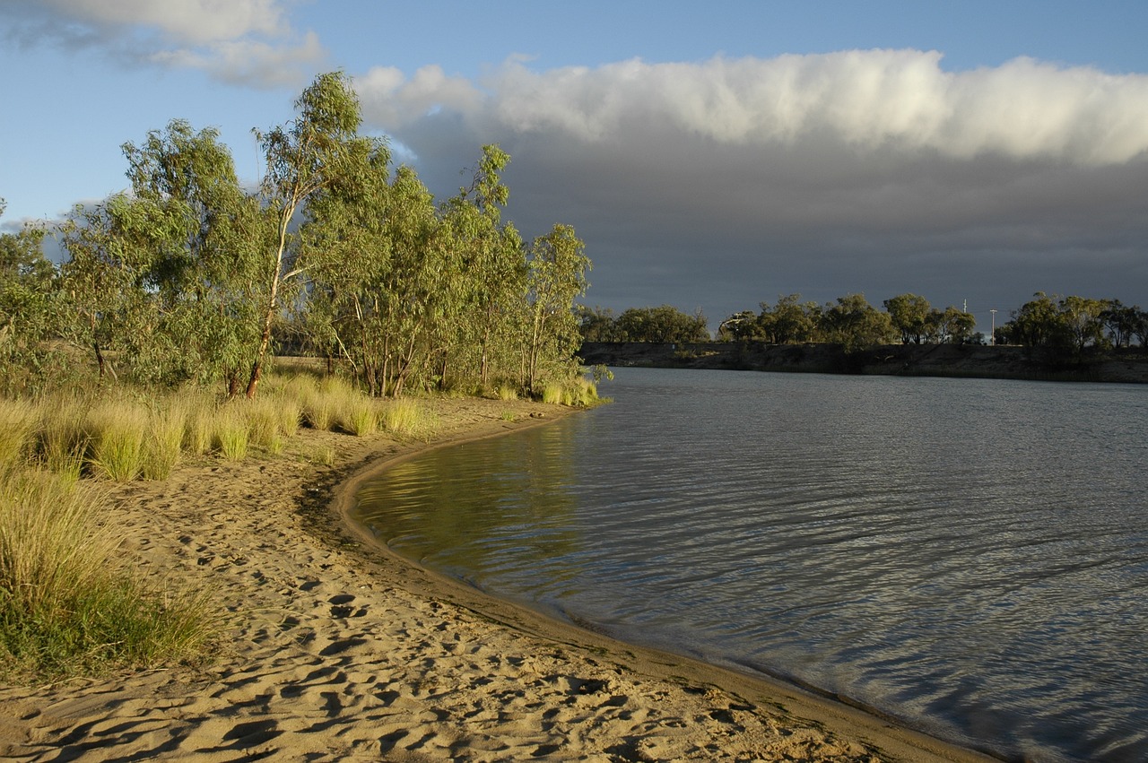
The Murray is not a river you see from above. It lies deep between clay banks, brown and sluggish, lined with River Red Gums whose trunks carry a new ring of mud after every flood. Travelling here, you are not after the view but the spot on the bank: sliding door open, folding chair in the sand, kookaburras in the branches, at night the splash of a Murray cod and the lights of a houseboat drifting downstream. In the mornings mist hangs over the billabongs in the Barmah forest; at midday the heat shimmers over vines, citrus orchards and mallee scrub. In between lie river ports from the era of paddle steamers, locks, wool and irrigation pioneers. Beyond Mildura the land turns red and empty, until at Mungo the sand gives up traces of more than 40,000 years of human history. And then you change state three times – each with its own rules for camping, fishing and the fruit in your fridge.
Stage-by-stage plan
1Stage 1: Wodonga to Yarrawonga (via Rutherglen) (approx. 95 km)
- The drive
- From Wodonga, the Victorian half of the twin city of Albury-Wodonga, head west via Barnawartha to Rutherglen and on the Murray Valley Highway (B400) through flat wine and grazing country to Yarrawonga. Well-made, straight country roads, around 1.5 hours’ driving. If you want to visit Albury first, you cross the river and are in New South Wales – the border runs along the Victorian bank, and the Murray itself belongs to NSW.
- Highlights & must-sees
- Gateway Island between Albury and Wodonga with riverside paths, and the Wonga Wetlands on the Albury side: restored wetlands with hides for watching waterbirds.
- Corowa opposite Rutherglen (NSW): the small town where one of the conferences on the road to Australian Federation took place in 1893 – today a quiet riverside town with swimming spots on the river.
- Lake Mulwala near Yarrawonga: a reservoir with dead red gums rising out of the water – a photo subject early in the morning when there is no wind.
- CampingSpirit overnight tip
-
Official campsite or RV park: Yarrawonga Holiday Park on the Murray just below the weir, with powered and unpowered sites and amenities; across the river in Mulwala (NSW) there are more parks on Lake Mulwala. During the summer and Easter holidays the area is a water-sports hotspot – book early then.
Free camping or nature tip (where legal): On the Victorian side, downstream of Yarrawonga, lies the River Murray Reserve, where Parks Victoria permits basic riverside camping on certain sections; which sections are open and which conditions apply is set section by section – check with Parks Victoria beforehand. On the NSW side, Murray Valley National Park and Murray Valley Regional Park offer bush campgrounds for which NSW National Parks may require a booking or fee. Dirt access roads quickly turn slippery after rain.
- Insider tip for campers
- Do a big shop, fill up with fuel and stock up on water in Albury-Wodonga – until Echuca there are only smaller country towns. The town of Rutherglen is covered in detail in the CampingSpirit guide to the Victorian High Country; here a short stop for a bottle of Muscat for the evening by the river is the better use of your time.
2Stage 2: Yarrawonga to Echuca-Moama (via Barmah) (approx. 145 km)
- The drive
- On the Murray Valley Highway via Cobram to Strathmerton, then on back roads via Nathalia to the village of Barmah on the edge of Barmah National Park, and on a sealed road on to Echuca. Flat and easy, around 2 hours’ driving; within the park itself there are dirt and sand tracks that are closed during floods or after rain.
- Highlights & must-sees
- Barmah National Park: together with the Millewa forest opposite in NSW, the largest River Red Gum forest in the world, a Ramsar wetland and Yorta Yorta Country; the Barmah Lakes with reeds, water lilies and more than 200 bird species.
- Port of Echuca: the historic timber wharf from the days when Echuca was Australia’s largest inland port, with a Discovery Centre and one of the largest operating paddle-steamer fleets in the world.
- A trip on one of the old paddle steamers – such as the PS Adelaide (1866) or the PS Pevensey – from the wharf in Echuca.
- CampingSpirit overnight tip
-
Official campsite or RV park: NRMA Echuca Holiday Park on the riverbank near the Port of Echuca, with power, amenities and water and waste disposal; across the river in Moama (NSW) there are more holiday parks on the river. Echuca-Moama is well booked at weekends and during the holidays – book ahead.
Free camping or nature tip (where legal): In Barmah National Park, camping is permitted at the Barmah Lakes Campground and at designated riverside sites; since Parks Victoria reintroduced fees (temporarily at half price since July 2025), many sites must be booked – check the current status of each site with Parks Victoria. Opposite, in the NSW Murray Valley National Park, are the small Moira South Campgrounds (2–4 sites each, booking required, only via unsealed access roads, not recommended for motorhomes). Firewood rules differ by park and state – observe them on site; do not park under large red gums, which drop heavy branches without warning.
- Insider tip for campers
- Echuca has narrow streets in the town centre around the port: leave the camper at the park and walk to the wharf. The tracks in the Barmah forest are partly deep sand or clay – in a two-wheel-drive rental campervan, stick to the main access roads. When the forest floods (usually winter/spring) tracks are closed; check notices from Parks Victoria.
3Stage 3: Echuca-Moama to Swan Hill (via Gunbower Island) (approx. 155 km)
- The drive
- On the Murray Valley Highway north-west via Torrumbarry to Gunbower, along Gunbower Creek to Cohuna and Kerang, and through lake and grazing country to Swan Hill. Straight road, little traffic, a good 2 hours’ driving; the turn-offs to the riverside sites on Gunbower Island are dirt tracks.
- Highlights & must-sees
- Gunbower Island: the Murray’s largest inland island, between the river and Gunbower Creek, covered in red gum and black box forest, Ramsar-protected; canoe trips on the quiet creek.
- Koondrook and Barham (NSW): twin towns at a historic bridge over the Murray – the short detour shows you the river away from the highway.
- Lake Boga south of Swan Hill with the Flying Boat Museum: during the Second World War this was a repair base for Catalina flying boats.
- CampingSpirit overnight tip
-
Official campsite or RV park: BIG4 Riverside Swan Hill (formerly Swan Hill Riverside Caravan Park) on the river within walking distance of the Pioneer Settlement, with power and amenities; there are alternatives on the edge of town and at Lake Boga.
Free camping or nature tip (where legal): Gunbower Island is one of the classic riverside camping areas on the Murray: Gunbower National Park and the adjoining State Forest have numerous numbered riverside sites. In the State Forest, camping is generally free and permitted without booking (for example at Horse Shoe Lagoon on Gunbower Creek); from August to November access to the island may be restricted because of environmental watering; in the national park Parks Victoria’s rules apply – check status, booking and fire rules locally. No toilets: bring your own chemical toilet and a spade; bury waste around 20 cm deep, at least 100 m from water.
- Insider tip for campers
- Do not drive the clay tracks on Gunbower Island after even a few millimetres of rain – they turn as slick as soap, and if you get stuck, you wait. Cohuna has a public dump point and a supermarket for a restocking stop.
4Stage 4: Swan Hill to Mildura (via Robinvale) (approx. 230 km)
- The drive
- Continue on the Murray Valley Highway via Nyah and Piangil, where mallee scrub alternates with almond and grape plantations, to Robinvale on the great bend of the river, and via the Calder or Sturt Highway to Mildura. The longest drive of the route, around 3 hours; in summer start early.
- Highlights & must-sees
- Pioneer Settlement in Swan Hill: an open-air museum on the river with the paddle steamer PS Gem and an evening sound-and-light show.
- Euston Weir (Lock 15) near Robinvale: a lock and weir where you come to understand the regulated Murray – the locks make the river navigable for boats and hold back irrigation water.
- Lock 11 and the Mildura Weir right in town, plus Rio Vista House, the home of the Chaffey brothers, who founded Mildura as an irrigation colony.
- CampingSpirit overnight tip
-
Official campsite or RV park: Apex RiverBeach Holiday Park in Mildura, right on a sandy beach on the river west of the town centre, with power, amenities and water and waste disposal; there are also several larger parks in Mildura and across the river in Buronga (NSW). Robinvale has a caravan park on the river for an overnight stop.
Free camping or nature tip (where legal): Between Swan Hill and Mildura, on the Victorian side, there are sections of the River Murray Reserve and State Forest land with riverside sites; on the NSW side near Euston there are riverside areas whose use is regulated differently depending on the managing authority. In towns, overnighting in your vehicle is generally only permitted in designated areas – heed signs and WikiCamps comments.
- Insider tip for campers
- Mildura is the last large town before Mungo and South Australia: fill up here, swap your gas bottle and restock on food – but buy only as much fruit and vegetables as you will eat before the SA border (see stage 7). The river beaches are popular, but currents and submerged branches make swimming risky.
5Stage 5: Mildura to Mungo National Park (NSW) (approx. 110 km)
- The drive
- Across the bridge to Buronga (NSW) and then on Arumpo Road north-east through mallee and saltbush plains into Mungo National Park. Much of the route is dirt road – passable in normal vehicles when dry, muddy after rain; standing water has caused long closures in the past. Around 2 hours’ driving, corrugations and dust included.
- Highlights & must-sees
- Walls of China: the eroded sand and clay dunes (lunettes) on the eastern shore of dry Lake Mungo, especially at sunset; enter the lunette area only on paths or on a guided tour.
- Site of Mungo Lady and Mungo Man: finds more than 40,000 years old made the park a centrepiece of the Willandra Lakes World Heritage Area; information at the visitor centre.
- Mungo Woolshed near the visitor centre: the shearing shed of a former sheep station, built of cypress pine.
- CampingSpirit overnight tip
-
Official campsite or RV park: Main Campground a few minutes’ drive from the Mungo visitor centre (pit toilets, no water, no power, fires only in fireplaces; showers and flush toilets at the visitor centre, access in dry weather only) or the remote Belah Campground on the Mungo Track: no water, fires prohibited, dry weather only and not for long vehicles. Check booking options and status with NSW National Parks; the park’s daily vehicle fee is paid by self-registration at the visitor centre.
Free camping or nature tip (where legal): In the national park, camping is only permitted at the designated campgrounds. Outside it are large leasehold properties (stations) where you may not camp without permission.
- Insider tip for campers
- Many campervan rental agreements exclude unsealed roads – and that is exactly where Mungo lies. Before setting off, read the local alerts from NSW National Parks: after rain, access roads and the 70 km Mungo Track are closed. Take water, fuel and supplies for at least two days; mobile reception is poor.
6Stage 6: Mungo National Park to Wentworth (NSW) (approx. 150 km)
- The drive
- On Arumpo Road back to the Silver City Highway and along it north-west to Wentworth at the confluence of the Murray and the Darling (Baaka). First dirt road, then good sealed road; around 2.5 hours.
- Highlights & must-sees
- Junction Island and the lookout tower at the confluence: at the right water level you can see the murkier water of the Darling alongside that of the Murray.
- Perry Sandhills west of Wentworth: red shifting dunes in the middle of farmland, in the evening light a contrast to the green riverbanks.
- Old Wentworth Gaol: a colonial-era prison built from locally fired bricks.
- CampingSpirit overnight tip
-
Official campsite or RV park: Willow Bend Caravan Park in Wentworth near the confluence, with power, amenities and a dump point; more parks in town and in Buronga.
Free camping or nature tip (where legal): NSW has no statewide right to free camping; on Crown Land and council land the managing authority decides, often with maximum stays. Around Wentworth there are riverside areas where overnighting is tolerated or designated – check the current situation with Wentworth Shire or on WikiCamps.
- Insider tip for campers
- Wentworth is the last place before the SA border where you can eat fresh fruit and vegetables without a second thought: eat your fridge empty here. In town, also use the dump point and top up with water before heading into the Riverland.
7Stage 7: Wentworth to Renmark (SA) (approx. 130 km)
- The drive
- On the Sturt Highway (A20) west through mallee scrub and wheat country, briefly through Victoria and across the border into South Australia, past the Yamba quarantine station and via Paringa to Renmark. A straight, well-made highway with truck traffic, around 1.5 hours. Turn your clocks back half an hour when you cross the border – South Australia is on Central Time.
- Highlights & must-sees
- Yamba quarantine station: this is where your fridge contents’ journey ends. South Australia and the Riverland are a fruit fly-free zone, and the checks are meant seriously.
- Paringa Bridge: the historic bridge over the Murray with a lift span for river traffic at the entrance to town.
- Renmark Riverfront with the paddle steamer PS Industry and the story of the Chaffey brothers, who after Mildura also founded an irrigation settlement here.
- CampingSpirit overnight tip
-
Official campsite or RV park: BIG4 Renmark Riverfront Holiday Park on the riverbank east of the town centre, with power, amenities and water and waste disposal; more parks in Berri and Barmera.
Free camping or nature tip (where legal): Murray River National Park (Bulyong Island section near Renmark, Katarapko near Loxton) has basic riverside sites; under SA Parks rules they are booked online in advance, and park passes do not cover camping. Riverland councils also designate their own riverside sites – observe the rules and maximum stay on site.
- Insider tip for campers
- At the quarantine station, throw all fruit and fruiting vegetables – apples, citrus, bananas, tomatoes, capsicums, chillies, eggplants – into the bins, including cut leftovers. Beyond the station, PIRSA also checks at random roadblocks, and fines run to several hundred dollars. Exactly which kinds are affected is listed on fruitfly.sa.gov.au. Buy fresh in the Riverland – from traders accredited for the Pest Free Area; not every roadside stall is accredited.
8Stage 8: Renmark to Waikerie (via Loxton) (approx. 120 km)
- The drive
- Via Berri to Loxton on the great bend of the river, on via Moorook and Kingston-on-Murray back to the Sturt Highway and to Waikerie above ochre cliffs on the river. Short legs through citrus orchards and vineyards, around 1.5 hours of actual driving.
- Highlights & must-sees
- Loxton Historical Village on the riverbank: a reconstructed pioneer village with houses, workshops and farm machinery from the settler era.
- Katarapko section of Murray River National Park opposite Loxton: lagoons, backwaters and canoe routes in red gum forest.
- Hart Lagoon near Waikerie and the high limestone and ochre cliffs along the river, especially in late light.
- CampingSpirit overnight tip
-
Official campsite or RV park: Loxton Riverfront Holiday Park or Waikerie Caravan Park, both with power and amenities. In Waikerie and Loxton the council has also set up time-limited RV areas; in Moorook there is a council riverside site with self-registration and a maximum stay of 7 days within 21 days.
Free camping or nature tip (where legal): The Loxton Waikerie Council lists free riverside sites, such as Thiele’s Sandbar and Rilli Reserve near Loxton and Lowbank, Holder Bend, Ramco Point and Hogwash Bend near Waikerie – some with their own conditions, access in dry weather only. Katarapko, Loch Luna, Moorook Game Reserve and Maize Island are national park or reserve sites with fees.
- Insider tip for campers
- Public dump points: in Loxton on the Riverfront opposite the Lions Park and in West Traeger Drive (both grey water only), in Waikerie in Civic Avenue with drinking water. From Waikerie it is a good 2 hours on to Adelaide.
Camping practice & local rules
Wild camping & overnight parking
- Three states, three legal situations: Victoria, New South Wales and South Australia have no general right to free camping. On council land, councils regulate overnighting through local laws or by-laws; it is only permitted in designated areas, often with a maximum stay.
- Victoria: Parks Victoria campgrounds (Barmah, Gunbower, Murray-Sunset) have again been subject to fees and mostly to booking since July 2025, at half price for two years. In the River Murray Reserve, basic riverside camping is only permitted on certain sections and under the conditions that apply there – do not assume one section’s rules carry over to the next. In State Forests, camping is generally free unless signposted otherwise.
- New South Wales: national park campgrounds (Murray Valley, Mungo) through NSW National Parks; many parks charge a daily vehicle fee. Crown Land and Regional Parks have their own rules. Highway rest areas are for driving breaks; overnighting only where signposted.
- South Australia: book sites in Murray River National Park online in advance with SA Parks; park passes cover entry only. The Riverland councils designate free and paid riverside sites (list from Loxton Waikerie Council, similar ones from Renmark Paringa and Berri Barmera).
- On the riverbank: do not stand under large River Red Gums (branch drop), keep your distance from the water, observe each park’s firewood rules (collecting is banned in many places), and take your rubbish with you. WikiCamps and CamperMate show riverside sites with current user comments on closures and access.
- Floods and fire: the Murray rises slowly but over a wide area – riverside sites and tracks in Barmah, Gunbower and the Riverland are then closed. River levels and warnings from the Bureau of Meteorology and the state emergency apps (VicEmergency, Hazards Near Me NSW, Alert SA). On Total Fire Ban days, open fires are prohibited in all three states.
Waste disposal & supplies
- Dump points are found at all caravan parks and publicly in many river towns (including Cohuna, Loxton, Waikerie, Moorook); locations in WikiCamps and CamperMate. Never empty cassettes into the river or at riverside sites.
- Town mains water is safe to drink. Use river water only after treatment, and not at all during blue-green algae warnings – these are issued regularly for individual stretches along the Murray. There is no water at riverside sites or at Mungo; carry a 20-litre reserve per person.
- Gas: Australian bottles today mostly have the LCC27 valve, older ones POL. Swap them through the exchange system at service stations and hardware stores; refills only with a valid test date. European bottles and adapters will not help – buy or rent locally.
- Fuel: along the river, towns are rarely more than 60–80 km apart. The exception is the detour to Mungo – fill up in Mildura or Buronga and allow for the return trip.
- Fruit and vegetables: use them up before the SA border or dispose of them at the quarantine station; buy fresh in the Riverland. The Riverland is a Pest Free Area in its own right: at-risk fruit and vegetables may not be brought in even from other parts of South Australia.
Vehicle size & traffic rules
- Drive on the left, roundabouts clockwise. On the long highways, overtake road trains or B-doubles only with a clear view ahead; truck drivers can often be reached on UHF CB channel 40.
- Speed limits: unless signposted, 50 km/h in built-up areas and 100 km/h outside them in all three states, 110 km/h only on signposted sections. When passing stationary emergency and breakdown vehicles with flashing lights, slow to 40 km/h in Victoria and NSW and to 25 km/h in South Australia (applies to red/blue and yellow lights).
- Tolls: there are no toll roads on the route. If you arrive from Melbourne or Sydney, you will use tolled urban motorways; in NSW pay toll notices within 72 hours.
- Time zone: South Australia is half an hour behind Victoria and NSW – important for check-in and ferry times.
- Animals on the road: kangaroos and emus especially at dusk, sheep and cattle on unfenced sections. Avoid driving at night; do not swerve, brake in a controlled way.
- Rental campervans: many agreements exclude unsealed roads (Mungo, riverside tracks) and damage from animal collisions – read them beforehand. Foreign driving licence: a translation or international driving permit is only needed if it is not in English. 0.05 blood alcohol limit; phones only in a fixed cradle or hands-free.
- Fishing: up to the SA border the Murray is NSW water – an NSW fishing licence is required, even if you fish from the Victorian bank (a Victorian licence is valid there only on Lake Hume); for waters south of the river such as Gunbower Creek you need the Victorian licence. Murray cod has a closed season every year from 1 September to 30 November; between Yarrawonga Weir and Tocumwal all fishing is prohibited during this period. Check size and bag limits with the fisheries authority before your first cast.
CampingSpirit packing & preparation checklist
- Recovery tracks and a spade: for the sand and clay tracks to the riverside sites in Barmah, Gunbower and the Riverland – and for the toilet pit where there is no toilet.
- Water containers (at least 20 litres) and a water filter: riverside sites and Mungo have no drinking water, and the river water is murky and at times affected by algae.
- Insect repellent with DEET or picaridin, mosquito nets for windows and door: mosquitoes occur in huge numbers on the Murray, and health authorities periodically warn of mosquito-borne viruses.
- Shade sail, 12-volt fan and a cool box with a separate battery: in summer, temperatures over 40 °C are not unusual in Mildura and the Riverland.
- Folding cool bag for the border crossing: lets you quickly gather up all fruit and vegetables before the quarantine station and dispose of them.
- Folding canoe or inflatable kayak: Gunbower Creek, the Barmah Lakes and the backwaters of Katarapko are best explored from the water.
As of 2026-10. Closures, fees and booking rules change: check official sources before you go.