

In-depth guide · CampingSpirit
From Smith Rock via the Painted Hills, Sheep Rock and Kam Wah Chung to Sumpter and Baker City, back via Fossil, the Clarno Palisades and the Deschutes at Maupin to Madras: around 1,000 kilometres of high desert, pine-clad passes and 40 million years of Earth history.
The spirit of the route
East of the Cascades, Oregon tips over into another world. Juniper and sagebrush instead of Douglas firs, basalt walls above green ribbons of river, roads on which you meet more cattle than cars for hours on end. In the valley of the John Day River, Earth history lies open like a book: clay hills striped red, yellow and black from weathered volcanic ash, mudflow cliffs with petrified leaves, layers holding sabre-toothed cats and ancient horses. In between are gold-mining towns, a Chinese herbal shop where time stood still in 1948, and a rusting floating dredge in the Sumpter valley. In the morning you see pronghorn against the light from the sliding door, in the evening the clay of the Painted Hills turns deep red, and at night the sky is as black as you can hardly find any more in Europe. Driving here, you count in tanks of fuel, water jerrycans and the smoke map.
Stage-by-stage plan
1Stage 1: Bend to Prineville (approx. 85 km)
- The drive
- Leave Bend on the US-97 heading north across the lava plain to Terrebonne, then take Smith Rock Way and NE Crooked River Drive to the park. Afterwards follow Lone Pine Road and the O’Neil Highway through irrigated farmland with hay bales and pivot circles to Prineville. Good, flat roads throughout; pure driving time a little over an hour. The US-97 is four-lane and busy between Bend and Redmond; after that it quickly gets quiet. Filling stations and supermarkets in Bend, Redmond and Prineville.
- Highlights & must-sees
- Smith Rock State Park: tuff and basalt walls above a bend of the Crooked River, the birthplace of sport climbing in the USA. The Misery Ridge Trail climbs steeply to views of Monkey Face; the River Trail along the river is flatter. A day-use parking fee is charged (machine or annual pass); at weekends the car parks fill up early, and large vehicles then struggle to find space.
- Peter Skene Ogden State Scenic Viewpoint on the US-97 south of Terrebonne: three bridges span the roughly 90-metre-deep gorge of the Crooked River; from the fenced rim you look across to the old railway bridge. Large car park, suitable for motorhomes too.
- Prineville: county seat with the 1909 Crook County Courthouse and the Bowman Museum; on the west side of town are the data centres of large tech companies – a strange contrast to the cowboy everyday life in the feed stores.
- CampingSpirit overnight tip
-
Official campsite or RV park: Skull Hollow Campground (Crooked River National Grassland) east of Smith Rock: around 70 basic sites among the junipers, picnic table and fire ring, vault toilets, no drinking water, no hookups and no dump station; no reservations (first come, first served), season roughly mid-March to mid-November. If you need electricity and showers, start at Tumalo State Park on the Deschutes north-west of Bend (sites with hookups, showers, reservations via Oregon State Parks) or, east of Prineville, use Ochoco Lake Campground (Crook County) on the reservoir – check facilities and season there in advance. The Bivouac area in Smith Rock State Park is a walk-in tent site for climbers only and unsuitable for motorhomes.
Free camping or nature tip (where legal): Dispersed camping is permitted in the Crooked River National Grassland unless signed otherwise: 14 days maximum, stay on existing access tracks and hardened surfaces, leave nothing behind. Overnight stays are prohibited in Smith Rock State Park and in its car parks.
- Insider tip for campers
- Skull Hollow has no water: fill all tanks in Bend or Redmond. Visit Smith Rock early in the morning on a weekday – in summer the walls heat up strongly by midday, and the Misery Ridge Trail then becomes a shadeless slog. Dogs on a lead; rattlesnakes and marmots are about in the park.
2Stage 2: Prineville to Painted Hills and Mitchell (approx. 100 km)
- The drive
- Take the US-26 east past Ochoco Lake into the Ochoco Mountains: ponderosa pines, sweeping bends and a long climb to Ochoco Pass (around 1,440 metres). After that the road descends into dry hill country. About 6 kilometres before Mitchell, Burnt Ranch Road branches off to the north, then Bear Creek Road into the Painted Hills Unit – around 10 kilometres on narrow but easily drivable side roads. Pure driving time about 1.5 hours. There is no reliable place to fill up between Prineville and Mitchell; Mitchell has only a small filling station with limited opening hours.
- Highlights & must-sees
- Painted Hills Overlook and Carroll Rim Trail: from the viewpoint, the view of the striped clay hills; the Carroll Rim Trail (around 2.5 kilometres there and back) climbs to a ridge overlooking the whole unit. The colours formed from volcanic ash that weathered under a changing climate around 33 million years ago.
- Painted Cove Trail and Leaf Hill: a short boardwalk between bright red and yellow hills where the ground swells up like popcorn when wet, and a loop around a hill from which researchers have recovered thousands of leaf fossils. Wildfires hit parts of the unit in summer 2026. The unit has reopened; check the condition of individual trails on site or on nps.gov and stay on the trails.
- Mitchell: a tiny town in a narrow valley with wooden facades from the gold-rush era, a café and a shop that in summer also supplies cyclists on the TransAmerica route.
- CampingSpirit overnight tip
-
Official campsite or RV park: Mitchell City Park in town: a few RV sites with water and electricity (no sewer hookup), plus a tent lawn, toilets and picnic tables; the RV sites can be reserved through the City of Mitchell, tents without reservation. In winter the water is turned off, and on the weekend of the Painted Hills Festival (Labor Day) the park is closed to campers. Cooler is Ochoco Divide Campground (Ochoco National Forest) on the US-26 near the top of the pass: a small site under ponderosa pines with drinking water, no hookups, little parking space; it was closed after the 2026 wildfire – check its status with the Ochoco National Forest. Wildcat Campground on Mill Creek north of the US-26 is a quiet alternative for smaller vehicles; check for fire damage here too in advance. There is no campground in the Painted Hills Unit itself.
Free camping or nature tip (where legal): Dispersed camping outside campgrounds is permitted in the Ochoco National Forest (14 days maximum, keep your distance from water, use existing sites). The same applies on the BLM land around Mitchell, but much of the land along the roads is private – take fences and “No Trespassing” signs seriously. Overnight stays are prohibited in the Painted Hills Unit; the unit is open during the day only.
- Insider tip for campers
- Visit the Painted Hills in the late afternoon or just after sunrise: in low light and after a shower the colours are at their strongest; at midday they look washed out. Never walk on the hills – footprints remain visible for years, and heavy fines apply. There are toilets at the unit’s picnic area; drinking water and shade are scarce.
3Stage 3: Mitchell to John Day (approx. 135 km)
- The drive
- Continue east on the US-26 over Keyes Creek Summit, then down to the John Day River. At Picture Gorge the road squeezes through a narrow basalt canyon; here the OR-19 branches off north to the Thomas Condon Paleontology Center and Blue Basin (around 3 and 8 kilometres respectively). Return to the US-26 and drive through the grazing land of the John Day Valley via Dayville and Mount Vernon to John Day. Pure driving time around 2 hours on well-built two-lane roads. Filling stations in Dayville (small), Mount Vernon and John Day.
- Highlights & must-sees
- Thomas Condon Paleontology Center (Sheep Rock Unit): visitor centre with fossils spanning 40 million years – ancient horses, nimravids, oreodonts – and a laboratory you can look into through glass panes. Free admission; opposite is the historic James Cant Ranch with an orchard by the river. Seasonal opening hours, check on nps.gov.
- Blue Basin: the Island in Time Trail (around 2 kilometres there and back, flat) leads into an amphitheatre of blue-green clay with fossil replicas along the way; the Overlook Trail (around 5 kilometres) circles it with views into the valley. No shade and very hot in summer – go early and take plenty of water.
- Kam Wah Chung State Heritage Site in John Day: shop, pharmacy and home of the Chinese immigrants Ing “Doc” Hay and Lung On, who sold herbal medicine and goods here from the 1880s into the 1940s. Hundreds of herb drawers, tin cans and letters have been preserved untouched. Seasonal guided tours, check times with Oregon State Parks.
- CampingSpirit overnight tip
-
Official campsite or RV park: Clyde Holliday State Recreation Site between Mount Vernon and John Day: campground under cottonwoods on the John Day River with electric sites, showers and a dump station, plus tent tipis; check season and reservations via Oregon State Parks. For the cooler option: Magone Lake Campground (Malheur National Forest) north of John Day on a small mountain lake in pine forest, no hookups, seasonal.
Free camping or nature tip (where legal): Dispersed camping is permitted in the Malheur National Forest north and south of John Day; the forest roads are partly steep and rutted, so with large vehicles only use known spots close to the main roads. Overnight stays are prohibited in the Sheep Rock Unit and at Blue Basin.
- Insider tip for campers
- At Picture Gorge, at the OR-19 turn-off, you can see Native American rock art on the basalt wall – view it only from the roadside and do not touch the rocks. Restock in John Day: it is the largest town for a long way, with a supermarket, a garage and propane.
4Stage 4: John Day to Sumpter and Baker City (approx. 145 km)
- The drive
- Take the US-26 east via Prairie City, beneath the peaks of the Strawberry Range, and up to Dixie Pass (around 1,610 metres). At Austin Junction turn north-east onto the OR-7, through meadows and pine forest into the Sumpter Valley; make a short detour along the spur road into the town of Sumpter. Then continue past Phillips Lake to Baker City. Winding but well built; pure driving time around 2.5 hours. Filling stations in Prairie City and Baker City, nothing reliable in between.
- Highlights & must-sees
- Sumpter Valley Dredge State Heritage Area: a huge floating dredge that churned through the valley for gold from 1935 to 1954. The tailings piles still stretch for kilometres along the Powder River; you can visit the deck and the engine room.
- Sumpter: gold-mining town with wooden houses and saloons. The Sumpter Valley Railroad, a restored narrow-gauge steam railway, runs at weekends in season between Sumpter and McEwen; check the timetable in advance.
- Baker City: brick downtown from the gold rush with the 1889 Geiser Grand Hotel. If you have time, drive to the National Historic Oregon Trail Interpretive Center on Flagstaff Hill east of town (covered in detail in the guide to the Wallowas).
- CampingSpirit overnight tip
-
Official campsite or RV park: Union Creek Campground on Phillips Lake (Wallowa-Whitman National Forest) between Sumpter and Baker City: a larger site on the reservoir, some sites with hookups, others without; dump station, reservations via recreation.gov, check the season in advance. Simpler and closer to Sumpter: McCully Forks Campground in the forest above the town, small, no hookups.
Free camping or nature tip (where legal): Dispersed camping is permitted in the Wallowa-Whitman National Forest around Sumpter (14 days). Many areas in the valley, however, are private mining claims – do not camp or prospect on marked claims. Overnight parking on the streets is not permitted in Baker City.
- Insider tip for campers
- At Dixie Pass and Austin Junction it can freeze at night even in June and September – check your gas and blankets. The road into the Sumpter Valley is closely lined with tailings piles; motorhomes are best parked at the dredge site, not in the town centre.
5Stage 5: Baker City to Kimberly (approx. 255 km)
- The drive
- The long way back: on the OR-7 back to Austin Junction, on the US-26 to Mount Vernon, then on the US-395 north over Long Creek Mountain to Long Creek. From there the OR-402 leads west down into the canyon of the North Fork John Day River, via Monument to the junction at Kimberly. Long, lonely stretches with hardly any traffic; pure driving time around 4 hours. Fill up in John Day or Mount Vernon at the latest – Long Creek and Monument have only small shops with limited opening hours, which you cannot rely on.
- Highlights & must-sees
- Long Creek Mountain on the US-395: a pass through pine forest with wide views over the Blue Mountains and of recent burn areas – an object lesson in how fire has changed this landscape in recent years.
- North Fork John Day River along the OR-402: the road follows the river through a canyon with basalt benches and cottonwoods; in spring steelhead trout migrate upstream, and ospreys perch on the poles.
- Monument: a hamlet of a few houses by the river, surrounded by juniper slopes – the epitome of quiet eastern Oregon.
- CampingSpirit overnight tip
-
Official campsite or RV park: Lone Pine and Big Bend (BLM) on the OR-402 east of Kimberly: small, basic sites right on the North Fork, picnic tables and toilet, no electricity; check water and fees on site. For more comfort, spend a night earlier at Clyde Holliday (stage 3) and split the stage.
Free camping or nature tip (where legal): BLM land along the North Fork and the main stem allows dispersed camping unless signed otherwise (14 days within 28 days). A large part of the riverbanks, however, is private grazing land; only park on clearly public land – the BLM map or an app with a land-ownership layer helps.
- Insider tip for campers
- This stage is the backbone of the route and at the same time its risk: no mobile signal on long stretches, deer crossing at dusk, fires and road closures in summer. In the morning check TripCheck and the fire map to see whether the US-395 and the OR-402 are open, and keep an alternative route via Picture Gorge and the OR-19 in mind.
6Stage 6: Kimberly to Fossil (approx. 75 km)
- The drive
- Take the OR-19 north-west along the John Day River via Spray and Service Creek, then away from the river across uplands of wheat and pasture up to Fossil. A winding, narrow country road with cattle grids and occasionally cattle on the carriageway; pure driving time around one hour. Fuel available in Spray and Fossil, limited opening hours.
- Highlights & must-sees
- Wheeler High School Fossil Beds in Fossil: on the slope behind the school, at a well-known site, you may dig for roughly 33-million-year-old leaf fossils yourself and take a small amount home – an exception, since collecting is strictly prohibited in the National Monument. A small fee goes into a box at the school; information from the City of Fossil and at the Oregon Paleo Lands Center in town.
- Service Creek and Spray: put-ins for raft and canoe trips on the John Day River, one of the longest undammed rivers in the western USA.
- Fossil: county seat of Wheeler County with a brick courthouse and barely 500 inhabitants; a place of stillness with a café, a shop and a museum.
- CampingSpirit overnight tip
-
Official campsite or RV park: Bear Hollow County Park (Wheeler County) on the OR-19 south-east of Fossil: a shady site in pine forest by a creek, basic pitches with toilets and water; check fees and season with the county. Closer to the river: Shelton Wayside (Wheeler County), also on the OR-19, a small site with tables and toilets.
Free camping or nature tip (where legal): Most of the land around Fossil is private. Public BLM land lies along the John Day River below Service Creek, often reachable only via gravel roads or by boat; BLM rules apply there, with a 14-day maximum stay and fire restrictions.
- Insider tip for campers
- Fill up with water and fuel in Fossil before heading on into the emptiness of the OR-218. After the wildfires of recent summers, burn areas are fresh in places and trees unstable – do not park under dead trunks; check the current situation on site.
7Stage 7: Fossil to Maupin (approx. 120 km)
- The drive
- Take the OR-218 west, down into the valley of the John Day River to the Clarno Unit and over the bridge at Clarno, then across the hills to Antelope and up to Shaniko. From there Bakeoven Road crosses the wheat plateau and makes a long, steep descent into the Deschutes canyon to Maupin. Pure driving time around 2 hours. No reliable filling station between Fossil and Maupin.
- Highlights & must-sees
- Clarno Palisades (Clarno Unit): cliffs formed by mudflows (lahars) that buried a subtropical forest around 44 million years ago. The short Trail of the Fossils leads past boulders with imprints of leaves and branches; the Arch Trail climbs to a rock arch beneath the cliffs. Picnic area on the OR-218, no campground.
- Antelope: a village overrun from 1981 to 1985 by the movement around Bhagwan Shree Rajneesh and temporarily renamed; the commune was on the Big Muddy Ranch to the south-east. Today it is a quiet place again with a few houses.
- Shaniko: around 1900 a wool shipping centre at the end of a railway line, today almost a ghost town with a wooden hotel, schoolhouse and water tower – worth a photo stop on its dusty main street.
- CampingSpirit overnight tip
-
Official campsite or RV park: Maupin City Park: municipal campground right on the east bank of the Deschutes, RV sites with full hookups, tent sites, a toilet block with showers; reservations via the City of Maupin, book early in the summer rafting season and at weekends. Along the Lower Deschutes Access Road the BLM runs a chain of basic campgrounds: upstream Harpham Flat and Long Bend, downstream towards Sherars Falls and further on Beavertail and Macks Canyon. Nightly fee, toilets, little shade, no hookups.
Free camping or nature tip (where legal): On the Lower Deschutes, camping is permitted only at designated sites; free camping along the Access Road is prohibited and enforced. Overnight stays are prohibited in the Clarno Unit. On BLM land on the John Day River near Clarno, dispersed camping is possible unless signed otherwise; banks are partly private.
- Insider tip for campers
- Bakeoven Road has a steep gradient on the descent to Maupin – use engine braking and a low gear, and do not overheat the brakes. North of Sherars Falls the Lower Deschutes Access Road is washboard gravel, dusty in summer; large motorhomes are better off staying on the paved sections. At Sherars Falls, members of the Confederated Tribes of Warm Springs traditionally fish with dip nets from wooden platforms – keep your distance and do not take photos without permission.
8Stage 8: Maupin to Madras and Lake Billy Chinook (approx. 110 km)
- The drive
- Take the US-197 out of the canyon up onto the plateau and south to Shaniko Junction, there take the US-97 south to Madras; then via the Culver Highway and Jordan Road down to Cove Palisades on Lake Billy Chinook. The access road into the canyon has steep hairpins with a significant gradient but is approved for motorhomes. Pure driving time around 1.5 hours. Filling stations in Maupin and Madras.
- Highlights & must-sees
- White River Falls State Park near Tygh Valley (detour north of Maupin): a waterfall in a basalt gorge with the ruins of an old hydroelectric plant, a short, steep path to the foot of the falls; day use only.
- Cove Palisades State Park: here the Deschutes, Crooked and Metolius rivers meet in the Lake Billy Chinook reservoir; high basalt walls, swimming spots and boat hire. From the viewpoints on the access road you look out onto The Island, a protected plateau in the lake.
- Round Butte Overlook Park near Madras: viewpoint above the reservoir at Round Butte Dam with views of Mount Jefferson and the Cascades – after days in the desert, a farewell with snow on the horizon.
- CampingSpirit overnight tip
-
Official campsite or RV park: Cove Palisades State Park: Crooked River Campground with sites with electricity and water, some full hookup, showers and a dump station; Deschutes Campground on the upper arm of the lake is seasonal only. Reservations via Oregon State Parks; fully booked in summer. Other sites: Pelton Park (Portland General Electric) on Lake Simtustus below Round Butte Dam and Perry South (Deschutes National Forest) on the Metolius arm of Lake Billy Chinook; check the season in advance.
Free camping or nature tip (where legal): Around Madras lies the Crooked River National Grassland: dispersed camping permitted (14 days), only on hardened surfaces, no fires in summer. On the land of the Confederated Tribes of Warm Springs west of the lake, tribal rules apply – do not camp there without a permit.
- Insider tip for campers
- The access road to Cove Palisades climbs steep switchbacks; in high summer the engine overheats at walking pace, so switch off the air conditioning briefly if necessary. Around Madras and Warm Springs, too, fires break out again and again in dry summers; when there is smoke, the view of the Cascades disappears and air quality is poor – check AirNow.
Camping practice & local rules
Wild camping & overnight parking
- Oregon permits dispersed camping on BLM land and in the National Forests (Ochoco, Malheur, Wallowa-Whitman) as well as in the Crooked River National Grassland, usually for up to 14 days in the same place; then move on. Keep your distance from water, trails and campgrounds, use only existing sites, and take rubbish and toilet waste with you.
- In State Parks, State Heritage Sites and the units of the John Day Fossil Beds National Monument, overnight stays outside campgrounds are prohibited; the fossil units are open during the day only. Collecting fossils, rocks and plants there is a criminal offence.
- Private land dominates eastern Oregon: riverbanks, pastures and gravel roads often belong to ranchers, even if they look open. Respect fences, gates (close them!) and “No Trespassing” signs; an app or map showing land ownership (BLM maps, onX) is very helpful.
- Wildfire: from about June to October, Public Use Restrictions apply on BLM and forest land – campfires are often banned entirely, even in fire rings, smoking only inside vehicles, generators with spark arresters. Fireworks are always prohibited on federal land. Violations are punished with heavy fines and liability for firefighting costs.
- Reservations: Oregon State Parks via the central reservation system on oregonstateparks.org (a surcharge is charged for guests not resident in Oregon), Union Creek via recreation.gov; most forest, grassland and BLM sites without reservation. Smith Rock charges a day-use parking fee. The John Day Fossil Beds National Monument currently charges no admission; since 2026, surcharges partly apply to visitors without US residence at US national parks – check current rules and amounts on nps.gov.
- Apps: iOverlander, Campendium, The Dyrt and Recreation.gov; for fires and roads TripCheck (ODOT), the fire maps of InciWeb and Watch Duty, and AirNow for smoke.
Waste disposal & supplies
- Dump stations: at Tumalo, Clyde Holliday, Union Creek and Cove Palisades, and at some filling stations in Bend, Redmond, Prineville, John Day and Baker City. Practically none between Baker City and Maupin – empty the waste tanks before stage 5.
- Drinking water: many basic sites (Skull Hollow, BLM sites on the Deschutes) have no water or only seasonally. Allow at least 4 litres per person per day, more in summer; carry extra jerrycans and refill in every larger town.
- Fuel: larger gaps between Prineville and Mitchell, between Mount Vernon and Kimberly, and between Fossil and Maupin. Small filling stations are often open only during the day, some card-only; never start a stage with less than half a tank. Self-service fuelling is now permitted in Oregon, but many stations still have attendants.
- Grey water and chemical toilets only at dump stations; emptying them on pastures, in dry creek beds or on riverbanks is prohibited.
- Propane: US cylinders are refilled at filling stations, DIY stores and farm supply stores in Bend, Prineville, John Day and Baker City; European cylinders generally not.
- Shopping: large supermarkets only in Bend, Redmond, Prineville, Madras, John Day and Baker City; Mitchell, Fossil and Maupin have only small shops with a limited range.
Vehicle size & traffic rules
- Speed limits: on many two-lane highways east of the Cascades (including sections of the US-26, US-97 and US-395) the limit is 65 mph for cars and motorhomes, lower for trucks; elsewhere 55 mph. Limits through towns are often 25 mph and are enforced. Follow the signs.
- Mobile phone at the wheel hands-free only; this is strictly enforced in Oregon.
- There are no tolls, low-emission zones or tunnels on this route; propane is not restricted anywhere along the way.
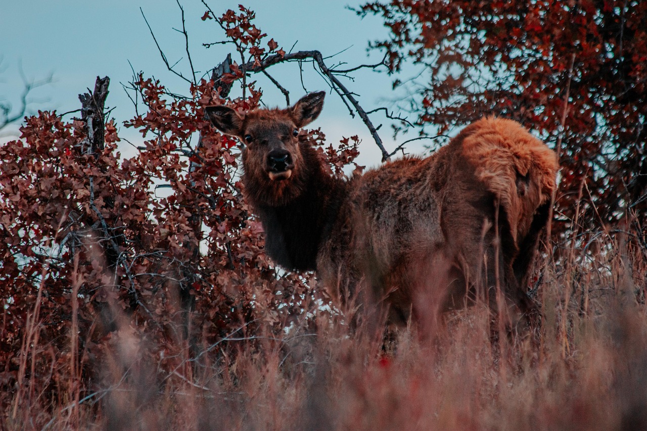
- Wildlife and livestock: open grazing land (“Open Range”) means cattle may stand on the road; if you hit one, you may be liable. Watch out for deer and elk at dusk.
- Heat: in July and August temperatures in the John Day Valley and on the Deschutes often exceed 35 °C. Schedule hikes in the fossil units for early morning, and check coolant, tyres and brakes before steep descents.
- Wildfire and smoke: every summer in recent years, large fires have burned in central and eastern Oregon, in 2026 also at the Painted Hills and along the US-26; check fire damage to trails and campgrounds on site or on nps.gov and the forest service websites. Roads can be closed without warning; always follow evacuation levels (Level 1–3). Check TripCheck and the fire maps daily.
- Winter: Ochoco Pass, Dixie Pass and Long Creek Mountain can be icy from October to April; chain requirements are signposted. Many forest campgrounds close in autumn.
- Emergency: 911. There is no mobile signal on long stretches of the OR-19, OR-218, OR-402 and the US-395 – download offline maps and leave your travel plan with someone.
CampingSpirit packing & preparation checklist
- Extra water jerrycans (at least 40 litres): many sites have no drinking water, and the towns are hours apart.
- Spare fuel can or at least a strict fuelling plan: the gaps between Baker City and Maupin are long, and small filling stations close early.
- Fire extinguisher and shovel: often required or strongly recommended on BLM and forest land in fire season, and sparks from exhausts or generators in dry grass are the most common cause of fires.
- FFP2 masks and a 12-volt air purifier: wildfire smoke can hang in the John Day Valley for days.
- Satellite communicator (e.g. an emergency messenger) and offline maps with a land-ownership layer: without mobile signal the only connection, and the map shows where public land ends.
- Sunshade or reflective window covers: on the shadeless BLM sites on the Deschutes the vehicle heats up strongly in summer.
As of 2026-10. Closures, fees and booking rules change: check official sources before you go.