


In-depth guide · CampingSpirit
From Pitlochry over the Drumochter Pass to Aviemore, along the Spey to the distilleries of Aberlour and Dufftown, over the Lecht and the Cairnwell to Braemar and down the Dee to the cliffs of Dunnottar: just under 400 kilometres across Scotland’s largest national park.
The spirit of the route
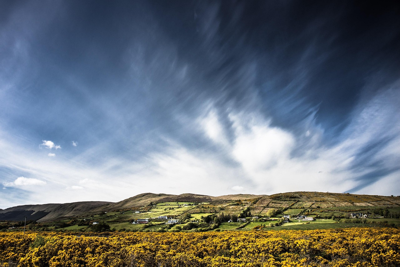
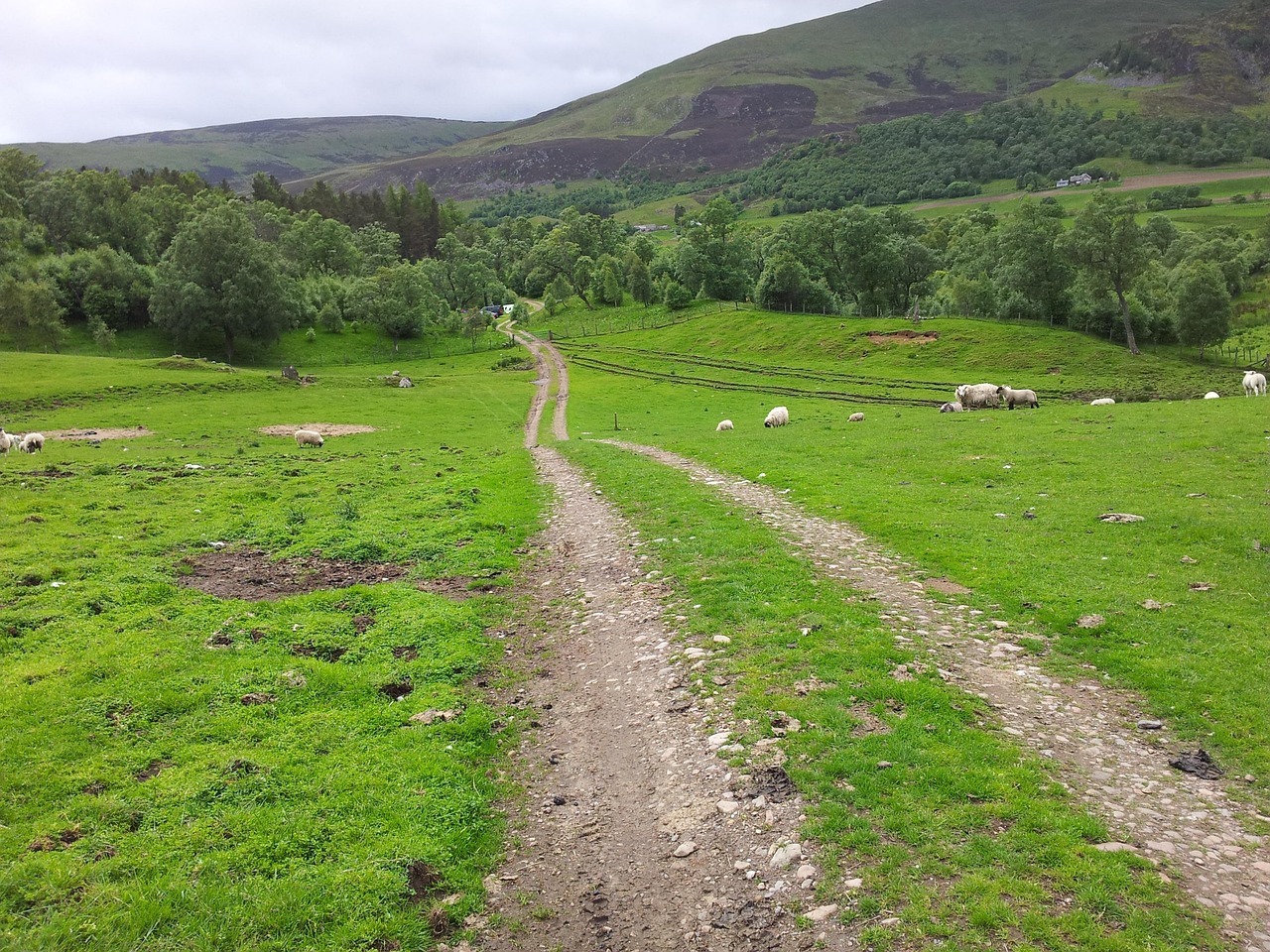
This route runs through Scotland’s interior, where the west-coast rain has been wrung out and the landscape becomes wider, drier and colder. Beyond Pitlochry the A9 climbs into the bare uplands of Drumochter, then in Strathspey old Scots pines with reddish bark stand in the heather, and above Loch Morlich lies the Cairngorm plateau, where snowfields often linger into June. Along the Spey the air smells of malt and peat smoke, the pagoda roofs of old maltings rise out of the birches, and salmon anglers stand waist-deep in the brown water. Then the Snow Roads: snow poles at the roadside, ski lifts standing silent in the heather in summer, snow gates that close in winter. From the sliding door you see grouse, red deer in the evening light and granite castles. At the end the land drops away to the North Sea, and Dunnottar stands on its rock above the surf.
Stage-by-stage plan
1Stage 1: Pitlochry to Blair Atholl (approx. 30 km)
- The drive
- From Pitlochry take the B8019 along Loch Tummel to Queen’s View and back, then the old road (B8079) through the Pass of Killiecrankie to Blair Atholl. The B8019 is two-lane but narrow, winding and lined with walls and trees; oncoming coaches call for patience. Around an hour’s driving without stops.
- Highlights & must-sees
- Pitlochry Dam with fish ladder: between spring and autumn salmon climb the chambers beside the hydro-electric station, and the visitor centre explains the Highlands’ hydro network.
- Queen’s View over Loch Tummel, looking west to the cone of Schiehallion – often with mist over the water in the morning.
- Pass of Killiecrankie with the National Trust for Scotland visitor centre and the Soldier’s Leap over the Garry, scene of the Jacobite battle of 1689.
- CampingSpirit overnight tip
-
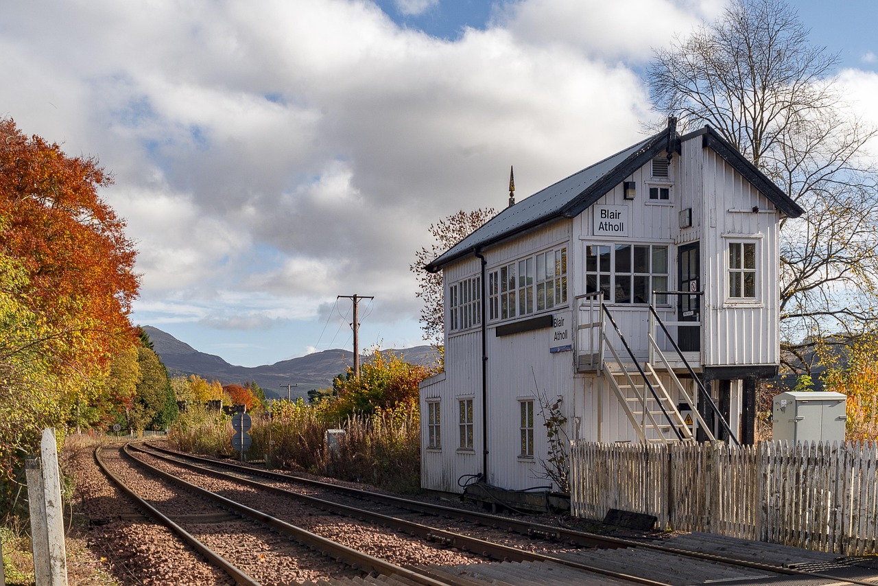
Official campsite or RV park: Blair Castle Caravan Park in Blair Atholl, set in the grounds of the white castle of the Dukes of Atholl: a large site with electric hook-ups, toilets and showers, fresh water and waste disposal, a few steps from the village and the railway. Alternatives are River Tilt Park on the edge of the village, or in Pitlochry Milton of Fonab Caravan Park on the Tummel and Faskally Caravan Park north of the town. Check opening seasons in advance; many sites close in late autumn.
Free camping or nature tip (where legal): The Scottish Outdoor Access Code permits tent camping, but explicitly does not apply to motorhomes, campervans or roof tents. The car parks at Queen’s View and Killiecrankie are for day use; overnight stays are not intended there. Plan your first night on a site.
- Insider tip for campers
- Pitlochry’s main street is narrow and busy in summer – park on the edge of town and walk; a footpath (around 4 km) leads from town to the small Edradour distillery. Fill up in Pitlochry before moving on: there are only a few filling stations along the A9 as far as Aviemore.
2Stage 2: Blair Atholl to Aviemore (approx. 80 km)
- The drive
- Take the A9 up Glen Garry to the Drumochter Pass (around 460 m), the highest point on the Perth–Inverness road, then down to Dalwhinnie and through Badenoch via Newtonmore and Kingussie to Aviemore. The A9 alternates between dual-carriageway and single-carriageway sections, and risky overtaking is common on the two-way stretches. Section-control cameras enforce average speeds. A good hour’s pure driving time.
- Highlights & must-sees
- Dalwhinnie: distillery with whitewashed buildings in one of the coldest settlements in Britain, right on the A889.
- Highland Folk Museum near Newtonmore: open-air museum with reconstructed turf houses and an 18th-century township.
- Ruthven Barracks: ruin of a government barracks from the Jacobite risings on a hill opposite Kingussie, floodlit at night.
- CampingSpirit overnight tip
-
Official campsite or RV park: In and around Aviemore: Rothiemurchus Camp and Caravan Park near Coylumbridge in the pine forest, Dalraddy Holiday Park south of town (hook-ups, water and waste disposal, toilets and showers) or Glenmore Camp Site right on Loch Morlich. According to Visit Cairngorms, the Cairngorm Mountain Motorhome Site above Glenmore has 45 pitches with fresh water, grey-water and chemical-toilet disposal, but no showers or toilets; it is only for vehicles with an on-board toilet, access is by code and booking is required. Kingussie also has a small aire with hardstanding pitches.
Free camping or nature tip (where legal): The national park authority allows overnight stays in roadside lay-bys where no signs prohibit it, but without camping behaviour: no awning, no chairs, nothing outside the vehicle, move on after one night. The old A9 lay-bys are noisy and sit beside a very busy road – a site in Aviemore is the better choice. In forest and walkers’ car parks, overnight stays are only allowed with the landowner’s permission.
- Insider tip for campers
- Upgrading the A9 to dual carriageway all the way is taking years; expect roadworks and traffic lights and check the current situation with Traffic Scotland. Aviemore has supermarkets and filling stations – stock up here for the next few days, as the choice in Tomintoul and Braemar is limited.
3Stage 3: Aviemore to Grantown-on-Spey via Glenmore (approx. 50 km)
- The drive
- From Aviemore take the Ski Road via Coylumbridge to Loch Morlich and up to the base station on Cairn Gorm, then back to Aviemore and via Boat of Garten and Nethy Bridge (B970) along the east bank of the Spey to Grantown. The Ski Road is well built but steep at the top; the B970 is narrow and winding. Around 1.5 hours without stops.
- Highlights & must-sees
- Loch Morlich with its sandy beach and view of the Cairngorm plateau, at its stillest in the early morning.
- Loch an Eilein in Rothiemurchus forest: a circular walk (around 5 km) round the loch, with a ruined castle on its island; pay car park at the estate entrance.
- RSPB Loch Garten Nature Centre near Nethy Bridge: osprey watching in the Abernethy pine forest in spring and summer (the nest is also on a live camera), plus red squirrels at the feeders; the rare capercaillie also lives in the pine forest. Check opening times in advance.
- CampingSpirit overnight tip
-
Official campsite or RV park: Grantown-on-Spey Caravan Park on the northern edge of town: hook-ups, toilets and showers, water and waste disposal, a few minutes’ walk from the Georgian centre. Along the way, according to Visit Cairngorms, the Castle Roy Trust near Nethy Bridge offers three motorhome pitches without facilities beside the ruin of Castle Roy, in return for a donation.
Free camping or nature tip (where legal): Around Glenmore and Loch Morlich, the car parks mostly belong to Forestry and Land Scotland and the Cairngorm estate; they are intended for day use and some are pay-and-display; where signs say “no overnight parking”, that applies. There is a campsite right on the shore of Loch Morlich – use it instead of the beach car parks.
- Insider tip for campers
- The funicular up Cairn Gorm is running again after years of repairs, but closes for a few days of maintenance each spring and autumn; check operation with Cairngorm Mountain in advance, and it does not run in gales. The base station is at around 630 m – the weather on the plateau is arctic, and even in summer wind and cold are dangerous. From Aviemore station the Strathspey Railway heritage line runs to Boat of Garten and Broomhill.
4Stage 4: Grantown-on-Spey to Dufftown via Aberlour (approx. 45 km)
- The drive
- Take the A95 down the Spey via Cromdale and Ballindalloch to Aberlour, on to Craigellachie and up the A941 to Dufftown. A wide, well-built main road with long straights through pasture and birch woods, narrow in the centre of Aberlour. Under an hour’s pure driving time – the day is shaped by the distillery visits.
- Highlights & must-sees
- Craigellachie Bridge: Thomas Telford’s cast-iron arch bridge over the Spey from 1814, best seen from the riverbank below the A941.
- Aberlour: distillery on the Lour Burn, riverside park on the Spey and the Speyside Way, which here follows the old railway line along the river.
- Dufftown, with Glenfiddich and Balvenie on the edge of town and the ruin of Balvenie Castle; the town calls itself the malt whisky capital.
- CampingSpirit overnight tip
-
Official campsite or RV park: Aberlour Gardens Camping Park between Aberlour and Craigellachie: hook-ups, toilets and showers, water and waste disposal in a former estate walled garden. Ask about access and length limits in advance. Dufftown itself has no large campsite – plan the night in Aberlour and drive the 7 kilometres to Dufftown in the morning.
Free camping or nature tip (where legal): Distillery car parks are for customers and off limits at night, as are A95 lay-bys with no-overnight signs. Some farms in Speyside host motorhomes through networks such as Brit Stops; check the conditions when booking.
- Insider tip for campers
- In Scotland the drink-drive limit is 0.5 per mille – even one tasting glass can be too much. Many distilleries give drivers their tasting measures in small bottles to take away (“driver’s dram”). Book tours in advance in summer and at weekends; some distilleries close in winter or open only on a few days.
5Stage 5: Dufftown to Tomintoul via Glenlivet (approx. 35 km)
- The drive
- From Dufftown take the B9009 south-west through rolling grassland into the valley of the Livet, then the B9008 past The Glenlivet distillery to Tomintoul. Narrow but two-lane minor roads with crests and cattle grids; livestock may be on the road. Just under an hour.
- Highlights & must-sees
- The Glenlivet: distillery on the site of the first legal licence in the glen, with a visitor centre looking out over the upland valley.
- Glenlivet Estate: waymarked walking and cycling trails through the glens, for example to the old smugglers’ routes and the ruin of Blairfindy Castle.
- Tomintoul: one of the highest villages in the Highlands, an 18th-century planned village with a square and the Discovery Centre.
- CampingSpirit overnight tip
-
Official campsite or RV park: Tomintoul Bowling Club Caravan Site on the edge of the village: according to Visit Cairngorms, eight pitches with toilet, fresh water and electricity, open all year, but no waste disposal – empty your cassette and grey water beforehand in Aberlour. Book at busy times. Next to it are the Glenlivet Wigwams with wooden cabins.
Free camping or nature tip (where legal): Tomintoul and Glenlivet have some of the darkest skies in Britain, and the temptation to park up somewhere out in the open is strong. On the estate’s walkers’ car parks, however, the rule is: overnight only with the landowner’s permission, observe the signs, no fires.
- Insider tip for campers
- Tomintoul and Glenlivet are part of the Cairngorms Dark Sky Park: moonless nights in autumn and winter are best for the stars and the Milky Way, while in high summer it hardly gets dark. Bring a red-light head torch. Fuel is scarce in the uplands – arrive with a full tank.
6Stage 6: Tomintoul to Braemar via the Lecht (approx. 50 km)
- The drive
- Take the A939 over the Lecht (around 640 m) to Cock Bridge, then via Gairnshiel and the B976 to Crathie and up the Dee on the A93 to Braemar. The Lecht is the notorious section of the Snow Roads: steep ramps (up to 20 % on the south side), crests, bends and snow gates at both ends. Beyond Cock Bridge the road narrows, and Gairnshiel Bridge is a tight, humpbacked stone bridge. Around 1.5 hours.
- Highlights & must-sees
- Well of the Lecht: spring with an inscription from 1754 and the ruin of an old iron and manganese mine at the foot of the pass road.
- Corgarff Castle: white tower house with a star-shaped wall, a government garrison after 1745 and in the 19th century a base against whisky smugglers, Historic Environment Scotland.
- Crathie Kirk and the approach to Balmoral, the royal family’s summer residence; grounds and exhibition open only in the summer months.
- CampingSpirit overnight tip
-
Official campsite or RV park: Braemar Caravan Park on the southern edge of the village: hook-ups, toilets and showers, water and waste disposal, camping pods; according to Visit Cairngorms, non-guests may use the disposal point for a small fee. For the Braemar Gathering on the first Saturday in September everything is booked up well in advance.
Free camping or nature tip (where legal): According to Visit Cairngorms, the estate offered an overnight ticket without facilities at the Balmoral car park on the A93 – check on site whether this still applies. Do not stay overnight on the Lecht or in the ski-area car parks without permission. Throughout the national park, from 1 April to 30 September, campfires and charcoal barbecues (including fire pits) are banned outside registered campsites, with fines of up to £500; gas, spirit and liquid-fuel stoves are allowed, wood and charcoal stoves are not.
- Insider tip for campers
- With a heavy vehicle the ramp from Cock Bridge up to the Lecht is the real test: start from Tomintoul so that you drive the steepest section downhill, in a low gear without riding the brakes. When the snow gates are closed there is no short detour – the alternative runs via Grantown, the A9 and Perth or via Huntly and Aberdeen, several hours.
7Stage 7: Braemar to Ballater via the Cairnwell (approx. 57 km)
- The drive
- From Braemar take the A93 through Glen Clunie up to the Cairnwell Pass (around 670 m), the highest point on any main road in Britain, and the Glenshee ski area; then back to Braemar and down the Dee via Crathie to Ballater. The A93 is wide and well built at the Cairnwell, and the old Devil’s Elbow hairpin has been bypassed. A good hour’s pure driving time.
- Highlights & must-sees
- Cairnwell Pass and Glenshee Ski Centre: in summer the Cairnwell chairlift runs when the weather allows; walk along the ridge with views of Lochnagar and the slopes of Glen Clunie.
- Devil’s Elbow: the old, narrow double bend south of the pass, today a footpath beside the new alignment.
- Braemar Castle and the village hill Creag Choinnich (a short, steep climb with views over the village and upper Deeside).
- CampingSpirit overnight tip
-
Official campsite or RV park: Ballater Caravan Park on the Dee, a few minutes’ walk from the centre. The site was flooded by Storm Frank in 2015 and has since been restored; check facilities and season in advance. At Glenshee Ski Centre there are overnight pitches for motorhomes near the café and toilets, with electric hook-ups and for a fee (no tents or caravans) – an option if you want to spend the night up high.
Free camping or nature tip (where legal): Around Braemar much of the land belongs to estates such as Mar Lodge (National Trust for Scotland) and Invercauld; car parks such as the one at the Linn of Dee are intended for day visitors. A93 lay-bys are only an option for one night where there is no prohibition sign and without camping behaviour.
- Insider tip for campers
- Ballater is the last good place to shop before Banchory; park on the edge of the village, as the streets in the centre are narrow. The Old Royal Station, where Queen Victoria alighted on her way to Balmoral, has been rebuilt after a fire. For the detour to the Linn of Dee (west of Braemar, single-track) allow around 20 extra kilometres.
8Stage 8: Ballater to Stonehaven via Banchory (approx. 52 km)
- The drive
- Take the A93 down the Dee via Dinnet, Aboyne and Kincardine O’Neil to Banchory, then the A957 (“Slug Road”) over the ridge to the coast at Stonehaven. The A93 is wide and well built; the Slug Road is two-lane with crests and bends. A good hour’s pure driving time; Dunnottar Castle is 3 kilometres south of Stonehaven.
- Highlights & must-sees
- Burn o’ Vat in the Muir of Dinnet: a scoured-out granite cauldron, reached through a gap along the burn, a short walk from the visitor centre.
- Falls of Feugh near Banchory: in autumn salmon leap the rapids below the bridge; Crathes Castle (National Trust for Scotland) is a short way east.
- Dunnottar Castle on a rock above the North Sea, reachable only by steps; the coastal path from Stonehaven takes around an hour.
- CampingSpirit overnight tip
-
Official campsite or RV park: Queen Elizabeth Park Caravan and Motorhome Club Site in Stonehaven, close to the beach, harbour and open-air pool, with hook-ups, toilets and showers, water and waste disposal. South of town is Upper Crawton Park, a small Camping and Caravanning Club site within sight of the coast; near Banchory there are several sites, such as Silverbank (Caravan and Motorhome Club) and Banchory Lodge Caravan Park.
Free camping or nature tip (where legal): The Dunnottar Castle car park is for day visitors; overnight stays are not permitted there. Stonehaven has car parks along the seafront, but check the overnight rules on the signs on site – a campsite is usually the safe choice.
- Insider tip for campers
- In Stonehaven don’t drive through the narrow harbour area; park at the beach car park and walk to the harbour and the fish and chips. If you are continuing to Aberdeen: a Low Emission Zone applies in the city centre (petrol from Euro 4, diesel from Euro 6), including for foreign vehicles.
Camping practice & local rules
Wild camping & overnight parking
- The Scottish Outdoor Access Code (Land Reform (Scotland) Act 2003) grants a broad right of access that includes tent camping – according to the national park authority, it does not apply to motorhomes, campervans or roof tents. Vehicles may only stay overnight where parking is permitted and no sign prohibits it; forest and walkers’ car parks only with the landowner’s permission.
- The Cairngorms National Park Authority explicitly asks: in lay-bys stay inside the vehicle only, with no awning, table, chairs or cooking outside, move on after one night, and never park in passing places, in front of gates or at field entrances. Camping Management Zones requiring a permit exist in Loch Lomond & The Trossachs National Park, not in the Cairngorms; here instead a byelaw bans campfires and charcoal barbecues from 1 April to 30 September outside registered campsites.
- Legal alternatives: campsites, the club sites (Caravan and Motorhome Club, Camping and Caravanning Club), aires such as those in Kingussie, Tomintoul or at the Cairngorm Mountain Motorhome Site, farm stops via Brit Stops and selected forest car parks in Forestry and Land Scotland’s “Stay the Night” scheme. The national park authority maintains an online map of sites, overnight car parks, disposal points and toilets. park4night and Campercontact are also useful.
Waste disposal & supplies
- Waste disposal here means an Elsan or Chemical Disposal Point (CDP). Public stations are rare; most are on campsites, and some – in Braemar, for example – are open to passing vehicles for a fee. Never empty grey water onto the ground, into ditches or drains, and do not empty cassettes into public toilets.
- Tap water is drinkable; British taps have different threads, and a hose kit with a universal adapter saves trouble. Hook-up bollards use blue CEE plugs; long cables are helpful on small sites.
- Gas: Calor Gas and Campingaz cylinders dominate in the United Kingdom; German cylinders are not exchanged or refilled. Autogas (LPG) is available at some filling stations, but rarely in the uplands – fill up in the lowlands before the route. Arrive with full cylinders and declare gas on the ferry or Eurotunnel; the operators have their own quantity limits.
Vehicle size & traffic rules
- Entry: Great Britain is not part of the EU. EU citizens need a passport and an Electronic Travel Authorisation (ETA), which has cost £20 since 8 April 2026 and is usually valid for two years. Carry the registration document and proof of insurance, and check the details on the Green Card with your insurer. Do not bring meat or dairy products from the EU; microchip, vaccination and certificate rules apply to dogs and cats – check in advance at gov.uk.
- Driving on the left: roundabouts go clockwise, with priority for traffic from the right. On single-track roads, such as the one to the Linn of Dee, use passing places on the left or wait opposite them. Tape or adjust your headlights for driving on the left. Section-control cameras are installed on the A9.
- Speed limits in mph: motorhomes up to 3.05 t unladen weight 60 mph (around 96 km/h) on single-carriageway roads, 70 mph on dual carriageways and motorways; heavier motorhomes 50 mph, 60 mph and 70 mph on motorways; vehicles towing a caravan 50 mph and 60 mph. In built-up areas usually 30 mph, increasingly 20 mph in residential areas. Dimensions for UK-registered motorhomes: maximum 12 m long, 2.55 m wide; no fixed height limit, but above 3 m a height notice in the cab is mandatory.
- Alcohol: in Scotland 0.5 per mille (50 mg per 100 ml of blood), stricter than in England. Mobile phones only hands-free. There are no tolls on this route; Low Emission Zones exist in Aberdeen, Dundee, Edinburgh and Glasgow. No overnight tax (visitor levy) is currently charged along this route; Highland and Perth and Kinross are planning one – check before you travel.
- Winter: the Snow Roads over the Lecht (A939) and the Cairnwell (A93) have snow gates that close in snow and ice, sometimes for days; check the current situation with Traffic Scotland. Winter tyres are not compulsory but are strongly recommended on these passes from November to April; carry snow chains. Many campsites close from November to March.
CampingSpirit packing & preparation checklist
- All-season or winter tyres and snow chains from October: the Lecht and the Cairnwell are among the highest roads in Britain, and snow is possible there as early as autumn.
- Midge net and repellent (Smidge or similar): from June to September the midges bite on still evenings at Loch Morlich and along the Spey.
- Small bottles or sample bottles for the “driver’s dram” at the distilleries – it is only drunk once you are on the site.
- Binoculars for ospreys at Loch Garten, red deer in Glen Clunie and salmon at the Falls of Feugh.
- Windproof layers, hat and gloves: on the Cairngorm plateau gales and temperatures around freezing occur even in summer.
- Red-light head torch and star chart for the Dark Sky Park around Tomintoul.
As of 2026-10. Closures, fees and booking rules change: check official sources before you go.