In-depth guide · CampingSpirit
From Plymouth across the Cape Cod Canal to the tip at Provincetown, by ferry to Martha’s Vineyard and then right across Massachusetts to Mount Greylock: around 700 kilometres between the Atlantic coast and upland forest.
The spirit of the route
Cape Cod is a curved arm of sand, and when you drive it in a camper you feel the land narrowing with every kilometre. Beyond the canal the air smells of pine resin and salt marsh; along Route 6A stand shingled houses of grey cedar, cranberry bogs and antique shops. On the outer side of the peninsula the Atlantic breaks against sand cliffs topped by lighthouses that have already had to be moved inland once. In the morning at the campground in the pine woods of Nickerson you hear bicycles on the Rail Trail; in the evening the sun hangs over Cape Cod Bay. Then the break: heading west, Route 2 climbs as the Mohawk Trail out of the Connecticut Valley into the hills, until at the Hairpin Turn the view opens over North Adams and the Berkshires. Sea and uplands in one week, linked by everyday New England small-town life.
Stage-by-stage plan
1Stage 1: Plymouth to Sandwich (Cape Cod Canal) (approx. 40 km)
- The drive
- From Plymouth south on Route 3 through pine and oak woods to the canal, then over the Sagamore Bridge onto the peninsula and along Route 6A to Sandwich. Route 3 is a four-lane road; the Sagamore Bridge has four narrow lanes with no shoulder, and on summer weekends traffic backs up here for kilometres. Driving time under an hour; with detours into Myles Standish State Forest, half a day. Fuel stations and supermarkets in Plymouth and along Route 3.
- Highlights & must-sees
- Plymouth: at the harbour you’ll find Plymouth Rock beneath its colonnaded portico and the replica Mayflower II; south of town the open-air museum Plimoth Patuxet shows the life of the settlers of 1627 and of the Wampanoag. Parking at the harbour is tight for large vehicles; check opening hours and admission in advance.
- Myles Standish State Forest between Plymouth and Carver: one of the largest forests in south-eastern Massachusetts, a pine barrens plain with dozens of crystal-clear kettle ponds and cycling and bridle paths. A good first stop after flying into Boston.
- Cape Cod Canal at Sandwich: paved US Army Corps of Engineers service roads run along both banks and serve as cycling and walking paths; from them you can watch freighters and tugs working against the current. At its eastern end near Scusset Beach the canal opens into Cape Cod Bay.
- CampingSpirit overnight tip
-
Official campsite or RV park: Scusset Beach State Reservation on the north bank of the canal in Sandwich: campground close to the beach and the canal mouth, with sites for RVs, toilets and showers and a dump station; check hookups and site lengths when booking. Alternatively Shawme-Crowell State Forest in Sandwich: a large campground in pine woods, no hookups, with showers. For the first night, Myles Standish State Forest has several camping areas by its ponds (no hookups). Book all three through ReserveAmerica.
Free camping or nature tip (where legal): Massachusetts has no dispersed camping on state land; in state forests you may only stay overnight at designated sites. The parking areas along the canal and at the Sandwich beaches are closed to overnight stays.
- Insider tip for campers
- Replacement of the canal bridges: MassDOT is preparing to rebuild the Sagamore Bridge (permits, procurement); according to the 2026 schedule, actual construction is not due to start until around 2031, and funding for the Bourne Bridge is still open. Lane closures for maintenance can nevertheless happen at any time; check the current status on mass.gov (Cape Cod Bridges Program). Avoid the bridges on Friday afternoons heading onto the Cape and on Sundays heading back to the mainland.
2Stage 2: Sandwich to Brewster (Nickerson State Park) (approx. 50 km)
- The drive
- Instead of the fast Mid-Cape Highway (Route 6), take Route 6A, the Old King’s Highway, east through Barnstable, Yarmouth Port and Dennis to Brewster. The road is two-lane, narrow and winding, lined with stone walls, trees and mailboxes; speeds mostly 30–40 mph. Driving time around 1.5 hours. Fuel stations are more likely on Route 6 and Route 28 than on 6A.
- Highlights & must-sees
- Sandwich: the oldest town on Cape Cod, with a mill pond, the Dexter Grist Mill and the Sandwich Glass Museum; the boardwalk leads across the salt marshes to Town Neck Beach.
- Old King’s Highway: a historic district of sea captains’ houses, churches and salt marshes; near Barnstable the views open across the Great Marshes to Sandy Neck.
- Cape Cod Rail Trail: a former railway line, around 40 kilometres of paved trail from Dennis via Brewster, Orleans and Eastham to Wellfleet. The trail runs right through Nickerson State Park; bike hire is available in Brewster and at other access points.
- CampingSpirit overnight tip
-
Official campsite or RV park: Nickerson State Park in Brewster: one of the largest campgrounds in New England, spread across seven camping areas in pine woods around the kettle ponds Flax Pond and Cliff Pond; showers, toilets, dump station, no electric or water hookups at the sites. Swimming spots and boat hire on the ponds. Sites book out early in summer; when booking on ReserveAmerica check site length and surface, as some sites are short or sloping.
Free camping or nature tip (where legal): The towns on Cape Cod almost universally prohibit overnight stays in beach, harbour and town car parks; in many places parking is banned from around midnight until morning, and tickets are issued consistently at beach car parks. Free camping is not a realistic option here.
- Insider tip for campers
- At Nickerson State Park, leave the vehicle where it is and use the Rail Trail by bike: you can reach Orleans and Eastham without hunting for parking. In Brewster the bay beaches dry out far into the distance at low tide (Brewster Flats); check the tide table.
3Stage 3: Brewster to Wellfleet (approx. 45 km)
- The drive
- Via Orleans onto Route 6, which from here on is the main road north through the Outer Cape, with detours to the beaches and lighthouses of Cape Cod National Seashore. Route 6 is two-lane and busy in summer; the side roads to the beaches are narrow. Driving time around an hour, a full day with stops. Fuel stations and supermarkets in Orleans and Eastham.
- Highlights & must-sees
- Salt Pond Visitor Center in Eastham: information centre for Cape Cod National Seashore with exhibits on geology and history; paths lead from here to Nauset Marsh and Coast Guard Beach.
- Nauset Light and the Three Sisters in Eastham: the red-and-white lighthouse was moved back from the eroding cliff in 1996; the three small wooden towers of the Three Sisters stand in a clearing nearby.
- Marconi Station Site in Wellfleet: from here Guglielmo Marconi sent a wireless message from the USA to England in 1903; viewing platform on the cliff and the short Atlantic White Cedar Swamp Trail on boardwalks through a white cedar swamp.
- CampingSpirit overnight tip
-
Official campsite or RV park: Wellfleet Hollow State Campground in Wellfleet: Massachusetts DCR campground in pine and oak woods, close to the Rail Trail and Wellfleet Bay; toilets and showers, some sites for RVs; check facilities, hookups and lengths when booking on ReserveAmerica. Cape Cod National Seashore itself has no campgrounds for vehicles.
Free camping or nature tip (where legal): In the National Seashore, overnight stays in car parks and on beaches are prohibited, and rangers patrol. The beach car parks close at night; during the day in summer a parking fee is charged per vehicle (day or season pass); check current amounts on nps.gov.
- Insider tip for campers
- The Seashore’s beach car parks (Coast Guard, Nauset Light, Marconi) are full by late morning on sunny summer days; arrive with your camper before 9 am, or for Coast Guard Beach use the shuttle from the Little Creek Parking Area. If you want to watch the sun set over the bay in the evening, head to Wellfleet harbour.
4Stage 4: Wellfleet to Provincetown (approx. 35 km)
- The drive
- North on Route 6 via Truro, through dunes and pine heath to the tip of Cape Cod; Route 6A runs parallel along the bay, with views of beach cottages and Pilgrim Lake. A short, flat stage, driving time around 40 minutes. Fuel stations in Wellfleet and Truro; in Provincetown the streets in the centre are narrow and unsuitable for RVs.
- Highlights & must-sees
- Highland Light (Cape Cod Light) in North Truro: the first lighthouse site on Cape Cod (1797); the present tower of 1857 was also moved back from the cliff in 1996; next to it is the Highland House Museum. Tower tours are seasonal; check dates in advance.
- Province Lands: shifting dunes, pine woods and boggy ponds at the northern end of the Seashore; the Province Lands Visitor Center has a viewing platform over the dunes, with Race Point Beach directly behind. A cycle path (Province Lands Bike Trail) loops through the dunes.
- Provincetown: a fishing and artists’ town with the Pilgrim Monument, Commercial Street and MacMillan Pier; the Pilgrims first landed here in 1620 before moving on to Plymouth.
- CampingSpirit overnight tip
-
Official campsite or RV park: Provincetown and North Truro have only private campgrounds; check availability, hookups and lengths with the operators in advance. Many campers stay a second night at Wellfleet Hollow State Campground and visit Provincetown as a day trip.
Free camping or nature tip (where legal): Provincetown does not allow sleeping in vehicles on streets or in public car parks. The dunes and beaches of the Province Lands are a protected area; overnight stays are only possible for holders of a special permit for off-road vehicles (Oversand Permit) on certain stretches of beach, which does not cover RVs in the usual sense.
- Insider tip for campers
- Parking an RV: there are hardly any spaces for large vehicles in central Provincetown; the large town car parks (including at MacMillan Pier) charge fees and fill up early in summer; ask the town’s parking department beforehand whether and where RVs may park. It is better to leave the camper in Truro or Wellfleet and come to Provincetown by bike, by Cape Cod Regional Transit Authority bus or, in summer, by ferry from Boston/Plymouth. Check current parking rules on the town’s website.
5Stage 5: Wellfleet to Woods Hole (Falmouth) (approx. 100 km)
- The drive
- Back west on Route 6 to the Route 28 exit and via Mashpee to Falmouth and Woods Hole. Route 6 is two-lane between Orleans and Dennis and four-lane west of there; on Route 28 and in Falmouth traffic crawls through many traffic lights and roundabouts. Driving time around 1.5–2 hours. Plenty of fuel stations along Route 28.
- Highlights & must-sees
- Woods Hole: a small harbour village at the south-western end of Cape Cod with the Woods Hole Oceanographic Institution, the ferry terminal for Martha’s Vineyard and a drawbridge over Eel Pond.
- Nobska Light: lighthouse on a rise above Vineyard Sound between Falmouth and Woods Hole; the access road is narrow and the car park small.
- Shining Sea Bikeway: cycle path on an old railway line from North Falmouth via Falmouth to the ferry terminal in Woods Hole, partly along the coast.
- CampingSpirit overnight tip
-
Official campsite or RV park: There are no state campgrounds around Falmouth; Shawme-Crowell State Forest in Sandwich (around 30 kilometres) is the nearest public campground. Martha’s Vineyard has only a single campground, the private Martha’s Vineyard Family Campground near Vineyard Haven (sold to a new operator in 2026; check name, season and RV sites in advance); if you want to take your camper across, book it together with the ferry well ahead.
Free camping or nature tip (where legal): On Martha’s Vineyard and in Falmouth, sleeping in a vehicle outside campgrounds is not permitted; on the island this is strictly enforced. The ferry company’s car parks are not meant for overnight stays either.
- Insider tip for campers
- Martha’s Vineyard ferry: the Steamship Authority sails year-round from Woods Hole to Vineyard Haven (in summer also to Oak Bluffs). Vehicle spaces should be reserved and are often taken months ahead for summer; reservations open early in the year. The fare depends on vehicle length; vehicles of 20 ft (around 6 m) and over no longer qualify for the cheaper car rates; give exact dimensions when booking. For a day trip it is simpler and cheaper to leave the vehicle at one of the paid ferry car parks in Falmouth (free shuttle bus to the terminal; check beforehand with the Steamship Authority parking office whether RVs may park there) and use the bus or a bike on the island.
6Stage 6: Woods Hole to Charlemont (Mohawk Trail) (approx. 275 km)
- The drive
- A long transfer stage: over the Bourne Bridge back to the mainland, north on I-495 and from Littleton west on Route 2 via Fitchburg, Athol and Greenfield. From Greenfield the best-known section of the Mohawk Trail begins: Route 2 follows the Deerfield River through a narrow wooded valley to Shelburne Falls and Charlemont. Built almost to motorway standard as far as Greenfield, two-lane and winding after that. Driving time around 3.5–4 hours. Fuel stations in Greenfield; fewer west of there.
- Highlights & must-sees
- Shelburne Falls: a twin village on the Deerfield River with the Bridge of Flowers, a former trolley bridge planted from spring to autumn, and the Glacial Potholes, swirl holes scoured into the granite by the river below the dam.
- Mohawk Trail: opened in 1914 as one of the first scenic tourist roads in New England, it follows an old trail of the Indigenous people; along the way there are viewpoints, 1920s-style gift shops and riverside rest areas.
- Deerfield River near Charlemont: when water is released from the dams, the river becomes a destination for rafting and tubing; swimming spots and picnic areas along Route 2.
- CampingSpirit overnight tip
-
Official campsite or RV park: Mohawk Trail State Forest in Charlemont: campground right on Route 2 by the Cold River, in mixed woodland beneath steep slopes, with toilets and showers; check hookups and vehicle lengths when booking on ReserveAmerica, as large RVs only fit on some of the sites. Alternatively Savoy Mountain State Forest (campground by a pond on the plateau south of Route 2, accessed via steep minor roads).
Free camping or nature tip (where legal): Western Massachusetts is no different: overnight stays only at designated sites, no dispersed camping on state land. Rest areas and viewpoints on Route 2 are not legal places to spend the night.
- Insider tip for campers
- The stretch of Route 2 between Littleton and Greenfield has few sights: make use of the driving time and stock up on water, food and fuel in Greenfield. If you spend the evening in Shelburne Falls, you are more likely to find parking for larger vehicles on the edges of the village than on Bridge Street.
7Stage 7: Charlemont to North Adams and Mount Greylock (approx. 50 km)
- The drive
- Continue west on Route 2 via Florida, climbing to Whitcomb Summit and Western Summit, then descending in steep bends to the Hairpin Turn and North Adams. From there to Mount Greylock: from the north via Notch Road or from the south from Lanesborough via Rockwell Road, both narrow and winding; vehicles over 22 ft (around 6.7 m) long are banned from the summit roads. Driving time around 1.5 hours without the summit drive. Fuel stations in North Adams.
- Highlights & must-sees
- Hairpin Turn: a hairpin bend on Route 2 above North Adams with a wide view across the Hoosac Valley to the Taconic Mountains and into Vermont; the gradient and tight bend call for a low gear and great care in heavy vehicles.
- Mount Greylock State Reservation: at around 1,064 metres the highest mountain in Massachusetts; on the summit stand the Veterans War Memorial Tower and Bascom Lodge. The summit roads are only open seasonally (2026: mid-May to the end of October); check opening times on mass.gov.
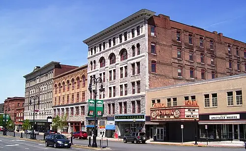
- North Adams: a former mill town with the MASS MoCA art museum in the buildings of a textile mill; east of town lies the west portal of the Hoosac railway tunnel.
- CampingSpirit overnight tip
-
Official campsite or RV park: Clarksburg State Park north of North Adams: campground by a pond near the Vermont border, with toilets and showers; check lengths and facilities when booking. Sperry Road Campground on Mount Greylock is a tent-only campground with no vehicle access (on foot only, roughly late May to early September); RVs cannot stay there. Alternatively, return to Mohawk Trail State Forest.
Free camping or nature tip (where legal): In Mount Greylock State Reservation, overnight stays in car parks and at viewpoints are not permitted; the reservation is only open from dawn to dusk. No dispersed camping.
- Insider tip for campers
- The Mount Greylock summit roads are narrow and steep, with tight bends and few passing places; they are closed to vehicles over 22 ft (around 6.7 m). The Visitor Center on Rockwell Road can be reached by all vehicles; if yours is too long, park there and take a hiking trail or the Appalachian Trail to the summit. Don’t overheat your brakes on the descent at the Hairpin Turn: use a low gear rather than braking continuously.
8Stage 8: North Adams to Lenox and Stockbridge (approx. 70 km)
- The drive
- South on Route 8 through the Hoosac Valley via Adams to Pittsfield, then on Route 7 to Lenox and Stockbridge. The road is two-lane, through small towns and woods, speeds 30–50 mph. Driving time around 1.5 hours. Fuel stations and supermarkets in Pittsfield. The easiest way on to Boston is via I-90 (Mass Pike) from Lee or Stockbridge.
- Highlights & must-sees
- Lenox: a town of Gilded Age “cottages”; The Mount, the estate of the writer Edith Wharton, and Tanglewood, summer home of the Boston Symphony Orchestra, with concerts on the lawn (July and August).
- Stockbridge: a main street with the Red Lion Inn, painted by Norman Rockwell in his picture “Stockbridge Main Street at Christmas”; the Norman Rockwell Museum is on the edge of town.
- Hancock Shaker Village west of Pittsfield: a Shaker museum village with the round stone barn of 1826; seasonal opening times.
- CampingSpirit overnight tip
-
Official campsite or RV park: October Mountain State Forest near Lee: the largest state forest in Massachusetts, with a campground on the Housatonic River, toilets and showers; check hookups and lengths when booking. Alternatively Pittsfield State Forest (camping areas at Berry Pond and Parker Brook) or Beartown State Forest at Benedict Pond near Great Barrington. All via ReserveAmerica.
Free camping or nature tip (where legal): The same rules apply in the Berkshires as in the rest of Massachusetts: no free camping on state land, and the towns do not tolerate overnight stays in town car parks. Use designated sites.
- Insider tip for campers
- During the Tanglewood season and the autumn colours in October, campgrounds in the Berkshires are fully booked at weekends; travel midweek or reserve early. In Stockbridge, don’t park your camper on Main Street; use the car parks on the edge of town instead.
Camping practice & local rules
Wild camping & overnight parking
- Massachusetts has no dispersed camping on state land: in the state forests and state parks of the Department of Conservation and Recreation (DCR) you may only stay overnight at designated, booked sites. Private land is off limits without permission.
- Cape Cod: the towns prohibit overnight stays in beach, harbour and town car parks, and many car parks close at night; in Cape Cod National Seashore sleeping in car parks is prohibited. Enforcement is strict in summer; tickets and towing are possible.
- Reservations: Massachusetts state park campgrounds are booked through ReserveAmerica; the booking window opens up to six months before arrival, so book early for Nickerson, Scusset and Wellfleet Hollow in summer. Many campgrounds have minimum stays at weekends and are closed outside the season; check season dates on mass.gov.
- Ticks and Lyme disease: Massachusetts is among the states with the most cases; deer ticks transmit Lyme disease, babesiosis and anaplasmosis. Tuck long trousers into your socks, use repellent and check yourself after every walk through grass and undergrowth. Poison ivy grows on dunes and woodland edges.
- Wildlife: there are black bears in western Massachusetts; keep food in the vehicle at night. Coyotes are widespread on Cape Cod; grey seals gather at the beaches of the Outer Cape, and with them great white sharks, so heed the swimming notices.
- Apps and websites: Campendium, iOverlander, The Dyrt; for state parks ReserveAmerica and mass.gov, for the National Seashore nps.gov/caco.
Waste disposal & supplies
- Dump stations: Nickerson State Park, Scusset Beach and other DCR campgrounds have dump stations for guests; apps such as Campendium or iOverlander help you find more. On the Outer Cape the choice is limited.
- Tap water in the towns is generally drinkable; many DCR campgrounds have taps but no water hookups at the sites. Fill your tank before you arrive.
- Don’t drain grey water onto the ground or into water bodies; empty chemical toilets only at dump stations. On Cape Cod, with its sensitive kettle ponds and groundwater, this is taken particularly seriously.
- Propane: fuel stations and dealers refill cylinders; European cylinders need an adapter and are usually not filled.
- Fuel: plentiful along Route 28 and Route 6 as far as Orleans, and in Plymouth, Greenfield, North Adams and Pittsfield; less choice and higher prices on the Outer Cape and along the Mohawk Trail.
- Electricity: many state park campgrounds in Massachusetts have no electric hookups; plan for battery, solar or generator quiet hours. Where hookups exist, they are usually 30 or 50 A.
Vehicle size & traffic rules
- Speed limits in mph: interstates and the Mass Pike mostly 65, Route 3 and the Mid-Cape Highway (Route 6) 50–65 depending on the section, two-lane rural roads 40–50, in towns 25–30. RVs are subject to the same posted limits.
- Tolls: I-90 (Massachusetts Turnpike) is tolled electronically (E-ZPass or billing by number plate, Pay by Plate); rental companies often charge a service fee on top. Otherwise there are no tolls on the routes described; the ferry to Martha’s Vineyard is charged.
- Dimensions and height: in the USA the maximum height is usually 13 ft 6 in (approx. 4.1 m); underpasses and parking garages may be lower. Storrow Drive, Soldiers Field Road (Boston) and Memorial Drive (Cambridge) are closed to lorries, buses, moving vans and other oversized vehicles, and some of their bridges are only around 9 ft (2.7 m) high – avoid them in an RV; important if you are setting off from Boston.
- Traffic law: since 2020 Massachusetts has had a strict ban on handheld phones while driving (hands-free only). Turning right on red after a full stop is allowed unless a sign prohibits it; open alcohol containers in the vehicle are prohibited. On roundabouts (rotaries), traffic already on the roundabout has right of way. A German driving licence is usually sufficient; an international one is recommended.
- Parks and fees: in Cape Cod National Seashore parking fees are charged at the beaches in summer; the America the Beautiful Pass is valid there, but not in the state parks. Since 2026, visitors without US residency have in some cases paid higher fees at heavily visited national parks; check current amounts on nps.gov. State park car parks charge day-use fees per vehicle, higher for non-residents.
- Bridges over the Cape Cod Canal: the Sagamore and Bourne bridges are the only road links; replacement of the Sagamore Bridge is not due to begin until around 2031, but lane closures for maintenance occur repeatedly – check the status with MassDOT.
CampingSpirit packing & preparation checklist
- Tick protection kit: repellent with DEET or picaridin, permethrin-treated clothing and tick tweezers – ticks are active on Cape Cod and in the Berkshires from spring to late autumn.
- Bikes with a rack: the Cape Cod Rail Trail, the Province Lands Bike Trail, the Shining Sea Bikeway and the canal paths spare you the search for parking on the peninsula.
- Off-grid equipment (auxiliary battery or solar panel): most state park campgrounds in Massachusetts have no electric hookups.
- Tide table and water shoes: on the bay side wide tidal flats dry out at low tide, and shells and stones are sharp.
- A warm layer and rain jacket: on the Atlantic coast wind and fog cool things down even in summer, and on Mount Greylock it is noticeably colder than in the valley.
- Binoculars: for grey seals at Race Point, whales off Provincetown and the view from the Hairpin Turn.
As of 2026-09. Closures, fees and booking rules change: check official sources before you go.