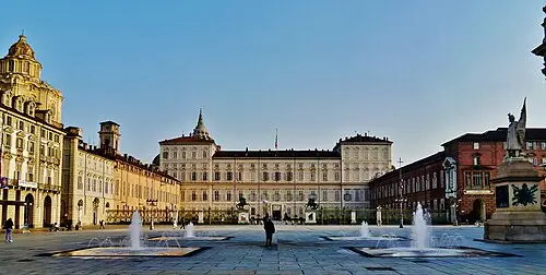
📷 Photo by Luis van den Bos on Unsplash
Langhe and Roero: Barolo country
Truffles, hazelnuts and castle villages on vine-covered hills south of Turin.
- Distance
- approx. 104 km (65 mi)
- Driving
- 1 h 26 min
- Suggested days
- 3
- Stops
- 5
- Countries
- Italy
- Best time to go
- May–June and September–October
- Tolls and vignettes
- ≈ €6
- Updated
- September 7, 2026
At a glance: 3-day road trip of about 104 km (65 mi) with 5 stops, from Turin to Barolo. About 1 h 26 min of driving in total. Best time to go: May–June and September–October. Tolls and vignettes for a car: about €6 (Italy).
More road trips in Italy · More road trips from Ivrea
Photos along the route


Route description
From Turin, head southeast to Asti, a town of medieval towers known for its sparkling wine and for its own Palio horse race. The road then follows the Tanaro valley to Alba, the capital of the Langhe and home of the white truffle.
South of Alba, the SP3 winds up into the Langhe hills, whose villages crowned by castles are surrounded by some of Italy’s most famous vineyards. Viewpoints such as La Morra look over the vine-covered slopes around Barolo, and the Roero hills lie across the Tanaro.
The route ends in Barolo, a small village below its castle, which houses a wine museum. Book tastings ahead in autumn, when the harvest and the truffle season bring the most visitors, and take care on the narrow roads between the vineyards.
Which stops are on Langhe and Roero?
In driving order. Distances are estimates between consecutive stops.
- 1Start
Turin
Italy - 256 km
Asti
Italy - 333 km
Alba
Italy - 415 km
Barolo and the Langhe vineyards
FoodBarolo, ItalyHill villages crowned by castles, surrounded by some of Italy’s most famous vineyards. Book a tasting ahead in autumn.
- 50 km
Barolo
Italy
How do you drive Langhe and Roero in 3 days?
3 days, split by driving time. Campsites from OpenStreetMap: check opening dates before you go.
- Day 1: Turin → Asti · 56 km · 0 h 47 minOvernight nearby, for example: Agripassione (4 km); Camping Umberto Cagni (2 km).
- Day 2: Asti → Alba · 33 km · 0 h 27 minOvernight nearby, for example: Alba Village (3 km); Camping Sole Langhe (13 km).
- Day 3: Alba → Barolo · 15 km · 0 h 13 minOn the way: Barolo and the Langhe vineyards.Overnight nearby, for example: Camping Sole Langhe (2 km); Alba Village (10 km).
When is the best time for Langhe and Roero?
The most pleasant months are usually May–June and September–October. Still fine, with some compromises, in April and July–August. July and August are the busiest months: book campsites early.
Estimate from long-term temperature averages, terrain and pass seasons
What should you know before driving Langhe and Roero?
Tolls and vignettes for a car: about €6 (Italy).
- Italy: Motorway tolls. Tolls on most autostrade; pay at the barrier by card or cash. Motorway limit for cars: 130 km/h.
Road rules and fees change. Check official sources before you travel.
More routes for the best months
Practical guides for this route

Themes
Plan this route for your vehicle
Scout adapts this route to your vehicle, your days and your budget.
FAQs
How long is Langhe and Roero: Barolo country?
3-day road trip of about 104 km (65 mi) with 5 stops, from Turin to Barolo. About 1 h 26 min of driving in total.
How many days do you need for Langhe and Roero: Barolo country?
We suggest 3 days: about 1 h 26 min of driving, which leaves time for the stops.
Where does Langhe and Roero: Barolo country start and end?
It starts in Turin and ends in Barolo.
Which countries does Langhe and Roero: Barolo country pass through?
Italy.
Where can you camp along Langhe and Roero: Barolo country?
OpenStreetMap lists 49 campsites and motorhome stopovers within 20 km of the stops on this route. For example: Caio Mario parking area, Grinto Urban Eco Village and Camping Bella Torino.
How much are the tolls on Langhe and Roero?
Tolls and vignettes for a car: about €6 (Italy). Estimate with typical rates; motorhomes pay more, and vehicles over 3.5 t often pay by distance.