 📷 This image or media was taken or created by Matt H. Wade. To see his entire portfolio, click here. @thatmattwade This i…, CC BY-SA 3.0
Cape Cod
Plymouth, the Old King’s Highway, Chatham and the dunes of Provincetown.
- Distance
- approx. 205 km (127 mi)
- Driving
- 2 h 16 min
- Suggested days
- 3
- Stops
- 5
- States
- MA
- Best time to go
- May–June and September
- Tolls and vignettes
- ≈ $2
- Updated
- July 10, 2026
At a glance: 3-day road trip of about 205 km (127 mi) with 5 stops, from Boston to Provincetown. About 2 h 16 min of driving in total. Best time to go: May–June and September. Tolls and vignettes for a car: about $2 (MA).
More road trips in Massachusetts · More road trips from Boston
Photos along the route


Route description
From Boston, MA-3 runs south to Plymouth, where the Pilgrims landed in 1620. On the waterfront you can see Plymouth Rock and a replica of the Mayflower, and the Plimoth Patuxet Museums just south of town recreate a 17th-century English village and a Wampanoag homesite. Continue south to cross the Cape Cod Canal on the Sagamore Bridge.
Route 6A, the Old King’s Highway, winds along the north side of the Cape through Sandwich, Barnstable, Yarmouth Port and Brewster, past sea captains’ houses, antique shops and salt marshes. Head south to Chatham, at the elbow of the Cape, a town with a lighthouse, a fishing pier and seals on the sandbars off Monomoy. From there, US-6 heads north up the outer Cape.
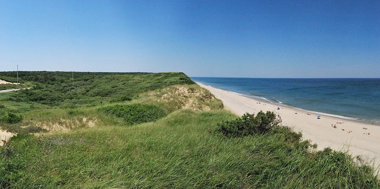
Cape Cod National Seashore begins at Eastham, with its visitor center at Salt Pond, Coast Guard Beach and Nauset Light, and continues past the Marconi wireless site and the high dunes and kettle ponds of Wellfleet and Truro. At the end of the Cape, Provincetown has a busy Commercial Street, the Pilgrim Monument and the open dunes of the Province Lands.
Traffic on the canal bridges is heavy on summer Fridays and Sundays, so plan crossings outside those times. The streets of Provincetown are narrow and parking is scarce, so leave larger vehicles at a campground and take a bike or shuttle. June and September are quieter, and many beaches charge for parking in season.
Which stops are on Cape Cod?
In driving order. Distances are estimates between consecutive stops.
- 1Start
Boston
MA - 266 km
Plymouth
MA - 379 km
Chatham
MA - 434 km
Cape Cod National Seashore
NatureWellfleet, MAForty miles of beaches, dunes and ponds on the outer Cape, with lighthouses along the way.
- 526 km
Provincetown
MA
How do you drive Cape Cod in 3 days?
3 days, split by driving time. Campsites from OpenStreetMap: check opening dates before you go.
- Day 1: Boston → Plymouth · 41 mi · 0 h 44 minOvernight nearby, for example: Maple Park Campground (12 mi); Sandy Pond Campground (12 mi).
- Day 2: Plymouth → Chatham · 49 mi · 0 h 53 minOvernight nearby, for example: Wellfleet Hollow State Campground (17 mi); Maurice’s Campground (14 mi).
- Day 3: Chatham → Provincetown · 37 mi · 0 h 40 minOn the way: Cape Cod National Seashore.Overnight nearby, for example: Dunes Edge Campground (< 1 km); Wellfleet Hollow State Campground (13 mi).
When is the best time for Cape Cod?
The most pleasant months are usually May–June and September. Still fine, with some compromises, in July–August and October. Cold, short days in December–February. July and August are the busiest months: book campsites early.
Estimate from long-term temperature averages, terrain and pass seasons
More routes for the best months
Practical guides for this route

 Photo by Malivez on Unsplash
Driving in the US: The Rules European Visitors Most Often Get Wrong at the Wheel

 Photo by Aleksandr Dalakian on Unsplash
Fuel, Tolls and Distances: Practical US Driving Math for Motorhome and Camper Travelers

 Photo by Tracy Zhang on Unsplash
US national parks: entry fees, passes and reservations in plain terms
Themes
Plan this route for your vehicle
Scout adapts this route to your vehicle, your days and your budget.
FAQs
How long is Cape Cod?
3-day road trip of about 205 km (127 mi) with 5 stops, from Boston to Provincetown. About 2 h 16 min of driving in total.
How many days do you need for Cape Cod?
We suggest 3 days: about 2 h 16 min of driving, which leaves time for the stops.
Where does Cape Cod start and end?
It starts in Boston and ends in Provincetown.
Which states does Cape Cod pass through?
Massachusetts.
Where can you camp along Cape Cod?
OpenStreetMap lists 46 campsites and motorhome stopovers within 19 mi of the stops on this route. For example: Wellfleet Hollow State Campground, Dunes Edge Campground and Maple Park Campground.
How much are the tolls on Cape Cod?
Tolls and vignettes for a car: about $2 (MA). Estimate with typical rates; motorhomes pay more, and vehicles over 3.5 t often pay by distance.