Red rock around Las Vegas: Red Rock Canyon and Valley of Fire
Two red sandstone parks within an hour of the Strip, joined by the lonely Northshore Road along Lake Mead.
- Distance
- approx. 241 km (150 mi)
- Driving
- 2 h 41 min
- Suggested days
- 3
- Stops
- 6
- States
- NV
- Best time to go
- March–April and November
- Tolls and vignettes
- None expected
- Updated
- June 1, 2026
At a glance: 3-day road trip of about 241 km (150 mi) with 6 stops, from Las Vegas to Boulder City. About 2 h 41 min of driving in total. Best time to go: March–April and November. No toll roads expected for a car.
More road trips in Nevada · More road trips from Las Vegas
Photos along the route


Route description
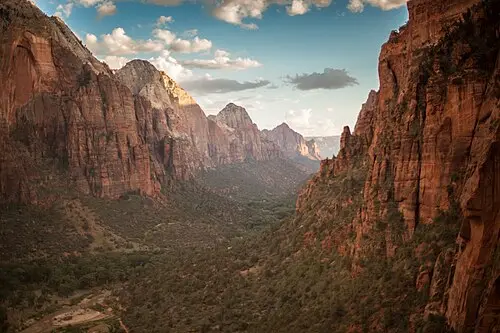
Start west of Las Vegas at Red Rock Canyon, where a 13-mile one-way drive loops past striped sandstone and trailheads; book the timed-entry slot in advance for most of the year. The visitor center explains the geology.
Drive north on I-15 and turn off on NV-169 into Valley of Fire, Nevada’s oldest state park. The road passes Elephant Rock, Atlatl Rock with its petroglyphs, and the White Domes road, where short trails lead to the swirling Fire Wave. The park’s two campgrounds have sites for RVs, some with hookups.
In the Moapa Valley, the Lost City Museum in Overton displays artifacts from Ancestral Puebloan villages that now lie under Lake Mead. The town is also the place to refuel.
Return south along the Northshore Road through Lake Mead National Recreation Area, with colorful badlands and bays of the reservoir. End in Boulder City, built for the Hoover Dam workers, a quiet town where gambling is not allowed. Spring and fall are best; summer days are dangerously hot.
Which stops are on Red rock around Las Vegas?
In driving order. Distances are estimates between consecutive stops.
- 1Start
Las Vegas
NV - 231 km
Red Rock Canyon
NatureLas Vegas, NVA one-way scenic drive past red and cream sandstone cliffs just west of Las Vegas. A timed-entry reservation is needed for much of the year.
- 3106 km
Valley of Fire State Park
NatureOverton, NVNevada’s oldest state park, with flaming red sandstone, petroglyphs at Atlatl Rock and short trails like Mouse’s Tank. Some trails close on the hottest summer days.
- 47 km
Fire Wave
NatureOverton, NVSwirling stripes of red and white sandstone at the end of a short trail off the White Domes road. The colors glow most in late afternoon.
- 511 km
Lost City Museum
HistoryOverton, NVA small state museum of Ancestral Puebloan artifacts rescued from sites later flooded by Lake Mead, with a reconstructed pueblo outside.
- 685 km
Boulder City
NV
How do you drive Red rock around Las Vegas in 3 days?
3 days, split by driving time. Campsites from OpenStreetMap: check opening dates before you go.
- Day 1: Las Vegas → Red Rock Canyon · 19 mi · 0 h 21 minOvernight nearby, for example: Fletcher View Campground (14 mi); Red Rock Canyon Campground (3 mi).
- Day 2: Red Rock Canyon → Lost City Museum · 77 mi · 1 h 23 minOn the way: Valley of Fire State Park, Fire Wave.Overnight nearby, for example: Atlatl Rock Campground (10 mi); Echo Bay RV Village (16 mi).
- Day 3: Lost City Museum → Boulder City · 53 mi · 0 h 57 minOvernight nearby, for example: Canyon Trail RV Park (1 mi); Lake Mead RV Village (4 mi).
When is the best time for Red rock around Las Vegas?
The most pleasant months are usually March–April and November. Still fine, with some compromises, in February, October and December. Hot in May–September. July and August are the busiest months: book campsites early.
Estimate from long-term temperature averages, terrain and pass seasons
More routes for the best months
Practical guides for this route

 Photo by Malivez on Unsplash
Driving in the US: The Rules European Visitors Most Often Get Wrong at the Wheel

 Photo by Aleksandr Dalakian on Unsplash
Fuel, Tolls and Distances: Practical US Driving Math for Motorhome and Camper Travelers

 Photo by Tracy Zhang on Unsplash
US national parks: entry fees, passes and reservations in plain terms
Themes
Plan this route for your vehicle
Scout adapts this route to your vehicle, your days and your budget.
FAQs
How long is Red rock around Las Vegas: Red Rock Canyon and Valley of Fire?
3-day road trip of about 241 km (150 mi) with 6 stops, from Las Vegas to Boulder City. About 2 h 41 min of driving in total.
How many days do you need for Red rock around Las Vegas: Red Rock Canyon and Valley of Fire?
We suggest 3 days: about 2 h 41 min of driving, which leaves time for the stops.
Where does Red rock around Las Vegas: Red Rock Canyon and Valley of Fire start and end?
It starts in Las Vegas and ends in Boulder City.
Which states does Red rock around Las Vegas: Red Rock Canyon and Valley of Fire pass through?
Nevada.
Where can you camp along Red rock around Las Vegas: Red Rock Canyon and Valley of Fire?
OpenStreetMap lists 36 campsites and motorhome stopovers within 19 mi of the stops on this route. For example: Thousand Trails Las Vegas, Hitchin' Post RV Park and Motel and Las Vegas RV Resort.