
Utah Scenic Byway 12
Scenic Byway 12 runs about 123 miles from Panguitch to Torrey past Bryce Canyon, Escalante and Capitol Reef. Allow time for the Hogsback, a narrow ridge with steep drops.
- State
- Utah
- Length
- About 123 miles
- Start / end
- Panguitch – Torrey
- Top elevation
- About 9,000 ft (summit overlook)
- Best season
- Spring and autumn
What should you know before visiting Utah Scenic Byway 12?
No toll roads expected for a car. Size limits for motorhomes: Zion–Mount Carmel Tunnel, Zion NP (UT) (height 11 ft 4 in (3.5 m)).
- The road is open year-round, but winter storms can make sections impassable until plowed, and ice is a hazard on the Boulder Mountain stretch.
- Between Escalante and Boulder the Hogsback has hairpin turns and steep drop-offs into deep canyons. Take it slowly in a large motorhome.
- Fuel, food and lodging are available in Escalante and Boulder. Plan fuel stops yourself and refuel when you can.
The drive
The byway starts at US 89 near Panguitch and ends at SR 24 near Torrey. Going west to east, stops include the arches of Red Canyon, Kodachrome Basin State Park, Powell Point Vista, Escalante Petrified Forest State Park and the village of Escalante. Between Escalante and Boulder lie the trailhead for Lower Calf Creek Falls and the Hogsback. Boulder has the Anasazi State Park Museum, and a high overlook near the summit stands at about 9,000 ft. Without stops the drive takes under three hours.
Camping
Calf Creek Campground lies about 15 miles east of Escalante and takes reservations on Recreation.gov. Renovation closures were announced from July 2024, so check the BLM page. Dispersed camping is allowed in the area, often off Hole-in-the-Rock Road or Burr Trail. Pack out trash and dispose of waste properly. Hole-in-the-Rock Road is described as bumpy, and a stretch of the Burr Trail inside Capitol Reef is graded dirt that needs a 4WD vehicle. Flash floods are possible after storms.
FAQs
When is the best time to drive Scenic Byway 12?
In the Escalante area, spring is described as pleasant, with highs of about 65 to 75 degrees F. Summer brings sudden thunderstorms, and winter averages about 28 inches of snow. Autumn is cooler, with highs around 61 degrees F.
Does the byway cost anything to drive?
Driving the byway itself is free. Some attractions off the road, such as parks and state park sites, charge entry, so check each operator's page.
Which parks lie along the route?
The byway links Bryce Canyon and Capitol Reef National Parks, passes through Grand Staircase-Escalante National Monument and Dixie National Forest, and is near Kodachrome Basin and Escalante Petrified Forest State Parks.
Places to see

 © Daniel Olah danesduet10 · CC0
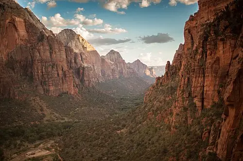
Zion National Park
Sandstone walls 2,000 feet high above the Virgin River. A shuttle runs the scenic drive for much of the year.

 © Florian ↟ florianjohannes_ · CC0
Bryce Canyon National Park
Amphitheaters crowded with orange hoodoos. The Navajo Loop takes you from the rim down among them.

 © Quinn Nietfeld quinton_nietfeld · CC0
Arches National Park
More than 2,000 natural stone arches. Timed-entry reservations are often required in peak season, so check…

 © Gfox228 · CC BY 3.0
Monument Valley
Sandstone buttes on Navajo Nation land, known from a century of Westerns. The valley drive is unpaved, and…

 © Ken Lund from Reno, Nevada, USA · CC BY-SA 2.0
Coral Pink Sand Dunes State Park
Pink-orange dunes blown from eroded Navajo sandstone, with a boardwalk, sandboard rentals and an area for…

 © daveynin from United States · CC BY 2.0
Toadstool Hoodoos
Balanced rocks perched on pale pillars in Grand Staircase-Escalante, reached on an easy walk of under two…

 © Ken Lund from Reno, Nevada, USA · CC BY-SA 2.0
Kolob Canyons, Zion National Park
Zion’s quieter northwest section, reached directly from I-15 exit 40. An 8 km paved scenic drive climbs…

 © David Starner · CC BY-SA 4.0
Cedar Breaks National Monument
A 600 m deep amphitheater of orange hoodoos at over 3,000 m elevation, with rim viewpoints along Utah 148.…
Trip guides

 © Jamie Hagan dearjamie · CC0
Utah's five national parks, in one loop from Las Vegas

 Photo by Oleg Chursin on Unsplash
Utah Scenic Byway 12

 Photo by Camden & Hailey George on Unsplash
Kanab to Page: pink dunes, hoodoos and Lake Powell

 © joannapoe · CC BY-SA 2.0