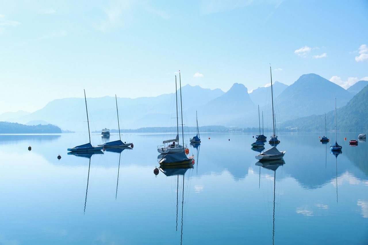
Salzkammergut Lakes
The Salzkammergut stretches east from Salzburg to the Dachstein and is known for its glacial lakes. A lake route can link Mondsee, Wolfgangsee, Bad Ischl and Hallstatt.
- Region
- Upper Austria, Salzburg, Styria (Austria)
- UNESCO
- Hallstatt–Dachstein/Salzkammergut (1997)
- Lakes
- Wolfgangsee, Attersee, Hallstätter See, Traunsee, Mondsee
- Suggested time
- 3–4 days
- Best season
- Mainly early summer to autumn
What should you know before visiting Salzkammergut Lakes?
No motorway tolls or vignettes expected for a car.
- Hallstatt, Obertraun, Gosau and Bad Goisern form the core zone of the UNESCO World Heritage site, inscribed in 1997. The area spans three Austrian states.
- Hallstatt is heavily visited, with up to about 10,000 people on peak days. Tour coaches need a booked entry slot (since 2020). Motorhomes: clarify access and parking with Hallstatt's parking management beforehand.
- In Upper Austria camping outside campsites is not generally banned, but municipalities can restrict it locally or ban it entirely. On green land, notifying the nature conservation authority is generally required.
The drive
One possible order: Salzburg, then Mondsee and Attersee, on to the Wolfgangsee with St. Gilgen and St. Wolfgang. Next come Bad Ischl, Hallstatt on the Hallstätter See, and Gosau or Bad Aussee. The Traunsee with Gmunden is a detour. This is a suggestion, not a signed route; check traffic and local access rules beforehand.
Camping
According to the Austrian government portal, camping outside campsites is not generally banned in Upper Austria. A stay beyond a brief rest in or beside a tent or motorhome counts as camping. Municipalities can ban or allow it locally, and on green land outside built-up areas the nature conservation authority generally has to be notified. Salzburg and Styria have their own rules. A motorhome magazine (April 2026) lists pitches in places such as Bad Ischl, Nußdorf am Attersee and Hallstatt. Check prices and opening times beforehand.
FAQs
What is part of the Salzkammergut UNESCO site?
The Hallstatt–Dachstein/Salzkammergut Cultural Landscape was inscribed in 1997. The core zone of about 284 km² covers Hallstatt, Obertraun, Gosau and Bad Goisern. It rests on salt mining since prehistoric times.
How crowded is Hallstatt?
Local politicians cite up to about 10,000 visitors on peak days, and some sources give higher estimates. Tour coaches have needed a booked entry slot since 2020. For motorhomes, clarify access and parking with the local parking management beforehand.
Can you wild camp in the Salzkammergut?
It depends on the state and the municipality. In Upper Austria the government portal says it is not generally banned, but municipalities can impose bans. Ask the municipality or the state government beforehand.
Places to see
 © Philipp Münch · CC BY-SA 4.0
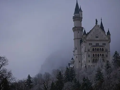
Schloss Neuschwanstein
King Ludwig II’s fairy-tale castle above the Alpine foothills. Buy timed tickets online.
 Photo by Hasmik Ghazaryan Olson on Unsplash
Hallstatt
A lakeside village below steep mountains. Park in the paid lots outside; the centre is car-free.
 © Rigorius · CC BY-SA 4.0
Herrenchiemsee Palace
King Ludwig II’s copy of Versailles on an island in the Chiemsee, with a hall of mirrors even longer than…
 © Michael.F.H.Barth · CC BY-SA 4.0
Eagle’s Nest (Kehlsteinhaus)
A house on the 1,834 m Kehlstein built for Hitler in 1938, reached through a rock tunnel and brass lift.…
 © Bahnfrend · CC BY-SA 4.0
Eisriesenwelt
Usually described as the largest ice cave in the world, high above Werfen, with ice formations seen by…
 © Michelle Maria · CC BY 3.0
Liechtensteinklamm
One of the deepest gorges in the Alps, explored on walkways above the water, with a newer spiral staircase…
 © Ailura · CC BY-SA 3.0 at
Kaprun High Mountain Reservoirs
Two turquoise reservoirs below the glaciers, the Wasserfallboden and, higher up at about 2,040 m, the…
 © Jebulon · CC0
Oberammergau painted houses
Façades covered in fairy-tale frescoes in the village of the Passion Play. Linderhof Palace is 12 km away.
Campsites nearby
Trip guides
 © Philipp Münch · CC BY-SA 4.0
German Alpine Road
 Photo by Hasmik Ghazaryan Olson on Unsplash
Salzkammergut lakes
 © Robot8A · CC BY-SA 4.0
Upper Bavaria: Tegernsee, Chiemsee and the Eagle’s Nest
 © User:MatthiasKabel · CC BY-SA 3.0