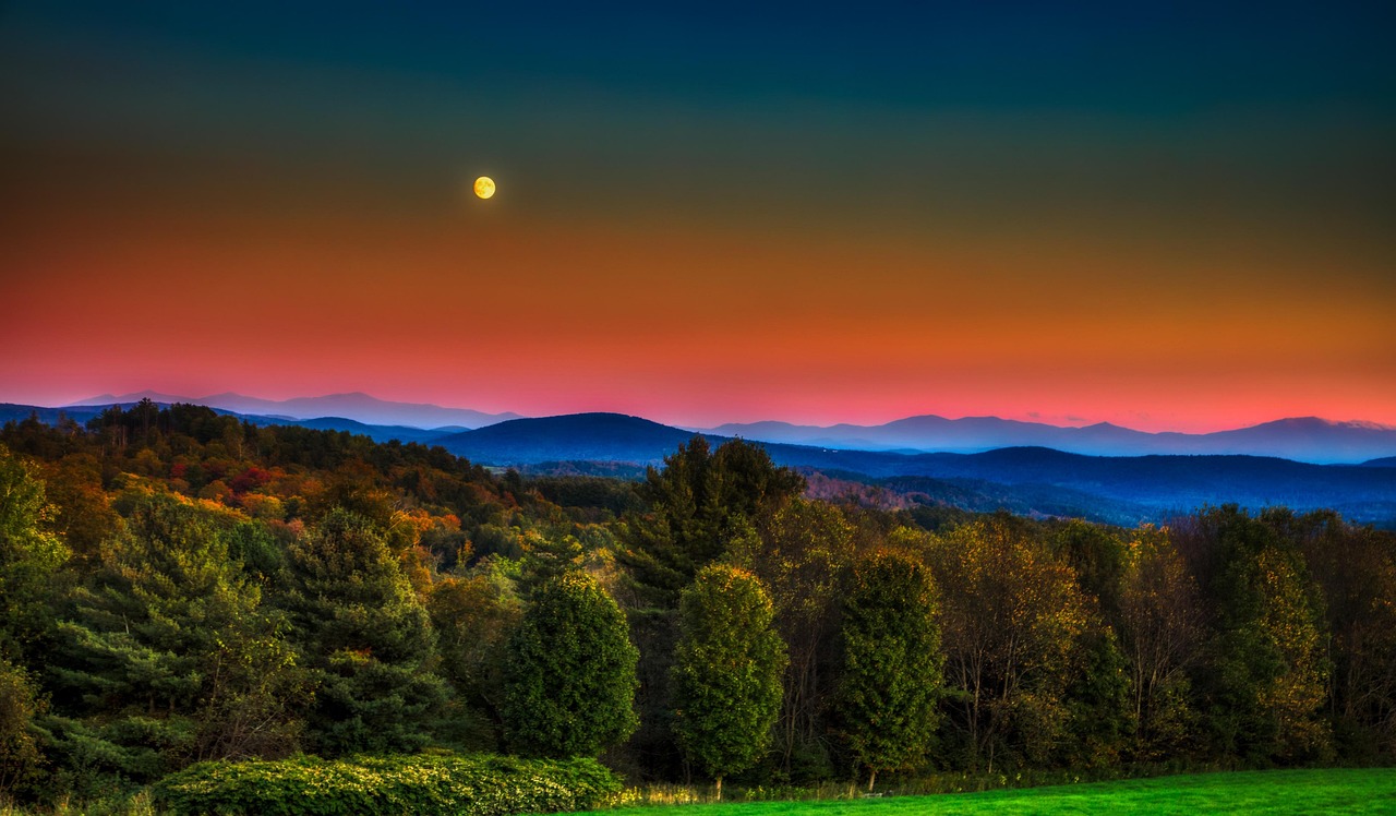
Vermont Route 100
Vermont Route 100 runs about 217 miles from the Massachusetts line in Stamford to Newport near Canada. It is the state's longest numbered highway.
- State
- Vermont
- Length
- About 217 miles
- Start / end
- Stamford – Newport
- Best season
- Summer and early fall; winter for ski areas
- Suggested time
- 2–3 days
What should you know before visiting Vermont Route 100?
No toll roads expected for a car.
- The road passes Wilmington, Ludlow, Killington, Waitsfield, Waterbury and Stowe on its way from the Massachusetts line to Newport.
- Vermont does not offer free dispersed car camping on state lands. Primitive camping means backpack-style camping at least 1,000 feet from any road.
- The state forest agency has proposed its first update in over 30 years to dispersed camping rules. Check the Department of Forests, Parks and Recreation before you go.
The drive
The route starts at the Massachusetts line in Stamford and ends in Newport. Between them lie Wilmington, Jamaica, Weston, Ludlow, Killington, Waitsfield, Waterbury and Stowe, among other towns. The sources used give no information on road conditions or vehicle limits, so check the Vermont Agency of Transportation for closures and work zones before you set out.
Camping
Two state parks near the route have campgrounds with tent and RV sites: Jamaica State Park, about half a mile from Jamaica village, and Coolidge State Park, about 2 miles up Route 100A. Coolidge has a steep, narrow entrance road that is hard for large RVs, and Jamaica has an 8-ton limit on its access bridge. On state land, primitive camping means backpacking in at least 1,000 feet from any road. The rules date from 1993 and are under revision.
FAQs
How long is Vermont Route 100?
The route data give about 217 miles, or roughly 349 km. It is the longest numbered highway in Vermont and links Stamford in the south with Newport in the north.
When is the best time to go?
Autumn foliage, summer outdoor activities and the winter ski season are the usual reasons to visit. The sources used give no traffic or road-condition details, so check conditions before each leg.
Can I wild camp in Vermont?
Not by car on state land. Primitive camping is on foot only, at least 1,000 feet from the road, with no water or toilets. The rules are being revised, so check with the Department of Forests, Parks and Recreation.
Places to see
 © Ymblanter · CC BY-SA 3.0
Fort Ticonderoga
An 18th-century star fort on Lake Champlain, taken by Ethan Allen and the Green Mountain Boys in 1775 and…
 © Eddie891 · CC BY-SA 4.0
Whiteface Veterans Memorial Highway
A toll road climbing to a stone castle just below the summit of Whiteface Mountain, with an elevator or a…
 © Tony Hisgett from Birmingham, UK · CC BY 2.0
Mount Washington Auto Road
A 7.6-mile toll road climbing to the 6,288-foot summit, where severe weather can arrive even in summer.…

 © Robert Linsdell from St. Andrews, Canada · CC BY 2.0
Flume Gorge
A narrow granite chasm about 800 feet long with walls up to 90 feet high, walked on boardwalks along a…

 © Asaf R asafyrov · CC0
Cadillac Mountain
The tallest peak on the North Atlantic coast, and often among the first places in the US to see sunrise.…

 © Tessa Bury · CC BY 4.0
Quechee Gorge
A 165-foot gorge seen from the Route 4 bridge, called Vermont’s Little Grand Canyon.

 © TheTurducken · CC BY 2.0
The Wild Center
A natural history museum of the Adirondacks with river otters, live exhibits and the Wild Walk, a raised…
 © rustygage · Pixabay Content License
Glen Ellis Falls
A 64-foot waterfall on the Ellis River in Pinkham Notch, a short walk with steps from a lot on NH-16.…
Trip guides
 © Tessa Bury · CC BY 4.0
Vermont Route 100
 © Ymblanter · CC BY-SA 3.0
Adirondacks: Lake George, Ticonderoga, Whiteface and Old Forge
 © rustygage · Pixabay Content License
White Mountain notches: Mount Washington to Franconia
 © NPS Photo · Public domain