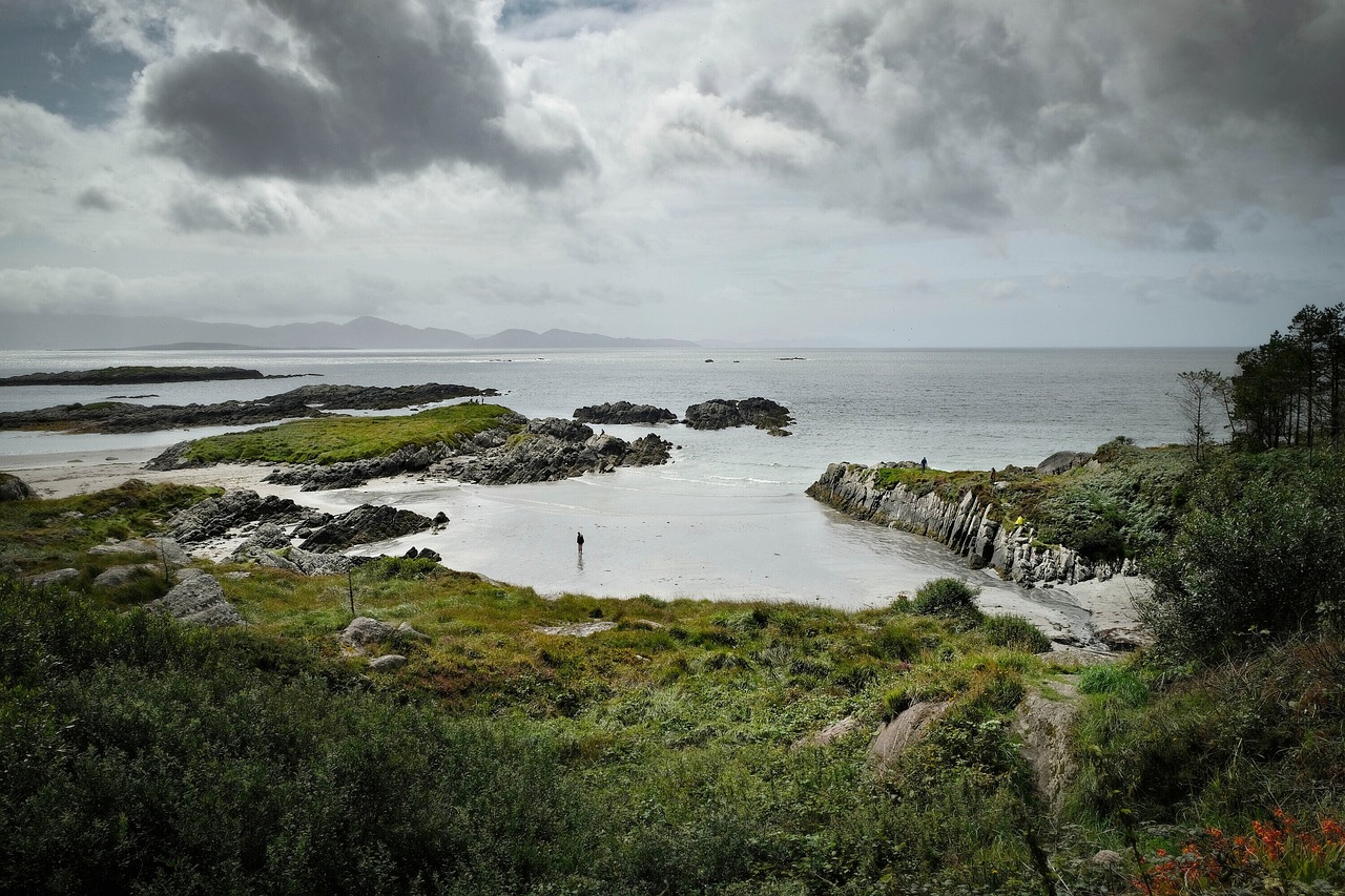
Ring of Kerry
The Ring of Kerry circles the Iveragh Peninsula for 179 km, starting and ending in Killarney. Narrow roads and tour coaches shape the day, and an early start helps.
- Region
- County Kerry, Ireland
- Length
- 179 km (111 mi)
- Road
- N71, N70, N72
- Suggested time
- A full day (about 3.5 h without stops)
- Best season
- May, June, September
What should you know before visiting Ring of Kerry?
Tolls and vignettes for a car: about €2 (Ireland).
- The loop follows the N71 to Kenmare, the N70 around the peninsula to Killorglin and the N72 back to Killarney. Towns on the way include Sneem, Waterville and Cahersiveen.
- Coaches mostly run in one direction and meet other traffic on narrow stretches. Guides disagree on the better direction for cars, so ask locally. Leaving Killarney around 8:00 helps.
- The main N70 is mostly two lanes and well surfaced. The narrow sections are on detours such as the Gap of Dunloe, so check them before taking a large motorhome.
- Fill the tank in Killarney before leaving. Rural stations may close early on Sundays. Kenmare is a good refuelling stop before Moll's Gap when driving anticlockwise.
The drive
Killarney National Park lies just south of the start, with Ross Castle and Lough Leane. Driven anticlockwise, the road passes Killorglin and Glenbeigh, then Cahersiveen and Waterville. Valentia Island is a detour, reached by bridge from Portmagee, which also offers a view toward Skellig Michael, an island off the coast. Sneem and Kenmare follow, before Moll's Gap and Ladies View lead back to Killarney.
Planning
Allow a full day and ignore short sat-nav times. July and August are busiest, while May, June and September have long days and fewer coaches. In Ireland there is no blanket right to camp or park overnight wherever you like. Use campsites, ask the landowner, and check local authority bye-laws and signs, which can restrict overnight stays in some places. National parks have their own guidance.
FAQs
Which direction should I drive the Ring of Kerry?
Sources disagree. Tour coaches run mostly in one direction, and car drivers choose either way to avoid meeting them. Ask locally on the day, and start early to stay ahead of the convoys.
How long does the Ring of Kerry take?
The loop is 179 km and takes about 3.5 hours without stops. With viewpoints, villages and a walk or two, plan a full day.
Can I wild camp with a motorhome in Kerry?
There is no blanket right to camp wherever you like in Ireland. Use campsites or ask the landowner, and check local authority bye-laws and signs, which can restrict overnight parking in some places. National parks have their own guidance.
How much are the tolls on Ring of Kerry?
Tolls and vignettes for a car: about €2 (Ireland). Estimate with typical rates; motorhomes pay more, and vehicles over 3.5 t often pay by distance.
Places to see
 © Elias Ehmann greene · CC0
Cliffs of Moher
Cliffs rising 214 m above the Atlantic on the Wild Atlantic Way.
 © Stinglehammer · CC BY-SA 4.0
Skellig Ring
A narrow loop off the Ring of Kerry with views of the Skellig islands. Boats to Skellig Michael leave from…
 Photo by Valerie on Unsplash
Healy Pass
A road of tight zigzags over the Caha Mountains, begun as famine relief work in the 1840s, with views over…
 © Ridiculopathy · CC0
Mizen Head Signal Station
A former fog signal station on a rocky tip reached by a footbridge over a chasm, at Ireland’s most…
 © Jo and Steve Turner · CC BY-SA 2.0
Slea Head Drive
A loop around the Dingle peninsula past stone beehive huts, with views to the Blasket Islands. Drive it…
 © Roger D Kidd · CC BY-SA 2.0
Dursey Sound
The tip of the Beara peninsula, where Ireland’s only cable car crosses a narrow sound to Dursey Island. It…
 © The Speckled Bird · CC BY-SA 4.0
Charles Fort
A star-shaped fort from the late 17th century guarding Kinsale Harbour, run by the Office of Public Works.…
 © Jane White · CC BY-SA 3.0
Drombeg Stone Circle
A stone circle, built of 17 stones of which 13 survive, on a terrace above the sea near Glandore, aligned…
Campsites nearby
Trip guides
 Photo by Jarek Skowron on Unsplash
The Wild Atlantic Way: Clare to Kerry
 Photo by K. Mitch Hodge on Unsplash
Ring of Kerry and the Skellig Ring
 Photo by Valerie on Unsplash
Ring of Beara and the Healy Pass
 © The Speckled Bird · CC BY-SA 4.0