 📷 Photo by Janne Simoes on Unsplash
US 50: The Loneliest Road in America
US 50 crosses central Nevada from the Reno and Carson City area to Ely and Great Basin National Park. Towns are far apart, cell service is patchy and fuel needs careful planning.
- State
- Nevada
- Length
- 375 to 500 miles, depending on the start
- Suggested time
- 2 to 4 days
- Start / end
- Fernley/Carson City – Ely/Baker
- Best season
- Spring to autumn, check winter conditions
What should you know before visiting US 50: The Loneliest Road in America?
No toll roads expected for a car.
- The official guide says eastbound travelers can stock up in Fernley, which has gas stations. It gives no fuel distances, so plan your own stops and refuel early.
- Many points along the route are beyond cell service. Download maps and route information before leaving, and carry water and warm clothing.
- Campgrounds are listed at Great Basin National Park, Fort Churchill, Cave Lake and Lahontan, and RV parks in Dayton and Baker. Check the operators for opening dates and reservations.
The drive
The name dates from a 1986 Life magazine article about US 50 between Fernley and Ely. The tourism office describes the trip as 375 to 500 miles, depending on the starting point, over 2 to 4 days. Main towns run west to east: Carson City, Dayton, Fallon, Austin, Eureka, Ely and Baker. Stops include Grimes Point, Middlegate (a historic Pony Express and stagecoach site), Hickison Petroglyph Recreation Area and Great Basin National Park with Wheeler Peak at 13,064 ft.
Planning
The official survival guide notes that many points are beyond cell service, so download route information first. The official guide mentions motels, restaurants and gas stations in Fernley, and food or lodging in Eureka and Baker. Check services in the other towns before you rely on them. The sources give no seasonal closures, vehicle limits or pass heights, so check the Nevada Department of Transportation for conditions, especially in winter. Wild camping rules were not covered; ask the land managers (BLM, Forest Service) before staying overnight off a campground.
FAQs
Why is US 50 called the Loneliest Road in America?
Life magazine used the phrase in July 1986 for the stretch between Fernley and Ely. The AAA reportedly advised against the drive and suggested carrying survival gear. Today the name is used to promote the route.
Where should I refuel on US 50?
The official guide says eastbound travelers can stock up in Fernley, which has gas stations. Other towns on the route, such as Fallon, Austin, Eureka and Ely, are the likely stops. Distances between them are long, so refuel early.
Can I camp along the route?
Campgrounds are listed at Great Basin National Park, Fort Churchill State Historic Park, Cave Lake State Park and Lahontan State Recreation Area; RV parks are named in Dayton and Baker. Check each operator for season and reservations.
Places to see
 Photo by Reinis Brūzītis on Unsplash
International Car Forest of the Last Church
Dozens of old cars, buses and trucks planted nose-down in the desert and covered in graffiti. Reached on a…
 © Ken Lund from Las Vegas, Nevada, USA · CC BY-SA 2.0
Rhyolite ghost town
The ruins of a 1900s gold boom town, including a house built from bottles, next to the ghostly sculptures…
 © AnnBoulais · Pixabay Content License
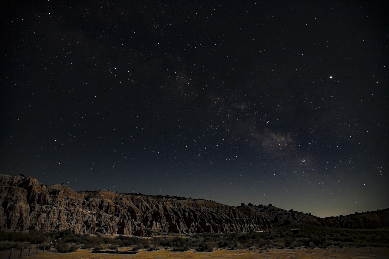
Cathedral Gorge State Park
Eroded bentonite clay formed into spires and slot canyons you can squeeze through. Moon Caves are a short…
 Photo by Chris Kofoed on Unsplash
Great Basin National Park
Ancient bristlecone pines, Lehman Caves and some of the darkest night skies in the country.

 © Chris M Morris · CC BY 2.0
Pahranagat National Wildlife Refuge
Spring-fed lakes and cottonwoods in the middle of the desert along US-93, busy with waterbirds. A good…
 © Ken Lund · CC BY-SA 2.0
Tonopah Historic Mining Park
Headframes, hoist houses and a viewing platform over an old stope on the site of the 1900 silver strike…
 © Famartin · CC BY-SA 4.0
Kershaw-Ryan State Park
A green canyon oasis just south of Caliente, with a spring-fed pond, picnic lawns and short trails up the…
 © Mobilus In Mobili · CC BY-SA 2.0
Ward Charcoal Ovens State Historic Park
Six beehive-shaped stone ovens from 1876, used to make charcoal for silver smelters. They are reached by a…
Campsites nearby
Trip guides
 Photo by John Bewlay on Unsplash
US-50: the Loneliest Road in America
 © Chris M Morris · CC BY 2.0
Extraterrestrial Highway and Nevada ghost towns
 © AnnBoulais · Pixabay Content License
Great Basin Highway: canyons, ghost towns and charcoal ovens
 © AnnBoulais · Pixabay Content License