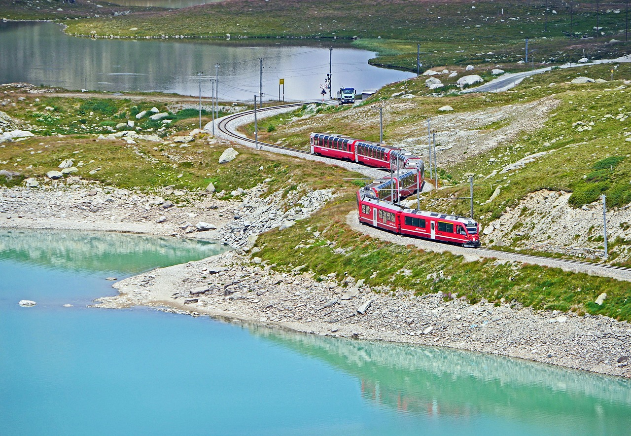
Engadin and the Bernina Pass
From the Engadin lakes, the Bernina Pass climbs to 2,328 m and drops into Val Poschiavo. The road is open year-round, but snow covers it for much of the year.
- Region
- Graubünden, Switzerland
- Start / end
- St. Moritz / Poschiavo
- Top elevation
- 2,328 m (7,638 ft)
- Open
- All year; snow and closures possible
- Best season
- Mainly summer to early autumn
What should you know before visiting Engadin and the Bernina Pass?
Tolls and vignettes for a car: about €19 (Italy).
- Switzerland has no general winter-tyre mandate (TCS), but vehicles must be roadworthy for the conditions. The pass overview calls winter equipment obligatory in the winter half-year; snow chains can be ordered temporarily.
- The pass overview gives a maximum gradient of 10% and 37 km between Pontresina and San Carlo. Its signage lists trailers behind heavy motor vehicles as permitted from 15 April to 15 November; check before towing outside that period.
- The Upper Engadin has eight campsites that can fill up in summer and autumn (Engadin tourism). Outside campsites, the legal situation varies from municipality to municipality.
The drive
In the Upper Engadin lie the Silsersee, the largest of the Engadin lakes, and the Silvaplanersee, described as popular with kite and windsurfers. Pontresina is the starting point for trips to the Bernina Pass, which runs to San Carlo in the Poschiavo area. Lago Bianco lies on the pass, which the Bernina Express train also crosses. The Maloja (1,815 m) and the Julier (2,284 m) are neighbouring passes. Check road conditions beforehand.
Camping
The Upper Engadin tourist board says the legal situation outside campsites varies from municipality to municipality, and a wild camping overview lists only exceptions in Graubünden: mountain bivouac, emergencies and private land with permission. The Swiss National Park can only be visited by day and bans fires. A Swiss media report points to official motorhome pitches on the Wohnmobilland Schweiz website. Fines vary by canton and municipality.
FAQs
Is the Bernina Pass open in winter?
Yes, the pass overview lists it as open all year, and Wikipedia says year-round since 1965. Chains may be needed in snow and closures are possible. Check the current situation with an automobile club or the road authority first.
How high is the Bernina Pass?
The summit is at 2,328 m. The road links St. Moritz in the Engadin with the Italian-speaking Val Poschiavo, which ends at Tirano in Italy.
Can you wild camp in the Engadin?
Mostly not. The Swiss National Park can only be visited by day, and an overview lists only a few exceptions in Graubünden. Municipalities regulate it differently, so ask the municipality beforehand.
How much are the tolls on Engadin and the Bernina Pass?
Tolls and vignettes for a car: about €19 (Italy). Estimate with typical rates; motorhomes pay more, and vehicles over 3.5 t often pay by distance.
Places to see
 © David Marcu davidmarcu · CC0
Passo dello Stelvio
At 2,757 m, the highest paved pass in Italy, with 48 numbered hairpins on the Trafoi side. Usually open…
 © Cialome · CC BY-SA 4.0
Monte Isola
One of the largest lake islands in Europe, almost free of cars. Leave the vehicle at Sulzano, take the…
 © Luca Giarelli · CC BY-SA 3.0
Naquane rock art park
Glacier-smoothed rocks carved with thousands of figures, from prehistoric hunters to ploughs and houses.…
 © Fdbef · CC BY-SA 3.0
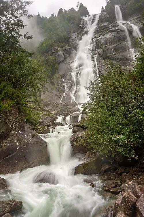
Nardis waterfall
A broad waterfall plunging over granite at the mouth of the Val Genova. In high summer the valley road is…
 © Stipa Jennifer · CC BY-SA 4.0
Lago di Tovel
A clear mountain lake under the Brenta walls that used to turn red with algae until the 1960s. A flat path…
 © Allie_Caulfield from Germany · CC BY 2.0
Sirmione
A castle town on a narrow peninsula in Lake Garda, with Roman villa ruins at the tip and thermal baths.
 © Manuel Velazquez · CC BY 3.0
Bellagio
Stepped lanes and villa gardens where Lake Como’s three arms meet. Car ferries cross to Varenna and…
 © giggel · CC BY 3.0
Bernina Pass
A 2,328 m pass with glaciers on one side and turquoise lakes on the other, shared with the red Bernina…
Campsites nearby
Trip guides
 Photo by Patrick Pahlke on Unsplash
Lake Garda and Lake Como
 Photo by Samuele Bertoli on Unsplash
Stelvio and Bernina: two giants of the Alps
 © Fabio Ingrosso from Italy · CC BY 2.0
Bergamo, Lake Iseo and the Valcamonica rock art
 © Marco Ober · CC BY-SA 4.0