Pacific Coast Highway or Route 66?
Pacific Coast Highway or Route 66? Both routes compared: length, driving time, best season, tolls and road limits, with our recommendation.
| Pacific Coast Highway | Route 66 | |
|---|---|---|
| Route | San Francisco → Santa Monica Pier | Chicago → Santa Monica Pier |
| Suggested days | 5 | 21 |
| Distance | 699 km (434 mi) | 3,744 km (2,326 mi) |
| Driving | 7 h 45 min | 41 h 33 min |
| Stops | 10 | 18 |
| Best time to go | April–June and September–November | April–May and September–October |
| Tolls and vignettes | None expected | ≈ $15 |
| Good to know | – | – |
Our recommendation
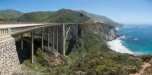
Choose the Pacific Coast Highway if you have about five days: roughly 699 km from San Francisco via Big Sur and Santa Barbara to the Santa Monica Pier, with coastal fog, elephant seals and whales. Many state park sites are limited to 27–40 ft and booked six months ahead, so plan early and check Caltrans QuickMap daily. Pick Route 66 if you have three weeks for about 3,744 km from Chicago to Santa Monica across seven states, with neon, diners, mesas and the Mojave. Both shine in spring and fall; Route 66 is hot in July.